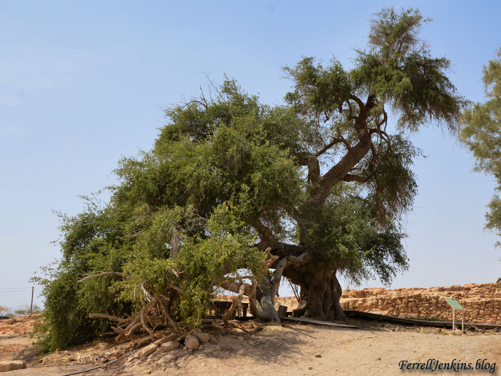
Methuselah is the oldest man mentioned in the Bible, but his namesake now lives at Keturah in the Arabah.
Thus all the days of Methuselah were 969 years, and he died. (Genesis 5:27 ESV)
His namesake is a male date palm grown from a seed discovered during the excavations by Prof. Yigal Yadin at Masada in the 1960s.
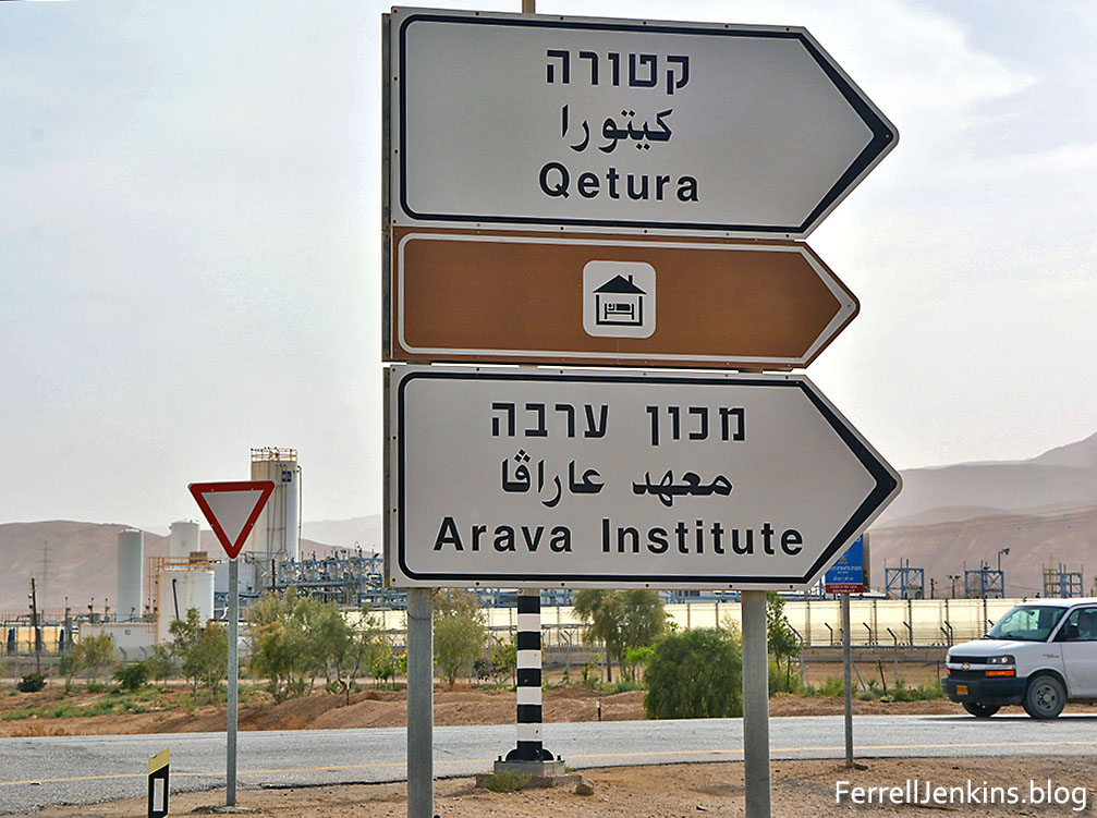
Getting to Keturah to see the palm is rather easy if you are traveling south (or north) on Highway 90.

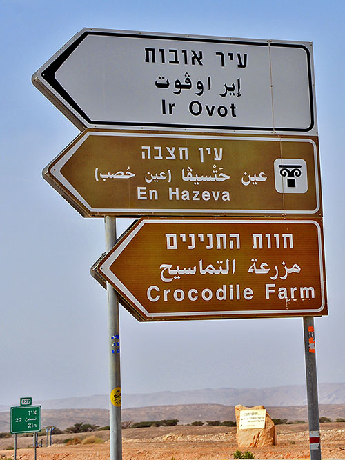
This sign on Highway 90 prominently marks the entrance to the Arava Institute. Notice the spelling of Ketura with a Q.. Photo by Ferrell Jenkins.
If you are using your phone or other device as a GPS you can just ask for directions to the “Ketura Ancient Palm” and it should direct you to the right place. (Disclaimer: it worked for us.) Note the spelling of Ketura as Qetura.
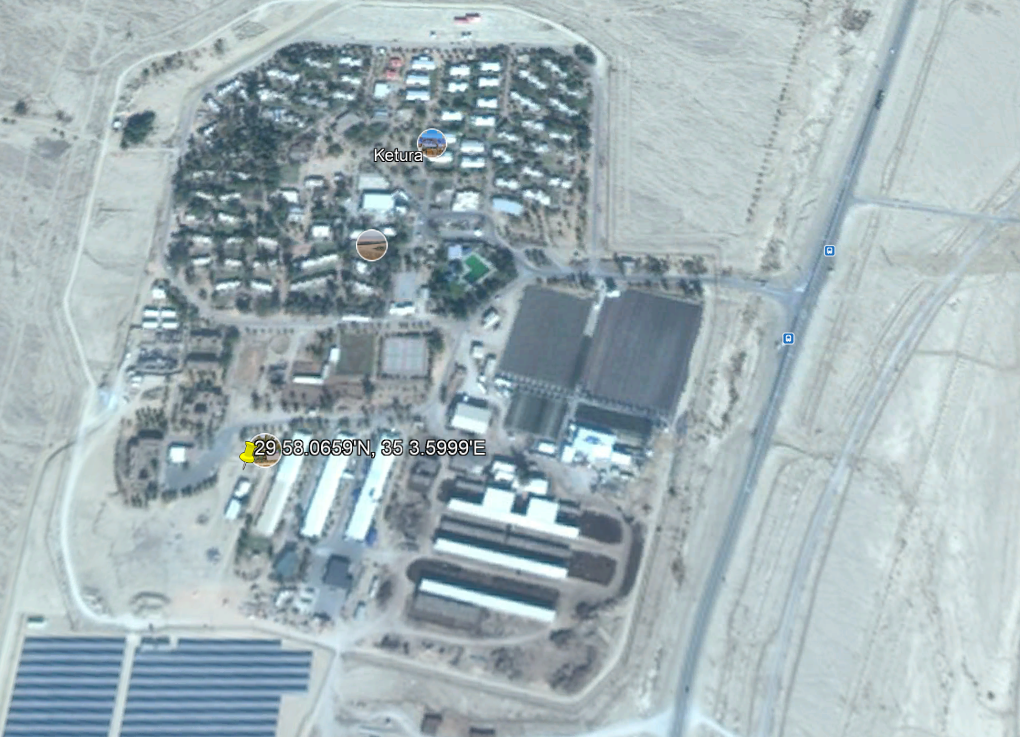
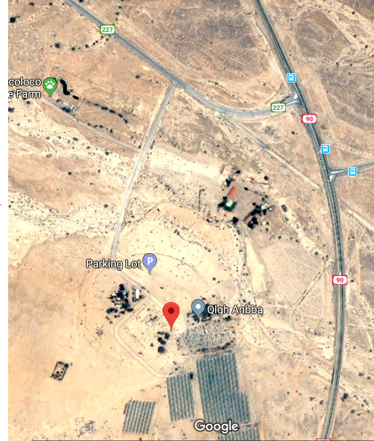
My GPS on the camera shows 29 58.0659’N, 35 3.5999’E, and here is the location on Google Earth Pro.

The Google Earth Pro location for the Ancient Palm.
But, I am a little ahead of myself. As we drove into the village from Hwy. 90 we noticed a lady dressed in white walking on the left side of the street. We stopped, asked about the ancient palm and were told to continue to a parking lot and the palm would be on our left. Best directions we received the entire trip. Most people just say “go straight and then ask.”
After we arrived at our destination we saw the woman who had given us directions coming our way. She was Dr. Elaine Solowey, director of the Arabah Institute. Leon Mauldin and I were delighted to hear firsthand from her the things we had read about the palm.

Ferrell Jenkins listening to the history of “Methuselah” from Dr. Elaine Solowey.
A sign attached to the fence around the palm tells the story more succinctly than I can. It is titled “A Date With Time.”
— “ —
“Methuselah” – a male date palm {Phoenix dactylifera}, grown from a 1,900 year old seed discovered during Prof. YigalYadin’s excavations of Masada in the 1960s.
It is likely that this date seed was from the food supply of the Zealots, a Jewish group who defended the fortress during the war against Rome and finally perished at the end of a prolonged siege In 73 CE.
In 2005, Dr. Sarah Sallon, Director of The Louis L. Borick Natural Medicine Research Center at Hadassah Medical Organization, Jerusalem, initiated a unique project to germinate ancient seeds found in archaeological sites in an attempt to reintroduce species that once grew in the Land of Israel.
In conjunction with Dr. Elaine Solowey, Director of the Center for Sustainable Agriculture at the Arava Institute for Environmental Studies (AIES), the attempt was successful. In March of that year the oldest seed ever germinated produced a date seedling, “Methuselah”, named after the oldest person mentioned in the Bible.
“Methuselah” then attracted International attention, with a mention on CNN and in National Geographic Magazine as well as a scientific article published in the journal, “Science”.
In 2011, the seedling was planted on the grounds of Kibbutz Ketura, representing the first time in almost two millennia that the Judean Date Palm, prized in antiquity for the taste, size and medicinal properties of its fruit, has been grown in Israel.
— ” —
In additional reading, I have picked up a few interesting points that our readers will appreciate.
A 2017 article by Stephanie Buck in Timeline reports that the seed found in the jar at Masada was tested by carbon dating.
Back at the lab, scientists broke off tiny chips of the seeds’ shells; carbon dating estimated their origin between 155 BC and 64 CE.
More interesting facts from the Timeline article:
Solowey got to work. First, she soaked the seeds in hot water to activate absorption. From there, she bathed them in nutrients and fertilizer made from seaweed. She chose the Jewish holiday, New Year for Trees, which in 2005 fell on January 25, as the day to plant. After a few months, she noticed a crack in the soil…then a sprout.”
In 2011 the palm flowered, but because it is male there was no fruit.
Solowey and her team “mated him with modern female date plants. His seed is healthy. ‘We got fruit and some 50% ancient date trees,’ says Solowey.”
Solowey explained to us that shoots from this palm could also be planted. When they are able to mate him with a female, then the fruit will be 100% ancient.
“Both the Bible and the Koran praise the date palm. The tree provided shade, food, and medicine. In the “land of milk and honey,” dates were the honey. The fruit was large, dark, and very sweet, says Solowey. It had good “shelf life” and was in high demand in Rome.”
“Roman emperors wanted Judean dates for their tables,” Solowey told Timeline. “Since they had absolutely nothing else good to say about Jews, Judea, or Judaism, I assume they were very good dates.”
“The ancient fruit made tonics for longevity, laxatives, and aphrodisiacs; lore claims they could cure infections. The date was so important to the region that it featured on ancient coinage, and even on Israel’s 10-shekel coin today. But 800 years ago, crusaders destroyed the last Judean palm and rendered the plant extinct. Dr. Sallon hopes Methuselah is the key to medicinal remedies once lost to history.”
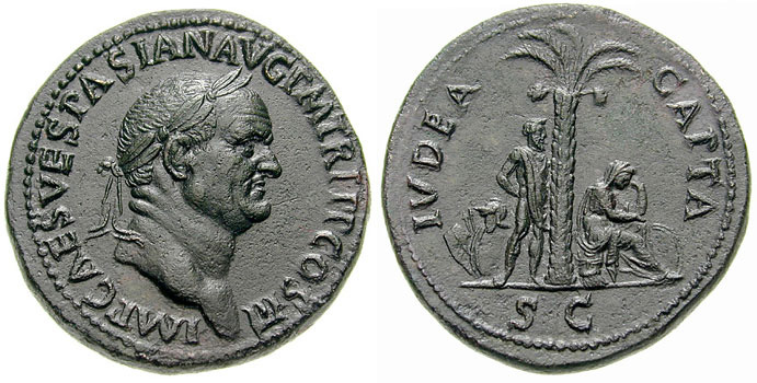
When the Romans captured Judea and destroyed the temple the emperors portrayed the captives siting under a date palm. Earlier, Herod the Tetrarch (Luke 23:7), some of the Roman prefects, including Felix (Acts 23-25), used the palm on their coins. We also see it on the Israeli 10 New Shekel coin.

Vespasiano_Sesterius_Iudaea_Capta-RIC_0424. From Wikimedia Commons.
Dr. Solowey ask if we would like to see some frankincense, balm, and myrrh plants in the hothouse. We were astonished when we entered the hothouse and saw those as well as several young potted palms.

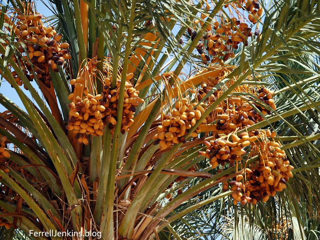
In the hothouse at Ketura we saw these growing young palms. Photo by Ferrell Jenkins.
The names were fascinating. I assumed the one named Eve was the first female plant. Others were labeled Ruthi, Boaz, Jeremiah, and Judah. We will patiently await the mating of Methuselah with one of these girls.
There is more to tell about other plants we saw in the hothouse, but that will need to wait for another time. I will tell you that Dr. Solowey mentioned one of her books to us. Trees of Fragrance and Mystery is available from Kindle. I have enjoyed the portions that I have read, especially about frankincense, balm, and myrrh.
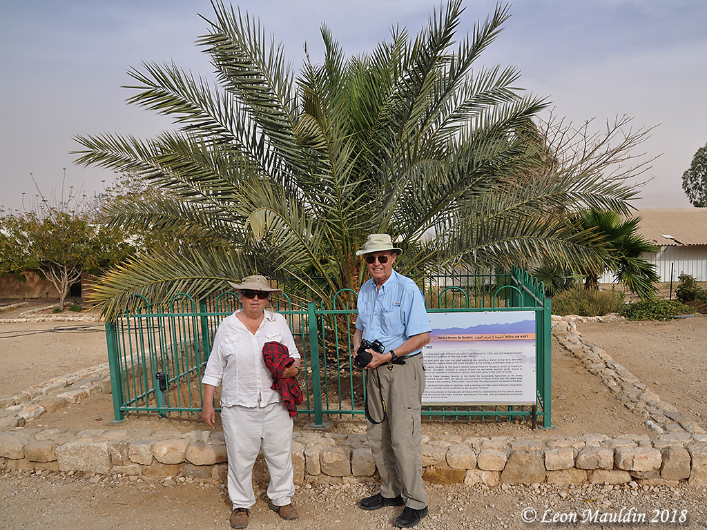
We saw and learned more than we had hoped for at Keturah. I want to go back in a few years in the summer as my wife and I did in 2008 and see Methusaleh’s “wife” like this.

Arabah date palm in August 2008. Photo by Ferrell Jenkins.
I wanted to add one more thought about dates being the honey of the Bible. There is little evidence for beekeeping in the promised land, but the discovery of a commercial apiary at Tel Rehov in the Jordan Valley has provided more information. Here is the summary by the excavators, Mazar and Panitz-Cohen.
The term “honey” appears fifty-five times in the Bible, sixteen of which as part of the metaphor of Israel as “the land of milk and honey.” This honey has been always understood as having been produced from fruits, such as dates and figs, with bees’ honey mentioned explicitly only twice, both times in relation to wild bees (Judg 14:8–9 and 1 Sam 14:27). However, careful reading of biblical metaphors mentioning honey led Forti (2006) to suggest that they refer mostly to bee’s honey, through in her view, due to the lack of agriculture in the Bible, the references are to honey collected in nature. Indeed, in no case does the Bible mention bee rearing as a productive industry. The discovery of the beehives at Tel Rehov shows that this was a well developed economic branch during the First Temple period. We can now assume that at least some of the notations of honey in the Bible pertain to bees’ honey. (Mazar, Amihai and Nava Panitz-Cohen. “It is the Land of Honey: Beekeeping at Tel Rehov.” Near Eastern Archaeology 70:4 (2007): 213-214.
Rehov was not an Israelite site.
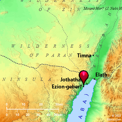
We are headed to Eilat, the southernmost tip of the Arabah in Israel. I am not sure if our next post will be about Eilat or if we will stop at Timna on the way. Thanks for following the blog.


You must be logged in to post a comment.