
Recently I was doing some reading in the late Denis Baly’s Geographical Companion to the Bible (1963) and decided to share his description of the Arabah (Arava in Israel).
The southern section of the Rift Valley is normally known as the Arabah, and it is, to the surprise of many people, almost as long as the section of the valley between the south end of the Dead Sea and the Lake of Galilee. A north-east-south-west upfold running across it raises the central part of the Arabah to 1,000 feet above sea-level, and then it sinks southwards again towards the Red Sea. Everywhere it is desert, save where occasional springs provide a welcome supply of water. However, historically it has had a double importance: as a trade route to the Red Sea and as a source of cooper. This is found in the dark-red Nubian sandstone which outcrops particularly on the eastern, or Edomite, side of the rift. The most important of these copper mines was at Punon (the modern Feinan), almost certainly the place where Moses raised the serpent in the wilderness (Num. 21:4-10; 33:42-43). On the western side the copper-bearing rock outcrops only in the extreme south, and is being mined today at Timna, where also it was obtained in ancient times. This is the place known to the modern tourist as “King Solomon’s Mines” (Deut. 8:9). (p. 57).
I propose in a series of posts to discuss briefly Lot’s Wife, views of the Arabah, the excavations at Tamar, Keturah, Timnah, and Eilat.
A short distance south of the southern end of the Dead Sea is a formation called Lot’s wife. While there is no historical reality to the formation being Lot’s wife it is an interesting natural formation that promotes the memory of Lot and his family. In the biblical description of the overthrow of the cities of Sodom and Gomorrah we are told,
But Lot’s wife, behind him, looked back, and she became a pillar of salt. (Genesis 19:26 ESV)
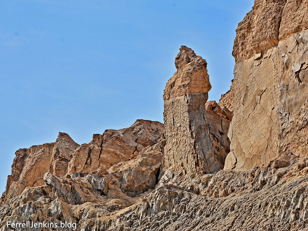
Lot’s Wife, a natural formation south of the Dead Sea. Photo by Ferrell Jenkins.
Lot’s wife stands as a perfect illustration of those who turn back from doing the will of the Lord. Even Jesus called attention to this Old Testament event.
Remember Lot’s wife. (Luke 17:32 ESV)
In the next post we plan to show you some of the arid terrain as we continue south in the Arabah.
Sadly, I see that neither Logos nor Accordance have Denis Baly’s The Geography of the Bible or The Geographical Companion of the Bible available.

Pingback: The Arabah – Copper mining at Timnah | Ferrell's Travel Blog
Very interesting to read Baly’s comments about the two ancient copper mining sites Punon/Feinan and Timna, on opposite sides of the Arava valley.
When our guide class took a 3-day field trip to Israel’s far south in 2006, our guide to the Timna park was geologist Menachem Marcus, whose explanation concerning the two places has always stuck with me: The Great Rift represents the joint between two major tectonic plates which, at least in that region, are sliding past each other, with the eastern (Asia) plate slowly moving north relative to the western (Africa) plate. Today’s hi-tech instrumentation can actually measure the rate! So, “winding back” those several millimeters of annual creep, over millions of years of geological time (sorry, Young Earthers), geologists posit that the two copper-rich sites, Punon and Timna, today some 60 miles distant, were once essentially the same place!
Finally, Baly states that copper ore “is being mined today at Timna”– and in his day, the 1960s, indeed it was. Spurred by high copper prices, an Israeli project revived mining there from the 1950s until 1975, in its heyday employing some 700 miners and providing the economic base for the nearby town of Eilat. After the closure, Eilat and its 10,000 or so inhabitants began reinventing itself as the tourist mecca we know today.
TOM POWERS / Waynesville, NC
🙂
If anyone claims that’s Lot’s wife, I’d take that with a grain of salt. It is interesting though.
Reblogged this on clawingmywayin.