24 When they came to Capernaum, the collectors of the two-drachma tax went up to Peter and said, “Does your teacher not pay the tax?” 25 He said, “Yes.” And when he came into the house, Jesus spoke to him first, saying, “What do you think, Simon? From whom do kings of the earth take toll or tax? From their sons or from others?” 26 And when he said, “From others,” Jesus said to him, “Then the sons are free. 27 However, not to give offense to them, go to the sea and cast a hook and take the first fish that comes up, and when you open its mouth you will find a shekel. Take that and give it to them for me and for yourself.” (Matthew 17:24-27 ESV).
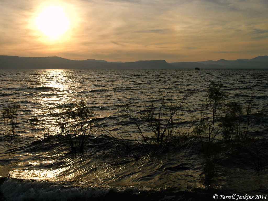
Fishing is still important on the Sea of Galilee. Tour groups to Israel usually have at at least one meal of the famous St. Peter’s Fish when we are in the Galilee.

Mendel Nun spent more than 50 years fishing the Sea of Galilee. He became an expert in the history of fishing on the Sea. His article, “Cast Your Net Upon the Waters: Fish and fishermen in Jesus’ Time” (Biblical Archaeology Review, 19:06), includes information on this episode. Because this is a lengthy quotation I will leave it full width for easier reading.
— • —
The musht is the only large fish in the lake that moves in shoals, which of course is a key to the identification of the fish in the story in Luke, although not the only one.
The flat shape of the musht makes it especially suitable for frying. The skeleton consists of an easily detachable backbone and relatively few small bones, and thus it is easy to eat. It has long been known as St. Peter’s fish. Recently, it has even been exported under this name. But, alas, the name is a misnomer.
Presumably the fish got its name because of an incident recorded in the Gospel of Matthew (Matthew 17:24–27). In this episode, the tax collectors come to Capernaum to collect the half-shekel Temple tax that each Jew was required to pay annually. Jesus tells Peter, “Go to the sea and cast a hook, and take the first fish that comes up, and when you open its mouth you will find a shekel; take that and give it to them for me and yourself.”
The musht was probably given the name St. Peter’s fish because of this miracle. However, this cannot have been the fish Peter caught with a hook and line. The reason is simple: Musht feeds on plankton and is not attracted by other food. It is therefore caught with nets, and not with hook and line. The fishermen on the lake have, since time immemorial, used a hook baited with sardine to fish for barbels, which are predators and bottom feeders. Peter almost surely caught a barbel. There can be only one explanation for the confusing change of name. It was good for tourism! The Sea of Galilee has always attracted pilgrims; musht (today raised mostly in ponds) is part of the unique local cuisine. It is delicious, especially when freshly fried. In ancient times, just as today, the fishing boats delivered their catch to the eating places on shore. Indeed, the proverbial metaphor for speed in the Talmud is “as from the sea into the frying pan.” This expression was part of daily speech in Tiberias and clearly refers to musht and not barbels; the latter are best when boiled.
The first Christians were local people and were therefore familiar with the various fish. They of course knew that the fish Peter caught could only have been a barbel and not a musht. However, as pilgrims began to come from distant regions, it no doubt seemed good for business to give the name “St. Peter’s fish” to the musht being served by the early lakeside eating houses. The most popular and easily prepared fish acquired the most marketable name! But even if Peter did not catch a musht, he deserves to have his name associated with the best fish in the lake.
Returning to the miracle of the fish caught in Luke (5:1–7), additional clues that the fish were musht are the kind of net referred to and the place and the time of the event. Several kinds of nets were used in the Sea of Galilee. The most important were the seine, the cast net and the trammel net.
— • —
For some time the most searched for article on this blog has been Fish of the Sea of Galilee. If you have not read the article and enjoy the photos I urge you to do so now.
Here is one of the photos from that post.

Use this shortlink to go to the article with more information about the fish of the Sea of Galilee: https://wp.me/p1zOp-42k


You must be logged in to post a comment.