
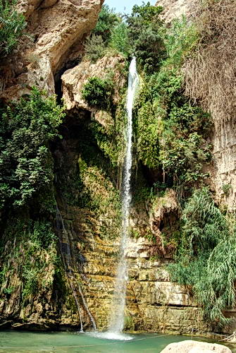
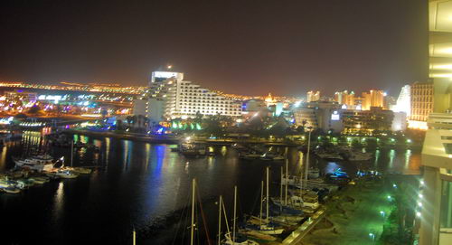
Today I put forth some extra effort to make a good photo at the spot on the north end of the Sea of Galilee called the Cove of the Sower. Some have suggested that this would have been the place where Jesus could speak to large numbers who assembled to hear Him.
Read the full account given by Mark in 4:1-20. Here is the way it begins:
He began to teach again by the sea. And such a very large crowd gathered to Him that He got into a boat in the sea and sat down; and the whole crowd was by the sea on the land. And He was teaching them many things in parables, and was saying to them in His teaching, “Listen to this! Behold, the sower went out to sow. (Mark 4:1-3)
Read the parallel accounts in Matthew 14:1-15 and Luke 8:4-10.
B. Cobbey Crisler conducted some experiments at places where the Bible records that large crowds gathered. The attempt was to see if the large number were able to hear a speaker without the aid of modern sound equipment. The places were Kadesh-barnea, Shiloh, and The Cove of the Sower in Galilee. I suggest you read the entire article (“The Accoustics and Crowd Capacity of Natural Theaters in Palestine.” Biblical Archaeologist, 1976. Vol. 39. Num. 4.
The study indicated that the Cove of the Sower would allow between 5000 and 7000 people to hear.
The water level of the Sea of Galilee is extremely low at this time due to lack of rain and snow in the past few years. In the photo posted below you will see many rocks in the foreground. Most years these rock would be covered with water. Due to the crops, and a highway, it is difficult to make out the amphitheater-like terrain. It would require several photos from different locations to show this, but it is there.
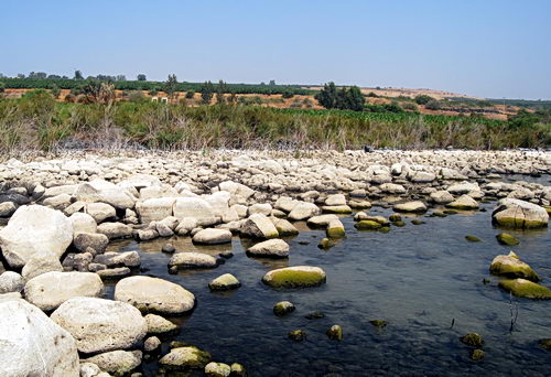
The Cove of the Sower in Galilee. Photo by Ferrell Jenkins.
We made a wrong turn and realized we were near Dan. We had been there in April, but I decided to make new photos of the gates. This was a good move, because the light was perfect for the purpose.
We drove to Metulla, on the Lebanese border, to make a photo of Abel beth-maacah. Read 1 Kings 15:20; 2 Kings 15:29 and 2 Samuel 20:16. In this case the tel was dry, and brown, but the surrounding area was green with fruit trees. It made the tel stand out.
Our next stop was at Kedesh, one of the cities of refuge in Old Testament times (Joshua 21:32). We were at the same place yesterday, but did not have time to get good photos. I am now sure that I was successful today either.
Our last stop before returning to Tiberias was to visit Acre (Acco, Akko). We passed the ancient tel on the way to see the Crusader ruins. The city is mentioned only once in the Old Testament (Judges 1:31), as a city that the tribe Asher was unable to retain as their possession. Akko is known as early as 1800 B.C. from Egyptian execration texts. In the period between the testaments the city came under the control of the Ptolemies of Egypt. As a result, the city’s name was changed to Ptolemais. Paul visited brethren in the city for a day on the return from his third journey (Acts 21:7).
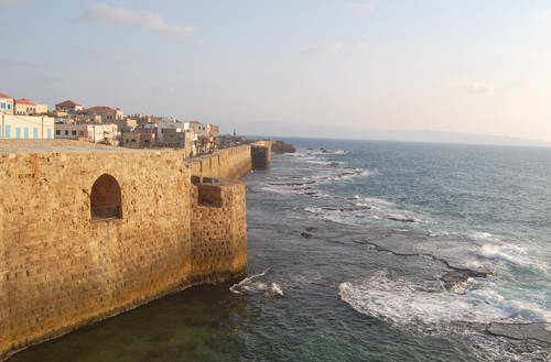
The Crusader fortress at Akko (Acre). Photo by Ferrell Jenkins.
Elizabeth and I realized today that we have traveled not only from Dan to Beersheba, but from Eilat on the Rea Sea to the border of Lebanon. We have traveled from the Jordan Valley to the Great Sea, the Mediterranean. We are very thankful for this opportunity.


You must be logged in to post a comment.