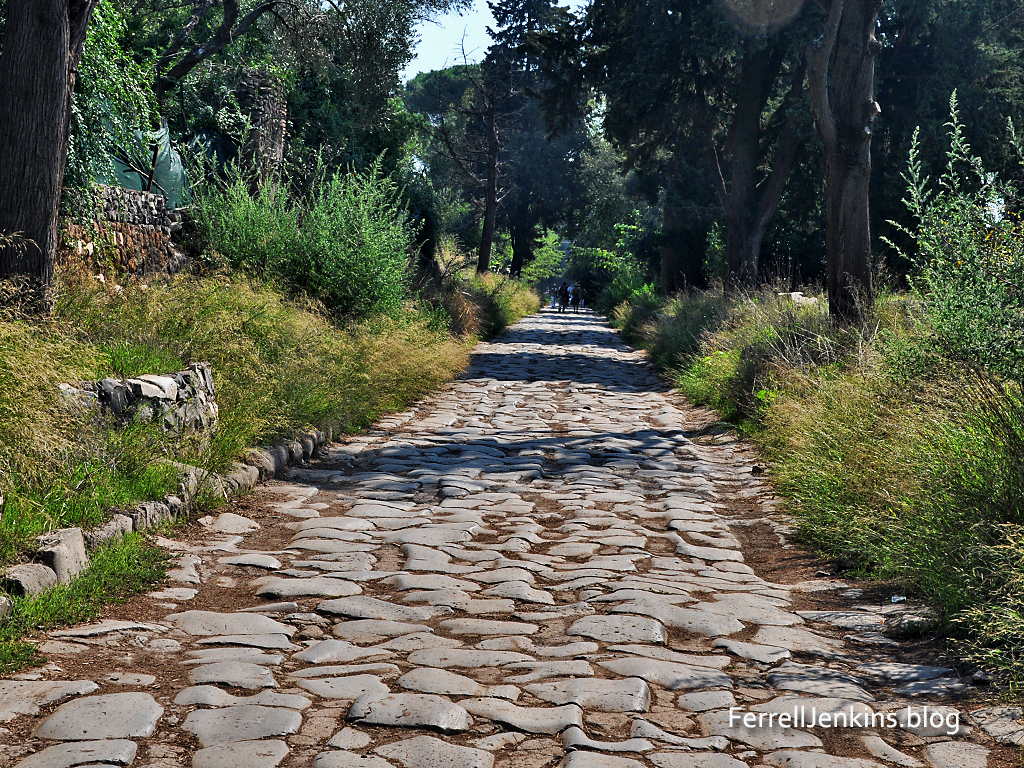
During his preaching journeys, the apostle Paul used several of the famous Roman roads. On the way to Rome as a prisoner he traveled the Appian Way (Latin Via Appia).
The Appian Way on the south side of Rome.
There we found brothers and were invited to stay with them for seven days. And so we came to Rome. And the brothers there, when they heard about us, came as far as the Forum of Appius and Three Taverns to meet us. On seeing them, Paul thanked God and took courage. And when we came into Rome, Paul was allowed to stay by himself, with the soldier who guarded him. (Acts 28:14-16 ESV)
he new high dam at Aswan was constructed at a time when the Soviet Union was providing technical, economic and military support to Egypt. I remember staying in a hotel in Egypt in 1973 filled with Soviet tourists. In the following years we saw none of them. Lake Nasser stretches south for more than 300 miles. Many of the Nubians who lived in this area had to be resettled by the Egyptian government.
Aswan is the location of the first cataract of the Nile River. This made it an ideal location for the Aswan Dam which was built between 1898 and 1902. This created a small lake south of the dam, but it was nothing to compare with Lake Nasser which has been formed as a result of the building of the new high dam at Aswan between 1960 and 1971.
Some scholars identify the Arabic name Aswan with the Syene of Ezekiel 29:10 and 30:6. It may be identified with the Sinim of Isaiah 49:12.
After Jerusalem, Corinth is one of the best-known cities mentioned in the New Testament. The apostle Paul visited Corinth on his second preaching tour (Acts 18). At the “judgment seat” (Greek, bema) in the agora Paul stood before the proconsul Gallio. Based on the inscription now exhibited in the museum at Delphi we think that Paul entered Corinth in the fall of A.D. 51, and left in the spring of A.D. 53.
The map is cropped from a larger map of the area around Corinth on the Bible Mapper Blog here.
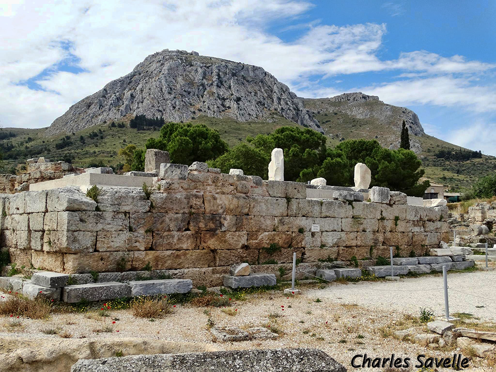
Since my last visit to Corinth some reconstruction has been made on the Bema and our photo below is published courtesy of Charles Savelle of BibleX.
The Bema where Paul stood before proconsul Gallio. The Acrocorinth looms over the city. Photo courtesy of Charles Savelle.
Corinth is located about two miles south of the narrow isthmus which forms the land bridge, and controlled access, between the main land mass of Greece and the Peloponnese. The isthmus is less than five miles wide. Small ships were dragged across the isthmus on the paved road now called the diolkos; larger ships unloaded their cargo which was carried across and reloaded. This avoided the long 200-mile journey around the Peloponnese. Nero abandoned his attempts to dig a canal across the isthmus (A. D. 67). Some scholars think the road only allowed the “occasional movement of military ships, conveyance of building materials from the southern to northern Corinthia, small-scale portaging of luxury goods, and [served as] the principal road from the Corinthian Gulf to the pan-Hellenic sanctuary of Poseidon at Isthmia” (Pettegrew,CorinthianMatters.comblog). The canal one sees today was constructed in 1881–1893.
Corinth “was situated on a plateau overlooking the Isthmus of Corinth about two miles from the Gulf. It lay at the foot of Acrocorinth, an acropolis which rises precipitously to 1,886 ft.…” and was easily defended in ancient times (Rupprecht 960).
Corinth had two good ports. Lechaion, to the west, on the Gulf of Corinth (an arm of the Ionian Sea), and Cenchrea, to the east, on the Saronic Gulf (an arm of the Aegean Sea).
The harbor of Cenchrea where Paul had his hair cut before departing for Jerusalem. Cenchrea was the home of Phoebe (Romans 16:1).
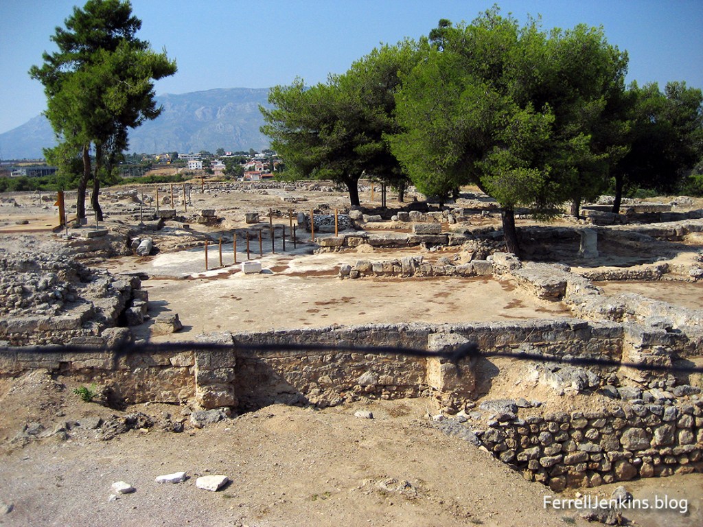
Another important community near Corinth was Isthmia. The biennial Isthmian games, second in importance to the Olympic games, were held there in honor of Poseidon at the isthmus of Corinth. Some scholars think Paul may have been present for one of these events while he was at Corinth. He frequently used athletic illustrations in his letters. See 1 Corinthians 9:24-25 as an example.
Ruins of the ancient site of Isthmia. The Corinth canal is to the right of this image. View is to the North West.
Over the years since the beginning of this blog I have posted several articles about Corinth. I suggest you put the name Corinth in the Search Box for a list of these posts. I think of this blog as a mini-dictionary of Bible lands and customs. I hope you will find it useful in your study of the Bible. Share it with you friends and suggest that they join our mailing list.
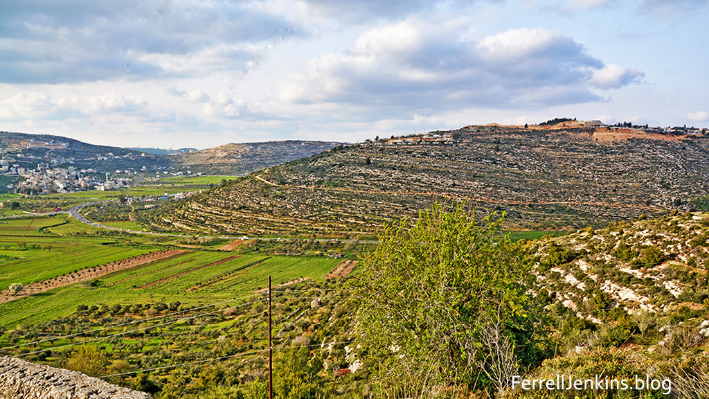
Our photo today shows an important site in the history of the tribe of Benjamin. The Valley of Lebonah is where the remnant of the tribe of Benjamin caught the daughters of Shiloh (Judges 21:16-25).
A view of the valley of Lebonah (left) and the natural hill on which Tel Shiloh can be seen on the top right.
The biblical text provides detailed information about the location of this event.
So they said, “Behold, there is the yearly feast of the LORD at Shiloh, which is north of Bethel, on the east of the highway that goes up from Bethel to Shechem, and south of Lebonah.” (Judges 21:19 ESV).
Our photo today was made from the hill on the west side of the valley of Lebonah. In the distance you will see Tel Shiloh on top of the natural hill.
The apostle Paul was of the tribe of Benjamin (Philippians 3:5).
The tabernacle stood at Shiloh for 300 years. Archaeological excavations are now being conducted by the Associates for Biblical Research under the direction of Dr. Scott Stripling. For more details on the next season of excavation see here.
Hierapolis is mentioned only once in the New Testament. The apostle Paul mentions Epaphras as a brother who has worked hard for the saints of the Lycus River valley.
For I bear him witness that he has worked hard for you and for those in Laodicea and in Hierapolis. (Col. 4:13 ESV)
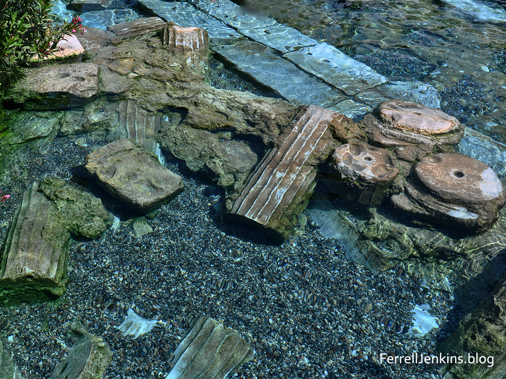
Hierapolis is noted for its warm springs which attract visitors due to their beauty and healing benefits.
The places where one may walk on the limestone cascades, or wade, or swim in the warm water is limited. But there is one public pool. Most of the time it is crowded with tourists, but I caught a time when very few were in it.
Fant and Reddish explain the significance of the pool.
The pool has attracted visitors throughout its history. During the Roman period, columned porticoes surrounded the pool. As a result of earthquake damage, several of the columns and other architectural pieces tumbled into the pool, where they can still be seen today. (A Guide to Biblical Sites in Greece and Turkey, p. 212).
One of the springs at Hierapolis now flows over the ruins of an ancient temple.
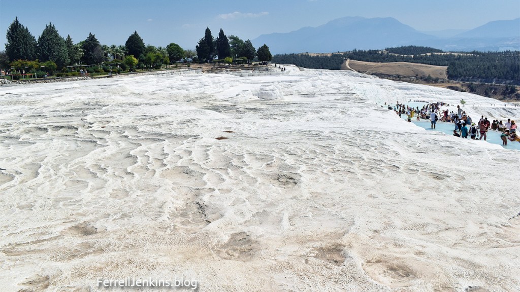
Visitors generally disregard the signs which ask them to stay off the newly formed hillsides.
In modern times the warm water is channeled to turn the hillsides into cotton castles. The town is now known as Pamukkale, a word meaning cotton castle or cotton fortress.
Looking south you may be able to see some of the ruins of Laodicea about six miles away. Colossae is located about ten miles southeast (to the left of this image).
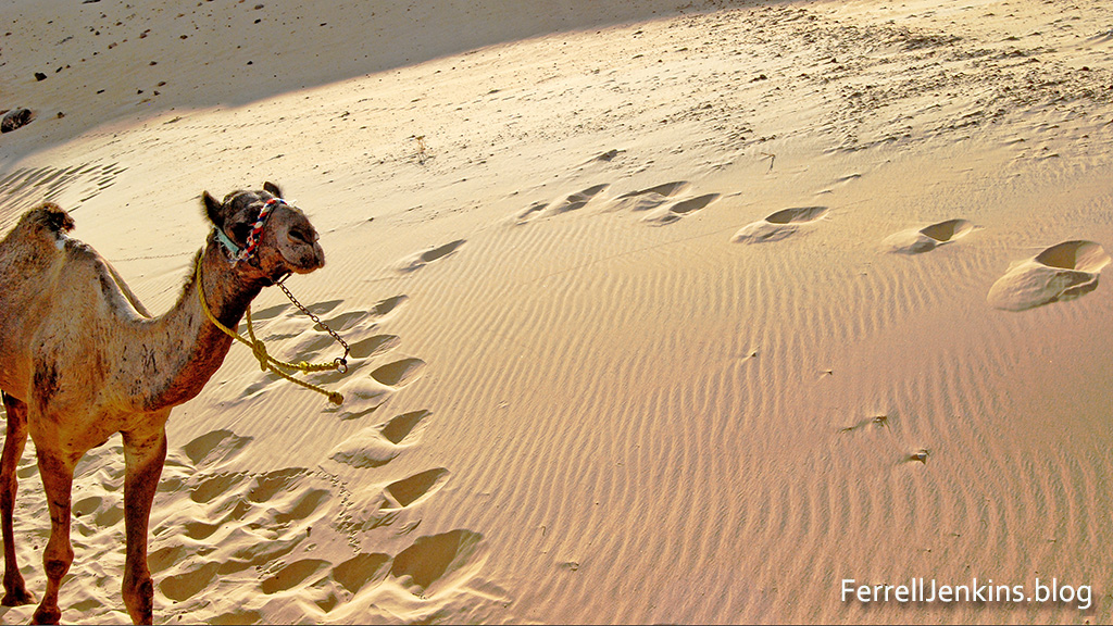
The Sahara, an Arabic word for desert stretches all the way across northern Africa. I have been able to visit deep into Morocco and in most parts of Egypt. The desert is impressive, but it is not a place one would wish to get lost.
Camels are suited to desert travel because they can drink large amounts of water and travel long distances between watering holes of one sort or another.
Along the Nile River one may see a few areas of greenery but much of the area is desert. Portions of it are covered by sand.
The story of Gideon and his 300 men includes information about the Midianites and Amalekites who had entered the promised land from the East.
And the Midianites and the Amalekites and all the people of the East lay along the valley like locusts in abundance, and their camels were without number, as the sand that is on the seashore in abundance (Judges 7:12 ESV).
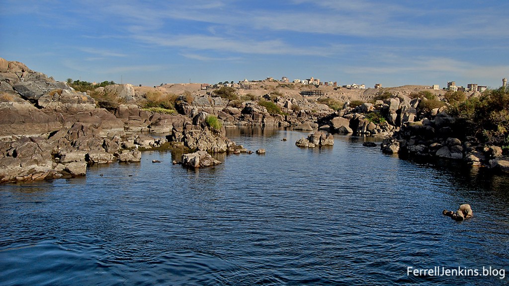
My first photo for today was made along the Nile River at the point of the first cataract near Aswan.
This photo was made along the Nile River at the first cataract of the Nile near Aswan.
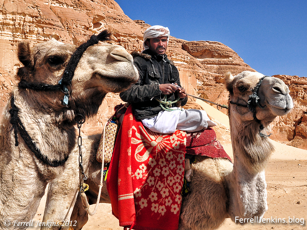
Part of a camel caravan in the eastern Sinai peninsula.
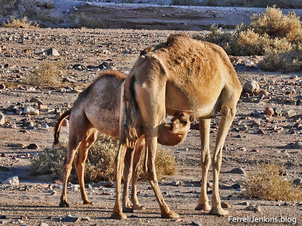
A shy young camel takes a peak at the bigger world under the protection of Mom. In this area the desert is more rocky than sandy.
I rode a camel on very few occasions during my fifty-plus years of traveling in the Middle East. Having been brought up in the rural south in the 40s and 50s of the last century I heard and read the expression “I would walk a mile for a camel” I developed my own saying: “I would walk a mile to avoid a camel.”
Tirzah is used in the Bible as the name of one of the daughters of Zelopehad. She and her sisters were married into the clans of the people of Manasseh the son of Joseph (Numbers 36:11; Joshua 12:24). The man in Song of Songs (or Solomon) tells his lady “You are beautiful as Tirzah, my love, lovely as Jerusalem, awesome as an army with banners” (6:4 ESV). The context, including Jerusalem, indicates he is comparing her to a beautiful city.
This photo shows a few of the excavated ruins of Tel el Farah, thought to be the site of Tirzah.
In today’s post we consider the name Tirzah as the name of a place.
Joshua captured the king of Tirzah during the conquest of the promised land (Joshua 12:24; 17:3).
Earlier when Abraham was at Shechem, the LORD promised him and his descendants the land of Canaan (modern Nablus) (Genesis 12:1-9).
About 931 BC after the death of Solomon Jeroboam rebelled and became king over Israel (the northern kingdom) at Shechem (1 Kings 11). Later the capital was moved to Tirzah (1 Kings 14:17).
R. K. Harrison describes the importance of Tirzah in the kingdom of Israel: “perhaps as the result of increasing political and economic relationships with Syria. Tirzah was the capital of Israel during the time of Baasha (1 Kings 15:21,33) and Elah (1 Kings 16:8-9). The seven-day reign of Zimri ended when he burned the palace over himself at Tirzah was being besieged by Omri (1 Kings 16:17-18). After ruling from Tirzah for six years, Omri moved the capital of Israel to Samaria (1 Kings 16:23-24) , probably because of his economic and political alignment with Phoenicia. Menahem, a resident of Tirzah, was able to overthrow Shallum (752 B.C.) toward the close of the northern kingdom’s existence and to usurp the throne, ruling for almost eleven years.
In 1982 I first visited Tel el Farah with the late Jimmy Cravens, a photographer friend from Tampa, Florida. The site still showed evidence of excavation. The gentlemen in the photo lived in a little house on the tel and served as the caretaker. I recall that he is showing us some of the walls that indicated a divider between the poor and those better off. He said he had worked with De Vaux during all of the excavations. The image is scanned from a slide that is still in good condition after 40 years.
The location of Tirzah is not certain. W. F. Albright identified it with Tel el Farah, a mound located about seven miles NE of Shechem (at modern Nablus). Roland De Vaux was associated with the Ecole Biblique in Jerusalem and conducted nine seasons of archaeological excavations at Tel el Farah between 1946 and 1960. Most of the tel is currently covered by an orchard.
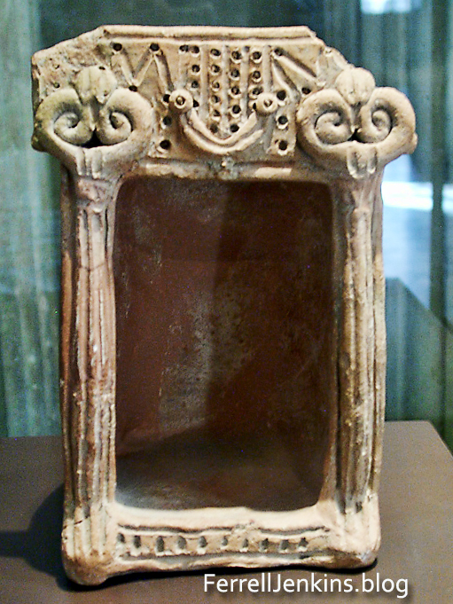
Several archaeological artifacts from Tel el Farah are displayed in the Louvre. This is a shrine or temple model from the site.
Tel el Farah north (likely Tirzah) should not be confused with Tel el-Farah south (likely Besor). See our article about a visit there a few years ago here. Google Earth Pro includes one photo from the south site with the information about the north site. It is easy to make this mistake.
If you wish to look up the site on Google Earth Pro or the maps you will need to search for Tel Fara North. Remember also that the site is in Palestine.


You must be logged in to post a comment.