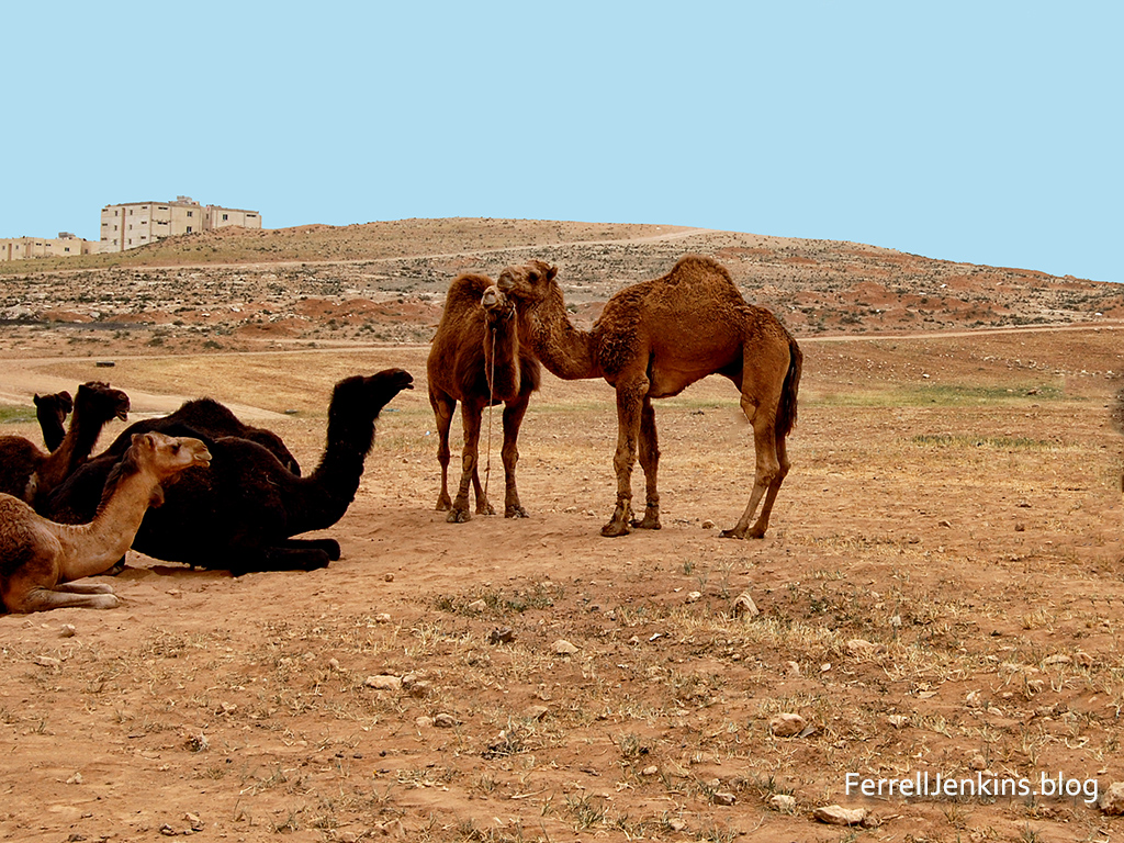
The site of Ramoth Gilead is located in northern Jordan near the Syrian border. The exact site is uncertain, but many scholars think Tall ar-Rumeith is to be identified with the biblical site. Ahab, king of ancient Israel, was concerned because the town of Ramoth Gilead which he claimed for the northern kingdom of Israel was controlled by Syria. Jehoshaphat, the king of Judah, agreed to go with Ahab to fight for Ramoth Gilead.
Camels in the foreground of the site possibly identified with Ramoth Gilead.
The prophets of the day seemed to be indebted to the kings and like good politicians assured them they would prosper in their effort to take the city. One prophet, a man named Micaiah came and told the king that he would not prosper. Micaiah said that he could only speak what the LORD told him.
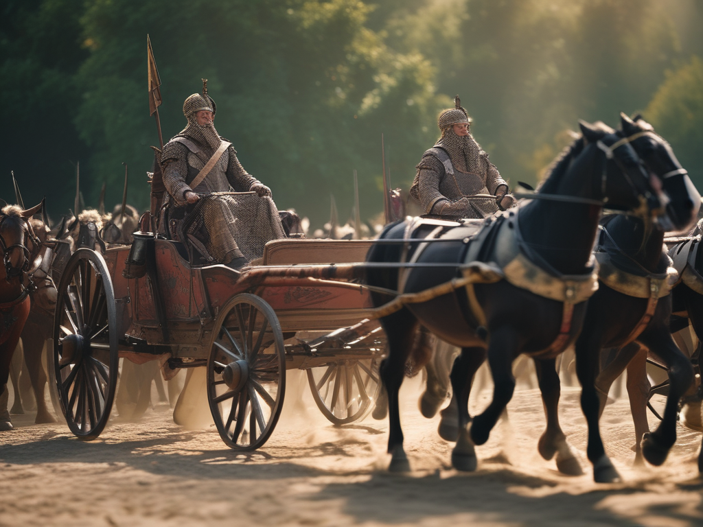
AI imagines that King Ahab looked something like this when he headed into battle.
When the kings arrived at Ramoth Gilead Ahab disguised himself and went into battle. He had convinced Jehoshaphat to put on his robes and go into battle. When the Syrian captains saw him, thinking he was Ahab, they went after him. When they saw it was not Ahab they turned back.
The Biblical record says that a “certain man drew his bow at random, and struck the King of Israel between the joins of his armor.” The soldiers of Israel propped up the king in his chariot and he died that evening. Ahab was taken back to Samaria for burial.
No amount of disguise can hide one from the LORD. This is another events that shows that the LORD rules in the kingdoms of men.
Read 1 Kings 22 for the full account of this event.
The arrogance of rulers frequently is given as a reason for God’s judgment upon the nations they rule. Notice first the example of ancient Egypt.
“Son of man, set your face against Pharaoh king of Egypt, and prophesy against him and against all Egypt; speak, and say, Thus says the Lord GOD: “Behold, I am against you, Pharaoh king of Egypt, the great dragon that lies in the midst of his streams, that says, ‘My Nile is my own; I made it for myself. (Ezekiel 29:2-3)
The Lord prophesied that (ancient) Egypt would become the lowest of the kingdoms (Ezekiel29:14-15). I have a lesson on the prophecies against Egypt in Introduction to Christian Evidences. All of my books are available from the Florida College Bookstore in Temple Terrace, FL (813-988-5131).
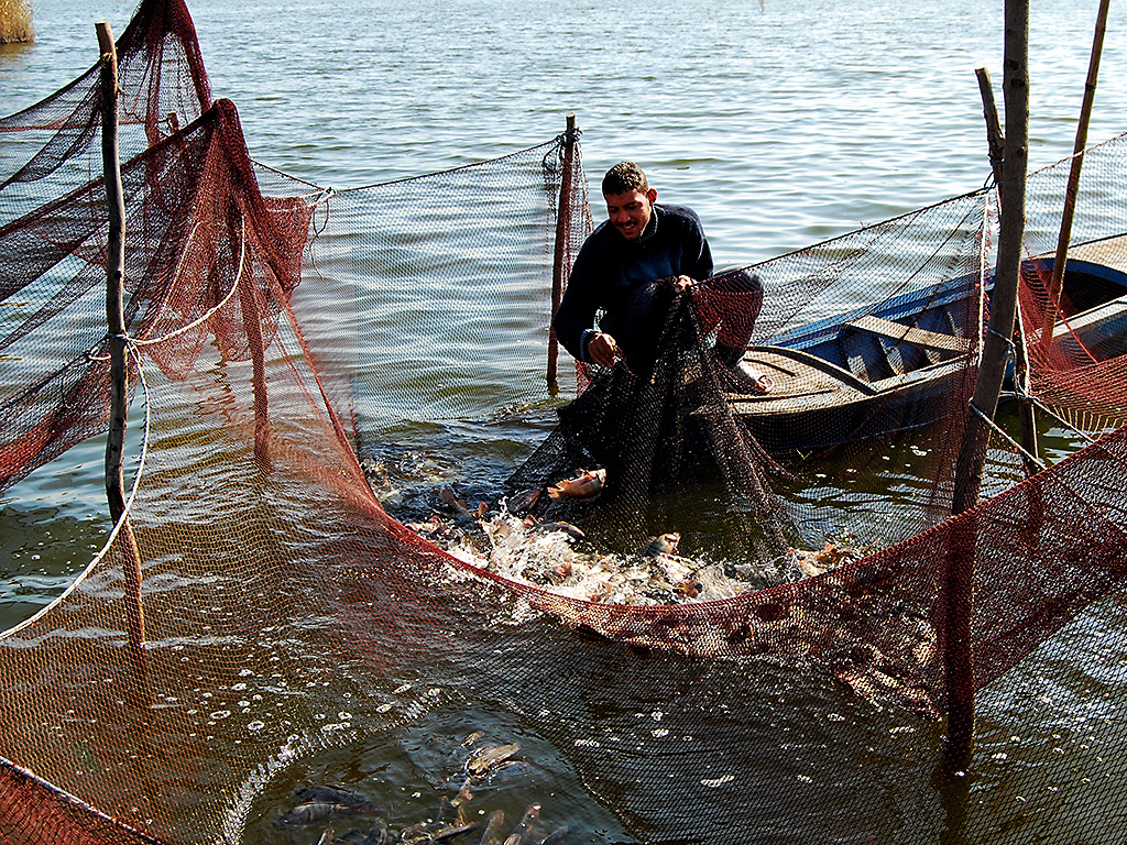
Fisherman in the Nile River south of Alexandria, Egypt. (C)FERRELL JENKINS 2008
The book of Habakkuk mentions a time when Edom (descendants of Esau). failed to come to the aid of Jacob (Israel) when they were under attack. Remember that Jacob and Esau were brothers.
When the prophet Habakkuk learned that the LORD was raising up the Chaldeans (the Babylonian Empire) against Edom, the prophet was puzzled that this could happen. In essence he said, “The Chaldeans are more wicked than the Edomites.” The LORD told Habakkuk that he would bring judgment upon the nations that failed to serve Him. That event was called the Day of the Lord (Habakkuk 1:15) or the Day of Jehovah. (ESV) or the Day of the LORD” (NAS, NKJ).
The Day of the Lord is described in highly figurative language in the Bible. It is a day when the mountains shake, when the rivers flood, the sun is darkened and the moon turns to blood. It is not the final judgment, but the judgment of nations. The prophet Obadiah spoke against Edom. Notice these words:
The vision of Obadiah. Thus says the Lord GOD concerning Edom: We have heard a report from the LORD, and a messenger has been sent among the nations: “Rise up! Let us rise against her for battle!” 2 Behold, I will make you small among the nations; you shall be utterly despised. 3 The pride of your heart has deceived you, you who live in the clefts of the rock, in your lofty dwelling, who say in your heart, “Who will bring me down to the ground?” 4 Though you soar aloft like the eagle, though your nest is set among the stars, from there I will bring you down, declares the LORD. (Obadiah1:1-4 ESV)
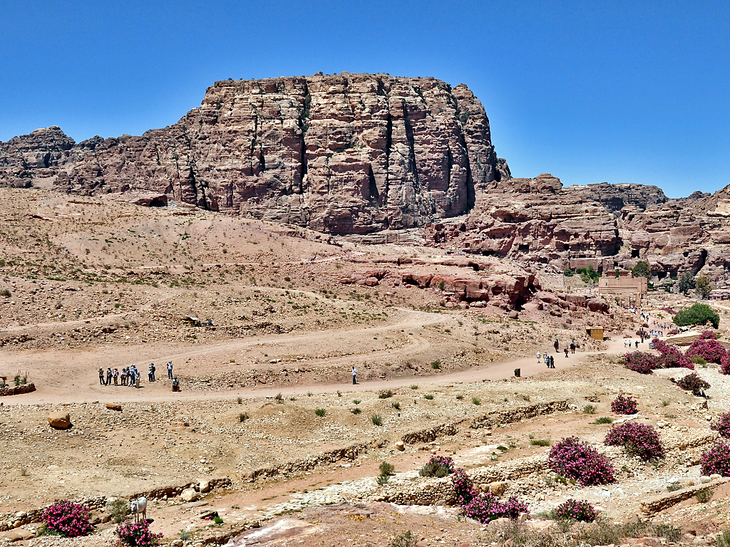
The site of Umm el Biyarah at Petra, Jordan. This was the fortress of the ancient Edomites Photo (c) Ferrell Jenkins.
Homer Hailey, my beloved college professor who first introduced me to the prophets, often said “God judges nations in time and individuals in eternity.”
The LORD used Assyria to punish the northern kingdom of Israel in 722 BC. Through the prophet Isaiah he said that he still held the Assyrians accountable (Isaiah 10:12).
The Assyrians were brought down by the Babylonians who also brought down the Egyptians (Ezekiel 29:17-30).
Am I able to say that a given conflict on this globe is the Day of the Lord? Since I do not have a “thus saith the Lord” in these cases I will not be dogmatic, but I think frequently about this clear biblical teaching.
After the previous post I was ask how far the map extended. I have seen the map several times, but much of my detailed info comes from an article by Victor R. Gold: “The Mosaic Map of Medeba.” This article first appeared in Biblical Archaeologist, XXI.3 (Sept. 1958), pp.59-71. It was included in a 3-volume set called The Biblical Archaeologist Reader, vol. 3.
Here is a section on the extent of the Map:
“Except for the [third century] Tabula Peutingeriana [road map of the world], the Madeba map is the only map of ancient Palestine still in existence. The large remaining section extends from Aenon in the Jordan valley, or near it, in the north, to the Canobic branch of the Nile in the south. Not even this section is complete, however, the footing of one of the columns rests over a section of Judea from Eleutheropolis (Beit Jibin) to Ashdod and Beersheba.” (Campbell, Edward F., and David N. Freedman, editors. The Biblical Archaeologist Reader 3. First ed., vol. 3, Doubleday and Company, 1970, pp. 359-65, 3 vols.
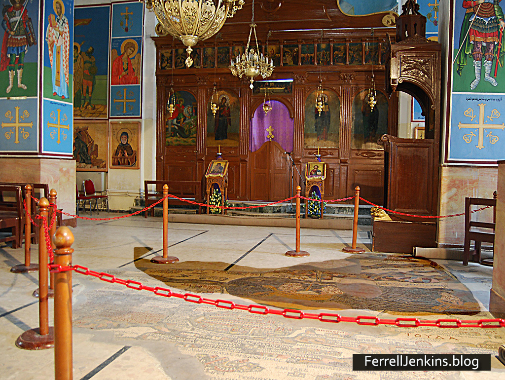
I am including a photo showing the actual size of the map in the church building floor at Madaba, Jordan. I have darkened the portion of the map that has been reconstructed there. We are not seeing all that is known to have existed. I have noted a small portion of the Nile Delta, and coastal towns such as Ashkelon and Ashdod. In my photos I can see mountains of Moab to the east, and Aenon in the northern Jordan Valley.
For the benefit of those who might like to see the size of the map in the Madaba church, I have darkened the map in the area that is cordoned off.
The Madaba Map is shown darker in the church floor to allow one to see the size of the map there.
The Madaba Map is an amazing piece of work. It would be nice if we had one in the vestibule where I meet with Christians.
About AD 560 the church at Madaba, now in Jordan, decided they needed a map in their building. They could not order one from their Bible class publisher, so they made a large Mosaic map on the floor of the building. This map was rediscovered in the 1880s.
Madaba was known as the Ammonite city of Medeba in Joshua 13:9,16 and Isaiah 15:2.
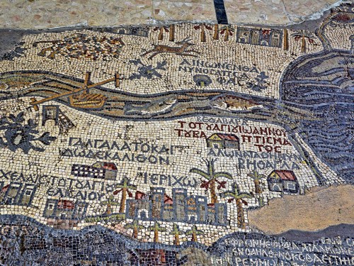
For now I wish to share a photo of a surviving portion showing the Jordan River flowing into the Dead Sea.
I understand the designer of the map to be saying that the fish of the Jordan River could not survive in the Salt Sea. This portion of the map also shows Jericho, the city of Palm trees (Deuteronomy 34:3; 2 Chronicles 28:15).
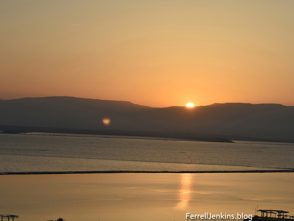
We set the clock to get up in time to see the sunrise across the Dead Sea. I was pleased with the result as the sun rose in the vicinity of Biblical Edom sending a ray across the Dead Sea. The smaller light to the left of center is a reflection from the camera lens.
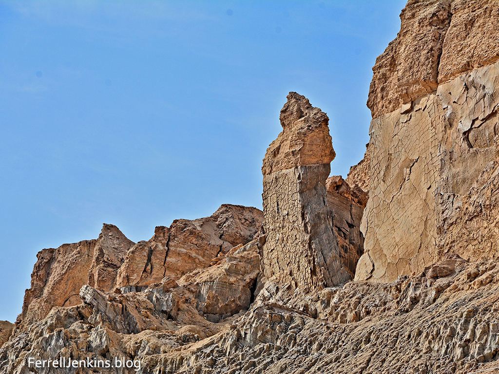
Now Lot went up out of Zoar and lived in the hills with his two daughters, for he was afraid to live in Zoar. So he lived in a cave with his two daughters. (Gen. 19:30 ESV)
While we were at the southern end of the Dead Sea we drove a little further south to see the formation nicknamed “Lot’s Wife.” This is based on the Biblical story of the destruction of Sodom and Gomorrah (Genesis 19. See especially Genesis 19:26, and the reference by Jesus in Luke 17:32).
As usual, these photos are available for download for use in teaching as long as credit is given to this source. For commercial use see our Photo Permission page.
Recent readers may not have noticed our header having a link on Indexes (Indices). If you go there you will find an Index of articles on Bethlehem and the Birth of Jesus. At this time of the year when many are thinking about the birth of Jesus and it’s meaning for all mankind I thought it would be good to call attention to these articles and photos. There have been several good comments and discussions about the date of the birth of Jesus.
I have many photos of shepherds and sheep, but not one of shepherds watching their sheep by night in the vicinity of Bethlehem. I do have some photos of shepherds with their sheep in the sheepfold at Heshbon in Jordan. I had been at Heshbon one afternoon visiting with the shepherds and making photos. When I saw their makeshift sheepfold I asked if I could come back in the evening and make some photos. The photo here is one made a dusk after the sheep had been gathered into the sheepfold. The shepherd and his family live in the tent. Heshbon was a former Moabite town given to the tribe of Reuben after the Israelites captured the Trans-Jordan tableland (Numbers 32:37).
Shepherds at Heshbon watching their flock at night.
To access the articles on Bethlehem click through here.
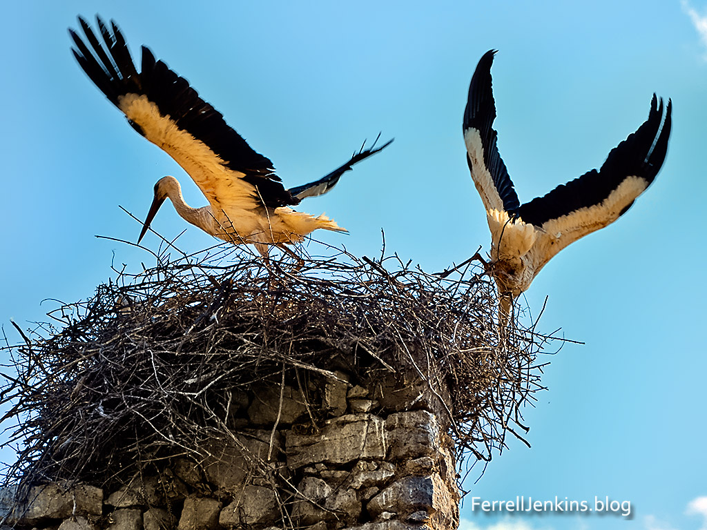
The stork is listed among the unclean birds in Leviticus 11:19 and Deuteronomy 14:18. The Psalmist says, “the stork has her home in the fir trees” (Psalm 104:17.
I have not seen a stork nest in a fir tree, but I have often seen them on the top of electric poles, chimneys, and ruined columns.
These storks are building a nest on the top of an old brick column at Kovanlik, Turkey. This photo was made yards away from the beginning of the Via Sebaste or Imperial Road that leads northeast across the mountains from the Pamphylian coastal plain to the Anatolian plateau. The approximate location is 37 10.4234N, 30 35.875E. Photo by Ferrell Jenkins
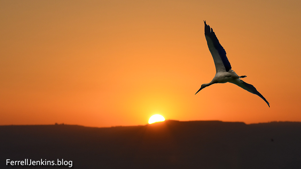
The prophet Jeremiah uses the faithfulness of the stork as it moves from one continent to another and then returns as an illustration of the faithfulness not seen in the people of the LORD.
Even the stork in the heavens knows her times, and the turtledove, swallow, and crane keep the time of their coming, but my people know not the rules of the LORD. (Jeremiah 8:7 ESV)
I have seen this played out repeatedly in my travels in Israel and Turkey. The storks fly from Europe and other northern climes to Africa in the fall of the year. The Great Rift provides the way for them to navigate through Syria and Israel/Jordan.
This is a composite photo showing a stork in the Jordan Valley and a sunrise over the Golan Heights. Photos by Ferrell Jenkins.
The prophet Zechariah also uses the wingspan of the stork as an illustration. In one of his visions he says,
Then I lifted my eyes and saw, and behold, two women coming forward! The wind was in their wings. They had wings like the wings of a stork, and they lifted up the basket between earth and heaven. (Zechariah 5:9 ESV)
The Keren Kayemeth Leisrael JNF website provides good information about storks, and other birds, in the Hulah valley here. Here is another nice site with information about storks and some good photos.
HT: Dr. Mark Wilson, author of Biblical Turkey, who gave the directions of the Via Sebaste mentioned with the first photo to Leon Mauldin and me. An article by Mark R. Fairchild in BAR includes a map showing two possible routes from Perga in Pampylia to Pisidian Antioch. The caption with the map suggests the Via Sebaste as possibly being used by Paul, but Dr. Fairchild does not think Paul would have traveled that way. Nonetheless it is possible that Paul might have used this route in one direction or the other, more likely on the return. (Fairchild, Mark R. “Why Perga?” Biblical Archaeology Review 39.6 (2013): 53–59.)
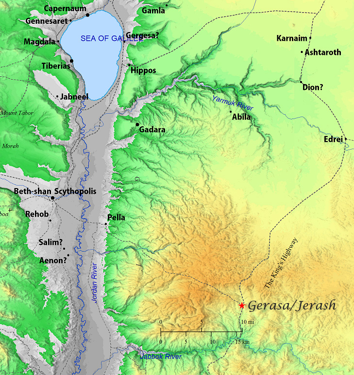
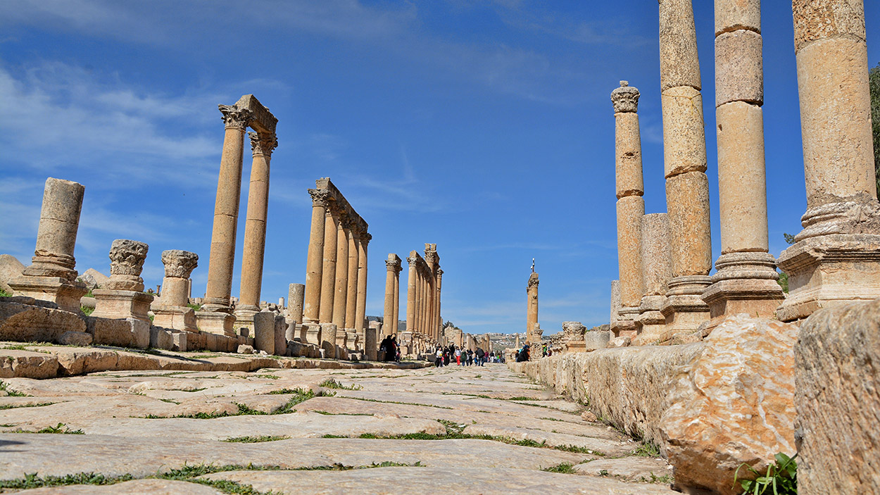
Jerash is also called Gerasa and Jarash. It was founded by Alexander the Great about 332 B.C., but declined as an important city about 300 B.C. The ruins are seen today are principally from the second century A.D. Roman city. We can imagine what the city of the time of Jesus looked like.
This map shows the relationship of Gerasa/Jerash to Galilee, the principal area of Jesus’ ministry. Photo prepared with BibleMapper v.5. ferrelljenkins.blog.
Jerash is located in a well-watered valley in the mountains of Gilead. The modern village is inhabited mostly by Circassians, who were brought there by the Turks in the last part of the 19th century.
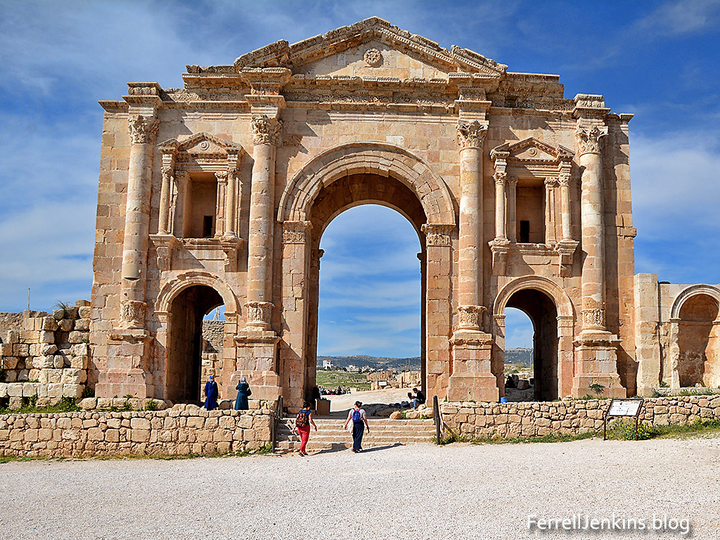
The Triumphal Arch was constructed at the time of the visit of the Emperor Hadrian in A.D. 129. Photo by Ferrell Jenkins.
A German traveler named Seetzen rediscovered Gerash for the Western world in 1806. Excavations were begun in the 1920s. The main points of interest include the following: Triumphal Arch (built in 129 A.D. to celebrate Hadrian’s visit; Oval-shaped Forum (only one of its kind from the Roman period, from 1st century); Temple of Artemis (columns are 45 feet high with Corinthian capitals); Cathedral Church (ca. A.D. 350-375). Thirteen Byzantine churches have been excavated at Jerash.
A view of the cardo of Jerash in Jordan. Jerash was one of the cities of the Decapolis. Photo by Ferrell Jenkins.
People from the Decapolis followed Jesus during His ministry in Galilee. Jerash was the second largest city of the Decapolis, after Damascus (Matthew 4:23-25). When Jesus traveled through the Decapolis he possibly visited the area around Jerash (Mark 7:31).
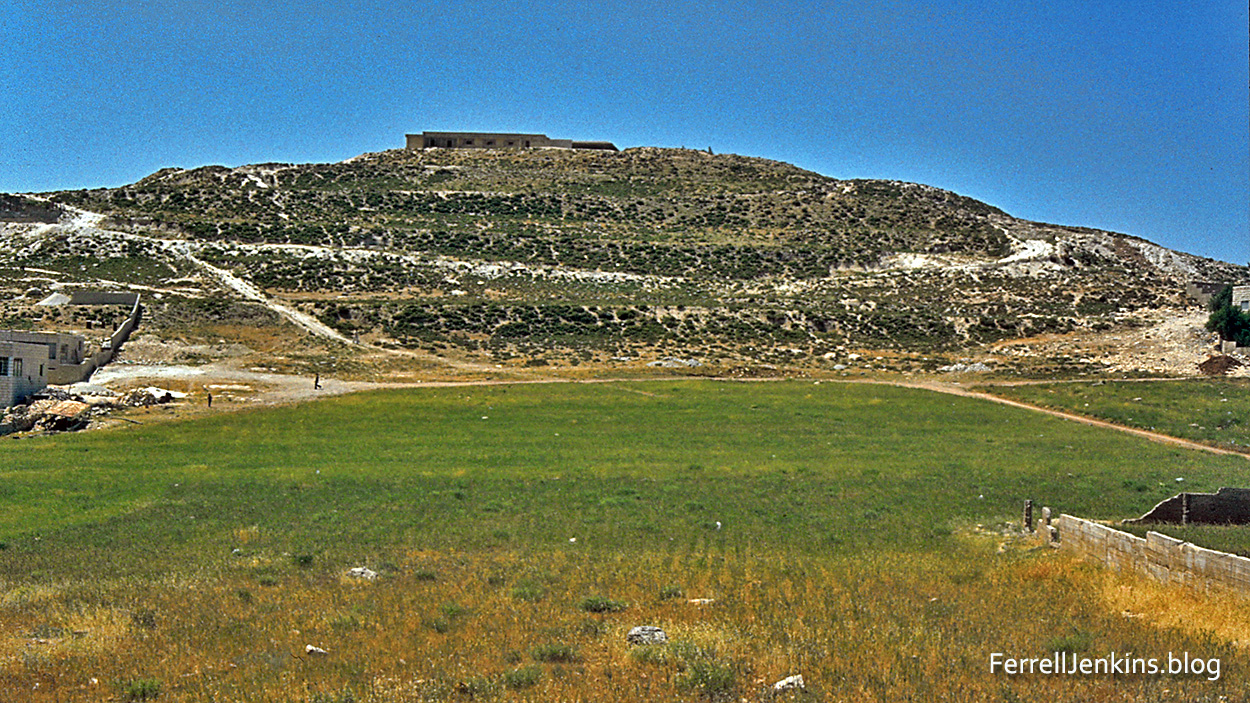
Gibeah of Saul. Scanned from a 1980 or 1981 slide. View from the east. Photo by Ferrell Jenkins.
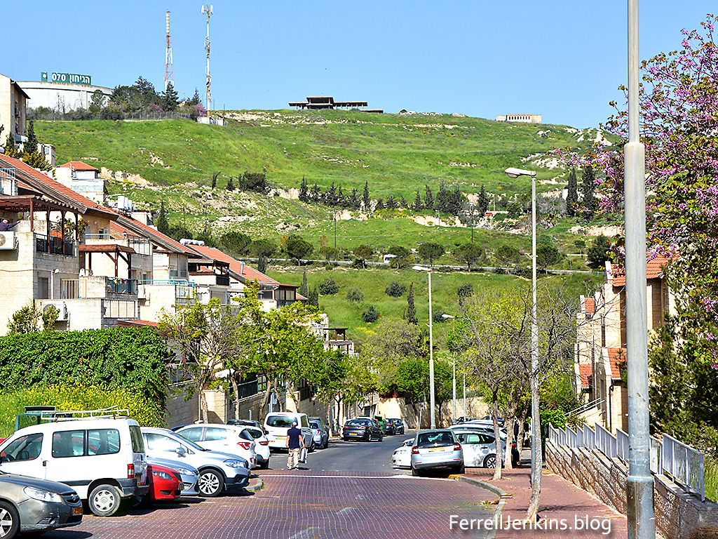
This is a modern view of Tall al Ful (formerly called Tell el-Ful) from the west side town of Pisgat Ze’ev Mizrah. Notice the structure on top of the mound. Explanation below.
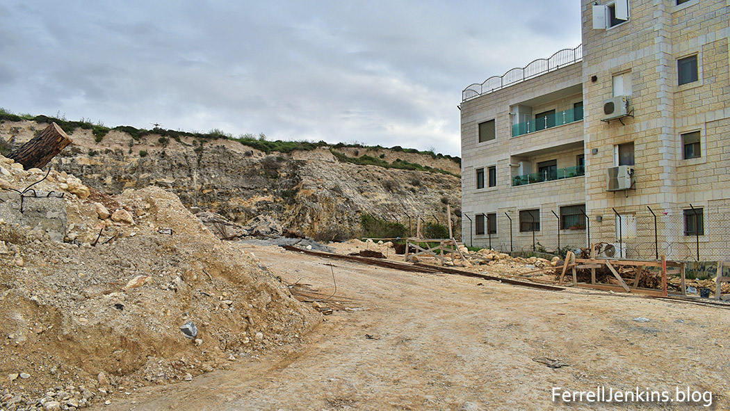
It is not uncommon in the Palestinian territory for houses to be built along the slopes of a tell if not the top. See this next picture as an example of the encroachment.
Construction underway that encroaches on the mound of ancient Gibeah. Photo by Ferrell Jenkins.
Israel’s first king was a man of the tribe of Benjamin named Saul. The Bible records that he was from Gibeah (1 Samuel 10:26). More than once the text refers to the town as “Gibeah of Saul” (1 Samuel 11:4; Isaiah 10:29).
Gibeah of Saul in the territory of the tribe of Benjamin. Made with BibleMapper 5.
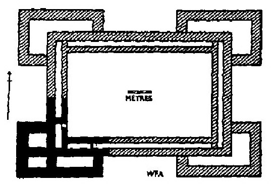
Gibeah was located about three miles north of Jerusalem on a main road leading north at an elevation of more than 2700 feet, about 300 feet higher than Jerusalem. It was a city of the tribe of Benjamin (1 Samuel 14:16) and is presently called Tal al-Ful (hill of beans) by the Arabs. William F. Albright excavated Gibeah during 1922 and 1933. From the time of King Saul, in the second half of the 11th century B.C., Albright found “a corner tower and part of the adjacent wall” (Albright, The Archaeology of Palestine, p. 120). The southwest tower of the fortress had three rooms and the indication was that the whole structure was at least two stories high. Some modern scholars have called this identification in question.
Reconstructed citadel excavated by Albright at Tall al-Ful.
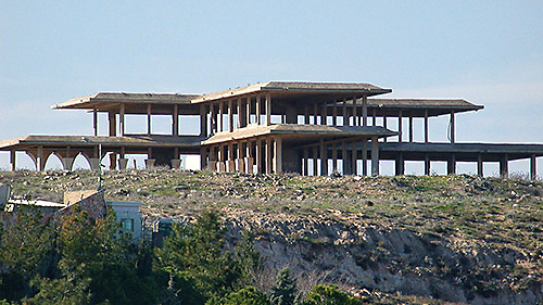
King Hussein of Jordan was in the process of building a palace on top of this impressive mound when Israel occupied the territory in June, 1967. The unfinished structure can still be seen.
The unfinished summer royal palace of King Hussein of Jordan. Photo: Todd Bolen, Pictorial Library of Bible Places.
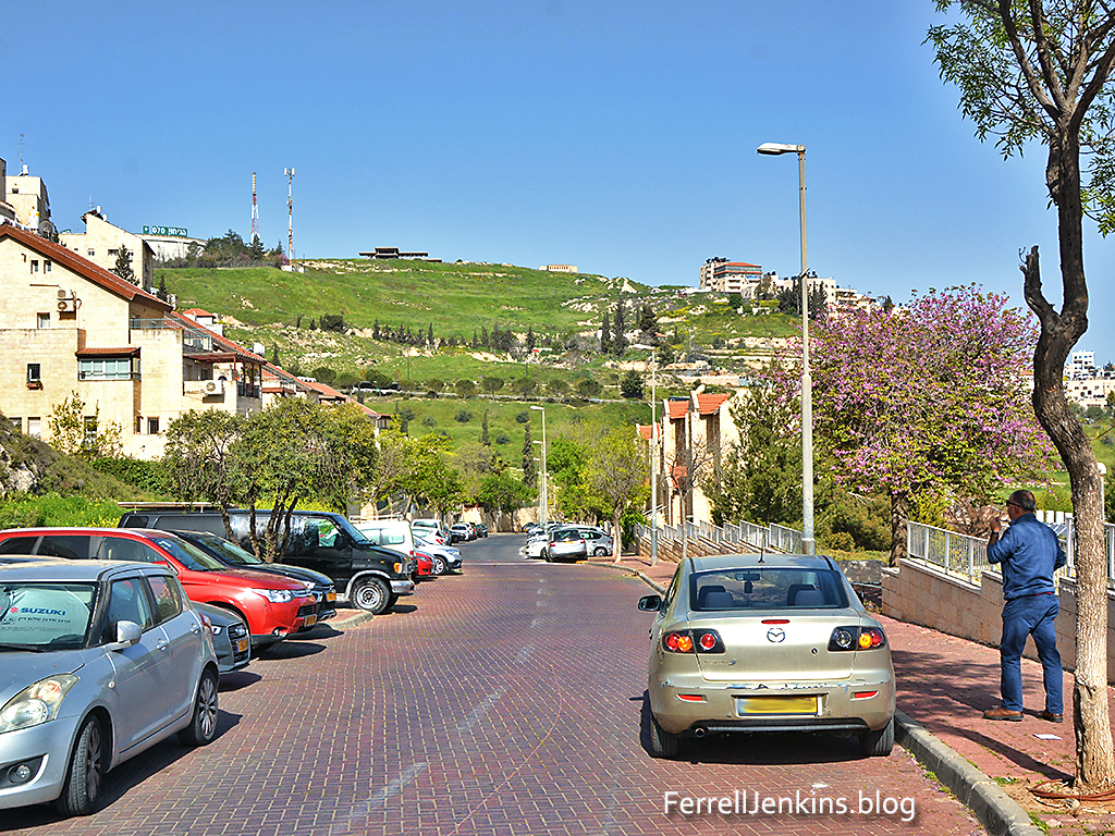
And finally, here is another view made from Pisgat Ze’ev.
Gibeah (Tall al-Ful) View from Pisgat Ze’ev to the east of the mound. Photo by Ferrell Jenkins.
From the Sea of Galilee to the Dead Sea is a distance of 65 miles but the Jordan river twists and turns for about 200 miles. The fall is about 590 feet (about 9 feet per mile). Nelson Glueck began his 1945 book, The River Jordan, by describing the river in beautiful terms.
THE JORDAN is a weird stream. It twists and tears its way swiftly downward in an almost incredibly sinuous manner from the sweet waters of the Lake of Galilee to the bitter wastes of the Sea of Salt or Dead Sea. Squirming frantically, burrowing madly, seeking wildly to escape its fate, the Jordan’s course from its crystal-clear beginnings to its literally dark and bitter end is a helpless race to a hopeless goal. Like Lot’s wife, it looks backward, but only inevitably to perish in the perdition of Bahr Lut, the “Sea of Lot,” as the Dead Sea is called by the Arabs. (p. 3)
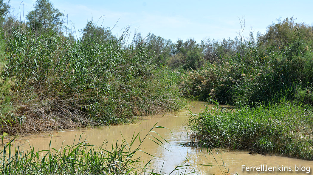
At the traditional site of the baptism of Jesus by John the Baptist, a place called Qasr el Yahud, a few miles north of the Dead Sea, only very short stretches of the river are visible (Matthew 3:13-17; John 1:28). The photo below shows one of the many curves in the river. Click on the photo for a larger image.
This photo was made at Qasr el Yahud, the traditional site of the baptism of Jesus in the Jordan River. Photo by Ferrell Jenkins.
The prophet Jeremiah describes the heavy growth on the banks of the Jordan as the thicket of the Jordan (Jeremiah 12:5; 50:44). Perhaps the reading in the Net Bible, “the thick undergrowth along the Jordan River,” provides a clearer understanding. “Lions could suddenly appear from the bushes” (Jeremiah 49:19; Lalleman, Tyndale Old Testament Commentaries).


You must be logged in to post a comment.