
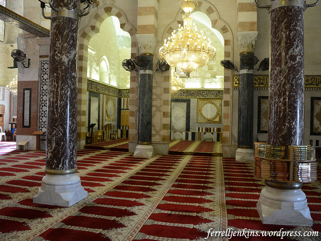
In two previous posts I wrote about visiting the Dome of the Rock and the Al-Aksa Mosque. You must know that I learn more from this blog than anyone. That is one of the reason I enjoy preparing it.
In the last post I stated that “There is good reason to believe that both Jesus and the Apostles used this entry to the Temple (Matthew 21:12-13; Acts 3:1).” Mark Hoffman, a professor who writes the helpful Biblical Studies and Technological Tools blog, after leaving nice comment about my post, said,
One question: I was under the impression that the typical pilgrim in Jesus’ time would enter by the triple gates to the right (east) and exit by the double gates to which you draw attention. Do you know if this is correct?
I’m trying to locate the rabbinic reference, but I believe that people who entered by the double gates were mourning or grieving, and by walking up the steps through the double gates, others were made aware of their sorrow.
I began to dig into the sources at hand to see if I could find an answer. Perhaps I had rushed past this information before, but I don’t remember it.
This morning Joseph I. Lauer, who provides so much helpful information that I use on the blog, provided an answer.
Mishnah Middot 1:3 states in part that “the two Huldah Gates in the south were used for entering and exiting.” Mishnah Middot 2:2 states in part that “All those entering the Temple Mount enter towards the right and circle and exit toward the left, except for one to whom something [adverse] occurred, for he would circle toward the left.” Circling toward the left would indicate to the others that he was a mourner or had been excommunicated.

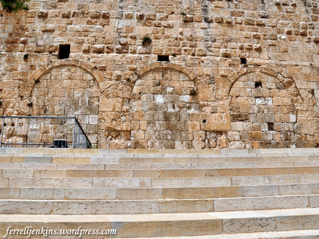
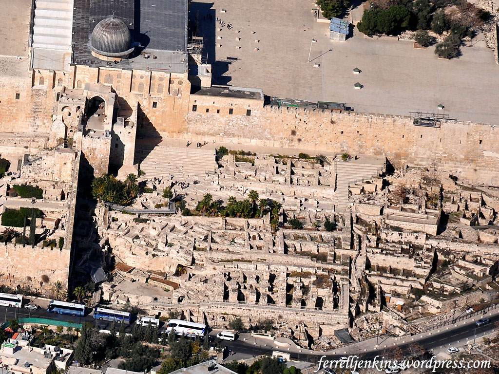
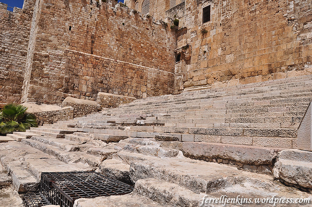
Most of the Double Gate is covered by a later building, but a small portion of the eastern door jamb can be seen in the left of our photo. Herodian stone work has been found inside the gate. The lower part of a window in the Al Aksa Mosque is visible at the top of the photo. Photo by Ferrell Jenkins.
By this time I had already located that reference and other interpretations of the Mishnah quotation. One source that was helpful was John McRay’s Archaeology and the New Testament.
In the Mishnah it is said that temple worshippers entered on the right and exited on the left. [Middoth 2:2] This statement may relate to the purification process involved. At Qumran, for example, small partitions in the stairways of the ritual baths kept those purified from being defiled by those who were yet unclean. A Talmudic passage refers to Gamaliel (the teacher of the apostle Paul, Acts 22:3) and the elders standing on top of the stairs at the Temple Mount. [Tosepthta Sanhedrin 2:2] Thus, entrance to the Temple Mount may have been through the Double Gates and exit through the Triple Gates. [Middoth 1:3, etc.] (McRay, John. Archaeology and the New Testament. Grand Rapids: Baker, 1991: 107)
Jack Finegan, in The Archaeology of the New Testament, suggests that the Double Gate, on the west, was used both for the “entry and exit of pilgrims,” and that the Triple Gate (on the east) “was used by the priests.”
On the south side of the Temple enclosure may be seen two gates, which are about seventy meters apart and now walled up. They are known as the Double Gate and the Triple Gate. They are usually identified with the gates in the middle on the south side mentioned by Josephus, and with the two Huldah Gates mentioned in Middoth, and they are sometimes called the Western and Eastern Huldah Gates, with the supposition that pilgrims entered the Temple area by the western gate and departed by the eastern gate. An alternate theory supposes that the Double Gate itself provided for entry and exit of pilgrims and was thus itself the two Huldah Gates while the Triple Gate was used by the priests. (Finegan, Jack. The Archaeology of the New Testament. Rev. ed. Princeton: Princeton UP. 1992. 206-207.)
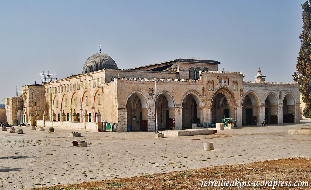
The Triple Gate in the southern wall of the Temple Mount. The gates you see here are much later, but an original Herodian stone is located to the left of the gates. Photo by Ferrell Jenkins.
I would also like to share one additional comment by Meir Ben-Dov. He begins by discussing why the entry to the Temple would be from the south.
Throughout the ages it was a standard practice to build temples in the highest spot in any given area, so that a visit to the holy site involved “ascent.” The slope to the south of the Temple Mount was the longest and steepest of all the gradients surrounding it; only there was it possible to manifest the idea that the approach to the Temple Mount would be both impressive and steep enough to create the feeling of ascent. This also explains the call in the Bible, “Arise ye, and let us go up to Zion” (Jeremiah 31:6), not in its modern “Zionist” sense but quite literally; for it was addressed to the inhabitants of Jerusalem, most of whom were then living in the City of David, south of and below the Ophel.
After that he proceeds to discuss the southern gates that are the subject of interest here.
The two gates in the southern wall are about 70 meters apart and served the pattern established for entry and exit: “Whoever it was that entered the Temple Mount came in on the right and went around and came out on the left, save any [who have suffered some tragedy], for he went round to the left. ‘What aileth thee that thou goest to the left?’ ‘Because I am a mourner.’ ‘May He that dwelleth in this House give thee comfort’” (Midot Tractate 2:2).
The picture that emerges from this description has the majority of the public entering the compound via the eastern Hulda Gate, walking around the Temple, and exiting through the western Hulda Gate} while a person in mourning that year would walk around the Temple in the opposite direction, entering through the western gate and leaving through the eastern one. This was a fitting custom, for if a visitor to the Temple met anyone walking in the opposite direction – even a perfect stranger he immediately understood that the man had suffered a tragedy, inquired about it, and comforted the mourner in his grief. In this way, a visit to the Temple was personalized and helped to cultivate a sense of national solidarity, which was not common to the temples of other peoples. (Ben-Dov, Meir. In the Shadow of the Temple. Trans. Ina Friedman. Jerusalem: Keter, 1982. 136.)
Thanks to the two gentlemen who stimulated this study. I now leave it to others who may have interest to do additional research and draw their own conclusions.


You must be logged in to post a comment.