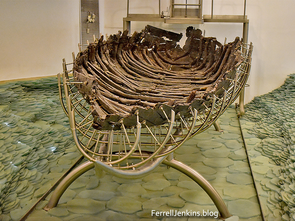
A Roman period boat was found buried in sand near the shore of the Sea of Galilee north of Tiberias . After a period of restoration the boat was put on exhibit at the Yigal Allon Galilee Boat Museum at Kibbutz Ginosar on the west shore of the Sea of Galilee, north of Tiberias.
The Roman boat on display in the museum at Kibutz Ginosar. Photo (c) by Ferrell Jenkins.
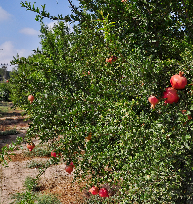
The Pomegranate was a popular fruit in Bible times. The ancient Israelites were promised “a land of wheat and barley, of vines and fig trees and pomegranates, a land of olive trees and honey” (Deuteronomy 8:8 ESV).
Our photo below shows the Pomegranate growing at Lachish in modern times.
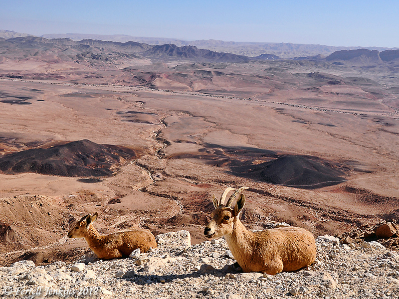
Ibex enjoy the view at Mitzpe Ramon, Israel, in the Wilderness of Zin. These two Ibex are lying on the edge of a steep cliff over a major highway below. Use the blog Search box to locate more photos of Ibex and additional information. Photo by Ferrell Jenkins.
Ibex enjoy the view at Mitzpe Ramon in the Wilderness of Zin. Photo by Ferrell Jenkins
Every time I think of working on tax preparation I think about this episode from the ministry of Jesus:
24 When they came to Capernaum, the collectors of the two-drachma tax went up to Peter and said, “Does your teacher not pay the tax?” 25 He said, “Yes.” And when he came into the house, Jesus spoke to him first, saying, “What do you think, Simon? From whom do kings of the earth take toll or tax? From their sons or from others?” 26 And when he said, “From others,” Jesus said to him, “Then the sons are free. 27 However, not to give offense to them, go to the sea and cast a hook and take the first fish that comes up, and when you open its mouth you will find a shekel. Take that and give it to them for me and for yourself.” (Matthew 17:24-27 ESV).
Fishing is still important on the Sea of Galilee. Tour groups to Israel usually have at at least one meal of the famous St. Peter’s Fish when we are in the Galilee.
Mendel Nun spent more than 50 years fishing the Sea of Galilee. He became an expert in the history of fishing on the Sea. His article, “Cast Your Net Upon the Waters: Fish and fishermen in Jesus’ Time” (Biblical Archaeology Review, 19:06), includes information on this episode. Because this is a lengthy quotation I will leave it full width for easier reading.
— • —
The musht is the only large fish in the lake that moves in shoals, which of course is a key to the identification of the fish in the story in Luke, although not the only one.
The flat shape of the musht makes it especially suitable for frying. The skeleton consists of an easily detachable backbone and relatively few small bones, and thus it is easy to eat. It has long been known as St. Peter’s fish. Recently, it has even been exported under this name. But, alas, the name is a misnomer.
Presumably the fish got its name because of an incident recorded in the Gospel of Matthew (Matthew 17:24–27). In this episode, the tax collectors come to Capernaum to collect the half-shekel Temple tax that each Jew was required to pay annually. Jesus tells Peter, “Go to the sea and cast a hook, and take the first fish that comes up, and when you open its mouth you will find a shekel; take that and give it to them for me and yourself.”
The musht was probably given the name St. Peter’s fish because of this miracle. However, this cannot have been the fish Peter caught with a hook and line. The reason is simple: Musht feeds on plankton and is not attracted by other food. It is therefore caught with nets, and not with hook and line. The fishermen on the lake have, since time immemorial, used a hook baited with sardine to fish for barbels, which are predators and bottom feeders. Peter almost surely caught a barbel. There can be only one explanation for the confusing change of name. It was good for tourism! The Sea of Galilee has always attracted pilgrims; musht (today raised mostly in ponds) is part of the unique local cuisine. It is delicious, especially when freshly fried. In ancient times, just as today, the fishing boats delivered their catch to the eating places on shore. Indeed, the proverbial metaphor for speed in the Talmud is “as from the sea into the frying pan.” This expression was part of daily speech in Tiberias and clearly refers to musht and not barbels; the latter are best when boiled.
The first Christians were local people and were therefore familiar with the various fish. They of course knew that the fish Peter caught could only have been a barbel and not a musht. However, as pilgrims began to come from distant regions, it no doubt seemed good for business to give the name “St. Peter’s fish” to the musht being served by the early lakeside eating houses. The most popular and easily prepared fish acquired the most marketable name! But even if Peter did not catch a musht, he deserves to have his name associated with the best fish in the lake.
Returning to the miracle of the fish caught in Luke (5:1–7), additional clues that the fish were musht are the kind of net referred to and the place and the time of the event. Several kinds of nets were used in the Sea of Galilee. The most important were the seine, the cast net and the trammel net.
— • —
For some time the most searched for article on this blog has been Fish of the Sea of Galilee. If you have not read the article and enjoy the photos I urge you to do so now.
Here is one of the photos from that post.
A fisherman unloading his catch early in the morning at a dock at Tiberias, Israel.
Use this shortlink to go to the article with more information about the fish of the Sea of Galilee: https://wp.me/p1zOp-42k
If you use our SEARCH box and insert the word fish you will locate many articles about fish and fishing on the Sea. If you search for Mendel Nun you will find several more helpful articles about fishing and the harbors of the Sea of Galilee.
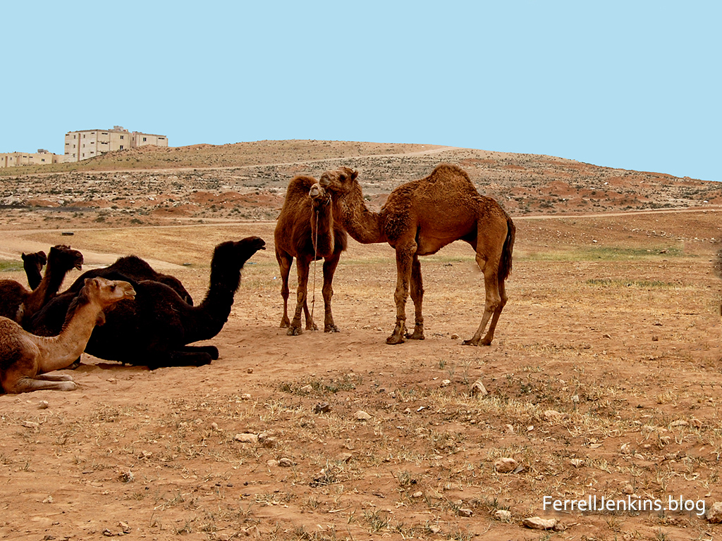
The site of Ramoth Gilead is located in northern Jordan near the Syrian border. The exact site is uncertain, but many scholars think Tall ar-Rumeith is to be identified with the biblical site. Ahab, king of ancient Israel, was concerned because the town of Ramoth Gilead which he claimed for the northern kingdom of Israel was controlled by Syria. Jehoshaphat, the king of Judah, agreed to go with Ahab to fight for Ramoth Gilead.
Camels in the foreground of the site possibly identified with Ramoth Gilead.
The prophets of the day seemed to be indebted to the kings and like good politicians assured them they would prosper in their effort to take the city. One prophet, a man named Micaiah came and told the king that he would not prosper. Micaiah said that he could only speak what the LORD told him.
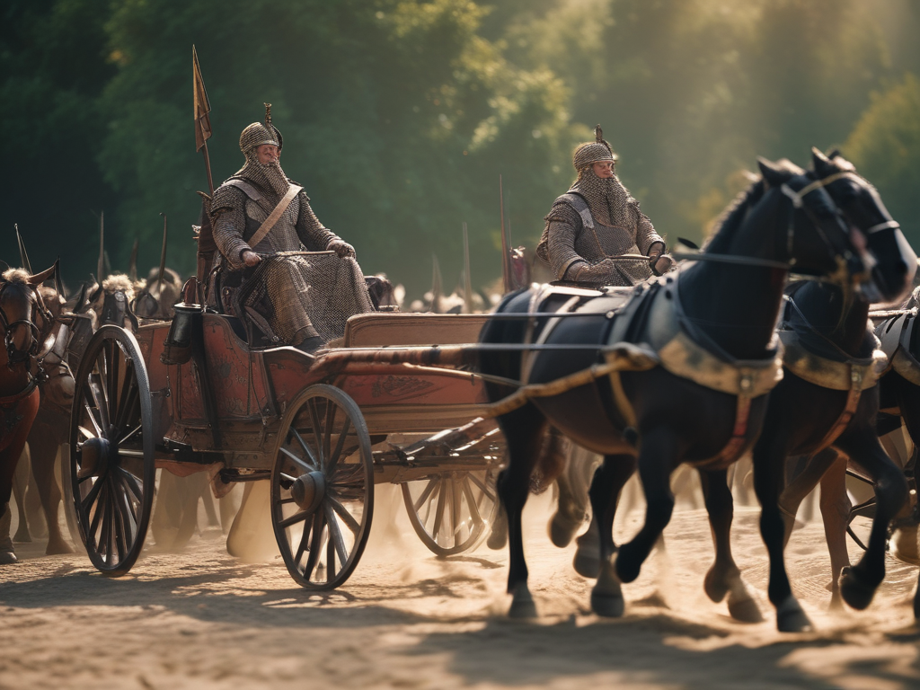
AI imagines that King Ahab looked something like this when he headed into battle.
When the kings arrived at Ramoth Gilead Ahab disguised himself and went into battle. He had convinced Jehoshaphat to put on his robes and go into battle. When the Syrian captains saw him, thinking he was Ahab, they went after him. When they saw it was not Ahab they turned back.
The Biblical record says that a “certain man drew his bow at random, and struck the King of Israel between the joins of his armor.” The soldiers of Israel propped up the king in his chariot and he died that evening. Ahab was taken back to Samaria for burial.
No amount of disguise can hide one from the LORD. This is another events that shows that the LORD rules in the kingdoms of men.
Read 1 Kings 22 for the full account of this event.
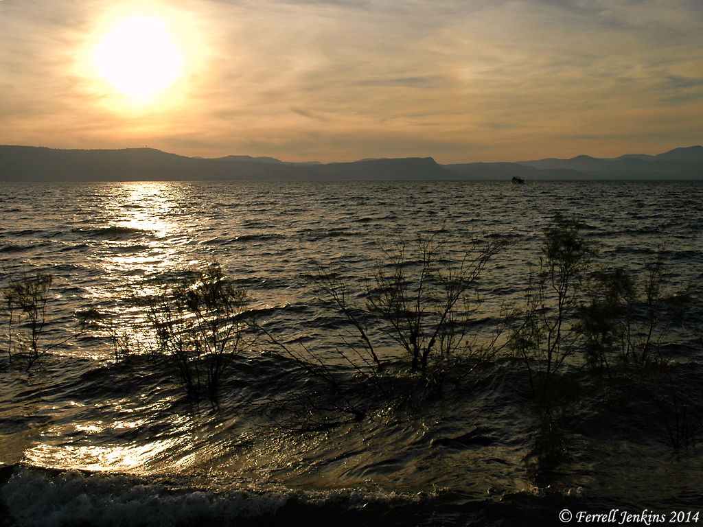
Many photos have been made of the sunrise on the Sea of Galilee. I certainly have made my share of them. On a rare occasion I have found my tour group or myself on the eastern shore of the Sea of Galilee at sunset. The photo below was made from En Gev. It illustrates several important things. The water looks choppy. This is more typical in the late afternoon than in the morning. The wind comes from the North East and causes turbulence on the water. That is what you see in this photo. Let me emphasize that this is NOT an AI generated picture..
A view of the Sea of Galilee from the east at sunset. Photo by Ferrell Jenkins.
Something resembling this happened on the occasion when the disciples saw Jesus walking on the water. See Matthew 14, Luke 5 and John 6. Notice that a strong wind was blowing on the sea (John 6:18).
If you have traveled in this region of Israel you will recognize Mount Arbel and the Horns of Hattin in the distance on the western side of the Sea of Galilee (or Kinneret).
The arrogance of rulers frequently is given as a reason for God’s judgment upon the nations they rule. Notice first the example of ancient Egypt.
“Son of man, set your face against Pharaoh king of Egypt, and prophesy against him and against all Egypt; speak, and say, Thus says the Lord GOD: “Behold, I am against you, Pharaoh king of Egypt, the great dragon that lies in the midst of his streams, that says, ‘My Nile is my own; I made it for myself. (Ezekiel 29:2-3)
The Lord prophesied that (ancient) Egypt would become the lowest of the kingdoms (Ezekiel29:14-15). I have a lesson on the prophecies against Egypt in Introduction to Christian Evidences. All of my books are available from the Florida College Bookstore in Temple Terrace, FL (813-988-5131).
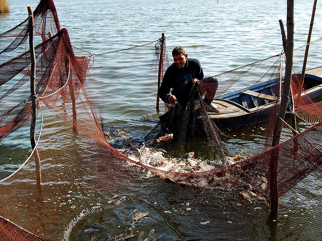
Fisherman in the Nile River south of Alexandria, Egypt. (C)FERRELL JENKINS 2008
The book of Habakkuk mentions a time when Edom (descendants of Esau). failed to come to the aid of Jacob (Israel) when they were under attack. Remember that Jacob and Esau were brothers.
When the prophet Habakkuk learned that the LORD was raising up the Chaldeans (the Babylonian Empire) against Edom, the prophet was puzzled that this could happen. In essence he said, “The Chaldeans are more wicked than the Edomites.” The LORD told Habakkuk that he would bring judgment upon the nations that failed to serve Him. That event was called the Day of the Lord (Habakkuk 1:15) or the Day of Jehovah. (ESV) or the Day of the LORD” (NAS, NKJ).
The Day of the Lord is described in highly figurative language in the Bible. It is a day when the mountains shake, when the rivers flood, the sun is darkened and the moon turns to blood. It is not the final judgment, but the judgment of nations. The prophet Obadiah spoke against Edom. Notice these words:
The vision of Obadiah. Thus says the Lord GOD concerning Edom: We have heard a report from the LORD, and a messenger has been sent among the nations: “Rise up! Let us rise against her for battle!” 2 Behold, I will make you small among the nations; you shall be utterly despised. 3 The pride of your heart has deceived you, you who live in the clefts of the rock, in your lofty dwelling, who say in your heart, “Who will bring me down to the ground?” 4 Though you soar aloft like the eagle, though your nest is set among the stars, from there I will bring you down, declares the LORD. (Obadiah1:1-4 ESV)
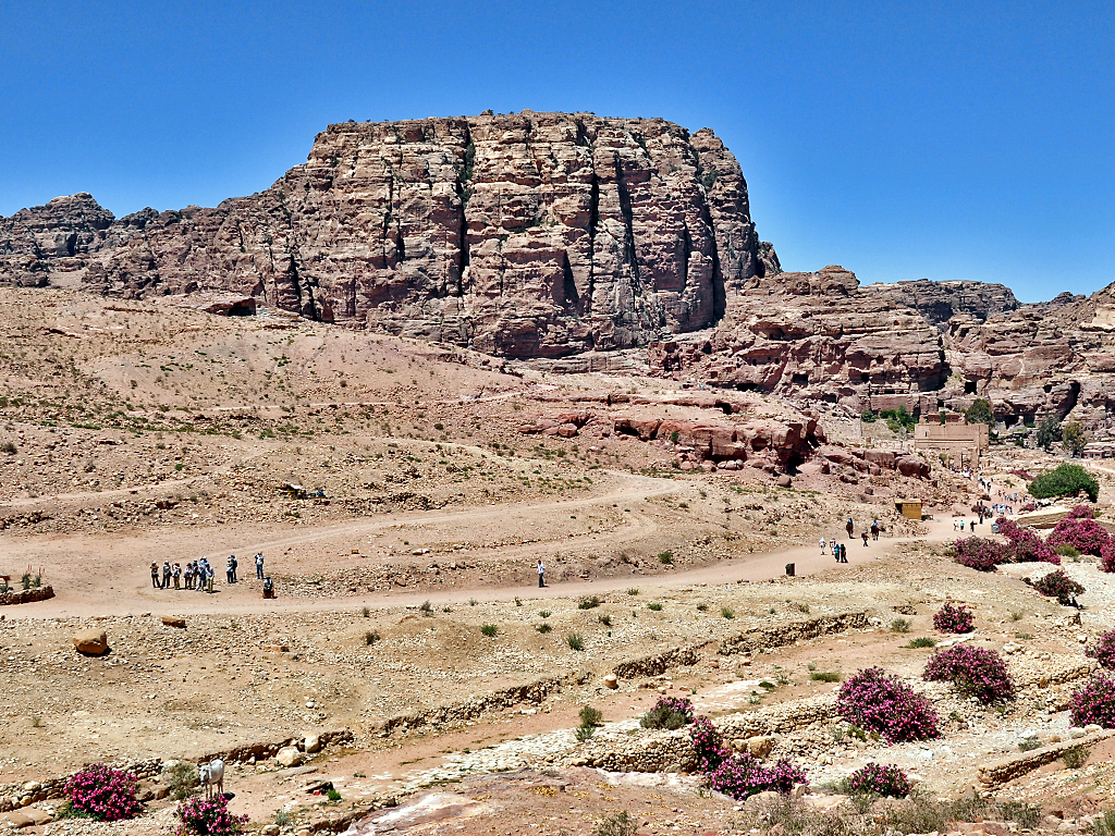
The site of Umm el Biyarah at Petra, Jordan. This was the fortress of the ancient Edomites Photo (c) Ferrell Jenkins.
Homer Hailey, my beloved college professor who first introduced me to the prophets, often said “God judges nations in time and individuals in eternity.”
The LORD used Assyria to punish the northern kingdom of Israel in 722 BC. Through the prophet Isaiah he said that he still held the Assyrians accountable (Isaiah 10:12).
The Assyrians were brought down by the Babylonians who also brought down the Egyptians (Ezekiel 29:17-30).
Am I able to say that a given conflict on this globe is the Day of the Lord? Since I do not have a “thus saith the Lord” in these cases I will not be dogmatic, but I think frequently about this clear biblical teaching.


You must be logged in to post a comment.