Category Archives: Flora and Fauna

Like Almond Blossoms

There is emphasis in the Hebrew Bible and in the New Testament that the biblical tabernacle and its furniture were made according to the pattern given by God (Exodus 25:9;

“And on the lampstand itself were four cups made like almond blossoms, with their calyxes [bulbs, knops, cups] and flowers,” (Exodus 37:20; Hebrews 8:5 ESV).

Earlier this year I made some pictures of almond trees in bloom at a site overlooking the Lebonah valley, on the north side of Shiloh. It is, in my judgment, a thing of beauty.

An almond blossom at a site overlooking the Lebonah Valley. Photo by Ferrell Jenkins.
An almond blossom at a site overlooking the Lebonah Valley north of Shiloh.

“The stork in the heavens knows her time”

The stork is listed among the unclean birds in Leviticus 11:19 and Deuteronomy 14:18. The Psalmist says, “the stork has her home in the fir trees” (Psalm 104:17.

I have not seen a stork nest in a fir tree, but I have often seen them on the top of electric poles, chimneys, and ruined columns.

These storks are building a nest on the top of an old brick column at Kovanlik, Turkey. This photo was made yards away from the beginning of the Via Sebaste or Imperial Road that leads northeast across the mountains from the Pamphylian coastal plain to the Anatolian plateau. The approximate location is 37 10.4234N, 30 35.875E. Photo by Ferrell Jenkins

The prophet Jeremiah uses the faithfulness of the stork as it moves from one continent to another and then returns as an illustration of the faithfulness not seen in the people of the LORD.

Even the stork in the heavens knows her times, and the turtledove, swallow, and crane keep the time of their coming, but my people know not the rules of the LORD. (Jeremiah 8:7 ESV)

I have seen this played out repeatedly in my travels in Israel and Turkey. The storks fly from Europe and other northern climes to Africa in the fall of the year. The Great Rift provides the way for them to navigate through Syria and Israel/Jordan.

A stork heading north and a sunrise over the Golan Heights. Photo: ferrelljenkins.blog.

This is a composite photo showing a stork in the Jordan Valley and a sunrise over the Golan Heights. Photos by Ferrell Jenkins.

The prophet Zechariah also uses the wingspan of the stork as an illustration. In one of his visions he says,

Then I lifted my eyes and saw, and behold, two women coming forward! The wind was in their wings. They had wings like the wings of a stork, and they lifted up the basket between earth and heaven. (Zechariah 5:9 ESV)

The Keren Kayemeth Leisrael JNF website provides good information about storks, and other birds, in the Hulah valley here. Here is another nice site with information about storks and some good photos.

HT: Dr. Mark Wilson, author of Biblical Turkey, who gave the directions of the Via Sebaste mentioned with the first photo to Leon Mauldin and me. An article by Mark R. Fairchild in BAR includes a map showing two possible routes from Perga in Pampylia to Pisidian Antioch. The caption with the map suggests the Via Sebaste as possibly being used by Paul, but Dr. Fairchild does not think Paul would have traveled that way. Nonetheless it is possible that Paul might have used this route in one direction or the other, more likely on the return. (Fairchild, Mark R. “Why Perga?” Biblical Archaeology Review 39.6 (2013): 53–59.)

Ferrell’s Favorite Foto #38 – a thistle

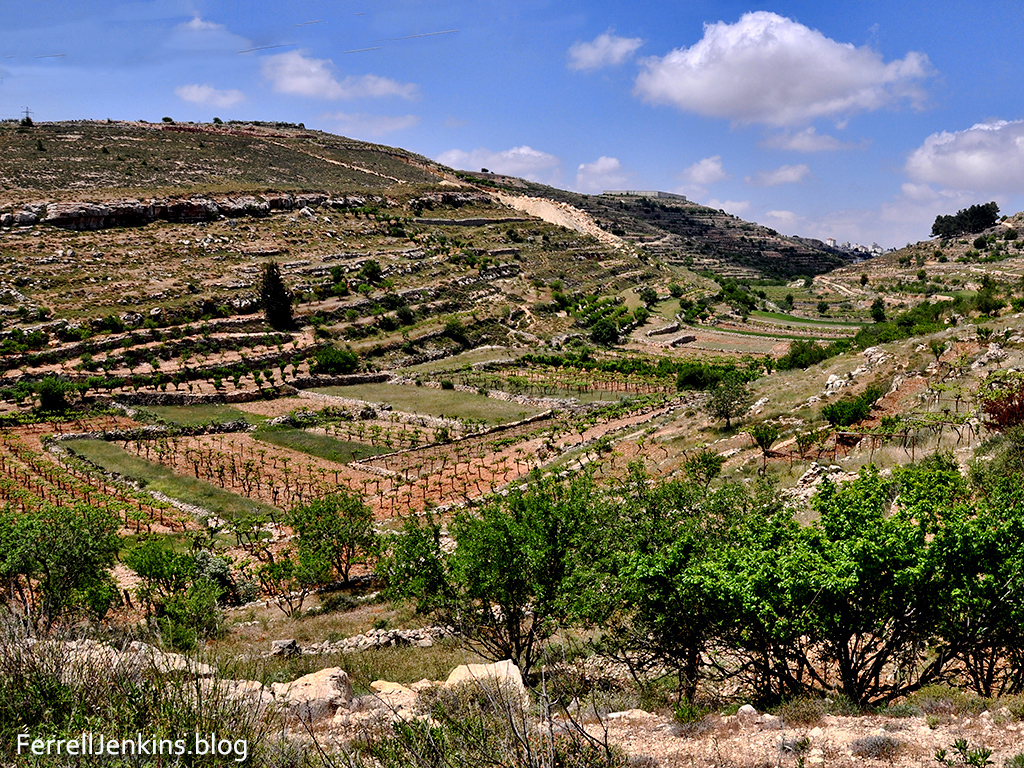
Our favorite foto today was made near Tel Goded, also known as Tell el-Judeideh. This mound has been suggested as the site of Moresheth-gath, the home of the prophet Micah (1:14; see The Sacred Bridge, 170). This site is located on the Israel National Trail.

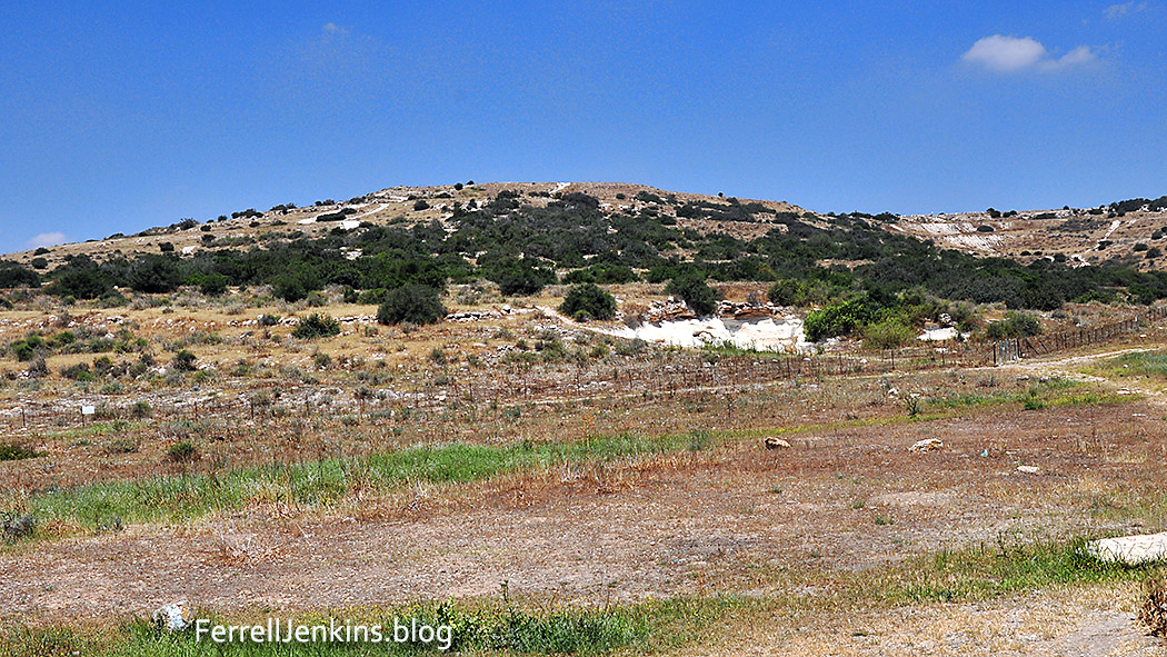
Tel Goded, also known as Tell el-Judeideh, may be the location of Moresheth-gath, the home of the prophet Micah. Photo by Ferrell Jenkins.

Our photo was made near an underground spring, or possibly a cistern, just outside the lower right corner of the photo.

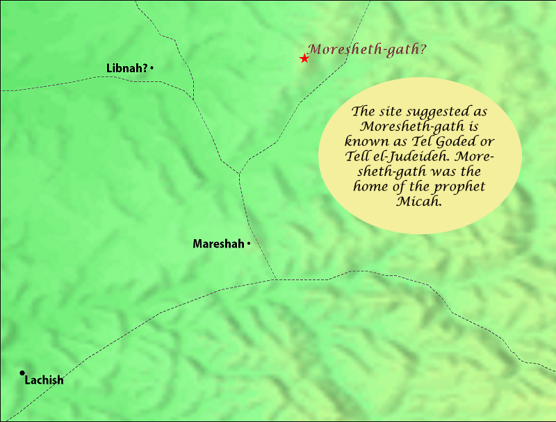
This map was created using BibleMapper 5. Moresheth-gath is located 5.9 miles from Lachish. The suggest site for Libnah is known today as Tel Burna.

Thorns and thistles are mentioned as a plant more or less worthless. As a result of man’s sin, the earth was to bring forth thorns and thistles (Genesis 3:18-19). Jesus said that false prophets could be recognized by their fruits. He said, “Are grapes gathered from thornbushes, or figs from thistles? (Matthew 7:15-16, ESV).

A large variety of thorns and thistles grow throughout the bible lands. During the rainy season many of them produce beautiful flowers, but later on they become a real problems to those who wish to walk through the fields. Peter may be drawing on this figure when he says, “Therefore, gird your minds for action”  (1 Peter 1:13 NAS). Just as a person of that time would gird up their flowing garment to keep it from hanging on the encroaching thistles along the path they were walking. We miss the imagery with our newer versions that say something like, “preparing your minds for action” (ESV).

William Barclay says,

He tells them to gird up the loins of their mind. This is a deliberately vivid phrase. In the east men wore long flowing robes which hindered fast progress or strenuous action. Round the waist they wore a broad belt or girdle; and when strenuous action was necessary they shortened the long robe by pulling it up within the belt in order to give them freedom of movement. The English equivalent of the phrase would be to roll up one’s sleeves or to take off one’s jacket. Peter is telling his people that they must be ready for the most strenuous mental endeavour. They must never be content with a flabby and unexamined faith; they must set to and think things out and think them through. It may be that they will have to discard some things. It may be that they will make mistakes. But what they are left with will be theirs in such a way that nothing and nobody can ever take it away from them. (Barclay, William, ed. The Letters of James and Peter. Philadelphia: Westminster John Knox Press, 1976. Print. The Daily Study Bible Series.)

I looked through several books showing the plants of the bible lands as well as the Thorns and Thistles photos in the Pictorial Library of Bible Lands. I think this is the Holy Milk Thistle, sometimes called Mary’s thistle.

Butterfly, thistle, insect near Tel Goded. Photo: ferrelljenkins.blog.

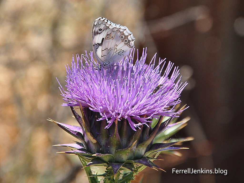
A beautiful butterfly on a thistle near Tel Goded (T. Photo by Ferrell Jenkins.

What makes this photo a favorite is not only that it is a thistle but that it also has a beautiful butterfly on it. If you look closely you may also see an insect, but you can’t miss the sharp thorns.

The comment by G. E. Post in the old Hastings, A Dictionary of the Bible, is interesting – even colorful.

There is probably no country on earth of the same extent which has so many plants with prickles and thorns as the Holy Land. One would be tempted to believe that this is a providential provision to protect them from the ravages of goats, asses, and camels, were it not that the mouths of these creatures are provided with a mucous membrane so tough that it seems impervious to thorns.

Some flowers of Mount Gilboa

Mount Gilboa figures prominently in the death of Saul and Jonathan. At this time in the appropriate season there are many beautiful flowers scattered here and there among the rocks.

The most famous flower of Mount Gilboa is the Gilboa Iris (Iris haynei). When a guide friend saw me at the hotel and asked where I had been he asked if I had seen the black Iris. My answer is still no, but I would like to. The photo below is available on Wikipedia. It is one of those flowers I wish I had made.

The Gilboa Iris. udi Steinwell / CC BY (https://creativecommons.org/licenses/by/2.5)

Here I am treading on floral landmines and I will gladly defer to several people I know who are much better informed about the flora of Israel. But I wanted to share a couple of photos that I made on Mount Gilboa.

Spring flower on Mount Gilboa. Photo: ferrelljenkins.blog.

Spring flower, possibly a Crown Anemone, on Mount Gilboa. Photo by Ferrell Jenkins

Spring flower on Mount Gilboa. Photo: ferrelljenkins.blog.

Perhaps a Hollyhock on Mount Gilboa in the spring. Photo by Ferrell Jenkins.

Spring flowers on Mount Gilboa. Photo: ferrelljenkins.blog.

White spring flowers, possibly in the Ainsworthia group, growing on Mount Gilboa. Photo by Ferrell Jenkins.

Kind comments are now open.

Agreement of Book and Land: Have you heard of the Atad tree?

At Neot Kedumim most of the trees are identified by name and often with references to biblical events. I enjoyed seeing the Atad tree. The sign at the base of the tree explains an important biblical event which names the atad tree.

The atad tree in the parable of Jotham. Photo: ferrelljenkins.blog

This sign explains the biblical reference to the atad tree in the parable of Jotham in Judges 9. Photo by Ferrell Jenkins.

For ease of reading here is the first paragraph of the sign. Some of the spellings have been changed to make the information more easily understood by English readers.

A parable told by Jotham after the death of his father, Judge Gideon, criticizing his brother Abimelech’s rise to power after the latter brutally murdered all 70 of his other brothers “upon one stone” (Judges 9:5). The parable tells of the trees seeking to anoint a king. They ask the olive, fig, and grapevine who each refuse, wishing only to continue to bear their fruit. Eventually the Ziziphus spina-christi (atad), frequently – and misleadingly – mistranslated as a bramble, agrees to assume the role with devastating consequences: “let fire come forth from the atad” (Judges 9:15).

The Hebrew text uses the term atad for the plant. Common English translations include bramble, thronbush, and thorn bush. Some writers think of the atad as a tree, such as the one you see here.

The Atad tree at Neot Kedumim. Photo: ferrell jenkins..blog.

The Atad tree at Neot Kedumim. Photo by Ferrell Jenkins.

For other references to the Ziziphus spina-christi see our photos and information here and here (note the last photo in that post).

The next photo shows some of the worthless fruit on the atad tree at Neot Kedumim. In contrast the fruit of the olive, the fig and the grape vine was very useful.

The fruit of the Atad tree of Joshua 9:14-15. Photo by Ferrell Jenkins at Neot Kedumim.

The fruit of the Atad tree of Joshua 9:14-15. Photo by Ferrell Jenkins at Neot Kedumim.

Ferrell’s Favorite Foto # 32 – the beauty of the simple

The water of Laodicea, site of one of the seven churches mentioned in the book of Revelation, came from hot springs immediately south of the city. By the time the water reached Laodicea it was lukewarm.  Jesus described the church as being like the water supply of the city.

“I know your works: you are neither cold nor hot. Would that you were either cold or hot! So, because you are lukewarm, and neither hot nor cold, I will spit you out of my mouth.” (Revelation 3:15-16 ESV)

Laodicea was one of three cities of the Lycus River Valley in Asia Minor (Colossians 2:1; 4:15-16). Today this area is in Turkey. Toward the end of the first century the book of Revelation was sent to several churches of Asia (Revelation 1:11).

This photo shows part of the water distribution tower at ancient Laodicea. Mount Cadmus, location of Laodicea, is seen in the distance.

Part of the water distribution system of ancient Laodices in Asia Minor (modern Turkey). Photo: ferrelljenkins.blog.

Ruins of the ancient water distribution system at Laodicea. Mount Cadmus, the location of Colossae, is visible in the distance. Photo by Ferrell Jenkins.

Notice in the previous photo to the right of the ruins you will see several people gathered. They are looking at the calcified clay pipes that once distributed water to the residences of Laodicea. When the water left the spring it was warm, but by the time it arrived at Laodicea it was lukewarm.

How here is our favorite foto for today.

Some fern, grain and tiny flowers grown in the calcified pipe that once brought water to Laodices. Photo: ferrelljenkins.blog.

This picture shows one of the broken clay pipes in the water distribution system, now calcified. But notice the little plants growing in the pipe. Photo by Ferrell Jenkins.

A florist could hardly do better. This pipe apparently became so clogged that dirt could settle in it and provide a bed for these little plants.

Ferrell’s Favorite Foto # 30 – the cedars of Lebanon

We have written several posts about the cedars of Lebanon which you may find by putting the word cedar in the search box. Possibly the best article to begin with is here.

I ran across this photo made in 2002. It shows part of the clump of famous trees at Besharre, Lebanon, with a view of the mountain still partially covered with snow in May.

The Cedars of Lebanon. ferrelljenkins.blog.

Besharre, Lebanon. Photo by Ferrell Jenkins.

Some photos are favorites because of the events surrounding the taking of the photo. Only twice have I been able to see the cedars. Once was in 1967 when my wife and I were joined by Louis and Margie Garrett and Joe Corley on a free half day to visit the area. As we strolled though the old trees we enjoyed some sun, then a sudden shower. A shop keeper opened and allowed us to warm up in his place. He even prepared some meat (something like spam I recall) wrapped in pita bread, Under the circumstance it was really good. This was not an easy trip to forget.

David McClister and I made a personal trip to the area May 8, 2002 and this slide is from that trip.

This is one of the places I would like to revisit.

The photo is sized for use in PPT for teaching purposes.

David leaves 200 men at the Brook Besor

In addition to the tours I led between 1967 and 2016 I have made numerous personal study trips with a variety of friends beginning as early as 1984. The largest number of those trips have been made with Leon Mauldin. On these trips we visit places that are difficult to reach by bus or take an unusual amount of time to reach — too time consuming for a group looking to see all they can in a typical 10-12 day tour.

In September, 2011, Leon and I spent some time in the south of Israel. One of the fascinating places we visited was the Brook Besor. Israelis call it Nahal Besor. Various English versions of the Bible use the terms Brook, brook or Wadi to describe the stream. For anyone who might wish to visit the area I will explain how we got there.

Using the modern maps at your disposal locate Beersheba (Be’er Sheva), then take highway 25 NW to highway 241 and turn left. Our first photo was made on the north side of highway 241 after we crossed the Besor.

Brook Besor on the north side of highway 241. Photo: ferrelljenkins.blog.

The Brook Besor on the north side of highway 241. Notice the typical dry terrain of the Negev in the background. Photo by Ferrell Jenkins.

Water is flowing somewhere among these reeds and during the winter rains we may be sure that the water is visible. Notice the dry terrain in the distance.

A short distance from the location of this photo, on the south side of the highway we saw this impressive mound. It is easy to reach, at least in dry weather, using the road across the fields.

Tel Sharuhen on the banks of Nahal Besor. ferrelljenkins.blog.

Tel Sharuhen on the banks of Nahal Besor. Most of the reeds like those we have shown in the photo above are on the opposite side of the tel. Photo by Ferrell Jenkins.

The Arab name for this archaeological mound is Tell el-Farah (South) to distinguish it from Tell el-Farah (North), the site of biblical Tirza near Shechem (1 Kings 15:33).

The Archaeological Encyclopedia of the Holy Land (1990) entry begins with this description of the Tell el-Farah (South).

The site is some 14 miles south of Gaza and 16 miles west of Beer-Sheba, near the ancient Via Maris (Roads) connecting Egypt and Mesopotamia. W.M.F. Petrie identified Tell el-Farah with Beth-Pelet (Josh. 15:27; Authorized Version: ‘Beth-Palet’), but W.F. Albright’s identification with Sharuhen (Josh. 19:6) is now accepted by most scholars. Apart from the biblical reference, Sharuhen appears three times in Egyptian sources of the New Empire: in the description of the Hyksos expulsion from Egypt, when Amosi besieged the Hyksos for three years at Sharuhen; in the records of the first campaign of Tuthmosis III; and in those of the campaign of Pharaoh Sheshonq.

Sharuhen is mentioned only once in the Bible as a city of the tribe of Simeon (Joshua 19:1-8; see especially verse 6).

This area looks rather hidden from society, but it was on two major international highways in biblical times.

Leon and I were looking for the possible site where David left 200 men who were too exhausted to make the trek to chase those who had burned Ziklag and taken several captives including two wives of David (1 Samuel 30; see especially verses 9, 10, and 21). I can easily envision this area being the place of the crossing of the Besor.

Ferrell Jenkins at Tel Sharuhen. ferrelljenkins.blog.

Brook Besor on the north side of Tel Sharuhen. This picture including Ferrell Jenkins was apparently made by Leon Mauldin. You have a nice view of the Brook Besor. Photo: ferrelljenkins.blog.

From the south side of the tel we took the steps (lower left corner of the photo) to the top.

Approach to Tel Shuarhen from the south. View of Brook Besor. Photo ferrelljenkins.blog.

Approach to Tel Sharuhen from the south. View of Brook Besor. Photo by Ferrell Jenkins.

The following signs in Hebrew and English identify the site as Tel Sharuhen.

Sign identifying Tel Sharuhen. Photo: ferrelljenkins.blog.

A nice sign identifying the tel as Tel Sharuhen. Photo by Ferrell Jenkins.

I was delighted when I saw these signs were  new.

Sign identifying Tel Sharuhen. Photo: ferrelljenkins.blog.

Sign in Hebrew and English identifying the mound as Tel Sharuhen. Photo by Ferrell Jenkins.

There are also signs at the site identifying Tel Sharuhen as part of the ANZAC Trail. This trail was made famous in 1917 when a light horse brigade of mostly Australian and New Zealand aboriginals defeated the Germans in the region.

The Anzac Trail of 1917. Tel Sharuhen is marked as number 6.

For those with further interest in the historic battle of 1917 I suggest two links. This link in the Times of Israel tells about the centennial retracing the route of the battle by descendants of the Aboriginal ANZAC soldiers in 2017.

More general information about the ANZAC Trail, including directions and a PDF of the map above, may be read here.

The seven photos in this post are sized suitable for use in a PowerPoint presentation for teaching.

Agreement of Book and Land – # 1

The Scripture and photo below of a perennial stream from En Prat illustrates perfectly the person described in Psalm 1.

Blessed is the man who walks not in the counsel of the wicked, nor stands in the way of sinners, nor sits in the seat of scoffers; but his delight is in the law of the LORD, and on his law he meditates day and night. He is like a tree planted by streams of water that yields its fruit in its season, and its leaf does not wither. In all that he does, he prospers. (Psalm 1:1-3 ESV)

Trees planted by the river. ferrelljenkins.blog.

En Prat where Wadi Kelt begins to flow down past Jericho and to the Jordan Valley. Photo by Ferrell Jenkins.

Ferrell’s Favorite Foto #22

This unusual photo of Capernaum was made from the hill above, up toward the Mount of Beatitudes. The photo shows the northeast corner of the Sea of Galilee with the Golan Heights visible.

Capernaum became the Galilean center for the ministry of Jesus.

And leaving Nazareth he went and lived in Capernaum by the sea, in the territory of Zebulun and Naphtali, (Matthew 4:13 ESV)

Capernaum from above the location on the Sea of Galilee. Photo: ferrelljenkins.blog.

View to the east of Capernaum from above the site. Photo by Ferrell Jenkins.

This photo was made May 15, 2010. The sky was fairly clear and the eastern shore of the Sea of Galilee is visible with perhaps a portion of the Plain of Bethsaida. Those are dried thistles in the foreground of the photo.