Category Archives: Old Testament

Boating on the Dead Sea

In 2005 a two-armed anchor was discovered on the shore of the Dead Sea, north of En Gedi. The materials associated with this anchor includes jujube wood, palm fiber, lead, iron, and bronze.

Two-armed anchor from the Dead Sea. Photo by Ferrell Jenkins.

Two-armed anchor from the Dead Sea. Photo by Ferrell Jenkins.

The sign associated with this exhibit in the Israel Museum reads as follows:

In ancient times, the Dead Sea was an active sea route, used  for the transportation of passengers as well as the agricultural  products and natural resources for which the area was famous.  This rare anchor, found on the Dead Sea shore, was made with the best of Hellenistic-Roman technology. Its size and style suggest that it belonged to a luxurious ship, one that may have  been part of the royal fleets of King Alexander Jannaeus or  Herod the Great, each of whom built palaces and fortresses near this Shore.

The anchor was found north of En Gedi and belongs to the period between the 2nd century B.C. and the 1st century A.D. The materials included in the anchor include jujube wood, palm fiber, lead, iron, and bronze.

I understand that this anchor, and another one about 500 years older, was located because of the receding of the waters of the Dead Sea. Our photo shows a view of the western shore of the Dead Sea north of En Gedi. In the recent past the water covered the land we see here.

Western shore of the Dead Sea north of En Gedi. Photo by Ferrell Jenkins.

Western shore of the Dead Sea north of En Gedi. Photo by Ferrell Jenkins.

The Dead Sea is known as the Salt Sea in Genesis 14:3.

Visualizing Isaiah: Trusting in horses and chariots

The prophet Isaiah describes what had happened to the people of Judah and Jerusalem.

Their land is filled with silver and gold, and there is no end to their treasures; their land is filled with horses, and there is no end to their chariots. (Isaiah 2:7 ESV)

The nation had come to depend on instruments of war rather than the LORD God.

Before the entry into the promised land, the LORD said that His people would desire a king. He laid down restrictions for that king. One of the stipulations is stated this way:

Only he must not acquire many horses for himself or cause the people to return to Egypt in order to acquire many horses, since the LORD has said to you, ‘You shall never return that way again.’ (Deuteronomy 17:16 ESV)

Solomon is especially noted for his trade in horses and chariots from Egypt (1 Kings 10:28-29).

Ahab, king of the northern kingdom of Israel, had a powerful army. The Assyrian king Shalmanesser III met Ahab and 11 other kings in the Battle of Qarqar in 853 B.C. The stone monolith from Kurkh records that Ahab provided 2,000 chariots and 10,000 foot soldiers to the confederacy.

Stables have been uncovered during excavations at Megiddo. The town is so clearly associated with horses and chariots that a metal sculpture has been erected at the site.

Metal sculpture of horses and chariot at Megiddo. Photo by Ferrell Jenkins.

Metal sculpture of horses and chariot at Megiddo. Photo by Ferrell Jenkins.

Because Megiddo was located on the main trunk road between Egypt and the empires of the north (Hittites and Syria) and those of the east (Assyria, Babylon, and Persia), we should not find this surprising.

Solomon is said to have built the house of the LORD, his own house, the Millo and the Wall of Jerusalem, and the cities of Hazor, Megiddo, and Gezer (1 Kings 9:15). The same context makes reference to chariot cities built by Solomon:

and all the store cities that Solomon had, and the cities for his chariots, and the cities for his horsemen, and whatever Solomon desired to build in Jerusalem, in Lebanon, and in all the land of his dominion. (1 Kings 9:19 ESV

Isaiah was spot-on.

The Pools of Solomon

It is a fact that numerous structures in Israel are incorrectly identified. Earlier travelers may have asked where this or that biblical event took place. There was always someone willing to show them what they wanted to see. Some items that come to mind include the Tower of David and Solomon’s Stables in Jerusalem, Ahab’s Palace at Jezreel, and Solomon’s Pools southwest of Bethlehem.

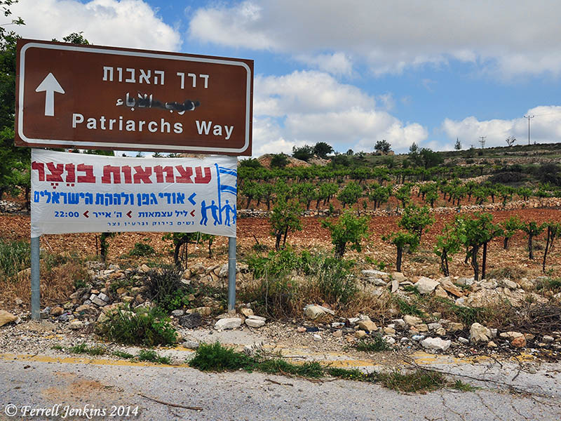
In the earliest days of my tours we were able to visit Solomon’s Pools as we traveled between Bethlehem and Hebron. In more recent years the Pools have been in the Palestinian Authority’s West Bank. This means going to Bethlehem and then making arrangement to visit the pools.

Solomon, who ruled about 970–931 B.C., is said to have developed vineyards, gardens, and pools.

I made great works. I built houses and planted vineyards for myself. I made myself gardens and parks, and planted in them all kinds of fruit trees. I made myself pools from which to water the forest of growing trees. (Ecclesiastes 2:4-6 ESV)

These pools do not belong to the time of Solomon. It may be legendary, but Josephus says that Solomon used to ride upon a chariot to a place called Etham (Etam). This area is described as “very pleasant in its fine gardens, and abounding in rivulets of water; he used to go there in the morning sitting high in his chariot” (Antiquities 8:186).

One of the earliest projects conducted by Amihai Mazar, in 1968, was a survey of the 70 kilometers of aqueducts. He wanted to see how accurate Conrad Schick has been in his 19th century surveys.

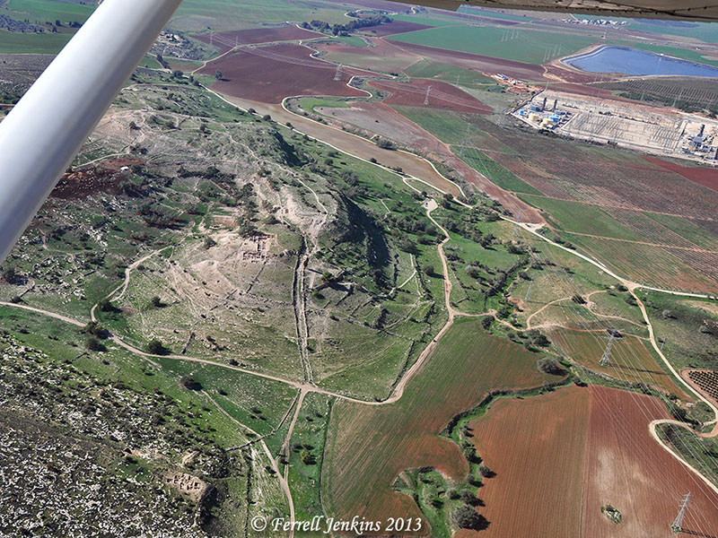
Several springs feed into the “pools of Solomon” from the south through two aqueducts. From the western pool a high level aqueduct carried water to the Upper City of Jerusalem. From the easternmost pool a low level aqueduct carried water to the Temple Mount.

One of the earliest projects conducted by Amihai Mazar, now Professor Emeritus at Hebrew University, in 1968 was a survey of 70 kilometers of aqueducts. He wanted to see how accurate Conrad Schick had been in his surveys in the 19th century. He says the pools,

must date to the Hasmonean period, perhaps to Alexander Jannaeus [126 B.C.–76 B.C.]. We don’t have any written sources, and there is no objective archaeological data for dating them. But we base our assumption on the fact that in the Mishnah the aqueducts are referred to and are very important for ritual purposes on the Temple Mount. (BAR, 10:3, May/June 1984).

Mazar’s study of “The Aqueducts of Jerusalem” is published in Jerusalem Revealed: Archaeology in the Holy City 1968–1974. 79-84.

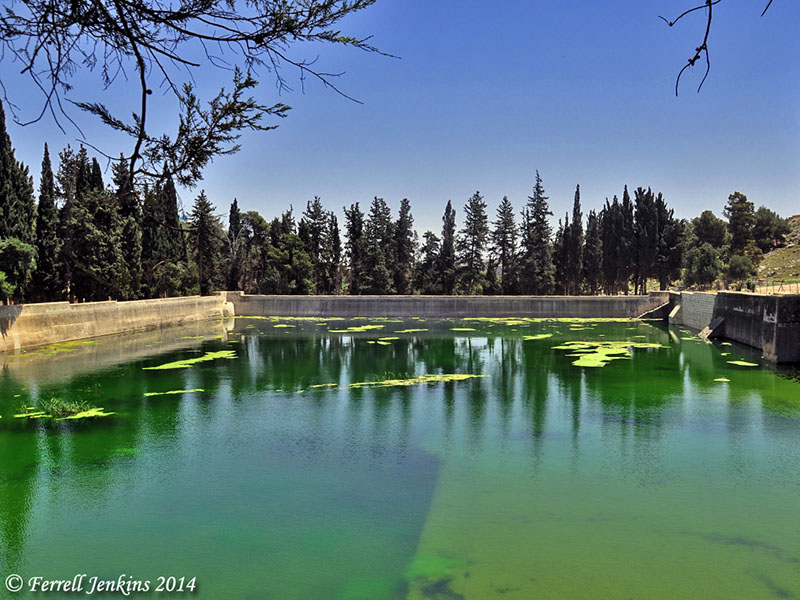
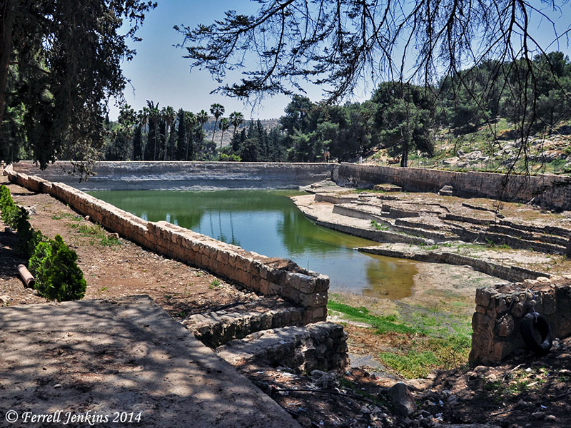
Our first photo shows the highest of the pools which I am calling the western pool.

The western most pool. View east. Photo by Ferrell Jenkins.

The western pool. View east. Photo by Ferrell Jenkins.

The middle pool is shown here with a view to the northwest. You can see the higher hills in the break between the trees.

The middle pool. View west. Photo by Ferrell Jenkins.

The middle pool. View northwest. Photo by Ferrell Jenkins.

The third pool (eastern) is shown below with a view toward the west.

The eastern pool. View west. Photo by Ferrell Jenkins.

The eastern pool. View west. Photo by Ferrell Jenkins.

A recent study of “Jerusalem’s Ancient Aqueduct System” by Tom Powers is available for download at his website here. This article can be helpful for those who wish to know more about the subject.

Jerome Murphy-O’Connor has a few pages devoted to Solomon’s Pools, including the aqueduct system, in The Holy Land (483-486).

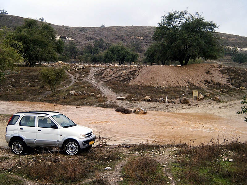
Within the past few weeks there has been some information, and some unfounded speculation, about a water system found at ‘Ain Joweizeh. Todd Bolen describes the location of the site:

The site is located 5.5 miles (9 km) southwest of the Old City of  Jerusalem, 3.5 miles (5.5 km) northwest of Bethlehem, and just down the slope to the west of Har Gilo.

Bolen has a good summary of what we know about this water system (“Royal Water System Excavated in Judean Hills”) in a recent post here.

BAR’s Bible History Daily includes photos of the Proto-Aeolic Capital associated with the recently discovered tunnel here.

Visualizing Isaiah: a booth in a vineyard

Because the events of the Bible took place in the Ancient Near East, we expect it to use illustrations from that world. Many of these cultural practices are different from those we know, but others are similar.

The prophet Isaiah describes what will happen to Jerusalem as a result of their sin.

And the daughter of Zion is left like a booth in a vineyard, like a lodge in a cucumber field, like a besieged city. (Isaiah 1:8 ESV)

Almost everyone has seen a fruit or vegetable booth along a highway during the picking season. Months later we may see that same booth in disrepair. In Biblical times, watchtowers and temporary booths were set up in fields to provide a moment of shade for the workers.

Our photo today was made a few miles east of Sardis (Revelation 3:1) in modern Turkey. It is near a vineyard and set amidst another crop. One can easily image it still standing in disarray when the winter rains come.

A booth in the field, east of Sardis. Photo by Ferrell Jenkins.

A temporary booth in the field, east of Sardis. Photo by Ferrell Jenkins.

The Judeans of the 8th century B.C. could easily visualize what Isaiah was describing, and those who were living when the city was destroyed by the Babylonians would see it as a fact.

Jeremiah’s lament over the city after 586 B.C. illustrates the point:

How lonely sits the city that was full of people! How like a widow has she become, she who was great among the nations! She who was a princess among the provinces has become a slave. (Lamentations 1:1 ESV)

Archaeological Conferences in Houston

The Dunham Bible Museum at Houston Baptist University will host an Archaeological Conference devoted to Khirbet el-Maqatir, proposed site for Biblical Ai, Saturday, February 8, 2014. Speakers include Dr. Bryant Wood, Dr. Eugene Merrill, Dr. Scott Stripling, and Dr. Leen Ritmeyer.

Information about the conference and registration details may be found here.

From January 21 – December 19, 2014, the Dunham Bible Museum will display a special exhibit, Khirbet el-Maqatir – History of a Biblical Site. This is in cooperation with the Associates for Biblical Research. Details here.

A scene in the eastern Sinai wilderness. Photo by Ferrell Jenkins.

A scene in the eastern Sinai wilderness. Photo by Ferrell Jenkins.

The Lanier Theological Library announces a lecture by James Hoffmeier and Stephen Moshier dealing with the exodus and the location of Mount Sinai. The titles for the January 18th lecture are,

  • Moses Did Not Sleep Here!
  • A Critical Look at Some Sensational Exodus and Mt. Sinai Theories

Registration information is here. (HT: Bible Places Blog).

The lectures by Hoffmeier and Moshier are the climax of a two day Consultation on the Historicity and Authenticity of the Exodus and Wilderness Traditions in a Post Modern Age. Details here.

Speakers include Richard Hess, Steven Ortiz, Alan Millard, Richard Averbeck, Lawson Youngers, Jr., and others.

Hiking Abraham’s footsteps

The full title of this Haaretz article is “Hiking in Abraham’s footsteps, from Turkey to the Holy Land.” Sounds incredible at the moment. To hike this complete trail from Haran (Genesis 12:4) to Beersheba (Genesis 21:31) (not to mention the trip to Egypt) requires travel in Turkey, Syria, Jordan, Israel, and the Palestinian Authority (West Bank).

Among the leaders back of the concept is David Landis and his wife Anna Dintaman, developers of the Jesus Trail from Nazareth to the Sea of Galilee. Their book, Hiking the Jesus Trail and Other Biblical Walks in the Galilee, is worthwhile even for those who do not plan to walk the trail.

Larry Haverstock walked the Jesus Trail in 2011. I see that Larry’s posts about the experience is still available on his blog. See the 3rd Journey. You will find some fascinating stories along with beautiful photos you may never see from a bus or car.

Larry Haverstock in the Zippori Forest north of Nazareth.

Larry Haverstock in the Zippori Forest north of Nazareth.

The link to the Haaretz article may be accessed here. In order to read the full article you must register for free access to 10 articles a month.

Don’t expect to walk the Abraham Path from Haran (in Turkey) to Beersheva [Beersheba], but you might be able to walk small portions of the trail everywhere except the part going through Syria.

There are many hiking trails in Israel, but most of these avoid contact with the Palestinian Authority. The new plan seeks to involve the local people in the development of facilities useful to hikers.

If you like hiking, or if you appreciate the geography of the Bible lands you will probably enjoy the article. Abraham Path has a nice web site with maps and photos here.

I don’t know what, if any, relationship there is between the Abraham  Path and the Patriarchs Way, a trail that is said to run from Beersheba to Nazareth. The defacing of the sign to eradicate the Arabic indicates one of the problems either trail might face. One often sees this sort of thing on signs pointing to Christian sites.

Sign pointing to Patriarchs Way off Hebron Road (Hwy. 60) south of Bethlehem . Photo by Ferrell Jenkins.

Sign pointing to Patriarchs Way off Hebron Road (Hwy. 60) south of Bethlehem . Photo by Ferrell Jenkins.

Walk the Land : A Journey on Foot through Israel, by Judith Galblum Pex, is a fascinating account of a couple who walked the Israel Trail from Eilat to Dan.

The Lachish letters (ostraca)

The first major archaeological excavation at Tell ed-Duweir (= Tel Lachish) was called the Wellcome-Marston Archaeological Research Expedition, directed by James Leslie Starkey. During that expedition, in 1935 eighteen pieces of broken pottery with writing were found in a room outside the city gate. Three more pieces were found in 1938. J. A. Thompson explains the importance of the letters:

They represent correspondence between the military commander of Lachish, a certain Yoash, and outpost commanders, in the days when Nebuchadnezzar was closing in on Jerusalem. Most of these letters are poorly preserved, but six of them give useful information about the time. (The New International Dictionary of Biblical Archaeology)

The room outside the gate where the "letters" were found. Photo by Ferrell Jenkins.

The room outside the gate where the “letters” were found. Photo by Ferrell Jenkins.

Jerusalem was destroyed by the Babylonians in 586 B.C. These letters were written shortly before that time and were in the room at the time of the destruction of Lachish. Take a look at the biblical evidence. The prophet Jeremiah describes a time when only the Judean cities of Lachish and Azekah were left.

when the army of the king of Babylon was fighting against Jerusalem and against all the cities of Judah that were left, Lachish and Azekah, for these were the only fortified cities of Judah that remained. (Jeremiah 34:7 ESV)

Lachish Letter #4 indicates that only Lachish was left at the time of writing.

“And let (my lord) know that we are watching for *[fire] signals of Lachish, according to all the indications which my lord hath given, for we cannot see Azekah” (Pritchard, The Ancient Near East).

Letter #3 mentions a prophet.

And as for the letter of Tobiah, servant of the king, which came to Shallum son of Jaddua through the prophet, saying, ‘Beware!, thy servant hath sent it to my lord. (Pritchard, The Ancient Near East)

D. Winton Thomas says that this is “the first occurrence in non-Biblical texts of the common Hebrew word for prophet (nabi).”

One of the Lachish letters displayed in the British Museum.

Lachish Ostracon II displayed in the British Museum. The word “Yahweh” [yhwh] is used as the first word (on right) of line 2 in this letter.

The prophet Jeremiah may not be the prophet mentioned in Letter #3, but he was a prophet in Judah at the same time, and he wrote about the same situation. Notice Jeremiah 34:6-7 again.

Then Jeremiah the prophet spoke all these words to Zedekiah king of Judah, in Jerusalem, when the army of the king of Babylon was fighting against Jerusalem and against all the cities of Judah that were left, Lachish and Azekah, for these were the only fortified cities of Judah that remained. (Jeremiah 34:6-7 ESV)

This example provides wonderful corroborating evidence for the historical trustworthiness of the writing of Jeremiah.

Reading the blogs #2

Michael G. Hasel of Southern Adventist University will join Yosef Garfinkel and Martin G. Klingbeil as co-directors of The Lachish Expedition in 2014. Southern has begun a web site devoted to the dig here. Categories include Project Overview, Goals and Strategy, History of Research, and Staff. We wrote about the Lynn H. Wood Archaeological Museum, at Southern, here.

The Judean fort at Lachish. Photo by Ferrell Jenkins.

The Judean palace-fort at Lachish is the largest Iron Age structure in Israel. Photo by Ferrell Jenkins.

Associates for Biblical Research announced here the death of ABR founder Dr. David Livingston. An issue of Bible and Spade devoted to the work of Dr. Livingston has been made available in PDF. Dr. Livingston gave much attention to locating Biblical Ai. I am hopeful Ancient Days, the web site devoted to his writings, will be maintained here.

Check ORBIS here. This is the Stanford Geospatial Network Model of the Roman World. Lot’s of possibilities here in studying Paul’s journeys.

The BBC reports on how some maps of the modern Middle East were drawn here.

Tom Powers has left Jerusalem for North Carolina. Hopefully he will maintain his View From Jerusalem web site. Now would be a good time to check “My Articles” and download his research material on the ancient aqueduct system, Conrad Schick, American Colony, and some ossuaries.

My friend Steve Wolfgang is trained as a historian and is a minister with a wide range of interests. This is reflected in his blog, ἐκλεκτικός.

I enjoy Larry Hurtado’s Blog. Check “Where did Earliest Christians Meet?” here. If you thought they always met in private homes, you might learn something.

One of my favorite blogs, checked regularly, is Charles Savelle’s Bible X, a blog devoted to all things Bible Exposition. Charles surveys material helpful to teachers and ministers. He recently included a link to online tools for creating Infographics, Self-Editing for Better Writing, and lots of brief book reviews.

I like to check on Dr. Rod Decker’s NT Resources. Rod has been diagnosed with cancer. One of his colleague’s is dealing with TN — “a nonterminal condition that produces some of the most excruciating pain known to medical science, and that on a very frequent basis.” Recently the two of them spoke in chapel before their students on the general theme “When Your World Crashes Down.” Their comments are available for download.

For sure I have mentioned Biblical Studies and technological Tools by Mark Hoffman. This is a great resources. The most recent post evaluates online backup and data syncing options.

For a few years now I have been using Dropbox for syncing material between my study computer and my traveling laptop. If you click here you will get 2.25 gig free, and I will get .25 gig addition. Click here.

Reading the blogs

The majority of the content of this blog deals with biblical studies, archaeology, travel and photography. Concentration is especially on travel in the Bible World. As a result of this I follow several blogs that are extremely helpful. These include:

Bible Places Blog. Todd Bolen’s Weekend Roundup, and Midweek Roundup are extremely helpful, as are his insightful comments on recent archaeological announcements.

HolyLandPhotos’ Blog by Carl Rasmussen covers numerous lesser known places. Recently he has covered some sites visited, or probably visited, by Paul on his journeys through Asia Minor (modern Turkey).

The wilderness of Judea. Photo by Ferrell Jenkins.

The wilderness of Judea. Photo by Ferrell Jenkins.

I have a few former students  who write about these areas. You might enjoy taking a look at Leon’s Message Board (Leon Mauldin), Exploring Bible Lands (Barry Britnell), Luke Chandler’s Blog. Leon recently posted photos of the gathering of olives at Shechem. Trent and Rebekah, former tour members, have posted some helpful articles during their six months in Israel.

Gordon Franz writes less frequently on his Life and Land Seminars, but most of his material reflects a considerable amount of research. As part of his ongoing Cracked Pot Archaeology series he posted a response to the theory that the Arabia of “Mount Sinai in Arabia” (Galatians 4:25) is in modern Saudi Arabia.

Leen Ritmeyer,  Ritmeyer Archaeological Design, writes about the way the buildings looked in Bible times as well as recent discoveries and developments.

Wayne Stiles seeks to connect the Bible and its Lands to Life. In a recent post he discussed the “Top 5 Gifts for Bible Lands Study.”

Shmuel Browns, Israel-tourguide, has an interesting blog with great photos. A recent post features fascinating photos of Nahal Prat or Wadi Qelt. This may be where Jeremiah was told to go and bury his loincloth (shorts) (Jeremiah 13:4-7). Most English versions use the word Euphrates for the Hebrew term Perath. The NET Bible transliterates the term. Nahal Prat is near Jeremiah’s hometown Anatot (Anathoth). We wrote about a morning with Shmuel here.

Recently I learned of two new blogs dealing with the Bible lands and customs. Mark Ziese writes Bible Lands Explorer. Mark’s most recent post is about the Milk Grotto in Bethlehem. Yep, a place dedicated to Mary feeding baby Jesus. Willis Britt writes on Lessons From The Land. A recent series deals with Preaching and the Land.

Believe me, there is quite an education in reading these blogs.

I keep links to these and other blogs on the Scholarly page at the Biblical Studies Info Page.

Elah River flooding at Tell es-Safi/Gath

Several times we have commented on the wonderful photos supplied by Prof. Aren Maeir about the archaeological excavations at Tell es-Safi/Gath, both during the season and throughout the year.

For the past two days Maeir has posted photos of the Elah River flooding at Safi/Gath. English readers will relate to the word brook. The Hebrew is nahal. This is the same brook we read about in the account of David choosing five smooth stones when he went to fight Goliath (1 Samuel 17:40). The term used here is equivalent to the Arabic wadi.

A stream like this is dry most of the year, but flows freely during the rainy, winter season.

The photo below is from the Tell es-Safi/Gath blog here. It was made by Uri Yehuda, a student in Prof. Maeir’s department at Bar Ilan University. Those who have visited Gath during the dry season should find it instructive.

Flooding of the Elah River next to Safi. Photo by Uri Yehuda.

Flooding of the Elah River next to Safi. Photo by Uri Yehuda.

You may locate this photo in hi-resolution, and another made by Aren on the blog. The best picture may be in video format with a young lady telling us it is the “flood of December.” The link to all of this material is here.

The Brook of Elah begins below Adulam, flows through the valley bearing its name, around Azekah, past Gath, and into the Mediterranean Sea.

In the aerial photo below you will see Tell es-Safi/Gath just to the left of the center of the photo. The Elah River (Brook) can be seen in the lower right corner of the photo. This photo was made December 15, 2009. The river bed is green because there had been earlier rains, but nothing like the recent storm seen in Israel.

Aerial view of Gath and the Elah Brook. Photo by Ferrell Jenkins.

Aerial view of Gath and the Elah Brook. Photo by Ferrell Jenkins.