Category Archives: New Testament

New discovery at Machaerus where John was imprisoned

All four of the Gospels make some reference to the imprisonment of John the Baptist (Matthew 14:3,10; Mark 6:17; Luke 3:20; John 3:24). This must have been a significant and traumatic event for both the disciples of John and the disciples of Jesus.

Mark, the shortest gospel,  gives the most complete account of why Herod Antipas arrested and executed John. See Mark 6:17-32.

Josephus, the late first century Jewish historian, includes a long section about John in Antiquities 18:116-119. Perhaps another time we will take a closer look at all of it. For now, I am concerned with the place of execution.

Accordingly he was sent as prisoner, out of Herod’s [Antipas] suspicious temper, to Machaerus [or spell it Macherus], the citadel I before mentioned, and was there put to death. Now the Jews had an opinion that the destruction of this army was sent as a punishment upon Herod, and a mark of God’s displeasure to him. (Antiquities 18:119)

Josephus also records that Herod’s wife, the daughter of Aretas IV, king of Petra (the Nabateans), learned of his plan to divorce her and marry Herodias. Without telling Antipas that she knew, she asked for permission to be sent to Machaerus.I suspect that Herod was glad to get her out-of-town. She was no dummy. She had made arrangements for her father’s army to bring her safely [from Machaerus] to Arabia [perhaps Petra]. This event led to a war between the armies of Aretas and Herod Antipas. Herod’s army was destroyed. See Antiquities 18:109-115 for the full story.

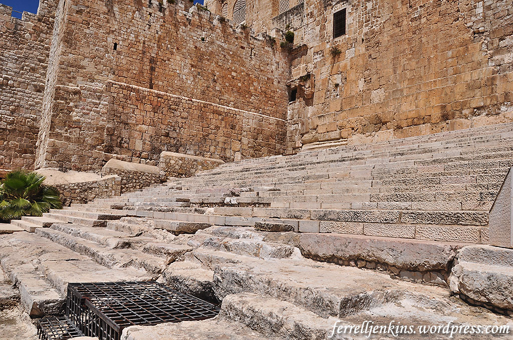
After several years of archaeological work at Machaerus, the Hungarian Archaeological Mission to Machaerus announces discovery of a large mikveh (ritual bath and immersion pool). The best report that I have seen is by Philippe Bohstrom in Haaretz here. He says,

The bath is the biggest of its kind ever found in Jordan. It boasts 12 steps and a reserve pool containing water to fill the pool when its water ran low.

Beyond its sheer dimensions, the architecture closely resembles mikvehs discovered in Qumran, on the other side of the Dead Sea, in Israel,  that had previously been considered to be unique.

The king-size mikveh was found three meters below the royal courtyard, where it had been hidden under 2,000 years of sand and dust. It had originally been equipped with a vaulted stone ceiling.

Large mikveh in Herod's palace at Machaerus, Jordan. Photo courtesy of Hungarian Archaeological Mission to Machaerus.

Large mikveh in Herod’s palace at Machaerus, Jordan. Photo courtesy of Hungarian Archaeological Mission to Machaerus.

The director of the Hungarian Archaeological Mission to Machaerus is Dr. Győző Vörös.

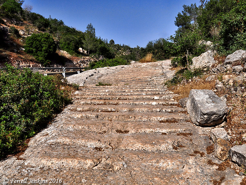
The location of the fortress is stunning. Herod the Great built it overlooking the Dead Sea from the east, as he had built a palace and fortress at Masada on the west side of the sea.

This photo gives some idea of the terrain. The citadel is located about 2300 feet above sea level. This would make it about 3600 feet above the Dead Sea.

Two columns stand on the top of Machaerus, where once the great palace of Herod the Great was located. Photo courtesty of the Hungarian Archaeological Mission to Machaerus.

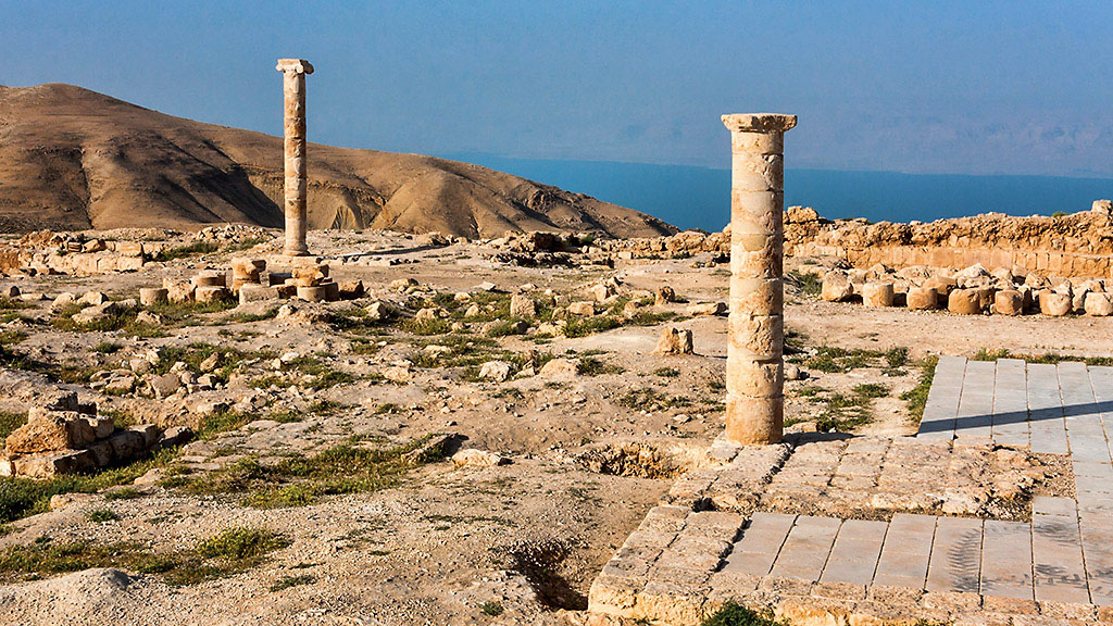
A few columns stand on the top of Machaerus, where once the great palace of Herod the Great was located. Photo courtesy of the Hungarian Archaeological Mission to Machaerus.

According to an article in The Jordan Times here,

The excavation team is employing theoretical architectural reconstruction as its first step towards the restoration and presentation of the monument. Through this process, archaeologists were able to reach new findings. 

Simulation of Herod's palace-fortress at Machaerus. Photo courtestsy of the Hungarian Archaeological Mission to Machaerus.

Simulation of Herod’s palace-fortress at Machaerus. Photo courtesy of the Hungarian Archaeological Mission to Machaerus.

Here is a brief summary about Machaerus.

  • Built by Alexander Jannaeus (102-75 B.C.).
  • Rebuilt by Herod the Great. This fortress is the eastern parallel to Masada.
  • Assigned to Herod Antipas at the death of Herod the Great (4 B.C.).
  • Destroyed by the Romans (A.D. 57).
  • Occupied by Jewish rebels (A.D. 66).
  • Captured by the Romans (A.D. 71).

The photos I have used here have been sized suitable for presentations. These, and others, are found in a higher resolution in the Haaretz article.

If you could use some nice photos of Machaerus to illustrate Bible lessons, I suggest you check out those by David Padfield here. Todd Bolen, at Bible Places Blog, had already posted a photo of the newly excavated Machaerus mikveh last November.

HT: Joseph I. Lauer

Hadrian at Caesarea Maritima

We have written several posts about the Roman Emperor Hadrian (A.D. 117 – 138). The most recent one was about the unique Hadrian exhibit at the Israel Museum here. Others can easily be found by putting the Emperor’s name in the Search box.

Years ago when I visited Caesarea with my groups I would see a headless statue made of porphyry thought to belong to Hadrian near the entrance to the Crusader Fortress. The statue, which was discovered accidentally in 1954, was displayed with a white marble statue on a later Byzantine street. I had asked a couple of guide friends but they did not know where the statue had been moved. A few weeks ago I spent some time trying to locate the statue in its new location but was unsuccessful.

When I realized that Larry Haverstock would be wandering around the Caesarea area for a few days ahead of joining a group tour I asked him if he would try to locate the statue.

Larry did not give up easily, and finally found the statue. Here is how he vividly describes his experience:

Turns out the elusive king’s imposing presence has been incorporated into the grounds of a large restaurant. According to Google Earth, his regal eminence is only 515 feet from the ticket seller for the Crusader Fortress / Harbor entrance at Caesarea. I just couldn’t believe it, after driving a couple of miles all around the site through banana groves and empty fields (following the museum guide’s instructions), only to discover that his headless visage had been hidden behind a fence which makes it impossible to know he’s there. In the end, I parked for free less than 200 feet from the truly impressive Emperor of Old.

A headless porphyry statue thought to be that of Emperor Hadrian displayed at Caesarea Maritima. Photo by Larry Haverstock.

A headless porphyry statue thought to be that of Emperor Hadrian displayed at Caesarea Maritima. Photo by Larry Haverstock.

And Larry thought it helpful to pose in front of the statue to give us some idea of the size.

Larry Haverstock and the headless Emperor Hadrian. Photo by L. Haverstock.

Larry Haverstock and the headless Emperor Hadrian. Photo by L. Haverstock.

Is Hadrian important to Caesarea? Certainly. When the city began to need more water than that supplied by the aqueduct built by Herod the Great, Hadrian added another aqueduct.

High level aqueduct at Caesarea Maritima. the portion on the right of the photo (east side) was built by Herod the Great. The portion beside it on the left was added by Hadrian. Photo by Ferrell Jenkins.

High level aqueduct at Caesarea Maritima. the portion on the right of the photo (east side) was built by Herod the Great. The portion beside it on the left (west side) was added by Hadrian. Photo by Ferrell Jenkins.

Thanks to our intrepid explorer, or as he described himself in an email today, “your antiquities sleuth in the field.”

Caesarea Maritima was a first century Roman capital and seaport. The gospel was first preached to the Gentiles here when Peter came from Joppa to Caesarea to tell Cornelius words by which he could be saved (Acts 10, 11).

The Apostle Paul used the harbor at Caesarea several times. He was imprisoned in the city for two years before departing for Rome (Acts 24:27; 27:1).

The Double and Triple Gates of the Temple Mount

In two previous posts I wrote about visiting the Dome of the Rock and the Al-Aksa Mosque. You must know that I learn more from this blog than anyone. That is one of the reason I enjoy preparing it.

In the last post I stated that “There is good reason to believe that both Jesus and the Apostles used this entry to the Temple (Matthew 21:12-13; Acts 3:1).” Mark Hoffman, a professor who writes the helpful Biblical Studies and Technological Tools blog, after leaving nice comment about my post, said,

One question: I was under the impression that the typical pilgrim in Jesus’ time would enter by the triple gates to the right (east) and exit by the double gates to which you draw attention. Do you know if this is correct?

I’m trying to locate the rabbinic reference, but I believe that people who entered by the double gates were mourning or grieving, and by walking up the steps through the double gates, others were made aware of their sorrow.

I began to dig into the sources at hand to see if I could find an answer. Perhaps I had rushed past this information before, but I don’t remember it.

This morning Joseph I. Lauer, who provides so much helpful information that I use on the blog, provided an answer.

Mishnah Middot 1:3 states in part that “the two Huldah Gates in the south were used for entering and exiting.” Mishnah Middot 2:2 states in part that “All those entering the Temple Mount enter towards the right and circle and exit toward the left, except for one to whom something [adverse] occurred, for he would circle toward the left.” Circling toward the left would indicate to the others that he was a mourner or had been excommunicated.

Most of the Double Gate is covered by a later building, but a small portion of the eastern door jamb can be seen in the left of our photo. Herodian stone work has been found inside the gate. The lower part of a window in the Al Aksa Mosque is visible at the top of the photo. Photo by Ferrell Jenkins.

Most of the Double Gate is covered by a later building, but a small portion of the eastern door jamb can be seen in the left of our photo. Herodian stone work has been found inside the gate. The lower part of a window in the Al Aksa Mosque is visible at the top of the photo. Photo by Ferrell Jenkins.

By this time I had already located that reference and other interpretations of the Mishnah quotation. One source that was helpful was John McRay’s Archaeology and the New Testament.

In the Mishnah it is said that temple worshippers entered on the right and exited on the left. [Middoth 2:2] This statement may relate to the purification process involved. At Qumran, for example, small partitions in the stairways of the ritual baths kept those purified from being defiled by those who were yet unclean. A Talmudic passage refers to Gamaliel (the teacher of the apostle Paul, Acts 22:3) and the elders standing on top of the stairs at the Temple Mount. [Tosepthta Sanhedrin 2:2] Thus, entrance to the Temple Mount may have been through the Double Gates and exit through the Triple Gates. [Middoth 1:3, etc.] (McRay, John. Archaeology and the New Testament. Grand Rapids: Baker, 1991: 107)

Jack Finegan, in The Archaeology of the New Testament, suggests that the Double Gate, on the west, was used both for the “entry and exit of pilgrims,” and that the Triple Gate (on the east) “was used by the priests.”

On the south side of the Temple enclosure may be seen two gates, which are about seventy meters apart and now walled up. They are known as the Double Gate and the Triple Gate. They are usually identified with the gates in the middle on the south side mentioned by Josephus, and with the two Huldah Gates mentioned in Middoth, and they are sometimes called the Western and Eastern Huldah Gates, with the supposition that pilgrims entered the Temple area by the western gate and departed by the eastern gate. An alternate theory supposes that the Double Gate itself provided for entry and exit of pilgrims and was thus itself the two Huldah Gates while the Triple Gate was used by the priests. (Finegan, Jack. The Archaeology of the New Testament. Rev. ed. Princeton: Princeton UP. 1992. 206-207.)

The Triple Gate in the southern wall of the Temple Mount. The gates you see here are much later, but an original Herodian stone is located to the left of the gates. Photo by Ferrell Jenkins.

The Triple Gate in the southern wall of the Temple Mount. The gates you see here are much later, but an original Herodian stone is located to the left of the gates. Photo by Ferrell Jenkins.

I would also like to share one additional comment by Meir Ben-Dov. He begins by discussing why the entry to the Temple would be from the south.

Throughout the ages it was a standard practice to build temples in the highest spot in any given area, so that a visit to the holy site involved “ascent.” The slope to the south of the Temple Mount was the longest and steepest of all the gradients surrounding it; only there was it possible to manifest the idea that the approach to the Temple Mount would be both impressive and steep enough to create the feeling of ascent. This also explains the call in the Bible, “Arise ye, and let us go up to Zion” (Jeremiah 31:6), not in its modern “Zionist” sense but quite literally; for it was addressed to the inhabitants of Jerusalem, most of whom were then living in the City of David, south of and below the Ophel.

After that he proceeds to discuss the southern gates that are the subject of interest here.

The two gates in the southern wall are about 70 meters apart and served the pattern established for entry and exit: “Whoever it was that entered the Temple Mount came in on the right and went around and came out on the left, save any [who have suffered some tragedy], for he went round to the left. ‘What aileth thee that thou goest to the left?’ ‘Because I am a mourner.’ ‘May He that dwelleth in this House give thee comfort’” (Midot Tractate 2:2).

The picture that emerges from this description has the majority of the public entering the compound via the eastern Hulda Gate, walking around the Temple, and exiting through the western Hulda Gate} while a person in mourning that year would walk around the Temple in the opposite direction, entering through the western gate and leaving through the eastern one. This was a fitting custom, for if a visitor to the Temple met anyone walking in the opposite direction – even a perfect stranger he immediately understood that the man had suffered a tragedy, inquired about it, and comforted the mourner in his grief. In this way, a visit to the Temple was personalized and helped to cultivate a sense of national solidarity, which was not common to the temples of other peoples. (Ben-Dov, Meir. In the Shadow of the Temple. Trans. Ina Friedman. Jerusalem: Keter, 1982. 136.)

Thanks to the two gentlemen who stimulated this study. I now leave it to others who may have interest to do additional research and draw their own conclusions.

Visiting the Al-Aksa Mosque

The entire Temple Precinct is called the Haram es-Sharif (Noble Sanctuary) by Moslems. They claim that the site has been identified with Islam since the religion’s beginning. The Al-Aksa (also El-Aqsa or el-Aksa) mosque is especially important because it is to this place that the Prophet Mohammad came on his night journey.

Our first photo shows the exterior of the mosque. Instead of being built on bedrock like the Dome of the Rock, this building sits on the substructure built by Herod the Great beginning in about 20 B.C. The Royal Stoa of Herod’s temple ran across the southern section of the platform at that time.

Exterior view of the Al-Aksa mosque. The dome of this building is made of lead. Photo by Ferrell Jenkins.

Exterior view of the Al-Aksa mosque. The dome of this building is plated with lead. Photo by Ferrell Jenkins.

Murphy-O’Connor describes the impression when one first enters the building.

The first impression on entering is of a forest of glacial marble columns (donated by Mussolini) and a garish painted ceiling (a gift of King Farouk); they belong to the last restoration (1938-42). Virtually nothing (except perhaps the general proportions) remains of the first mosque built by the caliph al-Walid (AD 709-15), and twice destroyed by earthquakes in the first 60 years of its existence. As restored by the caliph al-Mahdi in 780 it had fifteen aisles, but these were reduced to the present seven when the caliph az-Zahir rebuilt it after the earthquake of 1033. (The Holy Land, 4th ed., 94)

Al-Aksa has seven aisles running north-south. This is the central row. Photo by Ferrell Jenkins.

Al-Aksa has seven aisles running north-south. This is the central aisle with a view to the south. Photo by Ferrell Jenkins.

A special section of the Mosque is reserved for the Hashemite family of Jordan. Before the Six-Day war of 1967 their visits from Amman to Jerusalem must have been much more frequent. The Hashemite family claims descent from Mohammad, the name being derived from the name of the Prophet’s great-grandfather. The family is guardian of the Moslem holy places in Jerusalem.

This view to the east is reserved for the Hashemite family of Jordan. Photo by Ferrell Jenkins.

This view to the east is reserved for the Hashemite family of Jordan. Photo by Ferrell Jenkins.

Next, is a view looking west.

This view is toward the west. Photo by Ferrell Jenkins.

This view is toward the west. Photo by Ferrell Jenkins.

King Abdullah I was assassinated while entering the mosque in 1951. All of the sources I have read say this happened at the “entrance” to the mosque. Our guide moved aside a stack of books so we could see what he claimed was where one of the bullets lodged. I have placed the arrow to indicate the spot. This column is the first row as one enters the building. I have to leave the story there.

Our guide says that one of the bullets fired at King Abdullah I lodged in this column and was left here (where out arrow is pointing). Photo by Ferrell Jenkins.

Our guide says that one of the bullets fired at King Abdullah I lodged in this column and was left here (where out arrow is pointing). Photo by Ferrell Jenkins.

At the south end of the Mosque we were able to look down on the recently excavated steps that led to the Double Gate. This was one of the entrances to the Temple in the time of Jesus.

View of the Temple Mount steps from inside Al-Aksa moaque. Photo by Ferrell Jenkins.

View of the Temple Mount steps from inside Al-Aksa mosque. Photo by Ferrell Jenkins.

Below is our aerial photo of the Ophel excavations. The dome of the Al-Aksa Mosque is visible in the upper left. Notice the arrow-shaped shadow. Below the point we see what Benjamin Mazar called,

… a gigantic stairway which led from the Lower City (Ophel) to the [Hulda] gates. It is two hundred and fifteen feet wide; the foundation steps were cut into the natural bedrock on the slopes of the Temple Mount. The stairs were constructed of wide, trimmed and smoothed stone paving blocks, fitted together snugly. The stairway comprised thirty steps set alternately in wide and narrow rows. It ascended twenty-two feet to the upper road, also paved with large stones, immediately facing the Hulda Gates. South of it and below lay the wide plaza.” (The Mountain of the Lord, 1975, p. 143)

The window from which our previous photo was made can be seen in the wall, level with the top of the shadow arrow.

Aerial view showing the Al-Aksa dome, the Ophel, including the gigantic stairway that worshipers took to enter the temple. Photo by Ferrell Jenkins.

Aerial view showing the Al-Aksa dome, the Ophel, including the gigantic stairway that worshipers took to enter the temple. Photo by Ferrell Jenkins.

And, here is a closer view of the stairway. In this photo the window in the south wall of the Al-Aksa Mosque is visible at the top of the photo. At the time of Herod’s temple, worshipers ascended the steps, then entered through the double gates, taking more steps up to the Temple Mount platform.

The monumental steps that led to the temple in the time of Jesus. Photo by Ferrell Jenkins.

The monumental steps that led to the temple in the time of Jesus. Photo by Ferrell Jenkins.

There is good reason to believe that both Jesus and the Apostles used this entry to the Temple (Matthew 21:12-13; Acts 3:1).

Visiting the Dome of the Rock

We begin today’s journey with an aerial view of the Temple Mount, the site believed to be the Mount Moriah of the Bible, the location of the Temple of Solomon and the location of the Temple built by Herod the Great. The area underwent a number of changes after the destruction of the temple by the Romans in A.D. 70

Since the late 7th century A.D. the site has been occupied by Moslem shrines, the Dome of the Rock and the Al Aksa Mosque.

Our aerial photo shows the enclosed Islamic sanctuary area that is commonly called the Haram es-Sherif. Benjamin Mazar says that this area is about 40 acres in size. He points out that Josephus and the Mishna give smaller dimensions, and says that they apparently refer to “the Soreg or sacred enclosure” (The Mountain of the Lord, 119-120). Other writers say the area is 36 acres in size. Certainly large enough for the crowds who came to Jerusalem for festivals such as the Passover and Pentecost.

Aerial view of the temple precinct from the time of Herod the Great. Today the area is occupied by Moslem shrines, Al Aksa Mosque and the Mosque of Omar (Dome of the Rock). Photo by Ferrell Jenkins.

Aerial view of the temple precinct from the time of Herod the Great. Today the area is occupied by Moslem shrines, Al Aksa Mosque and the Dome of the Rock. Photo by Ferrell Jenkins.

In this precinct the events of Acts 2, including the first preaching of the Gospel by the apostles of Christ, took place on the first Pentecost after the resurrection of Jesus.

In A Brief Guide to the Dome of the Rock and Al-Haram Al-Sharif, published by the Supreme Awqaf Council (1966), it is stated that the entire area, also known as the Noble Sanctuary, “is the religious center of the Muslims of the Middle East and second only to Mecca in the Muslim World” (p.1). The claim is made that,

The Prophet himself spoke of Al-Aqsa, the original name for the place and, according to tradition, made a miraculous journey to it.

My first visit inside the Dome of the Rock was in April, 1967. It has been a number of years since I have been inside the Dome of the Rock. The beautiful building covers the rock upon which Abraham offered Isaac (Genesis 22), the site of some parts of Solomon’s Temple (2 Chronicles 3:1), and the site of the Temple Jesus visited during his earthly ministry.

This rock was once the threshing floor of Araunah purchased by David as a site upon which he built an altar to the LORD (2 Samuel 24).

The beautiful building now standing in this place is commonly called the Dome of the Rock. Here is an exterior view.

Dome of the Rock exterior. Photo by Ferrell Jenkins.

Dome of the Rock exterior. Photo by Ferrell Jenkins.

When one steps into the building he first sees a circular wall about six feet tall in the center. Drawing close, he peeks over the wall and sees a huge rock, the top of Mount Moriah. This is the centerpiece of the building.

The rock around which the Dome of the Rock is built. Photo by Ferrell Jenkins.

The rock around which the Dome of the Rock is built. Lights and electrical cords are laid out on the Rock. Photo by Ferrell Jenkins.

Leen Ritmeyer, one of the best experts on the Temple, believes that the rock is where Solomon built the Holy of Holies. See his Jerusalem The Temple Mount (published by Carta, 2015), pages 130-135, for details.

Over the rock is a beautiful dome. The interior is pictured here.

The ceiling of the Dome of the Rock. Photo by Ferrell Jenkins.

The ceiling of the Dome of the Rock. Photo by Ferrell Jenkins.

Next, we go to the cave underneath the rock. Ritmeyer says,

Walking round to the south, you reach an opening to an underground cave known as al-Maghara. This was a small natural cave, enlarged by the Crusaders and used to commemorate the angel’s announcement to Zacharias that he would have a son (Luke 1.1 3) . A hole is cut in the rocky ceiling to let the smoke from candles and incense escape (p. 132).

This photo shows the cave and a remnant of the structure built by the Crusaders.

The underground natural cave enlarged by the Crusaders for the construction of a church or chapel to commemorate the announcement to Zacharias (Luke 1:13). Photo by Ferrell Jenkins.

The underground natural cave enlarged by the Crusaders for the construction of a church or chapel to commemorate the announcement to Zacharias (Luke 1:13). Photo by Ferrell Jenkins.

There is much modern history of interest, but I will leave that for your further, individual study.

In a future post we hope to share our visit to the Al Aska Mosque.

The Galilee sunrise after a night of fishing

Sunrise on the Sea of Galilee (Lake Kinneret; Sea of Tiberias) evokes many memories of the ministry of Jesus and His disciples. No matter how many photos one takes, each one is unique.

I usually make these sunrise photos with two cameras, using multiple settings. The photo today is one that I especially like because I was able to catch the fisherman heading to harbor after a night of fishing.

Sunrise on the Sea of Galilee, May 17, 2015, 5:54 a.m. Photo by Ferrell Jenkins.

Notice this text detailing the third appearance Jesus made to His disciples after the resurrection.

 1 After this Jesus revealed himself again to the disciples by the Sea of Tiberias, and he revealed himself in this way.
2 Simon Peter, Thomas (called the Twin), Nathanael of Cana in Galilee, the sons of Zebedee, and two others of his disciples were together.
3 Simon Peter said to them, “I am going fishing.” They said to him, “We will go with you.” They went out and got into the boat, but that night they caught nothing.
4 Just as day was breaking, Jesus stood on the shore; yet the disciples did not know that it was Jesus.
5 Jesus said to them, “Children, do you have any fish?” They answered him, “No.”  (John 21:1-5 ESV)

Read the rest of the story and the miraculous catch of fish in John 21:6-14.

This post is a repeat from October 21, 2015.

Have you seen “Following the Messiah”?

Many of our readers have likely seen some of the new videos produced by Appian Media. Following a fundraising campaign a small group, including two professional producers and a cinematographer, visited Israel to film places associated with the ministry of Jesus.

Jeremy Dehut, a minister in Alabama, was so impressed with his visit to Israel a few months earlier with Barry Britnell he convinced his brother Craig, Stuart Peck, and Jet Kaiser, to join him and Britnell in this undertaking. These guys are not filming with their iPhone. Take a look as they get organized for one of their international flights. When you view some of the videos you will see the quality.

The Appian Media film crew gets ready for an international flight.

The Appian Media film crew gets ready for an international flight.

After a fundraiser this team made their trip to Israel and then spent months editing the large amount of video into this series of videos called “Following the Messiah.”

Go to the web page of Appian Media here and take a look at some, or all, of the videos. You may even download them for your own use in teaching.

The Appian Media team is engaged in their 2017 fundraising campaign in anticipation of another trip that will concentrate on the final days of Jesus in Jerusalem. The web page explains how you can participate in this effort.

Search for @appianmedia on Facebook or in Messenger to find the Appian Media page easily.

Appian Media is a 501(c)(3) non-profit organization designed to create FREE quality Biblical video content and other resources and make them available to everyone!

Take a look. You will be able to see where many of the events in the earthly ministry of Jesus took place, and your Bible reading will take on a new dimension.

Second century A.D. Roman road uncovered

Tuesday brought another press release from the Israel Antiquities Authority. The headline of the release calls this “a 2,000 Year Old Road,” but the text states that its’ construction is dated to the time of the Roman Emperor Hadrian (A.D. 117-138).

Aerial photographs of the road. Photographic credit: the Griffin Aerial Photography Company, courtesy of the Israel Antiquities Authority.

Aerial photographs of the road in the lower right corner of the photo. Photographic credit: the Griffin Aerial Photography Company, courtesy of the Israel Antiquities Authority.

The Press Release follows.

— “ —

A wide and impressive 2,000 year old road dating to the Roman period, in an extraordinary state of preservation, was revealed last February in archaeological excavations of the Israel Antiquities Authority near Highway 375. The excavation was conducted prior to laying a water pipeline to Jerusalem, at the initiative of, the Bet Shemesh water corporation “Mei Shemesh”. Students from “Ulpanat Amit Noga” in Ramat Bet Shemesh volunteered to participate in the dig.

The excavation director, Irina Zilberbod, at the site. Photographic credit: the Griffin Aerial Photography Company, courtesy of the Israel Antiquities Authority.

The excavation director, Irina Zilberbod, at the site. Photographic credit: the Griffin Aerial Photography Company, courtesy of the Israel Antiquities Authority.

According to Irina Zilberbod, director of the excavation on behalf of the Israel Antiquities Authority, “The road that we discovered, which 2,000 years ago passed along a route similar to Highway 375 today, was up to 6 meters wide, continued for a distance of approximately 1.5 kilometers, and was apparently meant to link the Roman settlement that existed in the vicinity of Beit Natif with the main highway known as the “Emperor’s Road”. That road was in fact a main artery that connected the large settlements of Eleutheropolis (Bet Guvrin) and Jerusalem. The construction of the Emperor’s Road is thought to have taken place at the time of Emperor Hadrian’s visit to the country, circa 130 CE, or slightly thereafter, during the suppression of the Bar Kokhba revolt in 132-135 CE. The presence of a milestone (a stone marking distances) bearing the name of the emperor Hadrian which was discovered in the past close to the road reinforces this hypothesis”.

Coins were discovered between the pavement stones: a coin from Year 2 of the Great Revolt (67 CE), a coin from the Umayyad period, a coin of the prefect of Judea, Pontius Pilate, dating to 29 CE and a coin of Agrippa I from 41 CE that was minted in Jerusalem.

The ancient coins that were discovered in the excavation. Photographic credit: Clara Amit, courtesy of the Israel Antiquities Authority

The ancient coins that were discovered in the excavation. Photographic credit: Clara Amit, courtesy of the Israel Antiquities Authority. The coin at the top is from the Umayyad period (A.D. 661-750). Bottom row (left to right): Herod Agrippa I – A.D. 41; Pontius Pilate – A.D. 29; Jewish Revolt – year 2 – A.D. 67-68.

Up until 2,000 years ago most of the roads in the country were actually improvised trails. However during the Roman period, as a result of military and other campaigns, the national and international road network started to be developed in an unprecedented manner. The Roman government was well aware of the importance of the roads for the proper running of the empire. From the main roads, such as the “Emperor’s Road”, there were secondary routes that led to the settlements where all of the agricultural products were grown. The grain, oil and wine, which constituted the main dietary basis at the time, where transported along the secondary routes from the surroundings villages and then by way of the main roads to the large markets in Israel and even abroad.

According to Amit Shadman, the Israel Antiquities Authority district archaeologist for Judah, “The ancient road passed close to the Israel National Trail and we believe that it will spark interest among the hikers. The Israel Antiquities Authority and Mei Shemesh Corporation have agreed that the road will be conserved in situ, for the public’s benefit”.

— ” —

Just a few days ago Todd Bolen called attention to David Bivins reports on the gradual destruction of the Roman road from Jerusalem to Emmaus here. The situation there is tragic. I have witnessed some deterioration of the Roman road near Golani Junction in just a few years. Let’s hope that the situations here will be reversed, and that this road will be preserved for many to see.

This recently uncovered road apparently connected with the road we described here.

Roman Road 4.2 km W of Mata on Hwy 375. S of Hwy. Photo by Ferrell Jenkins.

Roman Road 4.2 km W of Mata on Hwy 375. S of Hwy. Photo by Ferrell Jenkins.

I find it especially interesting that coins from A.D. 29, 41, and 67-68 should be found on a road constructed in circa A.D. 130. Others can fill in possible answers.

The roman roads that we see in Israel today were not built until about the time of the first revolt – ca. A.D.66, and mostly in the second century under Trajan and Hadrian.

Israel Roll writes,

The Roman road network in Judaea was not constructed at once, but evolved gradually from the First Revolt onward. Until then the Roman administration used roads that had been built during or prior to the reign of Herod. Our knowledge of those roads is scanty. and is based essentially on isolated written sources– mainly in the New Testament and Josephus. These sources do not
mention anything relating to road construction or maintenance before the beginning of the rebellion in 66 C.E. We may conclude, therefore, that the subject was not of central concern to the Roman procurators. (Israel Roll, “The Roman Road System in Judaea,” Jerusalem Cathedra 3 (1983): 138.

My thought is that the later Roman roads generally followed paths that were already in use by the people.

HT: Joseph Lauer

Ossuaries of interest

Many known ossuaries are undecorated. This means that after a while most people may not remember whose bones are contained therein. But there are some notable exceptions.

Caiaphas was the son-in-law of Annas. He was appointed high priest by Valerius Gratus, procurator of Judea, in A.D. 18 and deposed by Vitellius, legate of Syria, in A.D. 36 at the same time Pilate was removed as procurator of Judea. Caiaphas was the Jewish high priest before whom Jesus was tried (John 18:13-14, 24).

In November, 1990, a burial cave was found accidentally during construction of a water park at a promenade overlooking the Peace Forest just south of the old city of Jerusalem. The cave contained 12 ossuaries, two of which contained the name of the well-known family of the high priest Caiaphas. One ossuary bore the inscription Qafa, and the other bore the name Yehosef bar Qayafa (Joseph, son of Caiaphas) and Yehosef bar Qafa (Joseph, son of Caiaphas). Inside this beautiful ossuary was found the bones of six different people: 2 infants, a child between 2 and 5, a young boy between 13 and 18, an adult woman and “a male of about 60 years!”

According to Josephus, Caiaphas was named Joseph Caiaphas (Ant. 18.2.2).

The Caiaphas ossuary is on display in the Israel Museum. (See articles: Zvi Greenhut, “Burial Cave of the Caiaphas Family,” BAR 18.5 (1992): 29-36. Ronny Reich, “Caiaphas Name Inscribed on Bone Boxes,” BAR 18.5 (1992): 38-44.)

Ossuary of Caiaphas displayed in the Israel Museum. Photo by Ferrell Jenkins.

Ossuary of Caiaphas displayed in the Israel Museum. Photo by Ferrell Jenkins.

Simon the Builder. According to Mare “there are Herodian family tombs on Mount Scopus, just to the north of the Mount of Olives.” He says that one of the ossuaries has an Aramaic inscription naming a certain Simon, who is honored as “Builder of the temple” (The Archaeology of the Jerusalem Area, p. 198).

Ossuary of Simon the Builder displayed in the Israel Museum. Photo by Ferrell Jenkins.

Ossuary of Simon the Builder displayed in the Israel Museum. Photo by Ferrell Jenkins.

The first archaeological evidence of crucifixion was uncovered in 1968 when, during a controlled archaeological dig under the direction of the late Vasillios Tzaferis, an ossuary (bone box, or receptacle) was found north of Jerusalem, in the same tomb mentioned above, containing the bones of a man who had been crucified. His name was “Yehohanan, the son of Hagakol.” He is thought to have been between 24 and 28 years of age, and was about 5 feet 6 inches in height. His heel bone was recovered with an iron nail in it.

Ossuary of Yehohanan son of Hagkol displayed in the Israel Museum. Photo by Ferrell Jenkins.

Ossuary of Yehohanan son of Hagkol in the Israel Museum. Photo by Ferrell Jenkins.

Nothing is quiet as touching as the burial of child. The ossuary pictured below is a small one likely used for the bones of an infant or small child. It is displayed on the grounds of the Trappist Monastery at Latrun Abbey in Israel.

Ossuary for an infant displayed at the Latrun Abbey. Photo by Ferrell Jenkins.

Ossuary for an infant displayed at the Latrun Abbey. Photo by Ferrell Jenkins.

These three articles should provide a little insight into burial practices of the Jews at the time of Jesus.

I have found the chapter on “Tombs and Burial Customs” in Jodi Magness’ Stone and Dung, Oil and Spit, helpful.

The Ossuaries at Dominus Flevit

Thousands of Jewish graves are visible on the western slope of the Mount of Olives. Some of the grave markers are visible in this photo made from the Mount of Olives to the west. The Old City of Jerusalem is visible in the top half of the photo. I don’t know how old these graves are, but some of them are fairly recent.

Jewish graves visible on the western slope of the Mount of Olives. Photo by Ferrell Jenkins.

Jewish graves visible on the western slope of the Mount of Olives. Photo by Ferrell Jenkins.

But there are older graves in the area. If you have walked down from the observation plaza on the Mount of Olives, where the peddlers and camel jockeys abound, to the Garden of Gethsemane, you have likely passed the entrance to the Franciscan chapel of Dominus Flevit. Tradition has it that this is where Jesus stopped to weep over Jerusalem.

And when he drew near and saw the city, he wept over it (Luke 19:41 ESV)

Ossuaries in one of the tombs at Dominus Flevit on the western slope of the Mount of Olives. Photo by Ferrell Jenkins.

Ossuaries in one of the tombs at Dominus Flevit on the western slope of the Mount of Olives. Photo by Ferrell Jenkins.

The Dominus Flevit cemetery complex contains three tombs. Murphy-O’Connor says,

The first two on the right (counting from the entrance gate) are typical kokhim graves of the period 100 BC–AD 135, the dead were buried in narrow horizontal shafts and later their bones were collected in beautifully made stone boxes (ossuaries) in order to make room for others. (The Holy Land, 5th ed. p. 145)

Harold Mare describes the content of the cemeteries,

Beside seven sarcophagi, many ossuary (bone) boxes were excavated at the Dominus Flevit cemetery. The ossuary boxes, made of stone or wood and averaging 25 inches long, 15 inches wide, and 13 inches high, were decorated with inscribed designs on the sides and tops and often had names inscribed on them as well. Examples of these boxes can be seen in site in the excavation area at the Dominus Flevit and at the Israel Museum, Jerusalem. These boxes were used to contain the bones of the dead in secondary burials after the disintegration of the flesh. They were evidently used in Jerusalem until A.D. 70 or possibly until 135. (Mare, W. Harold. The Archaeology of the Jerusalem Area. Grand Rapids: Baker, 1987. p. 198.)

Mare also points out that several biblical names are found on various ossuaries. This does not mean that the ossuaries belonged to a known biblical character, but that the names were common during the period. John McRay gives a list of names found at this site:

Also found on the ossuaries were forty-three inscriptions. Written in Hebrew, Aramaic, and Greek, the inscriptions contain names familiar to readers of the New Testament– Yeshua (Aramaic for Jesus), Miriam (Mary), Martha, Eleazar (Lazarus), Judas, Salome, Matthew, Joseph, Jairus, John, Mattia (Matthias), Sapphira, Menahem (Manaean), Simeon, and Zechariah. (McRay, John. Archaeology and the New Testament. Grand Rapids: Baker, 1991. p. 197.)

Both of our photos are sized for PowerPoint use in teaching.