
The cedar from Lebanon was brought by sea to Joppa for the building of Solomon’s temple (2 Chronicles 2:16). But that port was not adequate to meet Israel’s needs. Scripture informs us that Solomon built a fleet of ships at Ezion-geber.
King Solomon built a fleet of ships at Ezion-geber, which is near Eloth on the shore of the Red Sea, in the land of Edom. And Hiram sent with the fleet his servants, seamen who were familiar with the sea, together with the servants of Solomon. And they went to Ophir and brought from there gold, 420 talents, and they brought it to King Solomon. (1Kings 9:26-28 ESV)
Then Solomon went to Ezion-geber and Eloth on the shore of the sea, in the land of Edom. And Hiram sent to him by the hand of his servants ships and servants familiar with the sea, and they went to Ophir together with the servants of Solomon and brought from there 450 talents of gold and brought it to King Solomon. (2 Chronicles 8:17-18 ESV)
Ezion-geber is said to be near Eloth (Elat, Elath, in some English versions). We pointed out in the previous post that Nelson Glueck thought he had located Ezion-geber at Tell el-Kheleifeh and that it was the same as Eloth. In 1962 Beno Rothenberg demonstrated that the installation at Tell el-Kheleifeh could not have been for copper smelting. In 1965 Glueck wrote an article in which he agreed with Rothenberg. This means that Tell el-Kheleifeh may not be Ezion-geber.
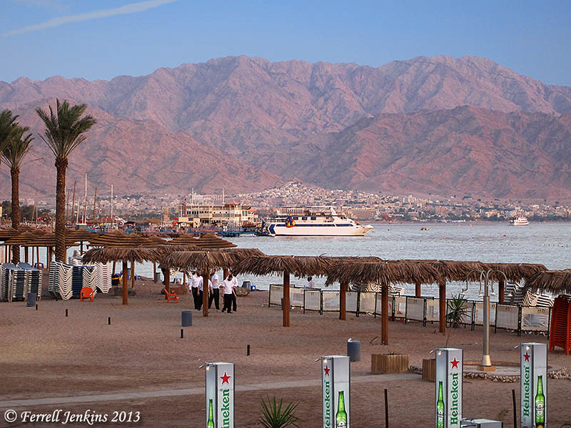
The north end of the Gulf of Eilat/Aqabah. The view is to the east and the city of Aqabah, Jordan. Tell el-Kheleifeh is only a short distance north of the shore in Jordan. Photo by Ferrell Jenkins.
Alexander Flinder says the coastline at Tell el-Kheleifeh is a “sandy beach, with shallow water – totally unsuitable for small craft, let alone for a substantial merchant fleet” (“Is This Solomon’s Seaport?” BAR, July/August 1989, p. 38). Flinder has suggested that Ezion-geber may have been on a small island in the Gulf of Eilat/Aqabah called Jezirat Faraun (Pharaoh’s Island). It is located about seven miles south of modern Eilat, but now under Egyptian control. Flinder’s study shows that there has been an artificial harbor at this location in several historical periods and that it was characteristic of other known Phoenician ports. See the complete article for more details and photos.

Pharaoh’s Island in the Gulf of Eilat/Aqabah from the west. Photo by Ferrell Jenkins.
Meir Lubetski, ABD, says,
Unique were the underwater archaeological findings which established the existence of an artificial enclosed harbor bordering a sizable natural anchorage, with jetties built out into the water to influence currents opposite the island on the shore of the mainland.
I can only point to a suggestion regarding the identity of Ezion-geber with Eloth (Elath). Kenneth A. Kitchen (New Bible Dictionary, 3rd ed., 1996, p. 305). says the two places were,
- Separate stations during the Israelite wandering (Numbers 33:35-36; Deuteronomy 2:8).
- Ezion-geber appears to be mentioned alone in the 10th-9th centuries, and is the point from which Solomon sent ships.
- Jehoshaphat’s planned expedition from Ezion-geber was wrecked (1 King 22:48; 2 Chronicles 20:36-37).
- King Uzziah of Judah captured Elath/Eloth from Edom and rebuilt it in the 8th century (2 Kings 14:22).
- Ahaz lost the port to the Edomites (2 Kings 16:6).
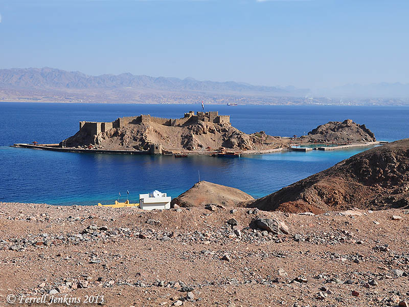
View of Pharaoh’s Island from the west. The view looks east across the Gulf of Eilat/Aqabah to Saudi Arabia, the Biblical land of Midian. Photo by Ferrell Jenkins.
The map at BibleAtlas.org shows the places we have discussed in this and the previous post. Notice the location of Ezion-geber is indicating, with a question mark, the location of Pharaoh’s Island.
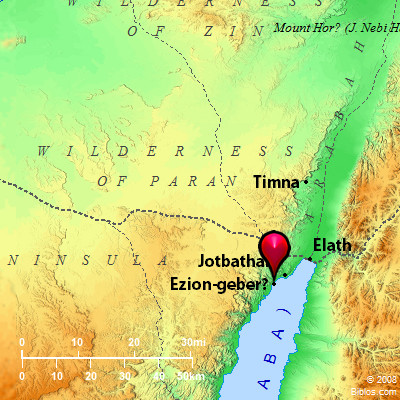
Map of Ezion-geber, Elath, and Timnah. BibleAtlas.org.


You must be logged in to post a comment.