
While David was at Mahanaim, his son Absalom and those of Israel who were aligned with him camped in the land of Gilead (2 Samuel 17:26-27). David remained at the gate of the city while his men went out to fight the rebels. The Biblical account says,
So the army went out into the field against Israel, and the battle was fought in the forest of Ephraim. And the men of Israel were defeated there by the servants of David, and the loss there was great on that day, twenty thousand men. The battle spread over the face of all the country, and the forest devoured more people that day than the sword. And Absalom happened to meet the servants of David. Absalom was riding on his mule, and the mule went under the thick branches of a great oak, and his head caught fast in the oak, and he was suspended between heaven and earth, while the mule that was under him went on. (2 Samuel 18:6-9 ESV)
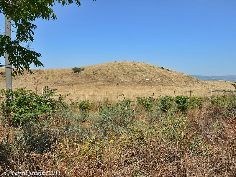
Even though many trees have been used by various invaders over the centuries, some forests of oaks may still be seen in both Cisjordan (territory west of the Jordan River) and Transjordan (territory east of the Jordan River). The photos below were made in a grove of trees growing the Golan Heights a short distance south of the junction of Highways 98 and 99 south of Mas’ada.
These trees may be much smaller than the “great oak” in which Absalom caught his head, but they could be quite dangerous to a person trying to make a fast getaway on a mule.
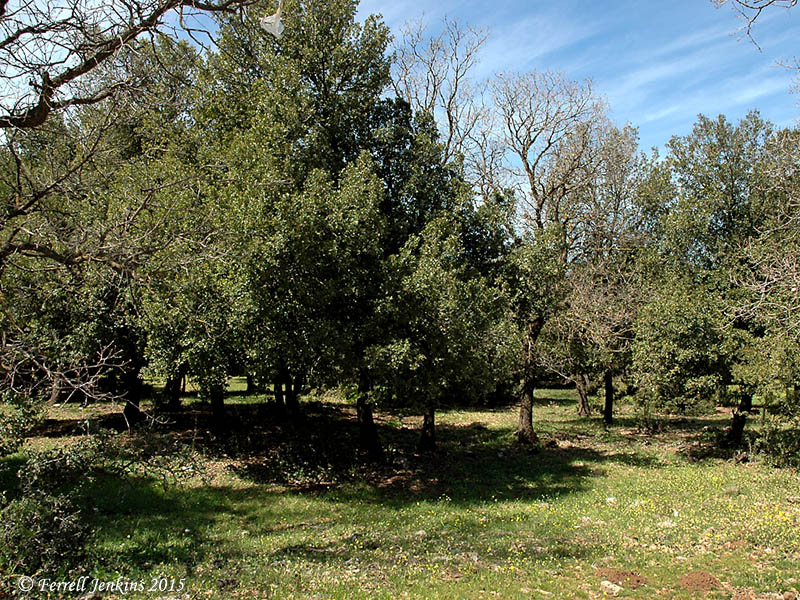
Oaks growing in the Golan Heights. Photo by Ferrell Jenkins.
Here are the leaves of this variety of tree.
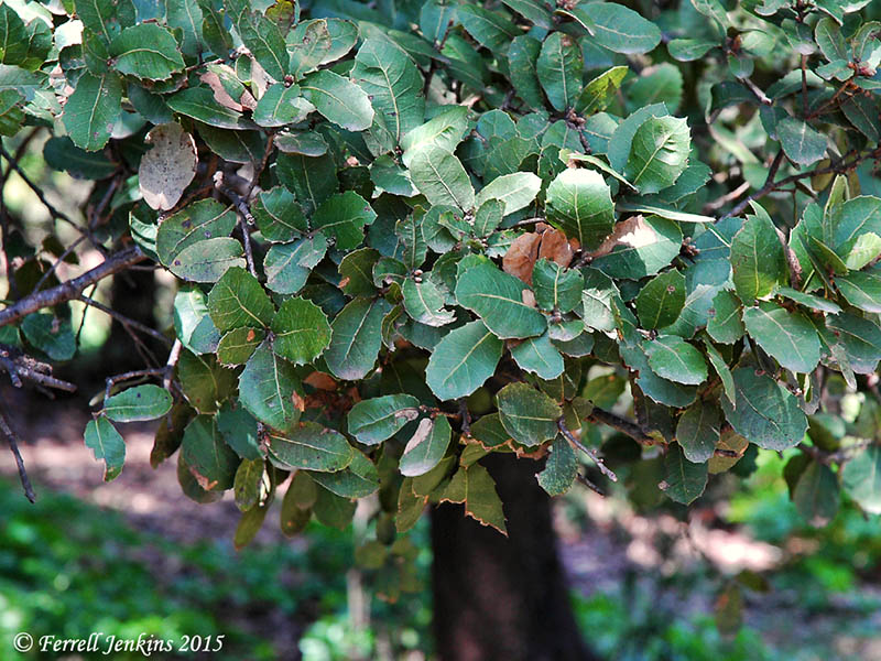
The leaves of oaks growing in the Golan Heights. Photo by Ferrell Jenkins.
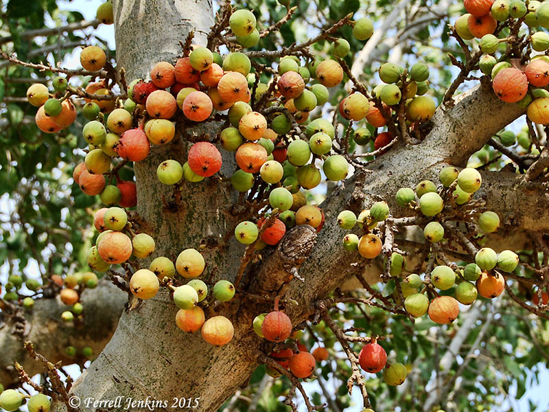
And the large acorns it grows.
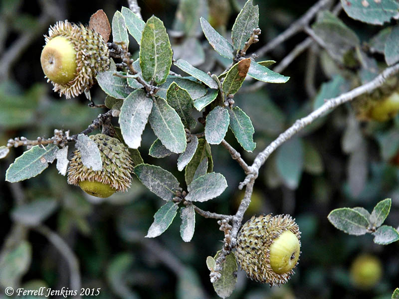
Acorns on the oaks of Bashan. Photo by Ferrell Jenkins.
The oaks of Bashan are mentioned by the prophets of Israel several times (Isaiah 2:13; Ezekiel 27:6; Zechariah 11:2).
The technical name for the oak shown here is Querqcus ithaburensis, and is known as the Tabor oak. Dr. David Darom, in Beautiful Plants of the Bible, say this about the tree,
The Tabor oak, being a large deciduous tree that dominates its surroundings, was often associated with ritual and religious customs. Tabor oak forests once covered large areas of the northern Coastal Plain, the Lower Galilee, the Hulah Valley and
the slopes of the Golan. Most of the trees were cut down during the ages so their excellent wood could be used in buildings, furniture and boats. (p. 44)
William M. Thomson, back in 1880, described a walk in one of the “grand old forests” near the Crocodile River between Caesarea and Dor.
I had a delightful ramble early the next morning in those grand old forests, and then understood perfectly how Absalom could be caught by the thick branches of an oak. The strong arms of these trees spread out so near the ground that one cannot walk erect beneath them; and on a frightened mule, such a head of hair as that vain but wicked son polled every year would certainly become inextricably entangled: and it is interesting to know that the region east of the Jordan, that “wood of Ephraim” where the battle was fought, is still covered with thick oaks, tangled bushes, and thorny creepers growing over ragged rocks, and ruinous precipices, down which the rebel army plunged in wild dismay, horses and men crushing each other to death in remediless ruin. Thus twenty thousand men perished in that fatal wood, which “devoured more people that day than the sword devoured.” (The Land and the Book or Biblical Illustrations Drawn from the Manners and Customs, the Scenes and Scenery, of the Holy Land: Southern Palestine and Jerusalem. New York: Harper & Brothers, 1880. Print.)
To be precisely Biblical, it was Absalom’s head that caught in the oak, but the excessive hair might have contributed to his misfortune.
Absalom was killed by Joab and his armor-bearers (2 Samuel 18:14-15). Balwin comments on Absalom’s ignominious end:
All that remains is to bury there and then in the forest the body of the rebel, his grave marked only by a huge cairn of field stones, which would in a relatively short time cease to be identifiable. It was an ignominious end. (Baldwin, Joyce G. 1 and 2 Samuel: An Introduction and Commentary. Vol. 8. Downers Grove, IL: InterVarsity Press, 1988. Print. Tyndale Old Testament Commentaries.)


You must be logged in to post a comment.