Category Archives: Israel

Flying over Beit She’an, Bethshan, Beth-shan

The Israelis call it Beit She’an, but English Bible readers will know it as Bethshan. The town is mentioned only a few times in the Old Testament. The English Standard Version uses both Beth-shan and Beth-shean to identify this town. Other English versions use a variety of spellings including Bethshan.

From atop the ancient tell, called Tell el-Husn or Tel Beth She’an, one has an impressive view of the area. Occupational levels date back at least to 3000 B.C. Artifacts from Canaan, Egypt, Anatolia, north Syria, and Mesopotamia have been uncovered from the mound.

The photo below was made from the air with a view northeast. A small portion of the Harrod Valley, with some fish ponds, is visible in the top of the photo. The River Harod flows to the east of the tel hidden by the line of trees.

Tel Husn (Bethshan) is visible in the bottom of the image. Photo by Ferrell Jenkins.

Tel Husn (Bethshan) is visible in the bottom of the image. Photo by Ferrell Jenkins.

For many Bible students the first event that comes to mind is the defeat of King Saul at the hands of the Philistines. After his death on nearby Mount Gilboa, Saul’s body was taken to Beth-shean and fastened to the wall of the city (1 Samuel 31).

During the Greek period the city was named Scythopolis (city of the Scythians) and expanded to the foot of the tell.

In 63 B.C. the Romans, under the general Pompey, made the city part of the Decapolis (a league of ten cities; Matthew 4:25; Mark 5:20; 7:21). This was the only city of the Decapolis west of the Jordan River. The city was populated by gentiles, Jews and Samaritans.

The main street of the Byzantine city. The tel of ancient Bethshan is visible at the end of the street. Photo by Ferrell Jenkins.

The main street of the Byzantine city. The tel of ancient Bethshan is visible at the end of the columned street. Photo by Ferrell Jenkins.

The city grew to its largest size during the Byzantine period as a “Christian” city. It came under Muslim control in A.D. 636, and was destroyed by an earthquake in A.D. 749.

Some of the earthquake damage at Bethshan. Photo by Ferrell Jenkins.

Some of the earthquake damage at Bethshan. Photo by Ferrell Jenkins.

The destroyed Byzantine city lies between the theater and the mound. That’s a lot of history in one small place.

The other Aphek – of Asher

The Anchor Yale Bible Dictionary follows William F. Albright in listing five towns named Aphek.

  1. Aphek of Asher (Joshua 19:29-30).
  2. Aphek of Aram (1 Kings 20:26-30).
  3. Aphek in Lebanon (Joshua 13:4).
  4. Aphek in Sharon (Joshua 12:18; 1 Samuel 4:1; 1 Samuel 29).
  5. Aphekah in Judah (Joshua 15:33).

In the previous post we discussed Aphek in Sharon where the Philistines were encamped while the Israelites were about two miles away at Ebenezer.

There was also a town named Aphek (Afek) located within the territory of the tribe of Asher.

Then the boundary turns to Ramah, reaching to the fortified city of Tyre. Then the boundary turns to Hosah, and it ends at the sea; Mahalab, Achzib, Ummah, Aphek and Rehob– twenty-two cities with their villages. This is the inheritance of the tribe of the people of Asher according to their clans– these cities with their villages. (Joshua 19:29-31 ESV)

The aerial photo below shows Aphek of Asher in the Plain of Akko (Acco, Acre). The city of Haifa and the western end of Mount Carmel can be seen jutting out into the Mediterranean Sea.

Aphek of Asher. View southwest toward the Bay of Haifa. Photo by Ferrell Jenkins.

Aphek of Asher. View southwest toward the Bay of Haifa. Photo by Ferrell Jenkins.

In this photo we see the tel in the foreground with Mount Carmel to the south. the Ladder of Tyre in the distance to the north.

Aphek of Asher. View south toward Mount Carmel. Photo by Ferrell Jenkins.

Aphek of Asher. View south toward Mount Carmel north-northeast toward the Ladder of Tyre. Photo by Ferrell Jenkins.

Various sites with the same name can be confusing, but a little investigation helps to distinguish them.

Note: Thanks to the keen eye of A.D. Riddle for catching my mistake above. I did not recall circling the tel while we were flying. I had never been to Afek, so when the pilot pointed it out I began shooting continuously. I appreciate A.D. correcting this.

The photo below stretches all the way from Akko (Acre) to the Ladder of Tyre. You should be able to make out a white mark stretching into the sea in the distance.

The Mediterranean coast from Akko (Acre) north to the Ladder of Tyre. Photo by Ferrell Jenkins.

The Mediterranean coast from Akko (Acre) north to the Ladder of Tyre. Photo: Jenkins.

For additional information about this stretch of land, see our earlier post here.

Aphek – where the Philistines were encamped

One of the significant battles between Israel and the Philistines took place during the time of Samuel when the ark of the covenant was located in the tent of meeting at Shiloh.

And the word of Samuel came to all Israel. Now Israel went out to battle against the Philistines. They encamped at Ebenezer, and the Philistines encamped at Aphek. (1 Samuel 4:1 ESV)

Israel encamped at Ebenezer, and the Philistines encamped at Aphek in the plain of Sharon. This indicates that the two places were fairly close to each other. Aphek is located about 21 miles west of Shiloh. Ebenezer is about 2 miles east of Aphek.

Herod the Great built a city at the site of Aphek and named it Antipatris in honor of his father.

Herod was also a lover of his father, if any other person ever was so; for he made a monument for his father, even that city which he built in the finest plain that was in his kingdom, and which had rivers and trees in abundance, and named it Antipatris. He also built a wall around a citadel that lay above Jericho, and was a very strong and very fine building, and dedicated it to his mother, and called it Cypros. (Jewish Wars 1:417)

Because Aphek/Antipatris sat on a major south-north and west-east routes, it was dominated by many nations. The dominant feature of the site today is the Turkish fort. Inside are the excavated ruins of buildings from Canaanite to Herodian/Roman times.

The apostle Paul stayed overnight at Antipatris on his journey from Jerusalem to Caesarea (Acts 23:31).

Aphek/Antipatris is known by the modern name Ras el-Ain because it is located at the headwaters of the Yarkon River which flows into the Mediterranean about 11 miles to the west.

Source of the Yarkon River at Aphek/Antipatris. Photo by Ferrell Jenkins.

Source of the Yarkon River at Aphek/Antipatris. Photo by Ferrell Jenkins.

Aphex/Antipatris is now dominated by the ruins of an Ottoman fortress.

The Crusader castle of Mirabel, later used as a Turkish fortress. Photo by Ferrell Jenkins.

The Ottoman fortress at Aphek/Antipatris. Photo by Ferrell Jenkins.

Our final photo shows the fortress and the source of the Yarkon River from the air. Notice in the previous photos the grass is brown. Those photos were made in August. The next photo was made in December and the grass is green.

Aerial photograph of Aphek/Antipatris. Photo by Ferrell Jenkins.

Aerial photograph of Aphek/Antipatris. Photo by Ferrell Jenkins.

Leon Mauldin has written about Aphek here.

In the next post we plan to write about “The Other Aphek.”


A miscellany of topics

In the past few weeks I have been occupied trying to get some out-of-print material ready for reprint. Occasionally I read something that I think should be shared. Take a look at these.

Ephesus Museum Open. Carl Rasmussen reports on his HolyLandPhotos’Blog that the Ephesus Museum in Seljuk is open after being closed for renovation.

Gentile References in Matthew. Charles Savelle presents a list of “Gentile References in Matthew” at BibleX.

Bible Places Blog. Todd Bolen’s Weekend Roundups have been extremely helpful the past couple of weeks. See here for the most current one.

The Fallow Deer. Shmuel Browns writes about how the Fallow Deer was reintroduced into Israel from Iran. Fascinating story with photos here. Browns does not say where he made his photos, but mentions that some of the deer were taken to Neot Kadumim. When Leon Mauldin and I visited Neot Kedumim in 2005 the deer there were young. I note that they are not as gray as those in Shmuel’s photos. Perhaps the age accounts for the difference.

Young fallow deer at Neot Kedumim. Photo by Leon Mauldin.

Young fallow deer at Neot Kedumim. Photo by Leon Mauldin.

Using Maps in Bible Study. Wayne Stiles writes about “The Value of Using Maps in Your Bible Study” here.

Mount Gilboa. The Times of Israel carries an article here with beautiful photos, of the Gilboa Mountains and the wildflowers growing there in the winter and spring.

A poppy and a bee at the Pool of Bethesda, Jerusalem. Photo by Ferrell Jenkins.

A poppy and a bee at the Pool of Bethesda, Jerusalem. Photo by Ferrell Jenkins.

Responding to Newsweek. Darrell L. Bock has two more responses here to the Newsweek article on The Bible.

How Many Saviors? Amazon has Ronald Nash’s Is Jesus the Only Savior? available in Kindle format for $1.99 for a limited time. This book can be very helpful in this time of emphasis on pluralism and inclusivism.

The Exodus. Last Friday I heard Gretchen Carlson’s interview with filmmaker Tim Mahoney on Fox News. It was the first I had heard of the film Patterns of Evidence: Exodus. The film is debuting Monday, January 19 at select theaters nationwide.

A wide variety of scholars are interviewed in the film, including Charles Aling, Manfred Bietak, John Bimson, Israel Finkelstein, James K. Hoffmeier, David Rohl (who has advanced a revised chronology ancient Egypt and Palestine),
Bryant Wood, and others.

For info on the film and places it will be shown see Patterns of Evidence: The Exodus. Here is the trailer.

A few nice photos are available for download.

From Patterns of Evidence.

From Patterns of Evidence.

You are on your own to see/hear and evaluate.

Added Note (Jan. 19, 2015). Todd Bolen calls attention to a review of the film by Larry Largent. This review confirms my suspicions that the flim was an effort to push a revised chronology. Take a look at this review at Biblical Remains.

The Other Bethlehem – Part 2

The unique buildings we now see in the little village of Beit Lehem HaGlilit (Galilean Bethlehem) were erected in the 1930s by a group of German nationals. A 2008 article by Lydia Aisenberg in the Jerusalem Post explains the origin and dispersion of the group. Aisenberg says that Beit Lehem HaGlilit and the nearby town of Waldheim (now Alonei Abba)…

…were built by the Templars [or Templers], a German-Christian sect and Nazi sympathizers who were rounded up by the British in 1939 and deported out of Mandate Palestine. Some chose to return to Germany, but the majority of the Templar community’s members emigrated to Melbourne, Australia.

The sect originated in southern Germany and carried a holy mission known as the Tempel Gemeinde, or Tempelgesellschaft. The sect’s name was later shortened to just “Templars,” often confused with another group, the Crusader-era Templer Knights.

The Templars arrived in the Ottoman controlled Holy Land in mid-l880 and began to build communities in different parts of the country: Haifa, Jaffa, Jerusalem, Sarona (Tel Aviv), as well as the two communities Beit Lehem HaGlilit and Waldheim in the Jezreel Valley.

After World War I, the British sent the Templars packing, but members of the sect were later allowed to return. They were banished for a second and final time when their Nazi connections were discovered in the late 1930s.

Templar youth from Palestine had been sent to attend “educational” youth activities and family visits in Germany, where they met with top Nazi officials. Photographs on display at the Beit Lehem HaGlilit home of the Fleischman family depict Templar sect members wearing swastika armbands and congregating in one of the large courtyards between the two-story buildings and outhouses.

The Templars of Beit Lehem HaGlilit (Galilean Bethlehem) and neighboring Waldheim (meaning “Forest Home” in German) were eventually rounded up by the British and sent to detention camps until their deportation, after which British Mandate soldiers and police were billeted in the Templars’ former homes.

When Jewish refugee families later moved into the Templar houses in Beit Lehem HaGlilit and Alonei Abba, they discovered hidden Templar belongings that attested the sect’s support of Adolf Hitler and the Nazi regime. Items discovered in the community’s homes included Nazi party pennants, badges, banners, pamphlets and flags, in addition to photographs.

The stone house below, built by the Templars, served as a community house for the German nationals who lived in Galilean Bethlehem in the 1930s.

The Community House at Beit Lehem HaGilit. Photo by Ferrell Jenkins.

The Community House at Beit Lehem HaGilit. Photo by Ferrell Jenkins.

The next photo is of the Holocaust memorial erected by the residents of the town in 2007. Aisenberg explains the significance of the monument.

Its six large marble slabs lean forward, as if struggling to keep their pride and stay erect under the heaviest of loads.

Engraved on the memorial are the names of Jews snatched from their homes, transported and murdered by the Nazis. The names of the European towns and villages in which they had lived for generations are also etched deep in the stones, which seem to strain under the weight of memorializing so many thousands of murdered Jews and their annihilated communities.

The victims whose memories are honored on the six marble blocks, unveiled last year, are extended family members of today’s residents of the pleasant, upscale community of Beit Lehem HaGlilit.

A smaller block of marble at the side of the memorial boasts an inscription reading: “Erected by the community of Beit Lehem HaGlilit, second generation since the Holocaust, in recognition of our parents who survived the Holocaust, made aliya to Eretz Israel, participated in the founding of the state and amongst the founders of Beit Lehem HaGlilit, our home and in memory of our family members who were murdered by the Nazis in Europe during the years of 1939-1945.”

Monument to Holocaust Victims at Beit Lehem HaGelit. Photo by Ferrell Jenkins.

Monument to Holocaust Victims at Beit Lehem HaGelit. Photo by Ferrell Jenkins.

The complete article by Lydia Aisenberg may be read here.

After Part 1 was posted, Erik Wold left a comment and link that is pertinent at this point. The Dec. 26, 2014 issue of the London Mirror carried an article entitled “Is this secret Nazi enclave the REAL Bethlehem where Jesus Christ was born?” here.

The authors of the article claim that the settlement in Galilean Bethlehem was an effort by Hitler and Himmler “to show that Jesus was born an Aryan, not a Jew.”

This is home to a secret Nazi sect waiting for the Second Coming in the heart of the Holy Land.

And behind it all is an anti-Semetic [Semitic] fantasy dreamed up by Adolf Hitler and Heinrich Himmler to show that Jesus was born an Aryan, not a Jew.

It may seem stranger than fiction but it all really happened in Bethlehem of Galilee, nine miles west of Nazareth.

The article also advances the theory of Dr Aviram Oshri that Jesus was born in Galilean Bethlehem, while acknowledging that the Israel Antiquities Authority “dismiss his claim as ‘worse than a joke.'”

As a result of something I read in the Mirror article I was led to Heidemarie Wawrzyn’s Nazis in the Holy Land 1933-1948. She says that the German colonies were used to aid Arab rebels. All of this came to a head about 1938 and resulted in the expulsion of the settlers.

I do not claim much knowledge about the Templars or the German settlement at Bethlehem, but I do find all of this intriguing as a prelude to the founding of the State of Israel in 1948.

Added Note: See the comment below by Tom Powers. Here is a copy of the photo he mentions. Use Tom’s link for the original at the Library of Congress.

Photo taken on Coronation Day of King George VI in 1937. The Fast Hotel, on lower Jaffa Road, was owned by a Templer family.

Photo taken on the Coronation Day of King George VI in 1937. The Fast Hotel, on lower Jaffa Road, was owned by a Templer family. Notice both Nazi Flags and the Union Jack.

The Other Bethlehem – Part 1

Everyone who has studied the earthly ministry of Christ knows that He was born in Bethlehem, the city of David, about six miles south of the ancient city of Jerusalem (Micah 5:2; Matthew 2:1-8; Luke 2:4,15). This village is designated as Bethlehem of Judea or Bethlehem Ephrath.

So Rachel died, and she was buried on the way to Ephrath (that is, Bethlehem), (Genesis 35:19 ESV)

The only reference to Bethlehem in the New Testament apart from the birth account in Matthew and Luke calls Bethlehem a village (kome; John 7:42) and ties it with the prophecy of Micah 5:2.

The other Bethlehem is located in the tribal territory of Zebulun (Joshua 19:15), about 7 miles northwest of Nazareth. For a list of the twelve cities of Zebulun see Joshua 19:10-15.

After the destruction of the temple in Jerusalem (A.D. 70) Bethlehem of Zebulun,

was known under the name of Bethlehem Zoriah — Bethlehem of Tyre — and was the seat of the priestly order of the family of Malchiah. Identified with Beit Lahm in Lower Galilee. (Avraham Negev, ed. The Archaeological Encyclopedia of the Holy Land, rev. ed., p. 58.

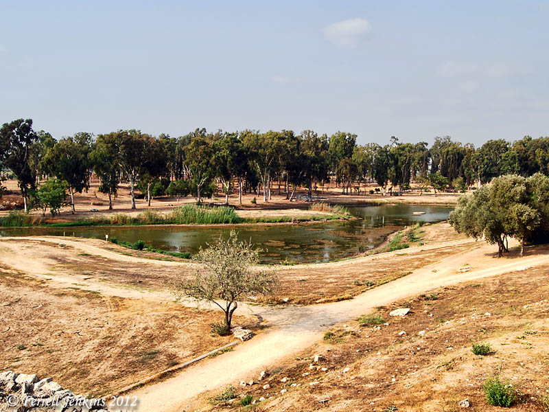
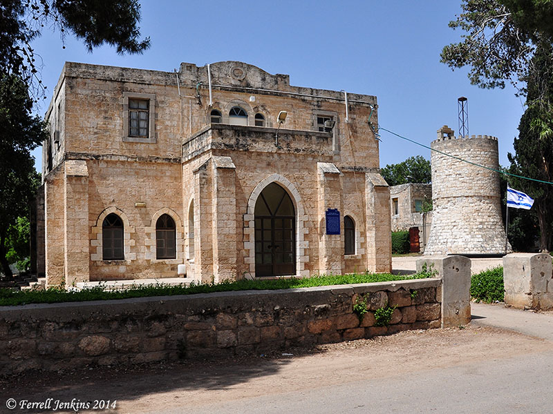
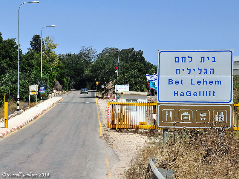
Galilean Bethlehem is now a small Jewish moshav, a cooperative agricultural settlement. The photo below shows the entrance to the moshav.

Entrance to the moshav of Beit Lehem HaGelit. Photo by Ferrell Jenkins.

Entrance to the moshav of Beit Lehem HaGelilit. Photo by Ferrell Jenkins.

The small map below shows the location of Galilean Bethlehem.

Map showing Galilean Bethlehem. BibleAtlas.org

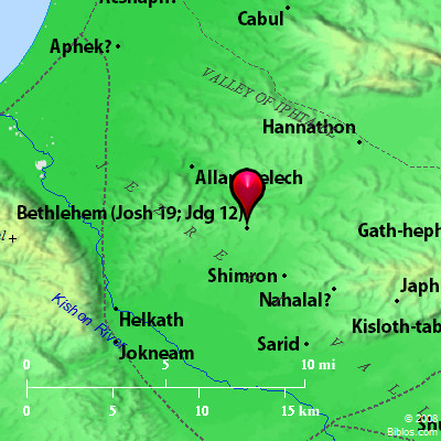
Map showing Galilean Bethlehem. New Testament Nazareth would be located at the far right of the map under the “h” in Japh. Credit: Biblos.com.

Could Jesus have been born here? Primarily because of the proximity of Galilean Bethlehem to Nazareth, some scholars have suggested that this was the birthplace of Jesus. National Geographic writer Marisa Larson raises this question in a Feb. 11, 2008, followup to the Dec., 2007, feature “Bethlehem 2007 A.D.”

Larson cites Aviram Oshri, a senior archaeologist with the Israeli Antiquities Authority, as someone who thinks that it was more likely that the historical Jesus was born in Bethlehem of Galilee rather than the Bethlehem of Judea.

“If the historical Jesus were truly born in Bethlehem,” Oshri adds, “it was most likely the Bethlehem of Galilee, not that in Judaea. The archaeological evidence certainly seems to favor the former, a busy center [of Jewish life] a few miles from the home of Joseph and Mary, as opposed to an unpopulated spot almost a hundred miles from home.” In this Bethlehem, Oshri and his team have uncovered the remains of a later monastery and the largest Byzantine church in Israel, which raises the question of why such a huge house of Christian worship was built in the heart of a Jewish area. The Israeli archaeologist believes that it’s because early Christians revered Bethlehem of Galilee as the birthplace of Jesus. “There is no doubt in my mind that these are impressive and important evidence of a strong Christian community established in Bethlehem [of Galilee] a short time after Jesus’ death,” he says. (copied from here, 12/27/14).

Oshri also expressed his views in Archaeology 58:6 (Nov.-Dec. 2005). He says that there is evidence of “a strong Christian community established in Bethlehem [of Galilee] a short time after Jesus’ death.” In fact, the first archaeological evidence is of a sixth century church [building].

Even if Christians of Galilee “revered Bethlehem of Galilee as the birthplace of Jesus” it does not negate the clear historical records of Matthew and Luke regarding the birthplace of Jesus in Bethlehem of Judea and the reason for the couple from Nazareth returning to the ancestral home in Judea.

If the Bible were written by men unaided by the Holy Spirit I think it would be reasonable to place the birth of Jesus in Bethlehem of Galilee and his upbringing in nearby Nazareth. There is an amazing undesigned coincidence here.

  • The Messiah was to be from the tribe of Judah (Genesis 49:10), and of the family of David (2 Samuel 7:11).
  • The birth of the Messiah was prophesied to be in Bethlehem Ephrath (Micah 5:2; Matthew 2:6). This was the Bethlehem of Judea.
  • The couple living in Nazareth were both of the family of David (Matthew 1:20; Luke 1:27,32,69). The legal line is traced through Joseph, and the blood line is traced through Mary in Luke’s account.
  • Joseph and Mary responded to the decree of the emperor Augustus that they return to their ancestral home for registration (Luke 2:1-5).

If Jesus had been born in Galilean Bethlehem, and if the Gospels had been written much later, as most critics claim, then they would have recorded a different story.

The ease with which writers could mix up the two Bethlehems, but did not, provides an  illustration of the amazing accuracy of the Bible.

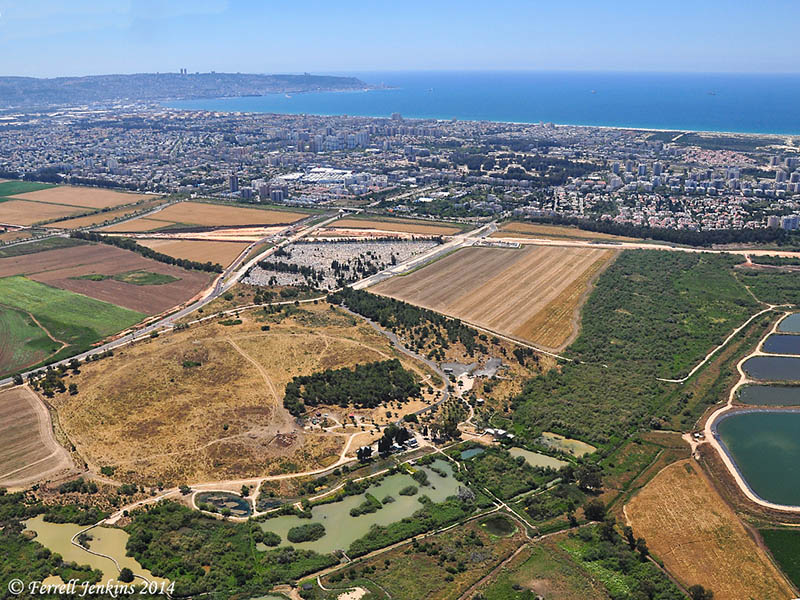
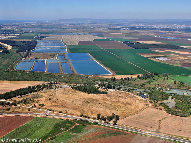
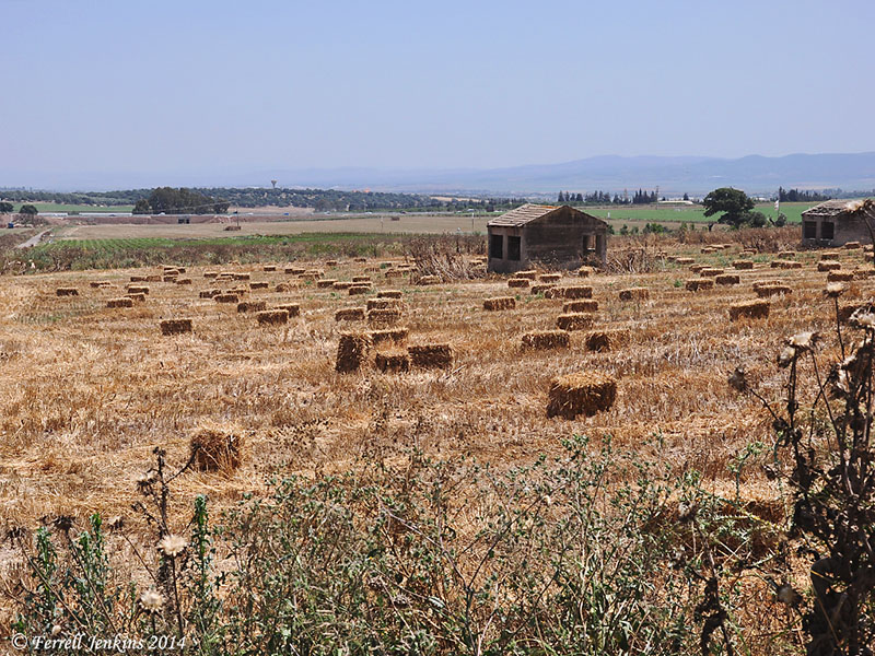
Beit Lehem HaGelilit is situated on the north side of the western end of the Jezreel Valley.

Valley from Beit Lehem HaGelit. Photo by Ferrell Jenkins.

View SE to the Jezreel Valley from Beit Lehem HaGelilit. Photo by Ferrell Jenkins.

On the hills of lower Galilee, to the east and north of Galilean Bethlehem, there are Olive orchards, and cows grazing among the oaks.

Cows graze among the Allon Oak trees at Galilean Bethlehem. Photo by Ferrell Jenkins.

Cows graze among the Oaks at Galilean Bethlehem. Photo by Ferrell Jenkins.

Bethlehem of Galilee may be mentioned one other time in the Bible as the home and burial place of Ibzan the judge (Judges 12:8). The context in which he is mentioned is dealing with various judges of the tribes of Zebulun and Ephraim.

In  a post to follow I plan to share some of the recent history of Galilean Bethlehem.

NASA photos of Israel and Middle East

NASA has posted several excellent photos made by Barry Wilmore from the International Space Station on Facebook. The photos were made on Christmas day, 2014. See how many landmarks you can identify. Click on the photo for a larger image. Do you see Tyre?

Israel, the West Bank, and part of Jordan from the ISS. Photo: NASA/Barry Wilmore.

Israel, the West Bank, and part of Jordan from the ISS. Photo: NASA/Barry Wilmore.

The photo below shows portions (or all) of (L to R) Egypt, Sinai Peninsula, Israel, Jordan, Lebanon, Syria, Turkey (including Euphrates River), and Iraq. Great photo.

The Middle East from the ISS. Photo: NASA/Barry Wilmore.

The Middle East from the ISS. Photo: NASA/Barry Wilmore.

Get out your Bible atlases and study these photos.

Our tax dollars put to good use, I would say.

Frankincense and Myrrh in the Bible

Frankincense and myrrh are mentioned together in the Song of Solomon and in the account of the visit of the magi from the east to see Jesus. Several significant things can be learned from these Biblical verses.

Look first at Song of Solomon 3:6.

“What is this coming up from the wilderness Like columns of smoke, Perfumed with myrrh and frankincense, With all scented powders of the merchant? (Song of Solomon 3:6 NAU)

  • Myrrh and frankincense are associated with the wilderness (desert; Hebrew, midbar).
  • Perhaps incense used in sacrifice or offering, “like columns of smoke.”
  • Associated with perfume and scented or fragrant powders.
  • Something traveling merchants would bring from the wilderness.

Song of Solomon 4:13-14 provides more insights.

“Your shoots are an orchard of pomegranates With choice fruits, henna with nard plants,  Nard and saffron, calamus and cinnamon, With all the trees of frankincense, Myrrh and aloes, along with all the finest spices. (Song of Solomon 4:13-14 NAU)

  • Associated with trees, and classified with spices.
The wilderness of Zin near Avdat. Photo by Ferrell Jenkins.

The wilderness of Zin near Avdat. Photo by Ferrell Jenkins.

The reference in the New Testament is in the account of the birth of Jesus (Matthew 2:1-11).

  • Frankincense and myrrh are in the category with gold, and offered as gifts to one who is considered a king and is being worshiped.
  • The magi have come from east of Jerusalem and Bethlehem.
  • Gold, frankincense, and myrrh are considered treasures.

All of these tips harmonize with what is known about frankincense and myrrh. The plants or trees from which these come are known to grow in the desert regions. They are not native to Biblical Israel. Traveling merchants from Arabia traveled long distances across the desert, making stops at Petra, Avdat, and other places on their way to Gaza and other Mediterranean ports where the products could be shipped throughout the Mediterranean world.

The photo below was made at Avdat (Ovdat), a Nabatean site in the Negev. The city was especially significant in the first century B.C. and the first century A.D. Avdat was stop number 62 on the famous Incense Route. It is now part of Israel’s National Park system, and a World Heritage Site. A display at the ticket office and shop explains about the Incense Route and shows some of the goods that were transported across the desert.

The header we are using for this blog, showing a caravan crossing the desert, was made at Avdat.

Frankincense and Myrrh on the Spice Route at Avedat. Photo by Ferrell Jenkins.

Frankincense and Myrrh on the Spice Route at Avdat. Photo by Ferrell Jenkins.

This post is a revision of one posted December 14, 2011.

The Herodium becomes more complex

The information below comes from a news release today from the Herodium Expedition at the Hebrew University of Jerusalem. The Herodium, built by Herod the Great, is located near Bethlehem, the birthplace of Jesus. See our recent Index of articles on Bethlehem and the birth of Jesus for numerous links about the Herodium.

— ♦ —

Archaeologists from The Hebrew University of Jerusalem’s Institute of Archaeology have discovered a monumental entryway to the Herodian Hilltop Palace at the Herodium National Park. The unique complex was uncovered during excavations by The Herodium Expedition in Memory of Ehud Netzer over the past year, as part of a project to develop the site for tourism. Photo of unique palace entry complex discovered at Herodian Hilltop Palace by Hebrew University archaeologists.

Photo of unique palace entry complex discovered at Herodian Hilltop Palace by Hebrew University archaeologists. (Credit: The Herodium Expedition at the Hebrew University of Jerusalem)

Photo of unique palace entry complex discovered at Herodian Hilltop Palace by Hebrew University archaeologists. (Credit: The Herodium Expedition at the Hebrew University of Jerusalem)

The main feature of the entryway is an impressive corridor with a complex system of arches spanning its width on three separate levels. These arches buttressed the corridor’s massive side-walls, allowing the King and his entourage direct passage into the Palace Courtyard. Thanks to the supporting arches, the 20-meter long and 6-meter wide corridor has been preserved to a height of 20 meters.   The Hebrew University archaeologists — Roi Porat, Yakov Kalman and Rachel Chachy — suggest that the corridor was built as part of Herod’s plan to turn Herodium into a massive artificial volcano-shaped hill, a vast and impressive monument designed to commemorate the architect-King.   Surprisingly, during the course of the excavations, it became evident that the arched corridor was never actually in use, as prior to its completion it became redundant. This appears to have happened when Herod, aware of his impending death, decided to convert the whole hilltop complex into a massive memorial mound, a royal burial monument on an epic scale.   Whatever the case, the corridor was back-filled during the construction of the massive artificial hill at the end of Herod’s reign. The upper section of a new monumental stairway stretching from the hill’s base to its peak, constructed during the course of this building phase, appears to have been built over it.   The excavators point out that not only was the arched corridor covered over in the course of the construction of the hill-monument, but also all the structures earlier built by Herod on the hill’s slopes, including the Royal Theater uncovered by the expedition in 2008, while still led by Prof. Ehud Netzer, since deceased.   The only edifice not covered over was the splendid mausoleum-style structure, identified by Netzer and the expedition as Herod’s burial-place. Together with the monumental cone-shaped hill, this constituted the unique Herodian Royal burial-complex.

Photo of unique palace entry complex discovered at Herodian Hilltop Palace by Hebrew University archaeologists. Credit: The Herodium Expedition at the Hebrew University of Jerusalem

Photo of unique palace entry complex discovered at Herodian Hilltop Palace by Hebrew University archaeologists. Credit: The Herodium Expedition at the Hebrew University of Jerusalem

During the course of the current excavations, the original impressive Palace vestibule, blocked when the corridor became redundant, was also exposed. This entry-room, decorated with splendid painted frescoes, had a magnificent entryway leading into it, and offered evidence of the rebel occupation during the Great Revolt (66-71 CE), including Jewish Revolt coinage and crude temporary structures.   In addition, the excavations in the arched corridor also turned up impressive evidence from the Bar Kokhba Revolt period (132-135/6 CE): hidden tunnels dug on the site by the rebels as part of the guerilla warfare they waged against the Romans. Supported in part by wooden beams, these tunnels exited from the hilltop fortress by way of the corridor’s walls, through openings hidden in the corridor. One of the tunnels revealed a well-preserved construction of 20 or so cypress-wood branches, arranged in a cross-weave pattern to support the tunnel’s roof.   In the future, according to Mr. Shaul Goldstein, Director of Israel’s Nature and Parks Authority, the excavation of the arched corridor will allow visitors direct access to the Herodium hilltop palace-fortress, in the same way that Herod entered it two thousand years ago. There are also plans to provide tourists direct access from the structures on the slope, the Royal Theater and the Mausoleum, via the earlier monumental stairway, to the hilltop Palace.

Aerial view of the Herodium. Photo by Ferrell Jenkins.

Aerial view of the Herodium. Photo by Ferrell Jenkins.

The Israel Nature and Parks Authority, the Heritage and Commemoration Department of the Prime Minister’s Office, the Israel Antiquities Authority, and the Etzion Bloc Regional Council and Civilian Administration are all co-partners in the development of the Herodium.   Ehud Netzer was a world-renowned professor at the Hebrew University’s Institute of Archaeology. Following several decades of excavations at the Herodium, Netzer discovered the tomb of Herod the Great in 2007. He died in 2010 at age 76 after being injured in a fall at the Heroudium archaeological site.

HT: Carl Rasmussen, HolyLandPhotos’ Blog; I see that Bible Places Blog has already posted information about this discovery.

Jesus visited Jerusalem during Hanukkah

The Gospel of John records more visits to Jerusalem by Jesus than any other of the Gospels. John is the only one to record the visit during the Feast of Dedication.

At that time the Feast of Dedication took place at Jerusalem. It was winter,  and Jesus was walking in the temple, in the colonnade of Solomon. (John 10:22-23 ESV)

BDAG translates the Greek term egkainia as “festival of rededication.” The feast is also known as Hanukkah and the Feast of Lights.

What is he Feast of Dedication? This feast, observed on the 25th of Kislev (roughly our December), had its origin in the period between the testaments. The desecration of the temple by the Seleucid ruler Antiochus Epiphanes took place in 168 B.C. The climax of the Maccabean revolt was the removal of all evidences of pagan worship from the temple. An eight day feast of dedication was observed in 165 B.C., and continued to be observed annually by the Jews.

At Modin, a village north-west of Jerusalem, on the way from Jerusalem to Lod, the Syrians tried to force an old priest by the name of Mattathias to offer a pagan sacrifice. The priest refused but another Jew volunteered to offer the sacrifice. Mattathias killed his fellow Jew and the Syrian officer. As word spread, Mattathias became a national hero. He was of the family of Hasmon (or Asmoneus). Thus began the Hasmoneans.

The discovery of a burial cave at Modin thought to have been used by the Maccabees and/or their descendants was reported in November, 1995. There are Israeli scholars who argue that this is not the true grave of the Maccabees. An article in Haaretz says,

Amit Re’em, an archaeologist of the Israel Antiquities Authority says all the evidence points to the fact that these graves are of Christians and pagans and that this burial site actually belongs to an ancient monastery.

Read the Haaretz article here.

Near Modin, signs point to the Maccabean Graves. Photo by Ferrell Jenkins.

Near Modin, signs point to the Maccabean Graves. Photo by Ferrell Jenkins.

Even though the Feast of Dedication was not a feast authorized by the Mosaic Law, it became part of the Jewish heritage, and Jesus came to Jerusalem at that time — at least once.

Jesus cleansed the Temple on two distinct occasions. The first time is recorded in John 2:14-22. The second account is recorded in Matthew 21:12-13; Mark 11:15-18; and Luke 19:45-48.

• This is a golden oldie from December 24, 2011.