
The prophet Jeremiah is told to,
“Take the loincloth that you have bought, which is around your waist, and arise, go to the Euphrates and hide it there in a cleft of the rock.” (Jeremiah 13:4 ESV)
Various English translations use waistband, shorts, sash, girdle, and underwear to describe the piece of clothing that Jeremiah had bought. Whatever, the indication is that the garment was relatively new. Now he must take it to the Euphrates and hide it in a cleft of the rock.
Remember that Jeremiah was was from the little town of Anathoth, on the NE side of Jerusalem (Jeremiah 1:1). We still lack certainty regarding the specific location of the town, but the name lives on today in the Arab town of Anata.
Where was the Euphrates? At first we think of this as an easy question to answer. But on second thought there is another possibility. Jeremiah may have been told to go to a place identified as En Prat (or Ein Prat) in modern Israel. This place is identified with Parah in Joshua 18:23, and is called Perath in English transliteration of the Hebrew word. The Hebrew word en means spring. It is sometimes spelled ein, and in Arabic we find it as ain.
I have seen the Euphrates in several locations in Turkey, Syria, and Iraq. In Turkey the river is called the Firat Nehri.
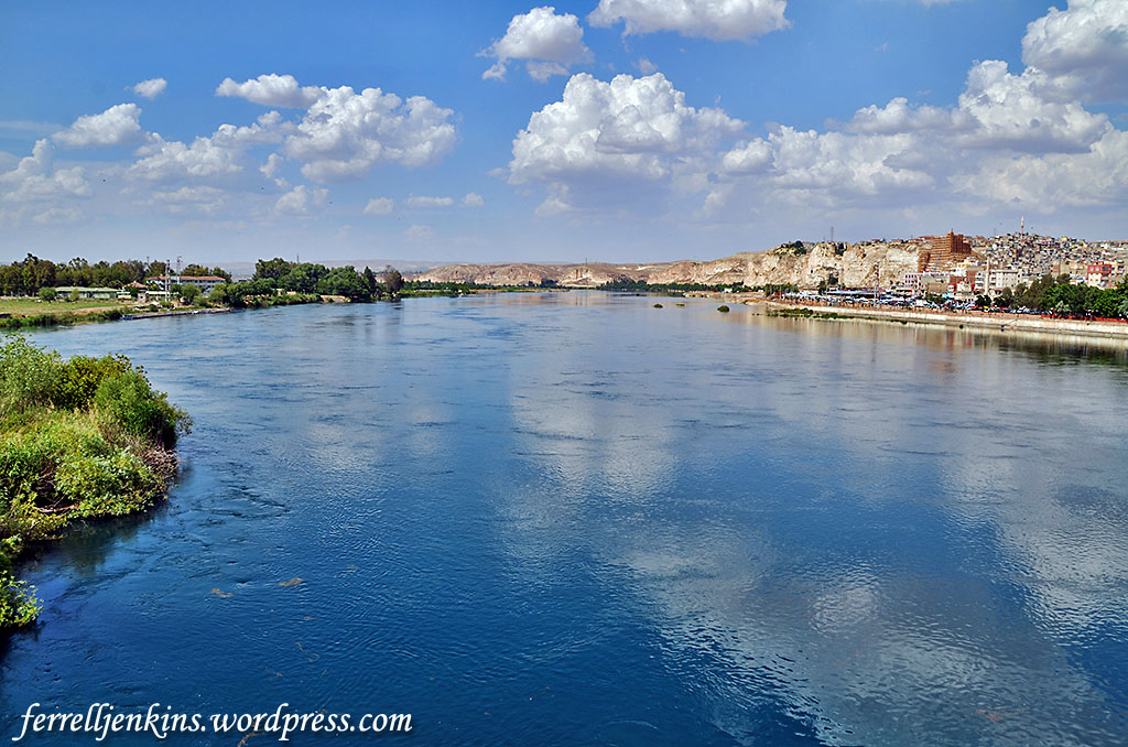
The Firat Nehri (Euphrates River) in Birecik, Turkey. Photo by Ferrell Jenkins.
The translator notes in the NET Bible provide a helpful comment:
There has been a great deal of debate about whether the place referred to here is a place (Parah [= Perath] mentioned in Josh 18:23, modern Khirbet Farah, near a spring ’ain Farah) about three and a half miles from Anathoth which was Jeremiah’s home town or the Euphrates River. Elsewhere the word “Perath” always refers to the Euphrates but it is either preceded by the word “river of” or there is contextual indication that the Euphrates is being referred to. Because a journey to the Euphrates and back would involve a journey of more than 700 miles (1,100 km) and take some months, scholars both ancient and modern have questioned whether “Perath” refers to the Euphrates here and if it does whether a real journey was involved. Most of the attempts to identify the place with the Euphrates involve misguided assumptions that this action was a symbolic message to Israel about exile or the corrupting influence of Assyria and Babylon. However, unlike the other symbolic acts in Jeremiah (and in Isaiah and Ezekiel) the symbolism is not part of a message to the people but to Jeremiah; the message is explained to him (vv. 9–11) not the people. In keeping with some of the wordplays that are somewhat common in Jeremiah it is likely that the reference here is to a place, Parah, which was near Jeremiah’s hometown, but whose name would naturally suggest to Jeremiah later in the LORD’s explanation in vv. 9–11 Assyria-Babylon as a place connected with Judah’s corruption (see the notes on vv. 9–10). For further discussion the reader should consult the commentaries, especially W. Holladay, Jeremiah (Hermeneia), 1:396 and W. McKane, Jeremiah (ICC), 1:285–92 who take opposite positions on this issue.
I have no fixed view on this subject, but the thought that Jeremiah went from Anathoth to Perath (= En Prat), a distance of 3 miles or so, is more sensible to me. Remember that Jeremiah had to make two trips to Perath, one to deposit his undergarment and another to retrieve it.
En Prat is located in the western edge of the wilderness of Judah at an elevation of 910 feet above sea level. You recall that Jerusalem is about 2400 feet above sea level. Here is a view as we approach En Prat. The elevation where I was standing is 1,060 feet above sea level.
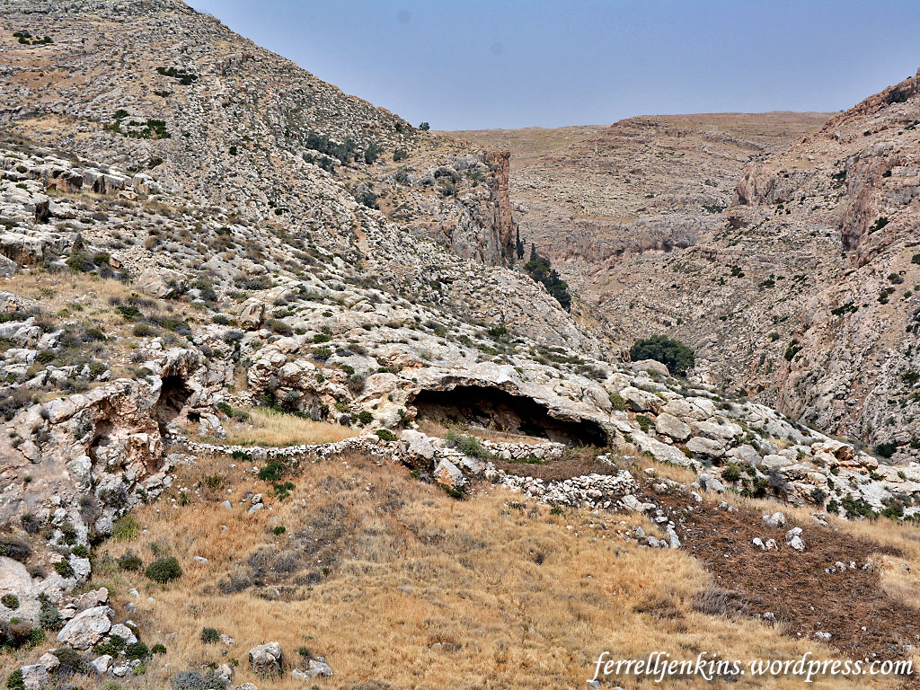
In the wilderness on the way to En Prat. In the photo you see caves, some of which were used as sheepfolds in the past. Photo by Ferrell Jenkins.
As Leon Mauldin and I reached En Prat this was the first photo of the area with a view to the west.
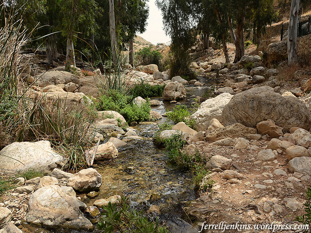
My first photograph of En Prat. Photo by Ferrell Jenkins.
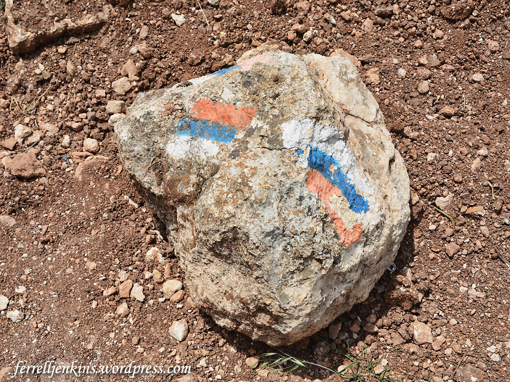
I thought about places Jeremiah might have hidden his under garment.
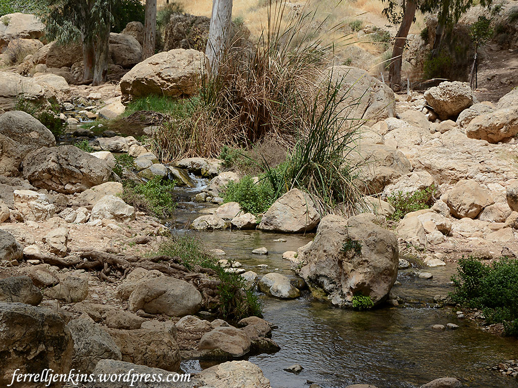
Many rocks around En Prat suitable for hiding a garment. Photo by Ferrell Jenkins.
Here is a final photo with a view east. This stream, Nahal Prat, is also known as Wadi Kelt (or Qelt, or Qilt) and flows past Jericho to the Jordan Valley.
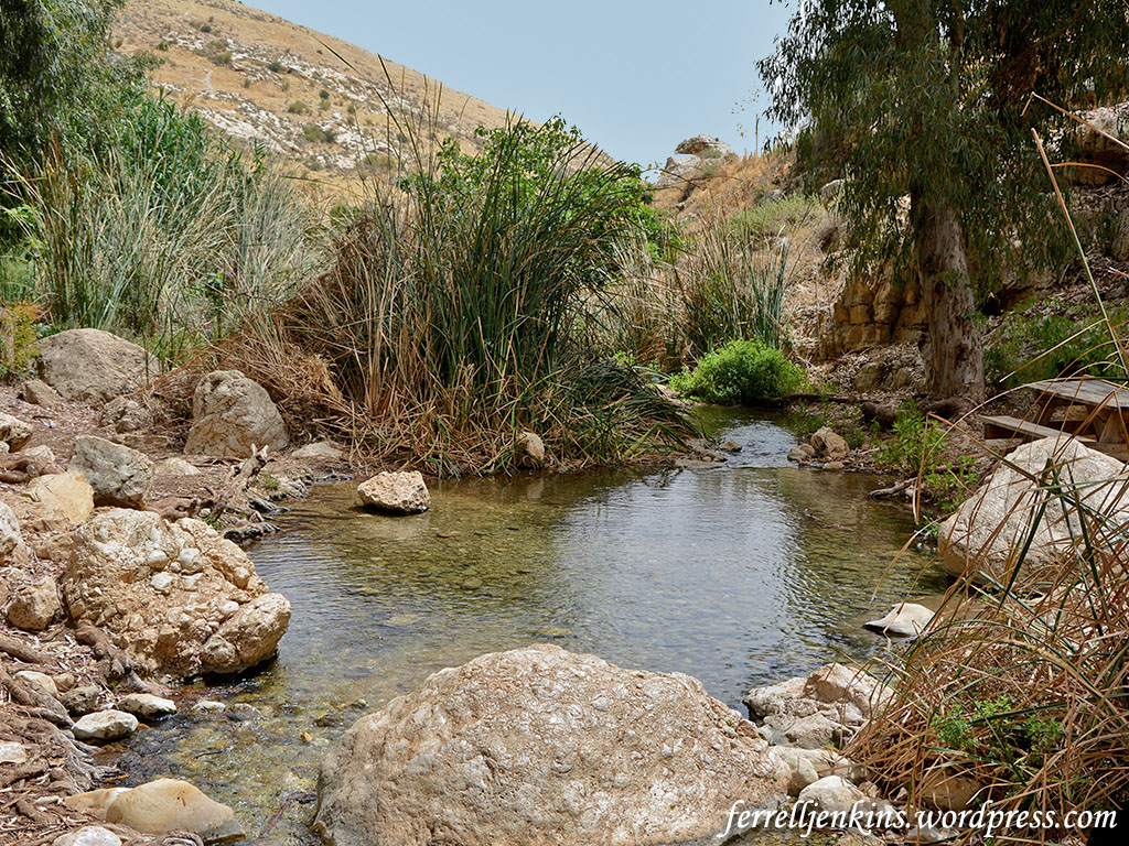
En Prat, view east toward the Jordan Valley. Photo by Ferrell Jenkins.
The small map below will show the relation between Jerusalem and Anathoth and En Prat (Perath, Parah).
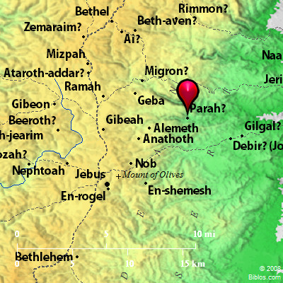
This map identifies Parah as possibly the site mentioned in Joshua 18:23. Map courtesty of BibleHub.com.
The Pictorial Library of Bible Lands, sold by BiblePlaces.com, includes a fabulous selection of photos of En Prat and Wadi Qilt in Vol. 4 – Judah and the Dead Sea.


You must be logged in to post a comment.