How the Spaffords came to make Jerusalem their home is an interesting story, but I will leave it for you to read in Bertha Spafford Vester, Our Jerusalem: An American Family in the Holy City 1881–1949. It may be difficult to locate a copy of the book for a reasonable price, but it is available in Kindle format for $8.39. Click here: Our Jerusalem.
The members of the American Colony lived under a series of governments — the Turks, British, Jordanians, and Israelis. Horatio died in 1888 during the Turkish rule. The American Colony had secured a place for burials on the south eastern slope of the traditional Mount Zion overlooking the Hinnom Valley.
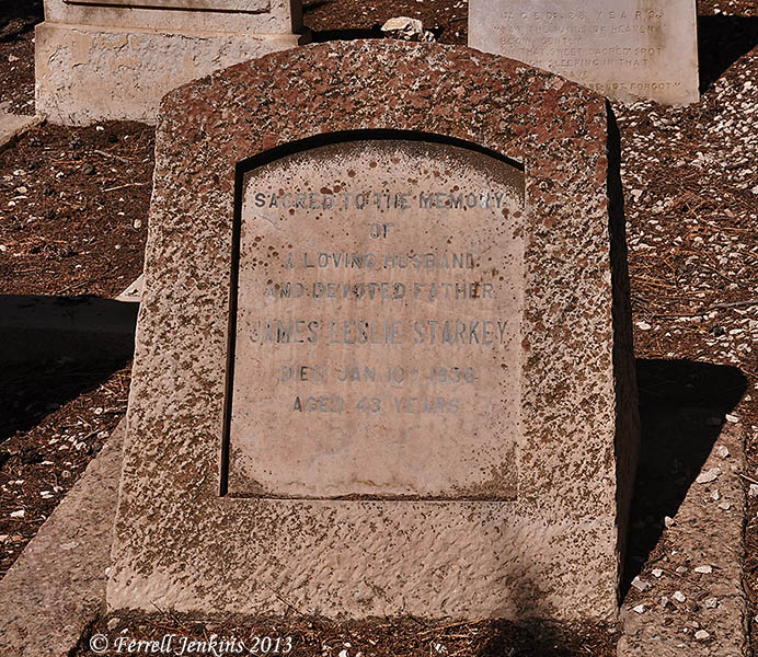
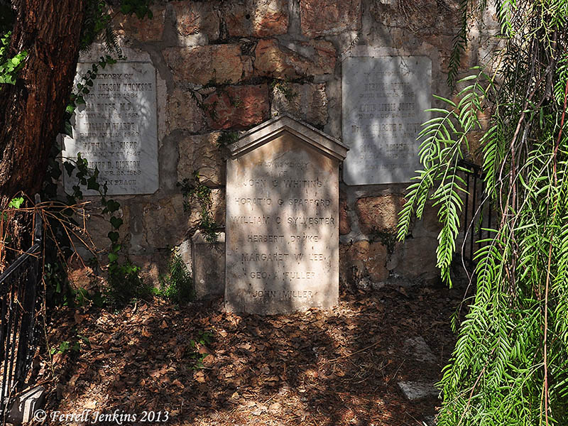
Before I can show you the grave marker of Horatio Spafford I should tell you about the desecration of his original grave. Toward the end of the 19th century, when the members of the American Colony needed a grave site, they learned that earlier burials had been removed and the remains placed “temporarily” in a large pit. After much effort, permission was granted by various ruling authorities for the bones to be gathered, and a small plot was granted for the burial of the American Colony members.
That small plot is pictured below. It is immediately inside the gate to the cemetery. The large marker identifies seven members of the American Colony whose remains were recovered: John C. Whiting; Horatio G. Spafford; William C. Sylvester; Herbert Drake; Margaret W. Lee; Geo. A. Fuller; John Miller. I have noticed at least four of these names in Vester’s Our Jerusalem. Whiting was also from Chicago. He and his family came to Jerusalem with the Spaffords, as did Margaret Lee.
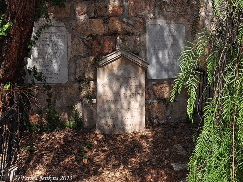
Grave stone for Spafford and other members of the American Colony in the Protestant Cemetery on Mount Zion. Photo by Ferrell Jenkins.
The two smaller markers in the wall identify others whose bones were recovered and buried in the common grave.
In 1896 a group of 37 Swedish farmers left Nås, Sweden, and made their way to Jerusalem. They took up residence at the American Colony. (Vester says there were 38, including 17 children, and a babe in arms. Perhaps the infant was born after leaving Sweden.) The Swedes mostly engaged in farming in the nearby Kidron Valley. I think you would enjoy reading the comment to the last post written by reader Erik Wold. You may see his photographs of Nås and read his Norwegian comments here (use Google Translate if you do not read Norwegian). The Swedish writer Selma Lagerlöf won a Nobel prize for her novel called Jerusalem, which was based on the American Colony. Bertha Vester says that her mother, Anna Spafford, “is the heroine in her book and is called Mrs. Gordon.”
Something else that has fascinated me is the fact that Eric Matson and the American Colony photographers worked from this location. About 40 years ago I edited a series of Bible Class literature called Truth in Life. We used some of Eric Matson’s wonderful Bible land photographs in the series. For more information about the work of Matson and the other photographers see Life in the Holy Land. I think Matson was the heir of one of the settlers from Sweden.
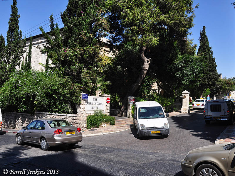
I do not know anything about the present ownership of the American Colony Hotel, but it is a prestigious 5-star luxury hotel.
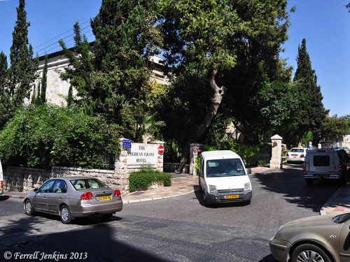
Entrance to the American Colony Hotel, Jerusalem. Photo by Ferrell Jenkins.
Would you like to see more photographs from the Protestant Cemetery?


You must be logged in to post a comment.