
Conrad Schick was born in Switzerland and first came to Jerusalem with a group of men who planned to teach the local young people vocational trades. This group soon disintegrated, and Schick eventually married Friederike Dubler, a German missionary.
Schick became well known as an architect and city planner. He also became involved with some of the late 19th century explorers. He surveyed significant parts of the Old City, and built models of the temple mount and other structures in Jerusalem to use in teaching.
Schick and his wife are buried in the Protestant Cemetery on Mount Zion.
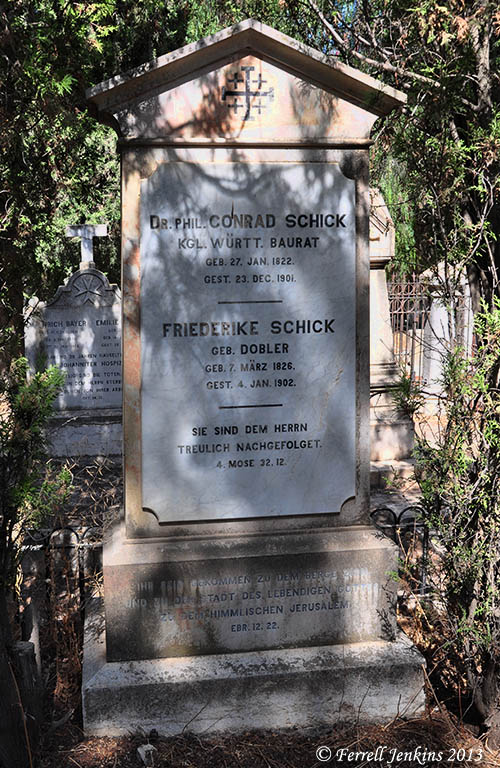
Grave marker for Conrad and Frederike Schick. Photo by Ferrell Jenkins.
Epitaphs are often fascinating. This grave stone includes two Scriptures in German.
… for they have wholly followed the LORD (Numbers 32:12)
But you have come to Mount Zion and to the city of the living God, the heavenly Jerusalem … (Hebrews 12:22)
The short lane leading from Nablus Road to the Garden Tomb is named for Conrad Shick [Schick].
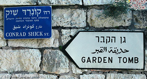
Conrad Shick Street leads to the Garden Tomb. Photo by Ferrell Jenkins.
Tom Powers has prepared an article about Conrad Schick, and I have made use of it in this post. The entire paper is fascinating. See here.
There is also a page devoted to Schick here.
Special Note: If you have any interest in the American Colony, and other people buried in this cemetery, please take a look at the comments by Tom Powers (Outremer) following the two earlier posts about the Spaffords.


You must be logged in to post a comment.