Category Archives: Israel

The fourth archaeological expedition to Tel Lachish

Announcement has been made through various sources of the anticipated fourth archaeological expedition to Tel Lachish. Archaeologists who have been working at Khirbet Qeiyafa (the Elah Fortress), Yosef Garfinkel, Michael Hasel, and Martin Klingbeil, announced a new excavation at Lachish in the Nov./Dec. 2013 issue of Biblical Archaeology Review. BAR has made available a collection of seven articles dealing with the third excavation (1974-1984) under the direction of Prof. David Ussishkin.

These links may be broken in the near future, but if you have access to the BAR on CD or Logos this may serve as a helpful bibliography.

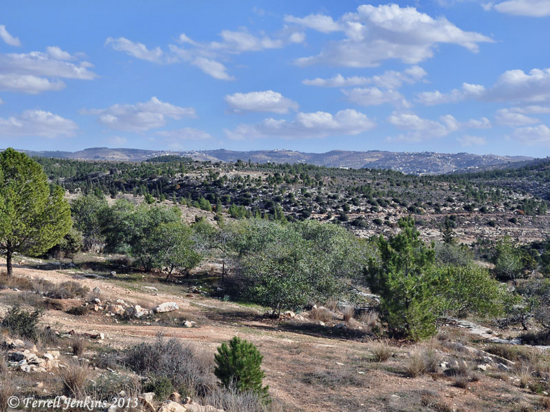
Lachish is thought to be the second most important city of Judah after Jerusalem. This is based on the fact that both the Assyrians and the Babylonians destroyed the city immediately before moving to Jerusalem. Rehoboam (931-913 B.C.) built Lachish and other cities in Judah for defense (2 Chronicles 11;5-9). Other kings fortified them to be used for the storage of food, oil and wine.

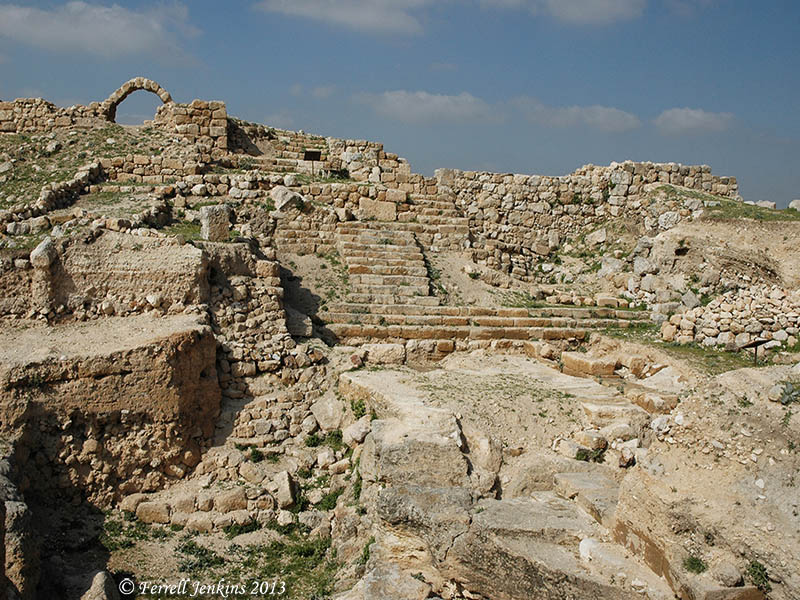
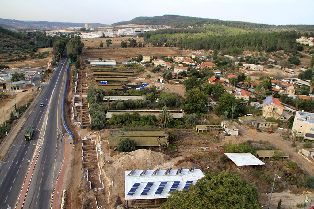
Our photo below shows Tel Lachish from the air. In the bottom left quarter (south west) of the photo you will see a small parking lot with a path leading through them to the gate of the city. To the right of the path, beginning at the grove of trees you will see the siege ramp built by Sennacherib, king of Assyrian, in 701 B.C. The photo also shows the defensive Judean counter-ramp found in the 1983, and described by Ussishkin in the 1984 article.

Tel Lachish from the air. Photo by Ferrell Jenkins.

Tel Lachish from the air. Photo by Ferrell Jenkins.

The previous excavations at Tel Lachish (earlier called Tell ed-Duweir) are,

  • A British expedition directed by James L. Starkey and Olga Tufnell – 1932-1938
  • Israeli expedition directed by Yohanan Aharoni, Tel Aviv University, 1966, 1968

Use the Search box to locate other entries on Lachish.

HT: Steven Braman

Snow in Israel

Today I have been reading of snow in Lebanon and Israel. There are reports that a foot of snow has fallen in Jerusalem in the past day. Todd Bolen links to the Jerusalem Post (with photos) and other snow links here.

My friend Elie just sent a photo of his back yard. This is in Bar Giyora, a town on Hwy. 375 between Bethlehem and the Valley of Elah. The town is located in the hill country of Judea.

Snow in the mountains of Judea. Photo by EMB, 12/14/13.

Snow in the mountains of Judea. Photo by EMB, 12/14/13.

“For as the rain and the snow come down from heaven and do not return there but water the earth, making it bring forth and sprout, giving seed to the sower and bread to the eater, so shall my word be that goes out from my mouth; it shall not return to me empty, but it shall accomplish that which I purpose, and shall succeed in the thing for which I sent it.” (Isaiah 55:10-11 ESV)

Here is a photo of the general area along Hwy. 375 with a view east toward the central mountain ridge (without snow).

Judean Hills. View east to central mountain range from Hwy. 375. Photo by Ferrell Jenkins.

Judean Hills. View east to central mountain range from Hwy. 375. Photo by Ferrell Jenkins.

On the Facebook page of Jerusalem University College you will find several nice photos of the snow in Jerusalem. Check here.

Zondervan Essential Atlas of the Bible

Frequently we have mentioned and recommended the Zondervan Atlas of the Bible by Carl G. Rasmussen. Every Bible student needs at least one or two good atlases to assist them in their study of the Scriptures.

Last month I attended some annual professional meetings in Baltimore and was pleased to see that Zondervan already had copies of the new Zondervan Essential Atlas of the Bible. One of the sales reps gave me a copy for review here.

At first appearance, the ZEAB has a beautiful cover of stiff, durable paper. It is a convenient 9 1/8″ x 7 3/8″ in size. The content is basically the same as the larger hard back edition. There has been some editing of the text to condense the book from 303 pages to 159 pages.

There are two major sections to the book: Geographical Section and Historical Section. The Geographical Section includes an Introduction to the Middle East as a Whole, and discusses the geography of Israel and Jordan, Egypt, Syria and Lebanon, and Mesopotamia.

The Historical Section covers the entire Bible from the Pre-Patriarchal Period to the Seven Churches of Revelation, with an additional chapter on Jerusalem, in 17 chapters.

The maps are superbly drawn and easy to read. A timeline accompanies each chapter. Rasmussen is noted for his Holy Land Photos web site. The photos are beautiful and helpful in illustrating the content.

This book has been prepared by a teacher, and I consider that a plus. In addition to his work at Bethel University, Carl continues to serve as an adjunct professor at Jerusalem University College. He has spent 16 years of his adult life in the Bible lands. His  Holy Land Photos’ Blog provides helpful, up-to-date, information about both familiar and unfamiliar places mentioned in the Bible. He has also led numerous tours through Bible lands.

This Atlas sells for $16.99. I see that Amazon has the Zondervan Essential Atlas of the Bible for $12.97. A Kindle version is about $3 less.

Either version is ideal for a person to take with them to Bible class, or on a tour of Bible lands.

The larger Zondervan Atlas of the Bible still remains indispensable for the serious student. I am trying to say you should have both books.

Carl has assisted me on several occasions in locating some of those hidden, out-of-the-way, places that most visitors to the Bible lands never see. I am pleased to commend this new edition of his book.

If not Tell Ḥesbân, where is Heshbon?

If Tell Ḥesbân is not biblical Heshbon, then the pool uncovered by S. H. Horn is likely not the pool mentioned in Song of Solomon 7:4.

If Tell Ḥesbân is not biblical Heshbon, then where is biblical Heshbon?

A sign at Tell Ḥesbân, erected by the excavators, lists evidence of occupation during the following periods:

  • Ajarmah [local tribe] village – ca. AD 1870-present
  • Ottoman Village
  • Mamuluk Regional capital – AD 1260-1500
  • Abbasid pilgrim rest. – AD 750-1260
  • Umayyad market town – AD 650-750
  • Byzantine Ecclesiastical center – ca. AD 350-650
  • Roman temple town – ca. 63 BC – AD 350
  • Hellenistic fortress – ca. 198 BC – 63 BC
  • Ammonite citadel – ca. 900 – 500 BC
  • Proto Ammonite village – ca. 1200 – 900 BC
  • Traditional Ammorite Stronghold.
Roman steps and market area at Tell Ḥesbân. Photo by Ferrell Jenkins.

Roman steps and market area at Tell Ḥesbân. Photo by Ferrell Jenkins.

Remember that we are looking for a town of Moab, and there is no evidence of the Moabites at Tell Ḥesbân.

Because not every reader of this blog speaks Bronze Age and Iron Age, I think I should list the general dates of these archaeological periods (following J. A. Thompson, The Biblical World (ed. Charles Pfeiffer).

  • Early Bronze (EB) — ca. 3200 – 2100 BC
  • Middle Bronze (MB) — ca. 2100 – 1550 BC – period of the Patriarchs
  • Late Bronze (LB) — ca. 1550 – 1200 BC – period of Moses, the Exodus, and the Conquest
  • Iron I — ca. 1200 – 900 BC – period of the Judges & the United Kingdom
  • Iron II — ca. 900 – 600 BC – period of the Divided Kingdom
  • Iron III — ca. 600 – 300 BC – period of Exile and Return
  • Hellenistic (Grecian) — ca. 300 – 63 BC – Between the Testaments
  • Roman — ca. 63 BC – AD 323 – New Testament & early Christian period

We are looking for a city belonging to the period of Moses, the Exodus, and the Conquest (the Late Bronze archaeological period). [*see note below]

After the disappointment at Tell Ḥesbân, those associated with Horn formed the Madaba Plains Project in order to continue the search for Heshbon. One of the great things about Todd Bolen’s Pictorial Library of Bible Lands is the fact that many of the photos include brief documentation with the photos. With one of the Tell Ḥesbân photos he says,

After this disappointing series of digs, the Madaba Plains Project was formed and the search for Heshbon continued.  Four Late Bronze sites were found within a 6 mile (10 km) radius of Tel Hesban; Tel Jalul is the biggest and thus the most promising site. Tel Jalul is the largest site in Jordan south of Amman.
Three possibilities exist for the location of biblical Heshbon: Tel Hesban, Tel el-Umeiri, and Tel Jalul. Hesban preserves the name, which makes it a good candidate, but it lacks archaeological evidence.
The PLBL collection includes photos of all of these places. The Institute of Archaeology Siegfried H. Horn Museum at Andrews University maintains a helpful web site that includes information about the Madaba Plains Project here.
Byzantine church at Tel Hesban. Photo by Ferrell Jenkins.

Byzantine church at Tel Hesban. Photo by Ferrell Jenkins.

The photo above shows the ruins of the Byzantine church at Tell Ḥesbân. Tel Jalul may be seen in the distance. Look for the long, plain “hill”, on the top of the hill on the far left of the photo.
Added Note: In the original post I stated that “We are looking for a city belonging to the period of the Patriarchs (the Late Bronze archaeological period).” A friend called my attention to the oversight. The chart above shows that the period of the Patriarchs is the Middle Bronze Age. I should have said, as now corrected above, that “We are looking for a city belonging to the period of Moses, the Exodus, and the Conquest (the Late Bronze archaeological period).”

Just doing a little road work

When I was a kid in North Alabama I found Indian arrowheads in the cotton fields when we hoed and picked cotton. (Yes, I really did!) The only Indian I ever heard of (on the radio) was Tonto.

In Israel, ancient ruins are discovered as foundations are dug for new buildings or roads are being widened. It happened recently along Highway 38 at Eshtaol, the area where Samson grew up (physically) (Judges 13:24-25). Eshtaol is located about 10 miles west of Jerusalem as one approaches the Sorek Valley and Beth Shemesh. I have stopped several times for gas and water at the station on the left side of the highway.

An aerial view of the large excavation along Highway 38. Photo: Sky View Company, courtesy of the IAA.

An aerial view of the large excavation along Highway 38. Photograph: Sky View Company, courtesy of the Israel Antiquities Authority.

Archaeologists working on behalf of the Israel Antiquities Authority exposed a site belonging to the Pre-Pottery Neolithic period. Buildings belonging to the end of the Chalcolithic period exposed a large standing stone (massebah) 51 inches high. The archaeologists said,

“The standing stone was smoothed and worked on all six of its sides, and was erected with one of its sides facing east. This unique find alludes to the presence of a cultic temple at the site”.  …  “In the past numerous manifestations have been found of the cultic practice that existed in the Chalcolithic period; however, from the research we know of only a few temples at ‘En Gedi and at Teleilat Ghassul in Transjordan”.

A Chalcolithic period building and the standing stone (massebah) positioned at the end of it. Photo: Assaf Peretz, courtesy IAA.

A Chalcolithic period building and the standing stone (massebah) positioned at the end of it. Photo: Assaf Peretz, courtesy IAA.

The IAA news release is available here. The photos we have used here, and four others, are available here. Several Israeli papers have articles about the find, including the one in Arutz Sheva here.

Todd Bolen discussed the identification of Eshtaol here.

Caesarea Maritima – the Lower Palace

A few columns of the Palace of the Procurators have been restored at Caesarea. The late Jerome Murphy-O’Connor describes the lower level of the Palace.

From the west colonnade one can look down to the sea shore at a point where its dominant feature is a rectangular rock-cut pool (35 x 18). There are channels to the sea on both sides. A square statue base can be discerned in the middle. The colonnaded pool was originally the centerpiece of a two-storey building (83 x 51 m) which surrounded it on all sides. Presumably it was here that the Roman procurators lived. Wave action and the activities of stone robbers have ensured that virtually nothing remains. A staircase in the north-east corner gave access to the upper level. (The Holy Land, Fifth Edition, p. 243)

Our photo below shows this area. In the foreground you will see portions of some mosaics.

The lower level of the Place of the Procurators. Photo by Ferrell Jenkins.

The lower level of the Place of the Procurators. Photo by Ferrell Jenkins.

This was not a bad place for the Roman procurators to live a luxurious life while the Apostle Paul was held in custody nearby (Acts 23:23 – 26:32).

Procurators associated with Caesarea in the New Testament include…

  • Pilate (A.D. 26-26) – John 18, et al.
  • Felix (A.D. 52-59) – Acts 23-25
  • Festus (A.D. 59-61) – Acts 24-26

The Jewish rulers associated with Caesarea include…

  • Herod the king [Agrippa I] (A.D. 37-44) – Acts 12
  • Herod Agrippa II (lived A.D. 27-100) – Acts 25-26

The Pool of Siloam like you have never seen it

Elie, my friend and guide in Israel, sent me a photo just a few minutes ago that he made Sunday at the pool of Siloam.

Water in the pool of Siloam due to a clogged drain. Photo: Elie Ben-Meir

Water in the pool of Siloam due to a clogged channel. Photo: Eliemelech Ben-Meir

Here is the explanation Elie gave:

Thought you might enjoy this shot of the pool. We couldn’t get in because of a clog in the channel that caused the pool to fill up and flood! We had to walk around and come in from the top past Ibrahim Siams antiquities shop and walk down the wooden stairs!

The Hippodrome at Caesarea Maritima

Herod the Great built a hippodrome along the Mediterranean coast at Caesarea Maritima in 10 B.C. to celebrate the opening of the city. In the second century A.D. the south end of the hippodrome was reconstructed as an amphitheater to be used for gladiatorial contests.

The seaside Hippodrome at Caesarea Maritima. Photo by Ferrell Jenkins.

The seaside Hippodrome at Caesarea Maritima. Photo by Ferrell Jenkins.

The apostle Paul was in prison at Caesarea for two years between A.D. 58 and 60 (Acts 23:23 – 26:32).

We discussed Paul’s possible use of the charioteer in Philippians 3:12-14 here.

Jerome Murphy-O’Connor – 1935-2013

The École Biblique et Archéologique in Jerusalem announced Monday the death of Jerome Murphy-O’Connor (1935-2013).

Fr. Jerome Murphy-O’Connor, O.P., passed away peacefully on Monday, November 11, 2013. He was 78 years old.

Fr. Murphy-O’Connor taught for more than four decades at the École Biblique et Archéologique. He was a world-renowned biblical scholar and author of numerous books on St. Paul and the Holy Land. Many throughout the world counted him their friend.

The writings of Murphy-O’Connor have been helpful to me. I have especially enjoyed The Holy Land An Oxford Archaeological Guide which is now in its 5th edition. In my recommendations of books for those traveling to Israel I have annotated this book with the words “Excellent. The Best.” I am pleased to say that I have seen several tour members using their copy of the book. I see the book is now available for the Kindle.

Holy Land

St. Paul’s Corinth: Texts and Archaeology (Good News Studies, Vol. 6) has been helpful in studying about Corinth. His article about traveling conditions in the first century in the second issue of (the now defunct) Bible Review has been extremely helpful in studying Paul’s journeys. (Murphy-O’Connor. “On the Road and on the Sea with St. Paul.” Bible Review 1:2 (1985).

HT: Jack Sasson; Bible Places Blog.

Caesarea Maritima – Palace and Hippodrome

Caesarea Maritima was a first century Roman capital and seaport. The gospel was first preached to the Gentiles here when Peter came from Joppa to Caesarea to tell Cornelius words by which he could be saved (Acts 10, 11).

Herod the Great built a city on the site of Strato’s Tower and named it Caesarea in honor of Caesar Augustus. It became a center of Roman provincial government in Judea. The city had a harbor and was located on the main caravan route between Tyre and Egypt. This city is called Caesarea Maritima (on the sea) to distinguish it from Caesarea Philippi.

The setting of the city on the Mediterranean is beautiful. The photo below shows the south end of the excavated hippodrome and the palace of the procurators.

Palace of the Procurators and the south end of the Hippodrome. Photo by Ferrell Jenkins.

Palace of the Procurators and the south end of the Hippodrome. Photo by Ferrell Jenkins.

An inscription with the name of Pontius Pilate, the Roman procurator, was found during the reconstruction of the theater June 15, 1961.

The Apostle Paul used the harbor at Caesarea several times. He was imprisoned here for two years before departing for Rome (Acts 24:27; 27:1), perhaps in the palace of the procurators.