
When the prophets of ancient Israel pointed out the coming judgment of God upon the Israelites they typically pointed out that their enemies had already, or were going to, face the same judgment. This applied not only to the major powers such as Assyrian, Babylon, or Egypt, but also smaller powers that lived closer. It included Syria (Damascus), the Philistines, Moab, Edom, and the Ammonites. When Judah is being addressed there will be also a reference to Israel (Ephraim, Samaria).
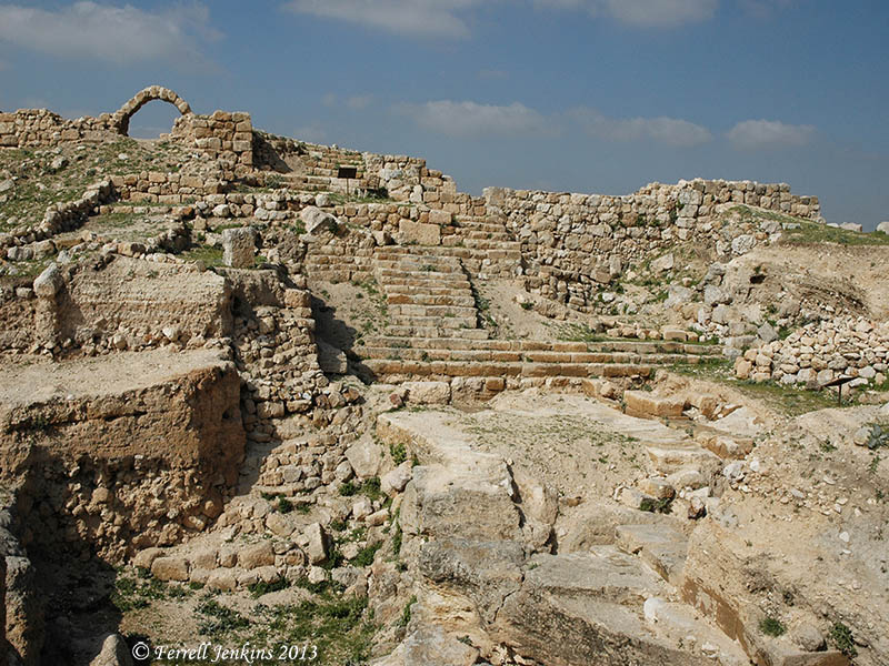
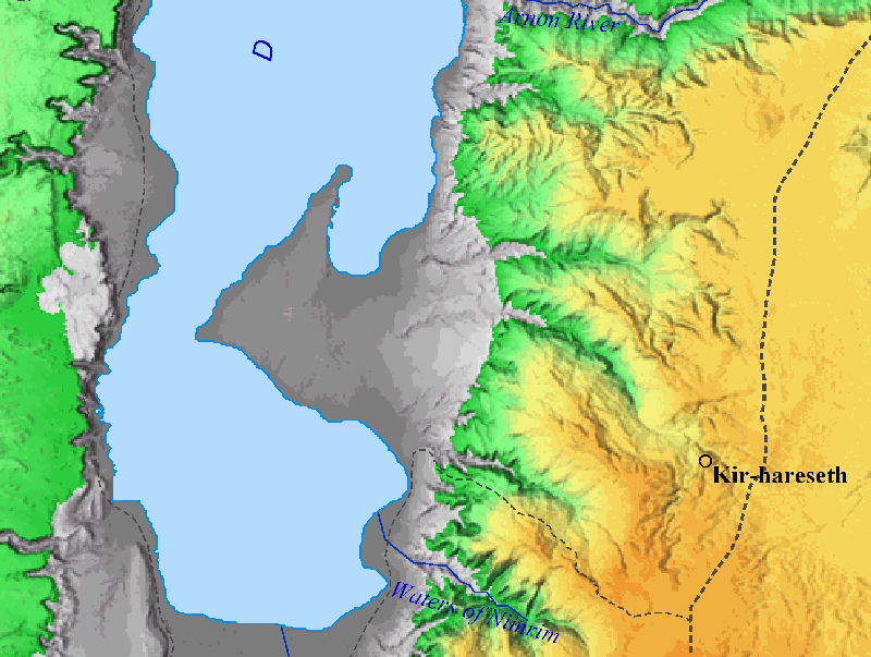
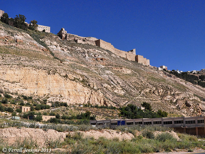
Chapter 15 begins “an oracle concerning Moab.” We have, in previous posts, mentioned many of the Moabite towns. I think you can use the search box and locate photos of Dibon, Nebo, Medeba (Madaba), Elealeh, and Kir-hareseth. Isaiah mentions the daughters of Moab fleeing across the Arnon.
Like fleeing birds, like a scattered nest, so are the daughters of Moab at the fords of the Arnon. (Isaiah 16:2 ESV)
We commonly think of the Arnon River (or gorge) serving as the dividing line between Moab (to the south) and Ammon (to the north). However, you will notice that most of the towns mentioned above are north of the Arnon. The boundary changed throughout Biblical history. At the time of Isaiah the boundary certainly includes cities north of the Arnon.

The Arnon River is shown on this map. BibleAtlas.org.
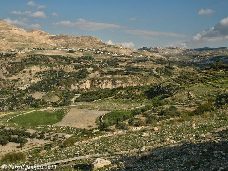
The Arnon is now known as the Wadi el-Mujib in Jordan. It was not an easy one to cross in ancient times. The river served as a major barrier for north-south travel. A modern road runs through it today. The river flows from East to West where it empities into the Dead Sea. The locals now refer to this as the “Grand Canyon of Jordan.”
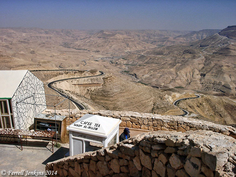
The Arnon gorge in Transjordan. View south. Photo by Ferrell Jenkins.
From this point the river flows west about 13 miles till it reaches the Dead Sea. A modern road now runs along the Dead Sea, and a small dam has been constructed to help control the water when it fills the gorge.
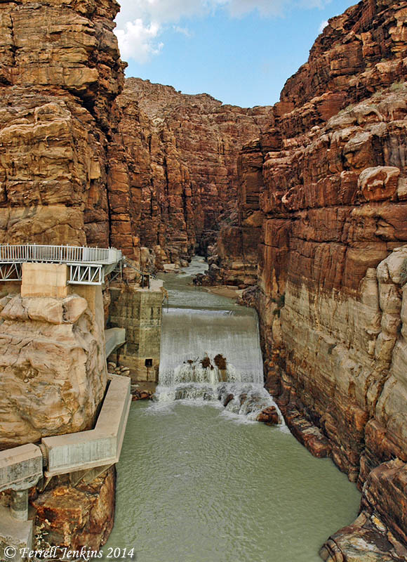
The Arnon River immediately before flowing into the Dead Sea. View east. Photo by Ferrell Jenkins.


You must be logged in to post a comment.