
Izmir is looking for local input on a restoration plan of the historic areas of Kadifekale and the agora.
On my last visit to Izmir I could see new work underway, especially in the area of the agora. The city now is developing a plan to restore an area of the city to make it more desirable for local citizens as well as tourists.
An article in Hurriyet Daily News (here) reports,
Municipal authorities in İzmir are calling for public participation amid an ambitious new project to redevelop some of the Aegean province’s most famous tourists sites in a bid to draw more visitors.
“We want to share ideas with scientists and the residents of İzmir. If we cannot get the support of citizens, it will not be possible to realize this project,” İzmir Metropolitan Mayor Aziz Kocaoğlu said.
Our first photo shows a portion of the Roman agora. The arches which appear to be at ground level are actually the lower level of a two-story building.
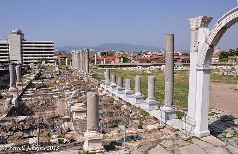
The Roman agora of Izmir, biblical Smyrna. Photo by Ferrell Jenkins.
The second photo was made from the agora, with a view of Kadifekale. The word Kadifekale means velvet castle. In ancient times this hill was called Mount Pagos. The article mentions plans to include a restored area on the mountain, including the theater which was built on the hillside. Mark Wilson says the ancient theater, now build over by houses, seated 16,000 persons (Biblical Turkey, 312).
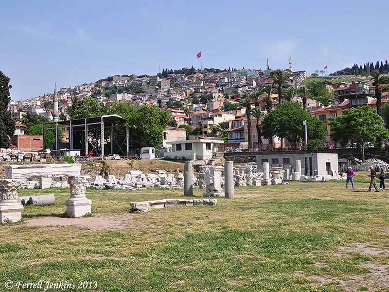
A view of Kadifekale (Mount Pagos) from the agora. Photo by Ferrell Jenkins.
Smyrna is mentioned in the Bible as the location of one of the Seven Churches addressed in the book of Revelation (the Apocalypse).
“And to the angel of the church in Smyrna write: ‘The words of the first and the last, who died and came to life. (Revelation 2:8 ESV; see also 1:11)


You must be logged in to post a comment.