Category Archives: Bible Lands

“It is the Land of Honey” – Tel Rehov discoveries on display at Eretz Israel Museum

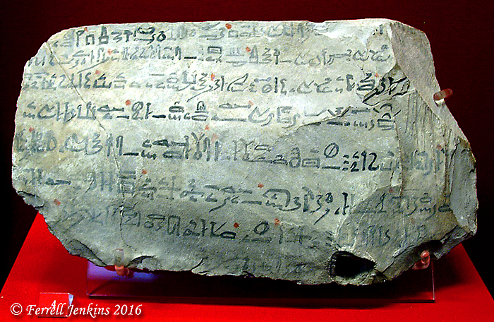
Tel Rehov is located about three miles south of Beth-Shean (Beth-Shan) on the east side of Highway 90. Rehov is not mentioned in the Old Testament, but it is known from Pharaoh Shishak’s city list on the wall of the temple of Amun in the Karnak Temple at Luxor, Egypt. This campaign is also mentioned in the pages of the Bible (1 Kings 14:25-28; 2 Chronicles 12:2-9).

Tel Rehov was occupied during the Bronze Age and the Iron Age. The city may be one of those not captured by Israel when they entered the Land under the leadership of Joshua.

The men of Manasseh did not conquer Beth Shan, Taanach, or their surrounding towns. Nor did they conquer the people living in Dor, Ibleam, Megiddo or their surrounding towns. The Canaanites managed to remain in those areas. Whenever Israel was strong militarily, they forced the Canaanites to do hard labor, but they never totally conquered them. (Judges 1:27-28 NET; cf. Joshua 17:12)

The city was destroyed by the Assyrians in the eighth century B.C. as they made their steady trek south.

Archaeological excavations were conducted at Tel Rehov from 1997 to 2012 under the direction of Prof. Amihai Mazar and Dr. Nava Panitz-Cohen of the Hebrew University of Jerusalem. For information and photos see the excavation website here.

View east of Tel Rehov in the Beth Shean Valley. Photo by Ferrell Jenkins.

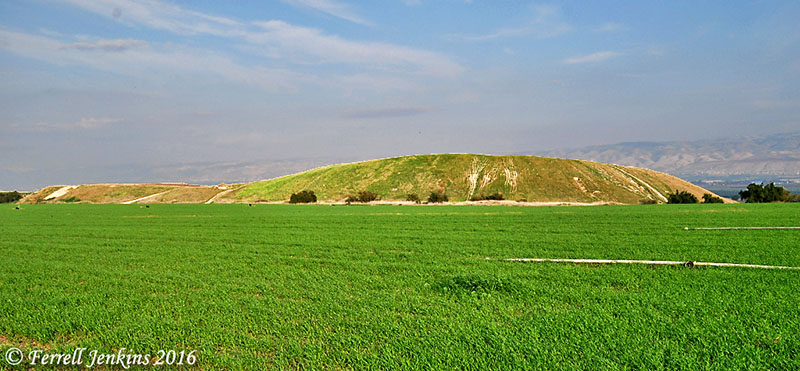
Tel Rehov in the Beth-Shean Valley to the east of Highway 90. The mountains of Gilead are visible in the distance. Photo by Ferrell Jenkins.

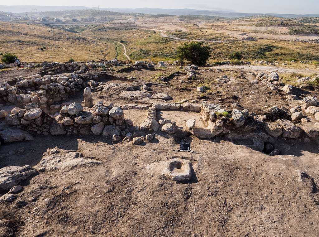
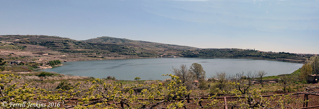
The next view takes us to the top of the mound. From there we see the Jordan Valley and a nice view of the Gilead mountains in modern Jordan.

View east from atop Tel Rehov. We see the Jordan Valley and the Gilead mountains. Photo by Ferrell Jenkins.

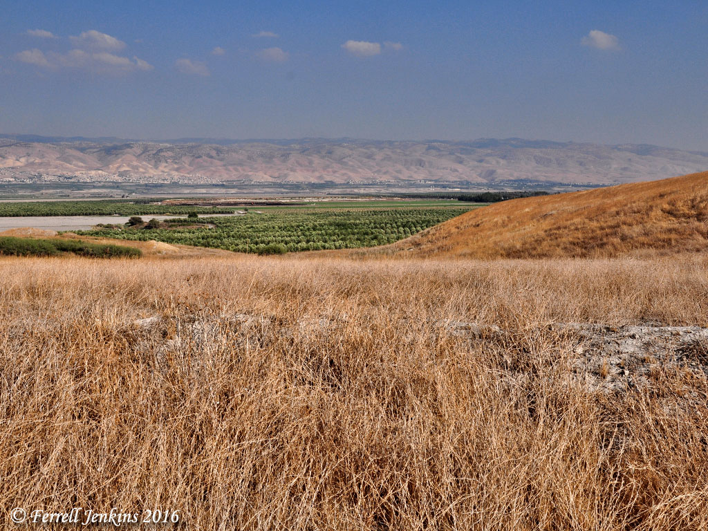
View east from atop the north end of Tel Rehov. We see the Jordan Valley and the Gilead mountains in the distance. Photo by Ferrell Jenkins.

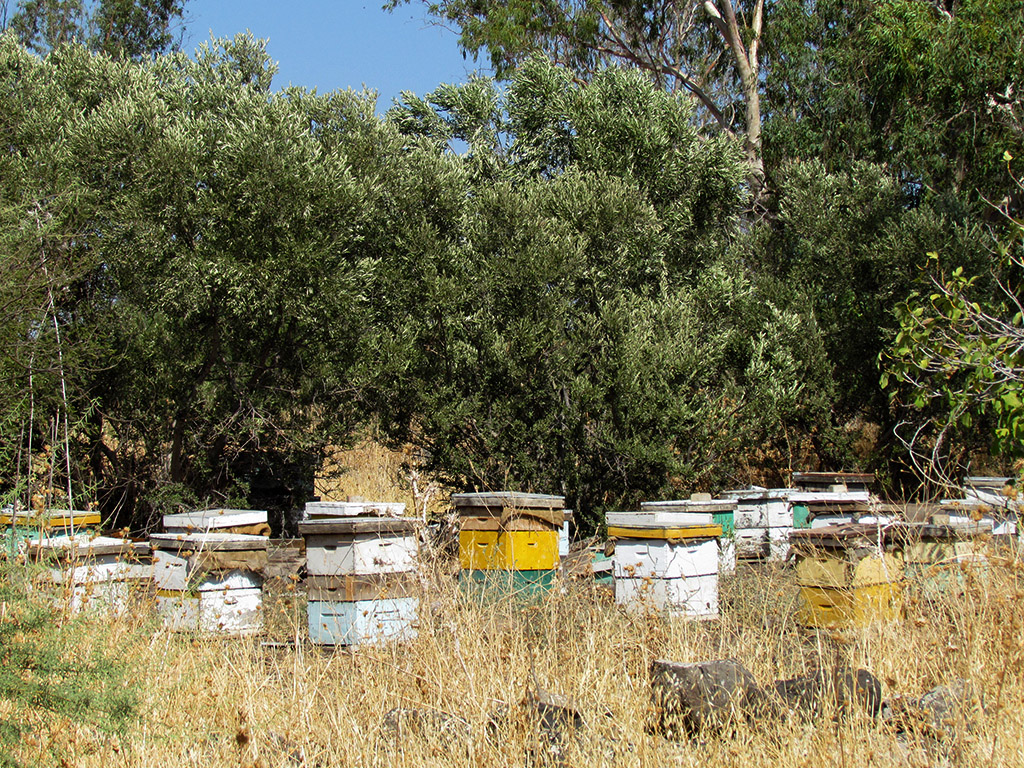
Many artifacts, including numerous household and cult objects, were uncovered at Tel Rehov. Perhaps the most unusual find was an industrial apiary. The small photo below from the excavation web site shows some of the beehives made of clay.

 Apiary at Tel Rehov, the eastern row of hives © Copyright - The Beth-Valley Archaeological Project, Hebrew University of Jerusalem,

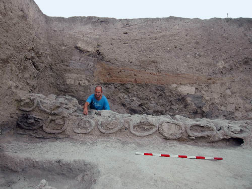
Apiary at Tel Rehov, the eastern row of hives. © Copyright – The Beth-Shean Valley Archaeological Project, Hebrew University of Jerusalem,

From January 12 to October 31, 2016, items from Tel Rehov are exhibited at the Eretz Israel Museum in Tel Aviv under the title It Is the Land of Honey. I had the opportunity to visit this exhibition in April. The Museum website provides detailed information about the exhibition and a few small photos here.

The houses at Tel Rehov during Iron Age IIA differed from the typical houses found in known Israelite cities. According to the Museum website,

A salient feature of the Iron Age IIA city was the exclusive use of mudbrick to construct all buildings, incorporating wooden beams in walls and floors. Each building was unique in its architectural plan, and did not resemble any of the common blueprints of the Iron Age II, such as four-room houses or pillared buildings.

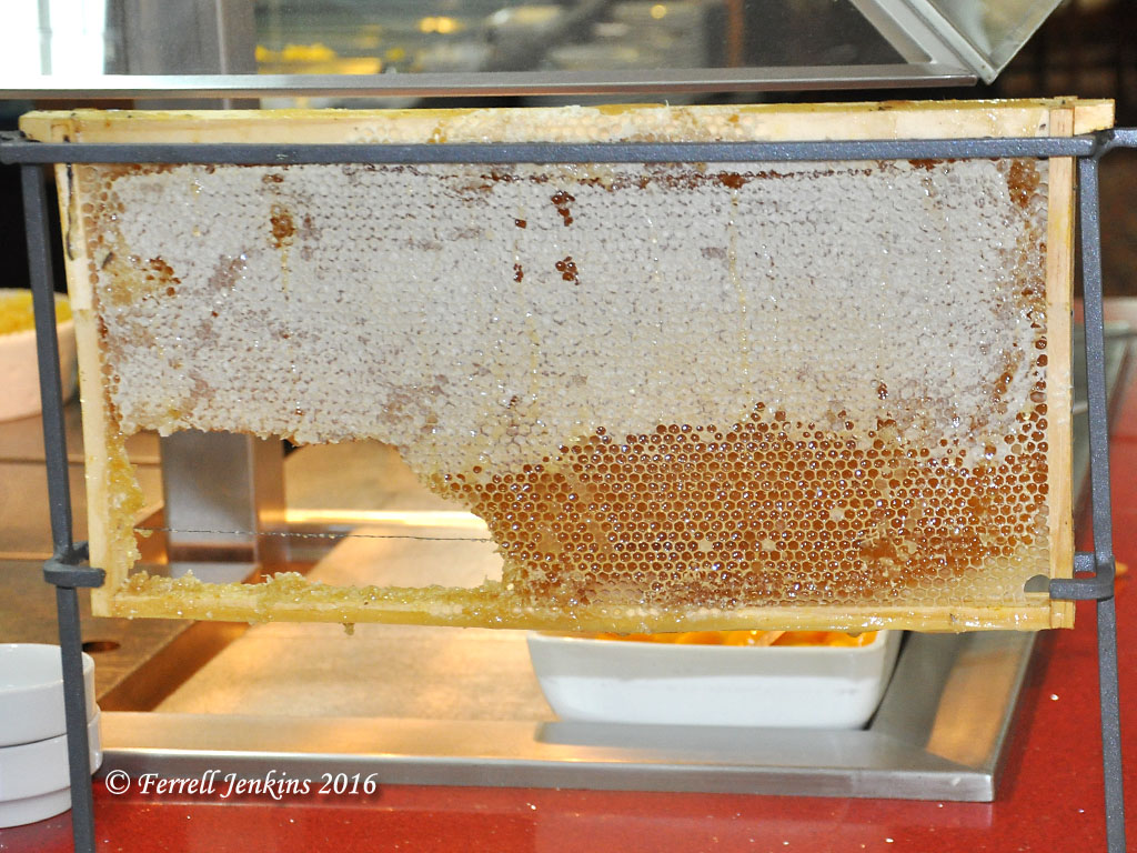
The photo below shows one of the clay beehives. A reconstruction of a honeycomb is visible on the right. Some of the bees found in the hives were determined to be from Anatolia, modern central Turkey. This adds one more piece of evidence showing how interconnected the nations of the ancient Middle East were. Some of the bees found in charred honeycombs are in the petri dishes in the front right of the photo. The lid of the beehive, with a hole in the center, is to the left of the hive. Click on the photo for a larger image.

One of the beehives from the Tel Rehov apiary. Eretz Israel exhibit. Photo by Ferrell Jenkins.

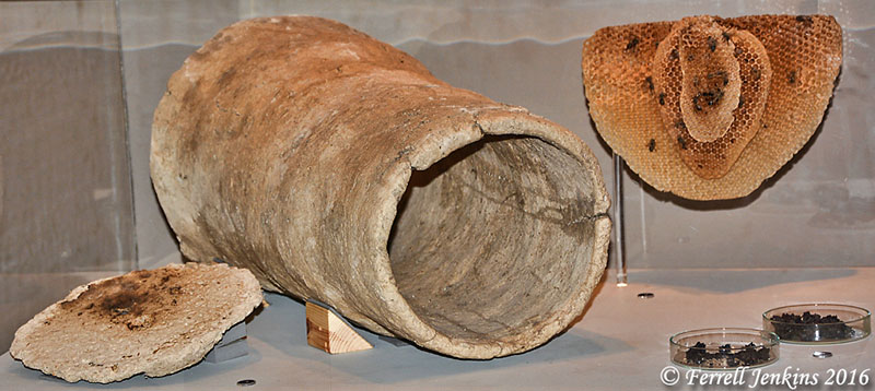
One of the beehives from the Tel Rehov apiary. Eretz Israel exhibition. Photo by Ferrell Jenkins.

The exhibition includes a large display of items from Tel Rehov. I will list just a few.

  • Several four horned altars made of clay.
  • A wide variety of household pottery, including an oven of the period.
  • One of the mud bricks of which the houses were constructed.
  • A reconstructed loom with weights found during the dig. Several others items from the “House of Elisha” are on display. The ostracon with the name of Elisha written on it in red ink is not displayed, but there is information about it in the exhibition book. There were several altars in this house.
  • A storage jar had the name Nimshi inscribed on it – the name identical to that of King Jehu’s grandfather (1 Kings 19:16; 2 Kings 9:2).
  • Some iron blades, arrow heads, and possibly a sickle.
  • Some typical Canaanite clay fertility goddesses.
  • Stamped jar handles unique to Tel Rehov.
Horned altar and chalices from Tel Rehov. Photo by Ferrell Jenkins.

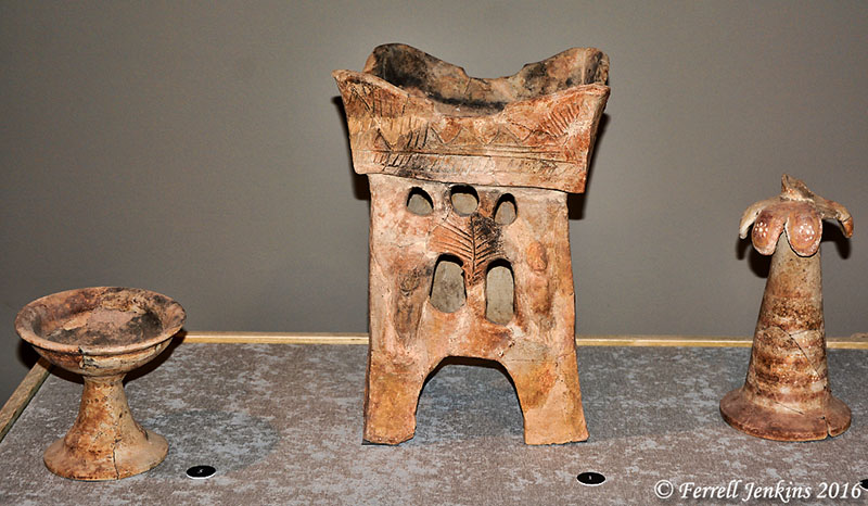
Tower shaped horned altar and chalices from Tel Rehov found in the area of the apiary. This altar is listed as being on loan from the Israel Museum in the exhibition book. If you miss the exhibition in Tel Aviv, perhaps you can see it later in the Israel Museum. Photo by Ferrell Jenkins.

The Museum has produced a nice 256-page book in Hebrew and English about Tel Rehov and the exhibition. I don’t see it listed at Amazon, but if you visit the exhibition you will probably wish to purchase a copy at the Museum shop.

Mazar and Panitz-Cohen published a brief article, with several photos of Tel Rehov artifacts, under the title “To What God? Altars and a House Shrine from Tel Rehov Puzzle Archaeologists” in the July/August 2008 Biblical Archaeology Review.

“A land flowing with milk and honey”

The promise made to the descendants of Abraham that they would receive “A land flowing with milk and honey” was made to them while they were in bondage in Egypt (Exodus 3:8; 13:5) and during the forty years of wilderness wandering (Leviticus 20:24; Deuteronomy 11:9).

Joshua and the prophets Jeremiah and Ezekiel affirmed that the LORD gave Israel a land flowing with milk and honey (Joshua 5:6; Jeremiah 32:22; Ezekiel 20:15).

You kept the promise that you swore on oath to their ancestors. You gave them a land flowing with milk and honey. (Jeremiah 32:22 NET)

The term honey (debash) is used in the Old Testament Scriptures 53 times. According to the Theological Wordbook of the Old Testament 17 of these are in the “land flowing with milk and honey.” The BDB lexicon says the term is used of “honey both of fruits and of bees.”

“Honey was among the products Jacob sent to Egypt for grain (Gen 43:11). It was even more prized then than today because, since they had no sugar, it was their chief sweetener” (TWOT).

The manna in the wilderness tasted like “wafers made with honey” (Exodus 16:31).

In a battle with the Philistines, Jonathan found honey dripping from the trees of the forest, ate some of it, and “had renewed energy” (1 Samuel 14:26-27 CSB).

The records we have in the Old Testament indicate that the bees of the land made their honey in the trees and rocks (Psalm 81:16).

Today, we see beehives throughout Israel. On one of our tours Rebekah Reeder Dutton asked if we could stop for a photo of some beehives. Her father maintains an apiary and she wanted some photos to show him. Since this was off the main highway we had plenty of space to stop for the photo. Rebekah kindly granted me permission to use one of her photos.

Bee hives in the Jordan River Park near Tel Bethsaida. Photo by Rebekah Dutton.

Beehives in the Jordan River Park near Tel Bethsaida. Photo by Rebekah Dutton.

The Ron Beach Hotel on the north side of Tiberias, at certain times of the year, has a honeycomb each morning for breakfast. Delicious.

Honey comb at the Ron Beach Hotel breakfast bar. Photo by Ferrell Jenkins.

Honeycomb at the Ron Beach Hotel breakfast bar. Photo by Ferrell Jenkins.

This honeycomb brings to mind several Biblical references. David describes the judgments of the LORD:

They are of greater value than gold, than even a great amount of pure gold; they bring greater delight than honey, than even the sweetest honey from a honeycomb.  (Psalm 19:10 NET)

The wise man urged the young man to eat honey, making the application that wisdom is sweet.

Eat honey, my child, for it is good, and honey from the honeycomb is sweet to your taste.  Likewise, know that wisdom is sweet to your soul; if you find it, you will have a future, and your hope will not be cut off. (Pro 24:13-14 NET)

xxxxx

Sinuhe takes a trip through Canaan

The earliest description of Canaan comes from an Egyptian literary text. In The Story of Sinuhe (see-NUU-hay) written in the 20th century B.C., a traveler tells of his pleasant stay in northern Canaan (possibly the Beka Valley of Lebanon). He describes the land as follows:

Figs were in it, and grapes. It had more wine than water. Plentiful was its honey, abundant its olives. Every (kind of) fruit was on its trees. Barley was there, and emmer. There was no limit to any (kind of) cattle. (qtd. in Pritchard, Ancient Near Eastern Texts, 19)

This description reminds one of the promise God made to the Israelites to bring them into a land flowing with milk and honey (Exodus 3:8). A copy of The Story of Sinuhe written on stone is on display in the Ashmolean Museum, Oxford, England. The stone below, now in the British Museum, contains the final stanza of the Story or Tale.

A portion of the Tale of Sinuhe. British Museum. Photo by Ferrell Jenkins.

A portion of the Tale of Sinuhe. British Museum. Photo by Ferrell Jenkins.

The photo of grapes from Lachish reminds us of the abundance of the land through which Sinuhe traveled.

Ripe grapes near Lachish in the Shephelah. Photo by Ferrell Jenkins.

Grapes on the vine near Lachish in the Shephelah. Photo by Ferrell Jenkins.

Measuring the Nile and your taxes

We have often heard the adaptation of Herodotus’ statement that Egypt is the gift of the Nile. The flooding of the Nile in ancient times was the key to the prosperity of the Nile Valley.

All along the Nile there are still examples of the Nile-o-meters that were used to measure the flooding. The higher the flood water, the more taxes that would be paid into the temple coffers.

In the photo below we see the meter on the Nile at Elephantine Island at Aswan. Notice the water lines along the rock structure. Entrance to the Nile-o-meter is from above, or from the opening to the right of center.

Elephantine Island at Aswan, Egypt. Photo by Ferrell Jenkins.

Nile-o-meter on Elephantine Island at Aswan, Egypt. Photo by Ferrell Jenkins.

The photo below provides a better view of the Nile-o-meter.

Nile-o-meter and steps on Elephantine Island at Aswan, Egypt. Photo by Ferrell Jenkins.

Nile-o-meter and steps on Elephantine Island at Aswan, Egypt. Photo by Ferrell Jenkins.

The principle is the same today. We pay taxes based on the amount we have earned within a year.

Therefore one must be in subjection, not only to avoid God’s wrath but also for the sake of conscience. For because of this you also pay taxes, for the authorities are ministers of God, attending to this very thing. Pay to all what is owed to them: taxes to whom taxes are owed, revenue to whom revenue is owed, respect to whom respect is owed, honor to whom honor is owed. (Romans 13:5-7 ESV)

Cache of coins from Hasmonean Period discovered at Modi‘in

An excavation at Modi‘in under the direction of the Israel Antiquities Authority has uncovered a hoard of silver coins dating to the Hasmonean period (126 B.C.). The coins were found within an agricultural estate already uncovered at the site of a new neighborhood. Here are some excerpts and photos from the  IAA news release.

According to Avraham Tendler, director of the excavation on behalf of the Israel Antiquities Authority, “This is a rare cache of silver coins from the Hasmonean period comprised of shekels and half-shekels (tetradrachms and didrachms) that were minted in the city of Tyre and bear the images of the king, Antiochus VII and his brother Demetrius II. The cache that we found is compelling evidence that one of the members of the estate who had saved his income for months needed to leave the house for some unknown reason. He buried his money in the hope of coming back and collecting it, but was apparently unfortunate and never returned. It is exciting to think that the coin hoard was waiting here 2,140 years until we exposed it”.

A coin of Antiochus VII against the background of the rest of the coins that were exposed – studio photograph: Clara Amit.

A coin of Antiochus VII against the background of the rest of the coins that were exposed – studio photograph: Clara Amit.

Dr. Donald Tzvi Ariel, head of the Coin Department at the IAA,

“The cache, which consists of 16 coins, contains one or two coins from every year between 135–126 BCE, and a total of nine consecutive years are represented. It seems that some thought went into collecting the coins, and it is possible that the person who buried the cache was a coin collector. He acted in just the same way as stamp and coin collectors manage collections today”.

Tendler added,

“The findings from our excavation show that a Jewish family established an agricultural estate on this hill during the Hasmonean period. The family members planted olive trees and vineyards on the neighboring hills and grew grain in valleys. An industrial area that includes an olive press and storehouses where the olive oil was kept is currently being uncovered next to the estate. Dozens of rock-hewn winepresses that reflect the importance of viticulture and the wine industry in the area were exposed in the cultivation plots next to the estate. The estate house was built of massive walls in order to provide security from the attacks of marauding bandits.

Aerial photograph of the Hasmonean estate house. Photographic credit: Griffin Aerial Photography, courtesy of the Israel Antiquities Authority.

Aerial photograph of the Hasmonean estate house. Photographic credit: Griffin Aerial Photography, courtesy of the Israel Antiquities Authority.

Numerous bronze coins minted by the Hasmonean kings were also discovered in the excavation. They bear the names of the kings such as Yehohanan, Judah, Jonathan or Mattathias and his title: High Priest and Head of the Council of the Jews. The finds indicate that the estate continued to operate throughout the Early Roman period. The Jewish inhabitants of the estate meticulously adhered to the laws of ritual purity and impurity: they installed ritual baths (miqwe’ot) in their settlement and used vessels made of chalk, which according to Jewish law cannot become ritually unclean.

. IAA archaeologist Jenny Marcus holding a chalk cup from the time of the Second Temple period which was discovered in the estate house. Photographic credit: Avraham Tendler.

. IAA archaeologist Jenny Marcus holding a chalk cup from the time of the Second Temple period which was discovered in the estate house. Photographic credit: Avraham Tendler.

Evidence was discovered at the site suggesting that the residents of the estate also participated in the first revolt against the Romans that broke out in 66 CE: the coins that were exposed from this period are stamped with the date “Year Two” of the revolt and the slogan “Freedom of Zion”. The estate continued to operate even after the destruction of the Temple in 70 CE. “It seems that local residents did not give up hope of gaining their independence from Rome, and they were well-prepared to fight the enemy during the Bar Kokhba uprising”, said Tendler. “During the excavation we saw how prior to the uprising the inhabitants of the estate filled the living rooms next to the outer wall of the building with large stones, thus creating a fortified barrier. In addition, we discovered hiding refuges that were hewn in the bedrock beneath the floors of the estate house. These refuge complexes were connected by means of tunnels between water cisterns, storage pits and hidden rooms. In one of the adjacent excavation areas a miqwe [mikveh] of impressive beauty was exposed; when we excavated deeper in the bath we discovered an opening inside it that led to an extensive hiding refuge in which numerous artifacts were found that date to the time of the Bar Kokhba uprising”.

Abraham Tendler, the excavation director, inside a hiding refuge that was connected to a ritual bath (miqwe) during the Bar Kokhba uprising. Photographic credit: Assaf Peretz, courtesy of the Israel Antiquities Authority.

Abraham Tendler, the excavation director, inside a hiding refuge that was connected to a ritual bath (miqwe) during the Bar Kokhba uprising. Photographic credit: Assaf Peretz, courtesy of the Israel Antiquities Authority.

And here is a short film clip in English made by EYECON, courtesy of the Israel Antiquities Authority.

Discoveries such as these provide insight into the period between the Old Testament and the New Testament, as well as background for the Jewish struggle against the Roman occupation we know from the New Testament and the writings of Josephus.

HT: Joseph Lauer

Learn by looking and listening

The Internet has provided information from all types of sources to satisfy the needs of almost every type of interest. Some of us might dismiss most of it as useless and time-wasting. On the other hand, we find it helpful in many ways.

A person with a basic education can become informed in many areas through the use of the Internet. The problem is that most have no guidance when it comes to vetting the material that is online. In college, through lectures, text books, and selected readings the student become familiar with reliable tools and learns how to avoid the unreliable ones.

Recently I have been looking at some materials that can be extremely helpful to those who wish to come to a better understanding of the Bible through an understanding of the Land of the Bible. At our Biblical Studies Info Page (under Scholarly, then Blogs) we keep links to some very helpful blogs. We have a few great links on this page also.

Today I wish to share a few links that should be helpful.

The Lanier Theological Library in Houston presents several top-notch lecturers each year, and the videos remain online for those not able to attend. The lecture I wish to point you to today is Dr John Monson – Physical Theology: The Bible in its Land, Time and Culture. Monson lived in Israel as a child and learned the importance of the land in understanding the Biblical text. Plan to spend a few hours in listening, pausing to take notes, or to listen again to one of his points. I had the pleasure of hearing this lecture a few years ago at a professional meeting. Monson current teaches at Trinity International University.

Now, here is a brief view. David Pettegrew, at Corinthian Matters, calls attention to Ancient Corinth via Drone. Those who have visited Corinth will find this video extremely interesting. It also includes some identifying captions.

I was getting ready to post this blog and noticed that Charles Savelle (Bible X) was posting some pictures on FB of his current trip in Greece. He has granted permission for me to share this beautiful photo of the Bema in the Agora at Corinth, with the Acrocorinth in the background. This is where the Apostle Paul stood before Gallio (Acts 18). If you do not frequent Bible X, do so now. Lot’s of helpful information, especially for students, teachers, and ministers.

The Bema (judgment seat) in the Corinth agora, with the Acrocorinth in the distance. Photo by Charles Savelle.

The Bema (judgment seat) in the Corinth agora, with the Acrocorinth in the distance. Photo by Charles Savelle.

Bill Schlegel, author of Satellite Bible Atlas (available here), has been making short drone videos of various portions of Israel to be used with his atlas. So far he has posted 13 videos on YouTube here. Bill is Associate Professor of Bible at The Master’s College, Israel Bible Extension (IBEX) and he uses some of his students to add explanatory notes to the videos. When you purchase the Satellite Bible Atlas you receive access to all of the maps in .jpg format, and 70 photos made from the drone. These include several places rarely included in photo collections. This atlas can be very helpful for anyone visiting Israel, or studying the Bible at home.

After almost 70 years, still searching for scrolls in the Judean Desert Caves

The Dead Sea Scrolls were discovered in caves along the western shore of the Dead Sea in 1947. In the years that followed, documents from the time of Bar Kochba’s revolt (A.D. 135) were discovered. At least some of the biblical texts and those from the second century A.D. can be seen at the Shrine of the Book in Jerusalem.

Time has not caused robbers to stop searching for materials in the Judean caves – not just at Qumran, but all along the eastern edge of the Judean Desert. Israel has been cracking down on the dealers in antiquities that fill the Old City of Jerusalem and other places. Recently the document below was seized in a joint operation by the Unit for the Prevention of Antiquities Robbery and the Israel Police. It dates to Year Four of the Destruction of the House of Israel (A.D. 139). We think of the Bar Kochba Revolt as reaching it’s culmination in A.D. 135. The Anchor Yale Bible Dictionary entry by Isaac and Oppenheimer says,

The rebels were united under the leadership of one man: Simeon Bar Kokhba. The revolt resulted in the emergence of a short-lived independent state marked by the organization of local authorities, the issue of coinage, and the leasing of state land.

The ancient text that dates to the Year Four of the Destruction of the House of Israel (139 CE), which was seized in a joint operation by the Unit for the Prevention of Antiquities Robbery and the Israel Police. Photographic credit: Shai Halevi, courtesy of the Leon Levy Digital Library, Israel Antiquities Authority.

The ancient text that dates to the Year Four of the Destruction of the House of Israel (139 CE), which was seized in a joint operation by the Unit for the Prevention of Antiquities Robbery and the Israel Police. Photographic credit: Shai Halevi, courtesy of the Leon Levy Digital Library, Israel Antiquities Authority.

Israel Hasson, director-general of the Israel Antiquities Authority, says,

“We plan on saving our most important heritage and cultural assets which have been plundered for years.”

The effort currently underway involves archaeologists and volunteer workers searching for pottery, scrolls, fragments, etc. in caves at Nahal Tse’elim, a site about 1½ miles north of Masada.

I prepared some of the photos provided by the Israel Antiquities Authority last evening, but did not have time to work on the post. This morning I see that Todd Bolen, Bible Places, has posted info. I decided to go ahead with this post for the 5 people who don’t read the Bible Places Blog and include different photos that others might enjoy and find useful.

A general photograph of Nahal Tse’elim. Photographic credit: Yoli Shwartz, courtesy of the Israel Antiquities Authority.

A general photograph of Nahal Tse’elim. Photographic credit: Yoli Shwartz, courtesy of the Israel Antiquities Authority.

The climb up (or down) to the cave is difficult.

Access to the cave is complicated and for safety’s sake requires the use of rappelling equipment. Photographic credit: Yoli Shwartz, courtesy of the Israel Antiquities Authority.

Access to the cave is complicated and for safety’s sake requires the use of rappelling equipment. Photographic credit: Yoli Shwartz, courtesy of the Israel Antiquities Authority.

Volunteers sift the dusty soil in hopes of finding some little scrap of a document or some other valuable item.

Volunteers at work in the archaeological excavation. Photographic credit: Yoli Shwartz, courtesy of the Israel Antiquities Authority.

Volunteers at work in the archaeological excavation. Photographic credit: Yoli Shwartz, courtesy of the Israel Antiquities Authority.

The IAA release included a video with the narration in Hebrew. Bolen calls attention to a brief video with English explanation at Arutz Sheva here.

Some archaeological projects keep their best stuff hidden away for decades. A word of thanks to the IAA for making material like this available to a wider audience.

HT: Joseph I. Lauer

Location, location, location – Shechem valley

“Location, location, location” is a phrase commonly used by realtors to describe the ideal plot or house for the prospective buyer. For some it means being near shopping. For others it means being near work. And for others it may mean being near recreational facilities, good schools, etc.
Last Sunday I was teaching John 4 regarding Jesus’ travel through Samaria and his stop at Jacob’s well. I mentioned that it is difficult now to get a good photo of the valley flanked by Mount Gerizim and Mount Ebal. I used this photo that I made in 2011 that provides a reasonably good view. I suggest you click on the photo for a larger image.
View west of the valley between Mount Gerizim (left-south) and Mount Ebal (right-north). Photo by Ferrell Jenkins.

View west of the valley between Mount Gerizim (left-south) and Mount Ebal (right-north). Photo by Ferrell Jenkins.

 This valley was an ideal location for many biblical events. Some of the significant events associated with the area are listed below.
  • Shechem is the first city of Canaan mentioned in the Bible. The land promise to Abraham was restated here (Genesis 12:6-7).
  • Jacob and his family settled at Shechem (Genesis 33:18). Jacob purchased a parcel of ground and erected an altar here.
  • Joseph’s brothers had gone from Bethlehem to near Shechem to graze their flocks (Genesis 37:12-13).
  • After entering Canaan, the Israelites gathered at Shechem on Mount Gerizim and Mount Ebal to hear Joshua read the blessings and curses of the Law (Joshua 8:30-34; cf. Deuteronomy 28-30).
  • Shechem was within the territory of Ephraim and served as a city of refuge (Joshua 20:7; 21:21).
  • Joseph was buried in a parcel of ground bought by Jacob (Joshua 24:32).
  • The Shechemites supported Abimelech in his bid to be ruler and gave him money from their temple of Baal-berith (Judges 8:33; 9). Jotham’s addressed the people of Shechem from Mount Gerizim with a fable (Judges 9:7ff.).
  • After the Exile, Shechem became a major religious center of the Samaritans. Their temple was built on Mount Gerizim (John 4:20-21).
  • Jesus visited Jacob’s Well near Shechem (John 4).

The general vicinity around Shechem was associated with the northern kingdom of Israel after the death of Solomon.

  • Shechem served as the temporary headquarters for the northern kingdom (1 Kings 12:25) beginning about 931 B.C.
  • The capital of Israel was moved to Tirzah during the reign of Baasha (908-886 B.C.; 1 Kings 15:21; 16:16).
  • After six years at Tirzah, king Omri (885-874 B.C.) purchased the hill of Samaria for his capital (1 Kings 16:24). The capital remained there until the city was captured by the Assyrians in 722 B.C.
  • (Dates are those from Mckinny, The Regnal Chronology of the Kings of Judah and Israel: An Illustrated Guide.)

Tirzah is located about 7 miles northeast of Shechem, and Samaria is about 7 miles northwest of Shechem.

Judges 9:37 recounts people “coming down from the center of the land” as they came down from Mount Gerizim. Bernhard W. Anderson uses the term navel says,

In the ancient period it was claimed that Shechem was the center of Canaan. (BA 20:1, 1957)

In introducing the series of articles on Shechem in the same issue of Biblical Archaeologist, G. Ernest Wright used the title “Navel of the Land.” That makes it fairly easy for us to remember it’s location on the map.

Talk about location!

For additional posts on Shechem, Gerizim, Jacob’s Well, or the Samaritans, type one of the terms in the search box.

Birket Ram on the road to Trachonitis

Birket Ram is located north of Mas’ada in the Golan Heights (now Northeastern Israel; formerly Syria). Using two 18mm images I was able to make this panorama. Click on the photo for a larger image.

Panorama of Birket Ram. Photo by Ferrell Jenkins.

Panorama (view south) of Birket Ram. Photo by Ferrell Jenkins.

Birket Ram is not mentioned in the Bible, but there is some related historical information.

Azaria Alon devotes only a single paragraph to Birket Ram, or Ram Pool.

Birket Ram is a natural water formation which measures 600 x 900 meters [1,968 x 2,952 ft.], reaches a depth of 6 to 10 meters [20 to 30 ft.], and holds about 3 million cubic meters of water. The pool has the appearance of a crater and is at an elevation of 940 meters [3,083 ft.]. It contains sweet water fed by underground springs and rain. Geologists believe that the pool was formed by volcanic activity in which the peak of the mountain blew off leaving a crater. (Israel National Parks & Nature Reserves, 2008. p. 39).

Josephus states that Panium [Paneas or Banias = Caesarea Philippi] is thought to be the source of the Jordan River. He claims, however, the source is Phiale (Birket Ram).

509 Now Panium is thought to be the source of the Jordan, but in reality it is carried there after a hidden manner from the place called Phiale:
510 this place lies as you go up to Trachonitis, and is fifteen miles from Caesarea, and is not far out of the road on the right hand;
511 and indeed it has its name of Phiale [vial or bowl] very justly, from the roundness of its circumference, as being round like a wheel: its water continues always up to its edges, without either sinking or running over;
512 and as this origin of Jordan was formerly not known, it was discovered when Philip was tetrarch of Trachonitis [Luke 3:1];
513 for he had chaff thrown into Phiale, and it was found at Panium, where the ancients thought the source of the river was, where it had been therefore carried [by the waters]. (Jewish Wars 3:509-513)

In 1865 Edward Robinson questioned the claim of Josephus saying,

This story helps to confirm the identity of Phiala with Birket er-Râm; but the supply of such a fountain as that of Bâniâs would exhaust this lake in a single day. (Physical Geography of the Holy Land)

Contrary to Alon’s claim that the water of Birket Ram is sweet, Robinson and other older sources say that the water is stagnant and slimy. I got no closer than the photo shows and can not testify about the quality of the water.

The shepherd and his sheep

When my traveling friend Leon and I left Jerusalem last Saturday the temperature reached a high of about 82 degrees. On the way to Tiberias we began to notice that the sky was hazy; it was filled with sand coming up from the south. This wind is known as the hamsin. The sand could be seen on the cars.

This morning we noticed that the sunrise would not be visible over the Sea of Galilee. When I checked the weather online, I found that a slow-moving storm was bringing flash floods (from the west) throughout the Mid-East. The weather yesterday in Galilee was hot, but this morning it was chilly – in the low 50s.

As we drove south through the Jordan Valley to Jerusalem we had periods of rain, and periods of beautiful sky and brilliant colors. As we approached Jericho we even had rain falling in the wilderness. This is a rare event.

The light rain settled the dust and made the landscape more photogenic. Here is a photo I made of a shepherd leading his sheep in the wilderness. Notice the heavy clouds to the East.

When we arrived in Jerusalem about 5 p.m. the temperature was 58 degrees.

A shepherd leads his sheep in the wilderness. Photo by Ferrell Jenkins.

A shepherd leads his sheep in the wilderness. Photo by Ferrell Jenkins.

The analogy of shepherd and sheep is used throughout the Bible. Psalm 23 is familiar even to many non-religious people.

1 The LORD is my shepherd; I shall not want.
2 He makes me lie down in green pastures. He leads me beside still waters.
3 He restores my soul. He leads me in paths of righteousness for his name’s sake.
4 Even though I walk through the valley of the shadow of death, I will fear no evil, for you are with me; your rod and your staff, they comfort me. (Psalm 23:1-4 ESV)