
Tuesday brought another press release from the Israel Antiquities Authority. The headline of the release calls this “a 2,000 Year Old Road,” but the text states that its’ construction is dated to the time of the Roman Emperor Hadrian (A.D. 117-138).

Aerial photographs of the road in the lower right corner of the photo. Photographic credit: the Griffin Aerial Photography Company, courtesy of the Israel Antiquities Authority.
The Press Release follows.
— “ —
A wide and impressive 2,000 year old road dating to the Roman period, in an extraordinary state of preservation, was revealed last February in archaeological excavations of the Israel Antiquities Authority near Highway 375. The excavation was conducted prior to laying a water pipeline to Jerusalem, at the initiative of, the Bet Shemesh water corporation “Mei Shemesh”. Students from “Ulpanat Amit Noga” in Ramat Bet Shemesh volunteered to participate in the dig.

The excavation director, Irina Zilberbod, at the site. Photographic credit: the Griffin Aerial Photography Company, courtesy of the Israel Antiquities Authority.
According to Irina Zilberbod, director of the excavation on behalf of the Israel Antiquities Authority, “The road that we discovered, which 2,000 years ago passed along a route similar to Highway 375 today, was up to 6 meters wide, continued for a distance of approximately 1.5 kilometers, and was apparently meant to link the Roman settlement that existed in the vicinity of Beit Natif with the main highway known as the “Emperor’s Road”. That road was in fact a main artery that connected the large settlements of Eleutheropolis (Bet Guvrin) and Jerusalem. The construction of the Emperor’s Road is thought to have taken place at the time of Emperor Hadrian’s visit to the country, circa 130 CE, or slightly thereafter, during the suppression of the Bar Kokhba revolt in 132-135 CE. The presence of a milestone (a stone marking distances) bearing the name of the emperor Hadrian which was discovered in the past close to the road reinforces this hypothesis”.
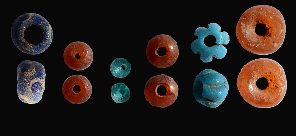
Coins were discovered between the pavement stones: a coin from Year 2 of the Great Revolt (67 CE), a coin from the Umayyad period, a coin of the prefect of Judea, Pontius Pilate, dating to 29 CE and a coin of Agrippa I from 41 CE that was minted in Jerusalem.

The ancient coins that were discovered in the excavation. Photographic credit: Clara Amit, courtesy of the Israel Antiquities Authority. The coin at the top is from the Umayyad period (A.D. 661-750). Bottom row (left to right): Herod Agrippa I – A.D. 41; Pontius Pilate – A.D. 29; Jewish Revolt – year 2 – A.D. 67-68.
Up until 2,000 years ago most of the roads in the country were actually improvised trails. However during the Roman period, as a result of military and other campaigns, the national and international road network started to be developed in an unprecedented manner. The Roman government was well aware of the importance of the roads for the proper running of the empire. From the main roads, such as the “Emperor’s Road”, there were secondary routes that led to the settlements where all of the agricultural products were grown. The grain, oil and wine, which constituted the main dietary basis at the time, where transported along the secondary routes from the surroundings villages and then by way of the main roads to the large markets in Israel and even abroad.
According to Amit Shadman, the Israel Antiquities Authority district archaeologist for Judah, “The ancient road passed close to the Israel National Trail and we believe that it will spark interest among the hikers. The Israel Antiquities Authority and Mei Shemesh Corporation have agreed that the road will be conserved in situ, for the public’s benefit”.
— ” —
Just a few days ago Todd Bolen called attention to David Bivins reports on the gradual destruction of the Roman road from Jerusalem to Emmaus here. The situation there is tragic. I have witnessed some deterioration of the Roman road near Golani Junction in just a few years. Let’s hope that the situations here will be reversed, and that this road will be preserved for many to see.
This recently uncovered road apparently connected with the road we described here.
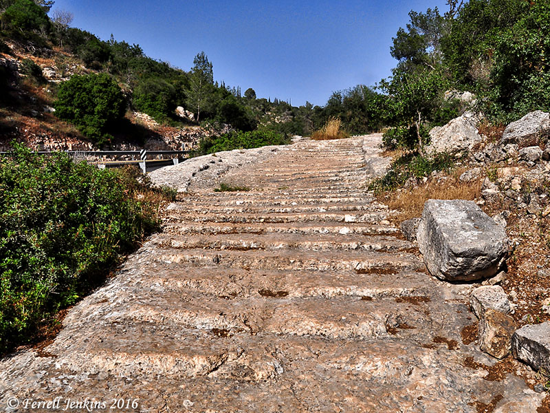
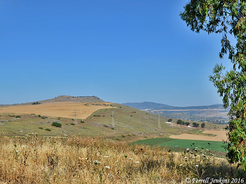
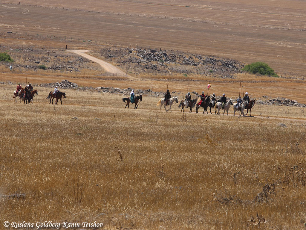
Roman Road 4.2 km W of Mata on Hwy 375. S of Hwy. Photo by Ferrell Jenkins.
I find it especially interesting that coins from A.D. 29, 41, and 67-68 should be found on a road constructed in circa A.D. 130. Others can fill in possible answers.
The roman roads that we see in Israel today were not built until about the time of the first revolt – ca. A.D.66, and mostly in the second century under Trajan and Hadrian.
Israel Roll writes,
The Roman road network in Judaea was not constructed at once, but evolved gradually from the First Revolt onward. Until then the Roman administration used roads that had been built during or prior to the reign of Herod. Our knowledge of those roads is scanty. and is based essentially on isolated written sources– mainly in the New Testament and Josephus. These sources do not
mention anything relating to road construction or maintenance before the beginning of the rebellion in 66 C.E. We may conclude, therefore, that the subject was not of central concern to the Roman procurators. (Israel Roll, “The Roman Road System in Judaea,” Jerusalem Cathedra 3 (1983): 138.
My thought is that the later Roman roads generally followed paths that were already in use by the people.
HT: Joseph Lauer


You must be logged in to post a comment.