
The Horns of Hattin is the name given to a saddle-shaped (or horn-shaped) extinct volcano located about five miles west of the Sea of Galilee. Several older writers, including Jesse L. Hurlbut, referred to this formation as the traditional Mount of the Beatitudes (A Bible Atlas [1910], 15). The hill is about 1200 feet above sea level. Few scholars hold this view today.
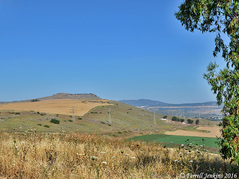
A view of the Horns of Hattin northwest of Highway 77. Photo by Ferrell Jenkins.
Below Hattin, on the edge of the Arbel Pass, there is a building believed by the Druze to be the burial site of Nebi Shu’eib (Jethro, the father-in-law of Moses; Exodus 3:1). The Druze gather here every spring for a festival.
One of the most important battles of history was fought at the Horns of Hattin on July 4, 1187. The Moslems, headed by Saladin, overpowered the Crusaders and captured most of Palestine including Jerusalem. Perhaps the most significant reason the Crusaders took their stand here was that they thought the Sermon on the Mount (Matthew 5-7) was spoken by Jesus on this hill.
I have never stood atop Hattin, but a friend of mine walked the Jesus Trail after our tour in 2011. Larry Haverstock shared some of his photos of the fascinating formation as he crossed it on his five-day trip from Nazareth to Capernaum.
This first photo shows ruins of a Roman road between Golani Junction and Magdala on the Sea of Galilee. The Jesus Trail followed this road. Larry’s friends will recognize his shadow in the photo.
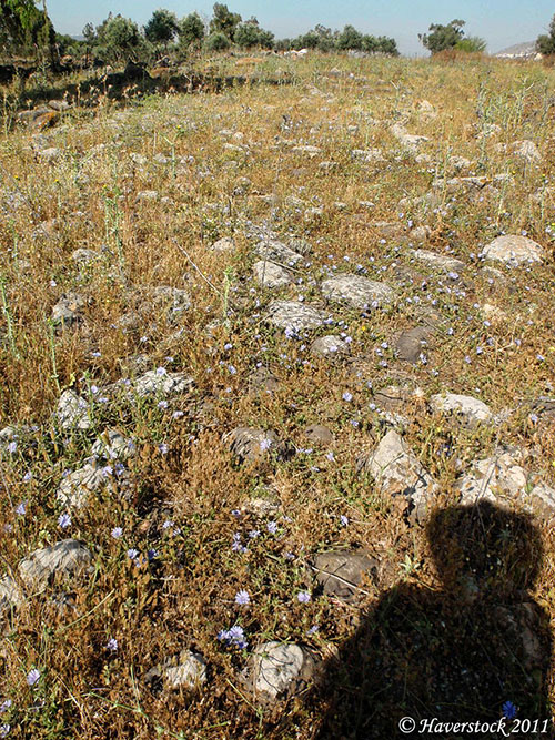
The Jesus Trail follows ruins of the Roman road from Golani Junction to Magdala. Photo by Larry Haverstock.
Following the road from the west one approaches the Horns of Hattin knowing that from the top there will be a wonderful view of the Sea of Galilee and the area of the Galilean ministry of Jesus.
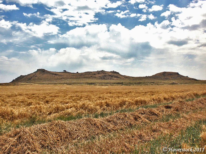
The Horns of Hattin from the west. Photo by Larry Haverstock.
Approaching the top of the formation you will see the southern hump and some of the volcanic rubble from ages past.

View to the east, while walking the Jesus Trail from Nazareth. Photo by Larry Haverstock.
The next photo made from Hattin shows Mount Arbel and portions of the Sea of Galilee. Larry writes and speaks vividly. I notified him that I would be posting this article today. He replied,
Can’t wait to see your Hattin article. I was up there all alone, not one other person in sight as far as the eyes could see from that amazing height. Could almost hear the echoing sounds of war reverberating across the centuries.
View of the Sea of Galilee from the Horns of Hattin. Photo by Larry Haverstock.
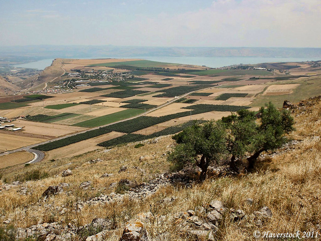
This photo provides a clear view of the depression to the north (left) of Mount Arbel through which the ancient road ran. The valley leading from the Horns of Hattin to the Sea of Galilee is known as Wadi Hamam. It is more commonly called the Arbel Pass, the Valley of the Robbers, or the Valley of the Pigeons. Some scholars say that the main trunk road from the Coastal Plain to Damascus came through this valley. It is common to hear this spoken of as the Via Maris (the way to the sea). This means that the main road from Nazareth, Sepphoris, and Cana to Capernaum ran through this valley. This is the way Jesus and His disciples traveled (Matthew 4:13; John 4:11-12). Other scholars suggest that the route from Capernaum to Nazareth ran to the north of the wadi and the rugged cliffs to the north.
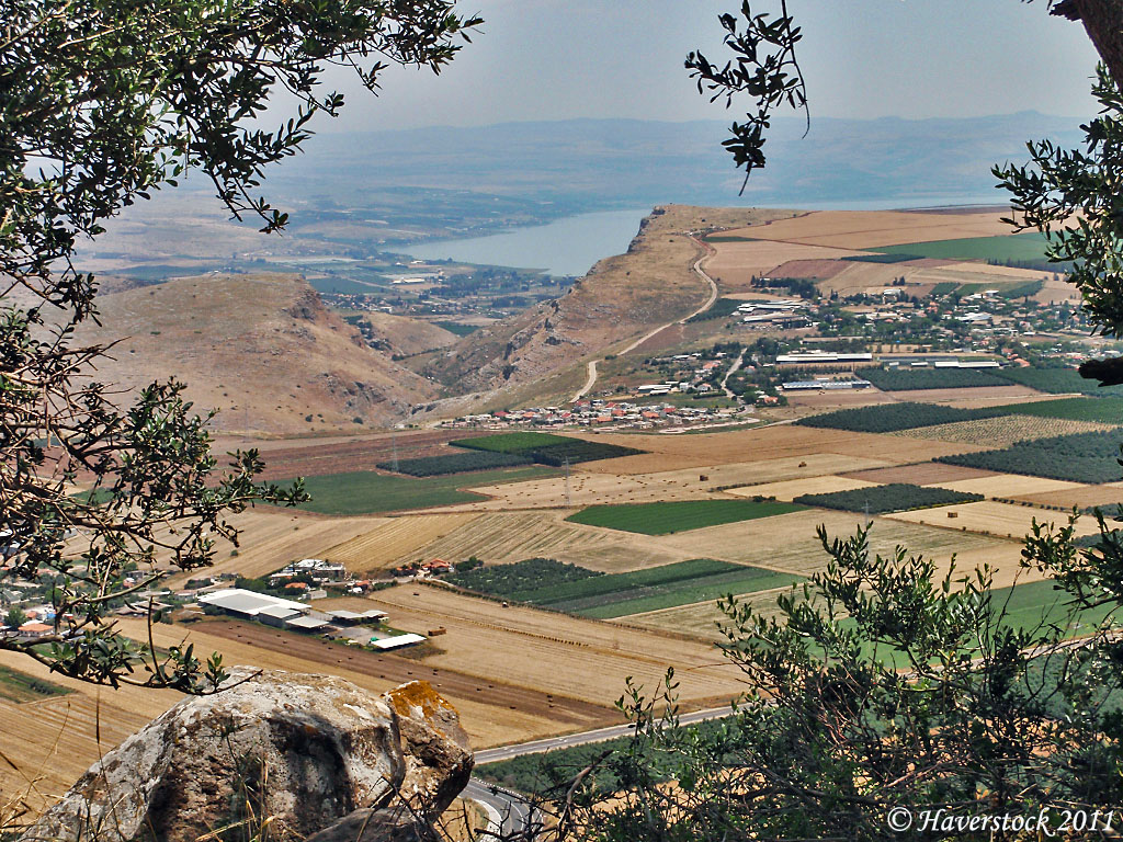
From the Horns of Hattin one sees Mount Arbel, the Arbel Valley, the plain of Gennesaret and the northern end of the Sea of Galilee. Photo by Larry Haverstock.
I have read several articles about the modern reenactment of the decisive 1187 battle between the Crusaders of the Kingdom of Jerusalem and the followers of Saladin. Here are a few links for those who would like to read more.
- Times of Israel 2016 article by Ilan Ben Zion here.
- Times of Israel 2015 article by Oded Balilty here.
- Daily Mail article with photos here.
Alon describes the day of the battle in 1187.
The engagement took place on a blistering-hot day and the Crusader soldiers encumbered by their heavy and clumsy armor in face of the light cavalry of their enemy. After a day-long battle, not one Crusader soldier remained alive on the battlefield. (Azaria Alon, Israel National Parks & Nature Reserves, 168.)
Numerous persons have included photos here and there on the Internet. I was impressed with some photos by Ruslana Goldberg-Kanin Teishov and requested permission to share two or three of them with our readers. Ruslana graciously granted permission. The next three photos are by her. The first shows Crusader soldiers readying for battle. You can see other of her photos here.
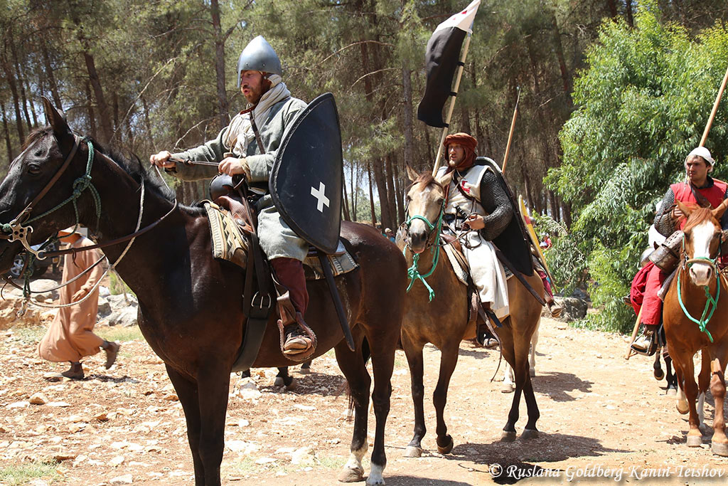
History buffs reenact the crusaders as they ready to defend the formation known as the Horns of Hattin. Photo by Ruslana Goldberg-Kanin Teishov.
This photo shows the heavy armor worn by some of the soldiers.
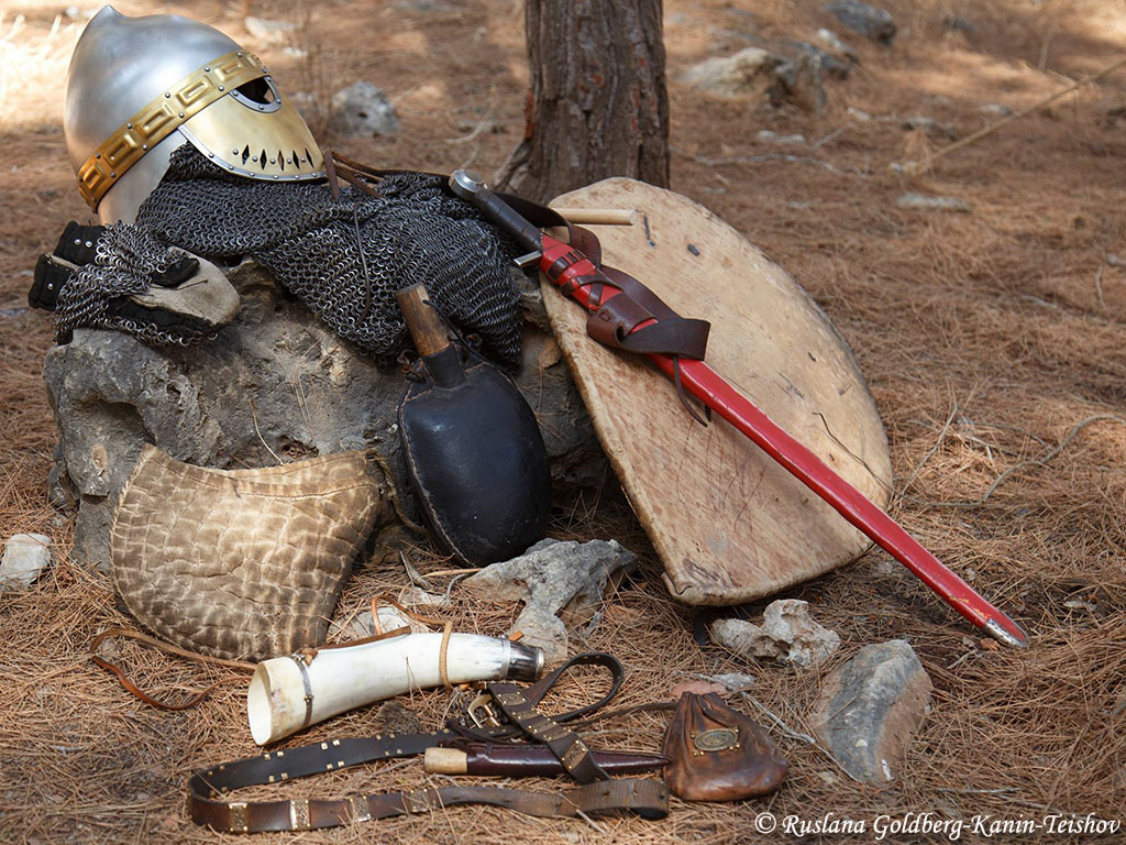
One of the soldier actors had his armor laid out to show what the Crusaders had to wear. History buffs reenact the crusaders as they ready to defend the formation known as the Horns of Hattin. Photo by Ruslana Goldberg-Kanin Teishov.
This photo shows soldiers as they approached the western slope of the Horns of Hattin.
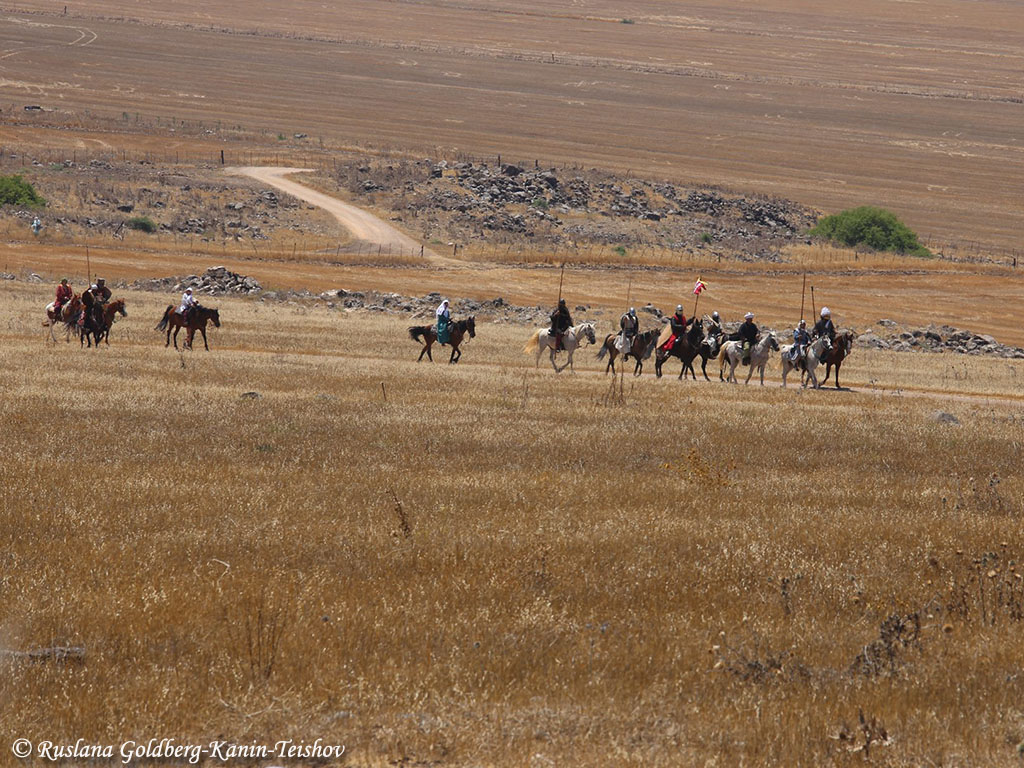
This photo shows soldiers as they approached the western slope of the Horns of Hattin. Photo by Ruslana Goldberg-Kanin Teishov.
The official web page for the Horns of Hattin project is here.
Did Jesus preach the Sermon on the Mount here? Probably not.
Many thanks to Larry Haverstock and Ruslana Goldberg-Kanin Teishov for making this post much more interesting than it would have been without their photos. If you wish to follow Larry on the Jesus Trail you may begin here and then use his blog archive to locate the other posts.


You must be logged in to post a comment.