Category Archives: Archaeology

Evidence of Cinnamon in use 3000 years ago

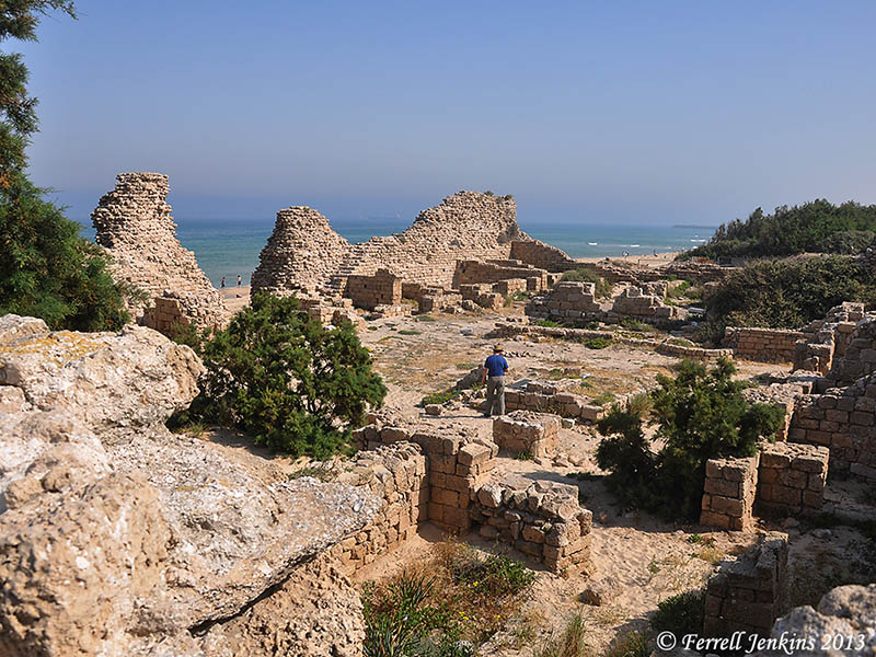
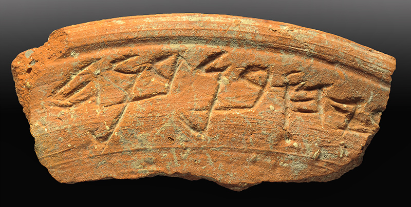
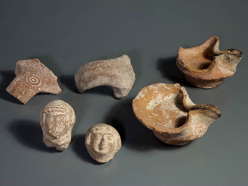
Live Science reports (here) on the investigation of 27 flasks from five archaeological sites in Israel showing that cinnamon was stored in them. The flasks date back to about 1000 years B.C. Ten of the 27 flasks contain “cinnamaldehyde, the compound that gives cinnamon its flavor, indicating that the spice was stored in these flasks.” Tel Dor is the only site named in the report.

At this time cinnamon was found in the Far East with the closest places to Israel being southern India and Sri Lanka located at least 3,000 miles (nearly 5,000 kilometers) away. A form of it was also found in the interior of Africa, but does not match the material found in these flasks.

This discovery “raises the intriguing possibility that long-range spice trade from the Far East westward may have taken place some 3,000 years ago,” researchers write in a paper to be published in the journal Mediterranean Archaeology and Archaeometry. Although cinnamon can be purchased today at any grocery or bulk food store, 3,000 years ago, people in the Levant would have needed to take part in trade that extended beyond the edge of the known world in order to acquire it, something this discovery suggests they were willing to do.

This trade may go back ever further into antiquity and involve other goods and parts of the Middle East. The researchers note, for example, that black pepper from India has been found in the mummy of Ramesses II, a pharaoh of Egypt who lived more than 3,200 years ago.

Cinnamon displayed on the Spice Route at Avedat. Photo by Ferrell Jenkins.

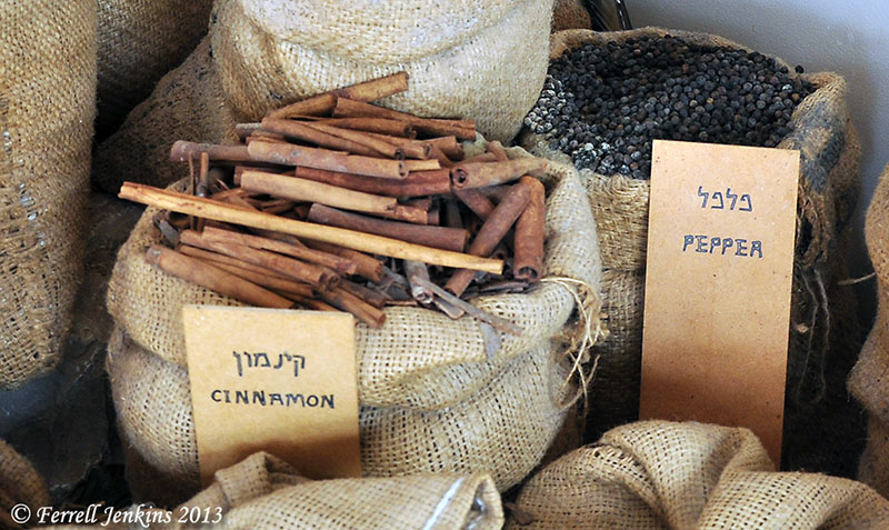
Cinnamon and pepper displayed on the ancient Spice Route at Avedat.

Cinnamon is mentioned only four times in the Bible.

  • Cinnamon was used in the anointing oil for the tabernacle (Exodus 30:23).
  • The adulterous woman tells the young man that she has perfumed her bed with cinnamon and other spices (Proverbs 7:17).
  • Cinnamon is used in the sexual/sensuous context of Song of Solomon 4:14.
  • Cinnamon is one of the spices imported by Babylon (the ancient Roman Empire) in Revelation 18:13.

Much archaeological work goes on in the library and in the lab.

HT: Joseph I. Lauer

Sargon II, Ashdod, and Isaiah 20:1

Ashdod was located along an international highway known as the Way of the Sea, the Way of Philistia, or the Via Maris. This was the important route connecting Egypt and Assyria. We have already discussed, in the past few posts, that the Assyrian king Sargon II captured Ashdod in 712/11 B.C. The prophet Isaiah makes reference to this event in Isaiah 20:1.

 The LORD revealed the following message during the year in which King Sargon of Assyria sent his commanding general to Ashdod, and he fought against it and captured it. (Isa 20:1 NET)

Sometime discoveries are made, but get little attention. A discovery at Tel Ashdod in 1963 falls into this category. Tel Ashdod was excavated from 1962 to 1972 under the direction of Moshe Dothan. David Noel Freedman wrote an article in Biblical Archaeologist (26:4, 1963)) about “The Second Season at Ancient Ashdod.” He describes the fragments of a stele of Sargon II.

Fragments of another stele, commemorating the victories of Sargon, were found at Ashdod during the current season, thus offering direct confirmation and vivid illustration of the biblical and Assyrian accounts. In all, three pieces of the stele were discovered. Enough can be made of their contents to show that the inscription duplicated in content if not precisely in wording other victory steles of the Assyrian king. By comparing the Ashdod stele with the others it will be possible to reconstruct the missing parts, one of which described the actual conquest of Ashdod. The inscription was carved in cuneiform signs characteristic of Sargon and his period, on all four sides of a slab of basalt which had been imported from a region north of Megiddo. It may have served as a pedestal for an obelisk, or a statue of the emperor. It must have been erected between the year of victory at Ashdod and the death of the king in 705 B.C., perhaps in 707 when a similar stele was set up in Cyprus. With the accession of Sennacherib in 704, most of the vessel countries revolted; Hezekiah of Judah and Sidqa of Ashkelon were the ringleaders in the west. They were able to liberate Ashdod from Assyrian control, and doubtless the event was observed by the destruction of Sargon’s victory stele, symbol of foreign oppression. These fragments of a monumental Assyrian inscription are the first ever found in Palestine.

The photos below were published in an article by Hayam Tadmor (“Philistia Under Assyrian Rule.” Biblical Archaeologist (29:3, 1966). Several years ago I used a digital camera to copy the photo. Sorry it is not better, but at least you can see the pieces. A photo of the piece in the middle below is also published in a BAR article (Jan-Feb, 2007) by H. Shanks on the “Assyrian Palace Discovered in Ashdod,” but the quality is about the same.
Fragment of the Sargon II inscription found at Ashdod.

Fragment of the Sargon II inscription found at Ashdod.

For several years the fragments were displayed in a case across from the replica of the Siege of Lachish in the Israel Museum. For the past years the fragments have not been on display. I made inquiry at the Museum earlier this year without any success. I wonder if the pieces have been moved to the Corine Maman Museum of Philistine Culture in Ashdod. Can anyone help with this?

This discovery is one of those that complement the biblical record. Sargon II (721–705 B.C.) is mentioned only once in the Bible — Isaiah 20:1. Isaiah says that the commanding general of Sargon II fought against Ashdod and captured it.

The photo below shows Sargon II (right) facing a person who is generally considered to be an Assyrian high dignitary. (See the discussion in Fant & Reddish, Lost Treasures of the Bible, 133-140.

Sargon II and an attendant. Displayed in Louvre. Photo by Ferrell Jenkins.

Sargon II and an official. Displayed in Louvre. Photo by Ferrell Jenkins.

Jack Finegan says of the reference to Sargon II in Isaiah 20:1,

… for a long time this was the only place in extant literature where his name was known.

The palace of Sargon II was discovered by Paul Emile Botta at Khorsabad in 1843. This relief comes from that palace, and is displayed in the Louvre. Other reliefs and artifacts from the palace are exhibited in the British Museum and the Oriental Institute of the University of Chicago.

Written copies of Isaiah existed in what we know as the Dead Sea Scrolls nearly 2000 years before the discovery of Sargon’s palace and archive. Perhaps we should be slow to think of Isaiah and other biblical writers as being unhistorical. To say this in a positive way, this illustrates the historical trustworthiness of the Bible. That the only reference to Sargon is specifically linked to Ashdod is even more impressive.

The Philistine city of Ashdod in the Bible

Ashdod is mentioned in the Bible as one of five cities of the Philistine Pentapolis (1 Samuel 6:17). The city is mentioned earlier among the Canaanite cities in the Ebla tablets. Here is a brief survey of the events recorded in the Bible.

  • Some of the Anakim were left in Gaza, Gath, and Ashdod after Israel entered the land (Joshua 11:22).
  • Ashdod was among some cities that remained under Philistine control even though it had been assigned to the tribe of Judah (Joshua 13:2-3; 15:46-47).
  • When Israel lost the Ark of the Covenant at Ebenezer, the Philistines brought it to Ashdod and placed it in the temple of Dagon (1 Samuel 5:1-8).
Representation of the Ark of the Covenant in the Tabernacle in the Wilderness at Timna. Photo by Ferrell Jenkins.

Representation of the Ark of the Covenant in the Tabernacle in the Wilderness at Timna.

  • Uzziah, king of Judah (767-740/39 B.C.), made war against Ashdod. He broke down the wall of Ashdod and built cities in the area (2 Chronicles 26:6).
  • King Sargon II of Assyria captured Ashdod in 712/711 B.C. (Isaiah 20:1).
  • After the return from Babylon, Nehemiah faced problems because some of the Judeans had married women of Ashdod. Their children spoke the language of Ashdod, and could not speak the language of Judah (Nehemiah 13:23-24).
  • The prophets Jeremiah, Amos, Zephaniah, and Zechariah spoke against Ashdod (Jeremiah 25:20; Amos 1:8; 3:9; Zephaniah 2:4; Zechariah 9:6).
  • Ashdod was known as Azotus in New Testament times (Acts 8:40).

In the next post we hope to discuss Isaiah 20:1 and the archaeological discovery that complements this text.

Massive Iron Age fortifications found at Ashdod-Yam

The American Friends of Tel Aviv University announced Monday the discovery of a massive fortification from the Iron Age.

— ♦ —

Researchers from Tel Aviv University have unearthed the remains of massive ancient fortifications built around an Iron-Age Assyrian harbor in present-day Israel.

At the heart of the well-preserved fortifications is a mud-brick wall up to more than 12 feet wide and 15 feet high. The wall is covered in layers of mud and sand that stretch for hundreds of feet on either side. When they were built in the eighth century B.C.E., the fortifications formed a daunting crescent-shaped defense for an inland area covering more than 17 acres.

The finding comes at the end of the first excavation season at the Ashdod-Yam archaeological dig in the contemporary Israeli coastal city of Ashdod, just south of Tel Aviv. Dr. Alexander Fantalkin of TAU’s Department of Archaeology and Ancient Near Eastern Cultures is leading the project on behalf of the Sonia and Marco Nadler Institute of Archaeology.

“The fortifications appear to protect an artificial harbor,” says Fantalkin. “If so, this would be a discovery of international significance, the first known harbor of this kind in our corner of the Levant.”

Building up and putting down. When the fortifications were built, the Assyrians ruled the southeastern part of the Mediterranean basin, including parts of Africa and the Middle East. Assyrian inscriptions reveal that at the end of the century, Yamani, the rebel king of Ashdod, led a rebellion against Sargon II, the king of the Assyrian Empire. The Kingdom of Judah, under King Hezekiah, rejected Yamani’s call to join the insurrection.

The Assyrians responded harshly to the rebellion, eventually destroying Philistine Ashdod. As a result, power shifted to the nearby area of Ashdod-Yam, where the TAU excavations are taking place. The fortifications seem to be related to these events, but it is not yet clear exactly how. They could have been built before or after the Ashdod rebellion was put down, either at the initiative of the locals or at the orders of the Assyrians.

“An amazing amount of time and energy was invested in building the wall and glacis [embankments],” says Fantalkin.

3D castles in the sand. More recent ruins — from the Hellenistic period, between the fourth and second centuries B.C.E. — were also found on top of the sand of the Iron Age fortifications. The buildings and walls were apparently built after the fortifications were abandoned and then probably destroyed by an earthquake in the second half of the second century B.C.E. Among the unusually well-preserved ruins were artifacts, including coins and weights.

The researchers employed a powerful new digital technique, photogrammetry, to create a 3D reconstruction of all the features of the excavation. The University of Nebraska-Lincoln provided the equipment. Dr. Philip Sapirstein, a postdoctoral fellow at TAU, served as a digital surveyor on the project.

The only archaeological work done previously at Ashdod-Yam was a series of exploratory digs led by late Israeli archaeologist Dr. Jacob Kaplan on behalf of the Tel Aviv-Jaffa Museum of Antiquities between 1965 and 1968. Kaplan believed the Ashdod rebels built the fortifications in anticipation of an Assyrian attack, but Fantalkin says the construction appears too impressive to have been done under such circumstances.

— ♦ —

Broken columns lie scattered among the wild flowers on the sand dunes covering Ashdod-Yam. Photo by Ferrell Jenkins.

Broken columns lie scattered among the wild flowers on the sand dunes covering Ashdod-Yam. Photo by Ferrell Jenkins.

The Ashdod-Yam Excavations website is here.

HT: Joseph Lauer

Visiting Ashdod-Yam — New Testament Azotus

Back in May, my friend Dan and I visited the site of Ashdod-Yam. The site is located a little over 3 miles NW of Tel Ashdod. Tel Ashdod, the city mentioned in the Old Testament, is difficult to visit. My young friends, Trent and Rebekah, mentioned visiting Ashdod a few weeks ago. The site, “now a cow pasture,”  is enclosed by a highway and railroad track on one side and an industrial park on the other. Finding the right hole in the fence is not easy.

You can see a small photo of the excavated area at Tel Ashdod in Journal 118 of Hadashot Arkheologiyot here. Biblical Archaeological Review has a full page photo of the Assyrian palace excavated at Tel Ashdod. (See “Assyrian Palace Discovered in Ashdod.” BAR, Jan/Feb 2007.)

Sargon II took the city of Ashdod in 712/711 B.C., an event mentioned in Isaiah 20:1. By Roman times Ashdod consisted of two cities, the coastal town of Azotus Paralios and the inland town of Azotus Mesogeius. (There is too much history for inclusion here.)

The citadel at Ashdod-Yam with a view north toward the modern city of Ashdod. Photo by Ferrell Jenkins.

The citadel, an early Islamic and Crusader fortress, at Ashdod-Yam with a view north. Photo by Ferrell Jenkins.

Azotus is mentioned only once in the Bible. After the baptism of the man of Ethiopia, the evangelist Philip “found himself at Azotus.”

But Philip found himself at Azotus, and as he passed through he preached the gospel to all the towns until he came to Caesarea. (Acts 8:40 ESV)

Except for the fortress, the large site of Ashdod-Yam resembles sand dunes. A joint excavation conducted by the Institute of Archaeology of Tel Aviv University and the Institut für Alttestamentliche Wissenschaft of the Leipzig University has just completed the current season. The excavation web site may may be accessed here.

Ashdod Yam. A view south toward Ashkelon. The large tel can be seen sloping down on the left of the photo. Photo by Ferrell Jenkins.

Ashdod-Yam. A view south toward Ashkelon. The large tel can be seen sloping down on the left of the photo. Photo by Ferrell Jenkins.

Below is a photo of the name of Azotos Paralios in the 6th century Madaba mosaic map.

Azotus Paralios is portrayed on the 6th century A.D. Madaba mosaic map. Photo by Ferrell Jenkins.

Azotos Paralios is portrayed on the Madaba mosaic map. Photo by Ferrell Jenkins.

City of David inscription may name a Bible character

The Israel Antiquities Authority announced Sunday the discovery of “a layer of rich finds including thousands of broken pottery shards, clay lamps and figurines … in the area of the Gihon Spring in the City of David, in the Walls around Jerusalem National Park.”

Most intriguing is the recent discovery of a ceramic bowl with a partially preserved inscription in ancient Hebrew. While not complete, the inscription presents us with the name of a seventh century BCE figure, which resembles other names known to us from both the Biblical and archaeological record [see Press Release] and providing us with a connection to the people living in Jerusalem at the end of the First Temple period.

Pottery sherd of a bowl from the end of the First Temple Period, bearing the inscription "ryhu bn bnh." Photo: Clara Amit, Israel Antiquities Authority.

Pottery sherd of a bowl from the end of the First Temple Period, bearing the inscription “ryhu bn bnh.” Photo: Clara Amit, Israel Antiquities Authority.

Dr. Joe Uziel and Nashon Zanton, directors of the dig, were working in ruins belonging to the period of the destruction of the Temple by the Babylonians when the inscription was found. They say that the name most similar to the inscription is “Zechariah the son of Benaiah, the father of the Prophet Jahaziel.”

 And the Spirit of the LORD came upon Jahaziel the son of Zechariah, son of Benaiah, son of Jeiel, son of Mattaniah, a Levite of the sons of Asaph, in the midst of the assembly.  And he said, “Listen, all Judah and inhabitants of Jerusalem and King Jehoshaphat: Thus says the LORD to you, ‘Do not be afraid and do not be dismayed at this great horde, for the battle is not yours but God’s. (2 Chronicles 20:14-15 ESV)

More information about this discovery is available in the IAA Press Release here. Other finds from the same area, shown in the photo below, are impressive.

Various finds from the fill layer of the end of the First Temple Period: oil lamps, LMLK stamped handles and female figurines. Photo: Clara Amit, Israel Antiquities Authority.

Various finds from the fill layer of the end of the First Temple Period: oil lamps, LMLK stamped handles and female figurines. Photo: Clara Amit, Israel Antiquities Authority.

HT: Joseph I. Lauer; Todd Bolen, Bible Places Blog (see here for more news links)

The Assyrians at the Source of the Tigris River

The Tigris River (called Dicle in Turkish) begins in the mountains of ancient Ararat and flows to the Persian Gulf. The Tigris is mentioned twice in the Bible. It is said to be the third of the rivers flowing out of the garden of Eden. It flows on the east side of Assyria (Genesis 2:14). The river is also mentioned in Daniel 10:4. The prophet stood beside “the great river, the Tigris.” Ancient Nineveh, near Mosul in northern Iraq, was built on the Tigris.

The Tigris River south of Diyabakir, Turkey. Photo by Ferrell Jenkins.

The Tigris River south of Diyabakir, Turkey. Photo by Ferrell Jenkins.

Ziyaret Tepe is identified with the Assyrian city of Tushhan. The city dates back to the Early Bronze Age (about 3000 B.C.), but there is a concentration of interest in the Late Assyrian period, c. 882–611 B.C. This corresponds to the biblical period of the Divided Kingdom.

Dr. Tim Matney, director of the Ziyaret Tepe Archaeological Expedition in southeastern Turkey, writes today about a visit to the source of the Tigris.

About 90km north of Diyarbakir there is a place in the Taurus Mountains where the Dibni Su, one of the two main sources of the Tigris River, comes flowing out of a large cave. The Dibni Su actually originates much deeper in the mountains, but the ancient Assyrians thought this to be the source of the Tigris and it is a dramatic landscape that had great significance to them. The modern name of the place is Birkleyn Gorge.

Take a look at three nice photos posted by Matney at the Ziyaret Tepe website here.

Matney says there are four small rock inscriptions made by Assyrian kings Tiglath-pileser I (1114–1076 B.C.) and Shalmaneser III (858–824 B.C.). Six Bible references may be found for Tiglath-pileser (2 Kings 15:29; 16:7,10; 1 Chronicles 5:6,26; 2 Chronicles 28:20), and two for Shalmaneser (2 Kings 17:3; 18:9). [See Comments below. The biblical kings are Tiglath-pileser III (745–727 B.C.), and Shalmaneser V (726–722 BC). Perhaps I will say more about these kings in a future post. My oldest son and I have the same name, and sometimes folks get us mixed up unless they know us.]

Ziyaret Tepe is scheduled to be flooded by the Tigris River as part of the project by the Turkish government to provide power and irrigation for the southeastern region of Turkey.

I have not visited Ziyaret Tepe, but have visited the general area (Diyabakir, Batman, et al. The photo below was made at Hasankef, an old town also scheduled to be flooded by the Tigris.

The Tigris River at Hasankef in southeastern Turkey. Photo by Ferrell Jenkins.

The Tigris River at Hasankef in southeastern Turkey. Photo by Ferrell Jenkins.

In addition to the Ziyaret Tepe blog, there is an interesting report on the site, with maps, at Past Horizons.

HT: Jack Sasson

Google Earth helps you see Biblical Sites

About a month ago Wayne Stiles posted an illustrated article about “Google Street View of 7 Biblical Sites.” There is some pretty neat stuff there, especially for those who have stood in these places and looked in all directions. Check all 7 views here.

Look at the photo below, and then see the same area in Google Earth.

The Western Wall, the Dome of the Rock, and the Mughrabi Gate are visible in this single photo. Photo by Ferrell Jenkins.

The Western Wall, the Dome of the Rock, and the Mughrabi Gate Bridge are visible in this single photo. Photo by Ferrell Jenkins.

Huge columns said to be 1900-years-old found buried at Laodicea

Hurriyet Daily News reported today the discovery of a large number of “1,900-year-old huge columns” at Laodicea.

Excavations in the Aegean province of Denizli’s ancient city of Laodicea have revealed 1,900-year-old huge columns seven meters underground. The columns were found in the area known as the northern agora, one of the oldest faith centers in Anatolia.

The head of the excavations, Professor Celal Şimşek, said the northern agora had been discovered last year and they were continuing restoration and conservation work there. He said the area was one of the largest agoras in Anatolia. “The columned galleries here are in a rectangular shape on an area of 35,000 square meters. We previously revived the columned galleries that we call the eastern porch. This year we found the extension of these columns seven meters underground. They were in the same condition as when an earthquake ruined them. The columns date back to 1,900 years ago. Dust erosion and residue have filled the earth here and preserved the columns.”

Şimşek said their goal was to finish the excavations by the end of the year and to revive the columns in the beginning of the next year. He said the ancient city of Laodicea had served as a religious center.

“When the columned galleries are completely unearthed, there will be a very nice touring area. Tourists will have the chance to see traces from the past up close.”

A nice gallery of photos illustrate the article. One is a drawing showing how the area may have looked before being destroyed by earthquake. We are given no hint how the age of the columns was determined and whether the earthquake that felled them was also about 1,900 years old. Mark Wilson says,

Because of earthquakes the city was rebuilt numerous times during its history. A devastating earthquake during the reign of Focas (AD 602-10) finally caused the site to be abandoned. The residents founded a new city called Ladik, now the Kaleiçi district of Denizli. — Biblical Turkey, 247.

Laodicea is mentioned only in Paul’s epistle to the Colossians (2:1; 4:13-16) and in the Book of Revelation (1:11; 3:14). Paul says that Epaphras worked diligently for the saints in Colossae, Laodicea, and Hierapolis. These were cities of the Lycus River valley.

We have visited Laodicea several times over the years and been delighted with the archaeological reconstruction underway. The city should be on everyone’s list of “must see” sites of Turkey. Turkey has approximately 1100 historical sites, and the country has made considerable progress in preparing some of them for visitors. Use the search box on this blog to locate previous entries about Laodicea.

Tourists on the Syrian Street at Laodicea. Colossae is located at the foot of Mount Cadmus, seen in the distance to the east. Photo by Ferrell Jenkins.

Tourists on the Syrian Street at Laodicea. Colossae is located at the foot of Mount Cadmus, seen in the distance to the east. Hierapolis is to the north (our left as we view the photo). Photo by Ferrell Jenkins.

HT: Joseph I. Lauer

Walking up the Roman siege ramp at Masada

Masada has caught my attention in the past few days. Those who have visited the site are aware of the Byzantine ruins, including a church, on the top of the plateau. A brochure published by the The Israel Nature and Parks Authority points out that Masada “sank into oblivion until the nineteenth century.”

The first scholars to identify Masada with the plateau known in Arabic as es-Sebbeh were Smith and Robinson in 1838, and the first to climb it were Wolcott and Tipping in 1842. Warren climbed Masada in 1867, Conder described and mapped it in 1875, Sandel discovered the water system in 1905, and Schulten studied mainly the Roman siege system in 1932.

Perhaps most visitors today associate the excavation of Masada with the late Yigael Yadin from 1963 to 1965. Masada National Park opened in 1966, and the first cable car to take visitors to the top was in 1971. The larger cable cars, holding about 40 passengers each, were added several years later.

My first visit to Masada was in 1969. At that time it was necessary to walk up the path on the siege ramp made by the Romans. In A.D. 73 or 74, “the Roman Tenth Legion Fretensis, led by Flavius Silva, laid siege to the mountain.” The ramp was built so the Romans could move their battering ram up to the western gate of Masada. The photo below was made from the plateau. The ramp is visible just below the bottom half of the photo, and the path is on the ridge. The path leading to our right (view from the top) goes to the large water cisterns.

The Roman siege ramp at Masada. Photo by Ferrell Jenkins.

The Roman siege ramp at Masada. Photo by Ferrell Jenkins.