
Subscribe to continue reading
Subscribe to get access to the rest of this post and other subscriber-only content.

Subscribe to get access to the rest of this post and other subscriber-only content.
Posted in Archaeology, Bible Lands, Bible Places, Bible Study, Old Testament, Travel
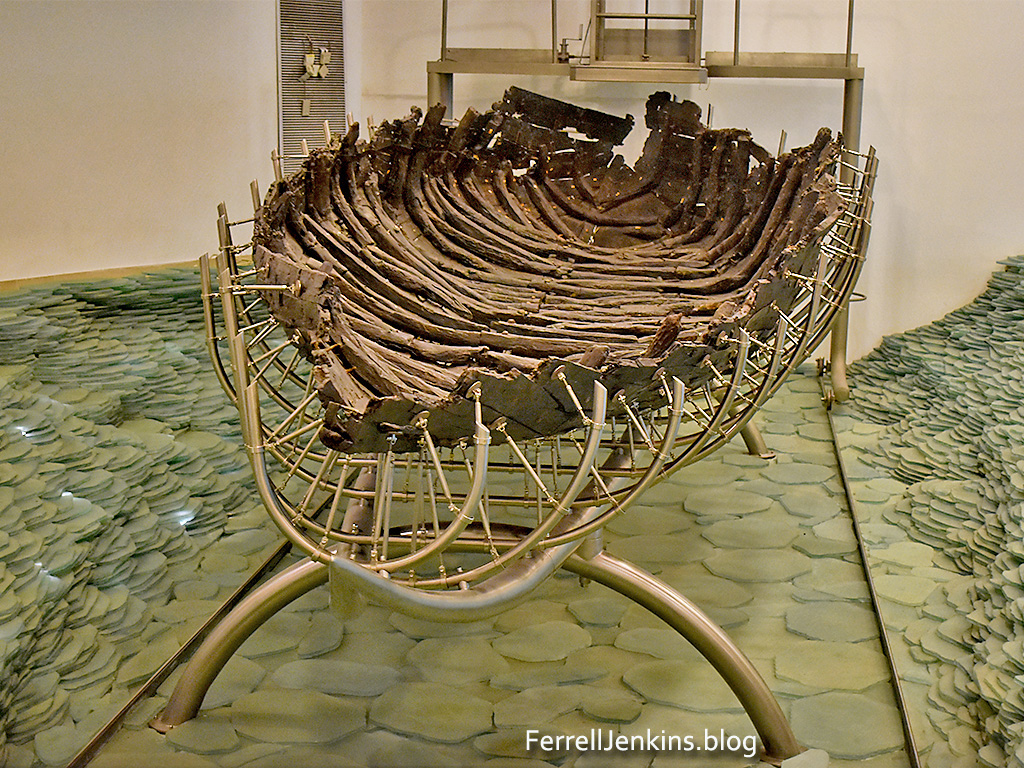
A Roman period boat was found buried in sand near the shore of the Sea of Galilee north of Tiberias . After a period of restoration the boat was put on exhibit at the Yigal Allon Galilee Boat Museum at Kibbutz Ginosar on the west shore of the Sea of Galilee, north of Tiberias.
tags
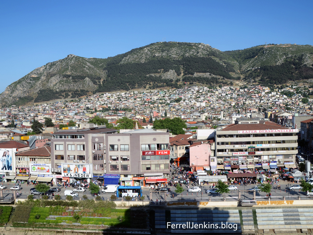
The site of Ramoth Gilead is located in northern Jordan near the Syrian border. The exact site is uncertain, but many scholars think Tall ar-Rumeith is to be identified with the biblical site. Ahab, king of ancient Israel, was concerned because the town of Ramoth Gilead which he claimed for the northern kingdom of Israel was controlled by Syria. Jehoshaphat, the king of Judah, agreed to go with Ahab to fight for Ramoth Gilead.
The prophets of the day seemed to be indebted to the kings and like good politicians assured them they would prosper in their effort to take the city. One prophet, a man named Micaiah came and told the king that he would not prosper. Micaiah said that he could only speak what the LORD told him.
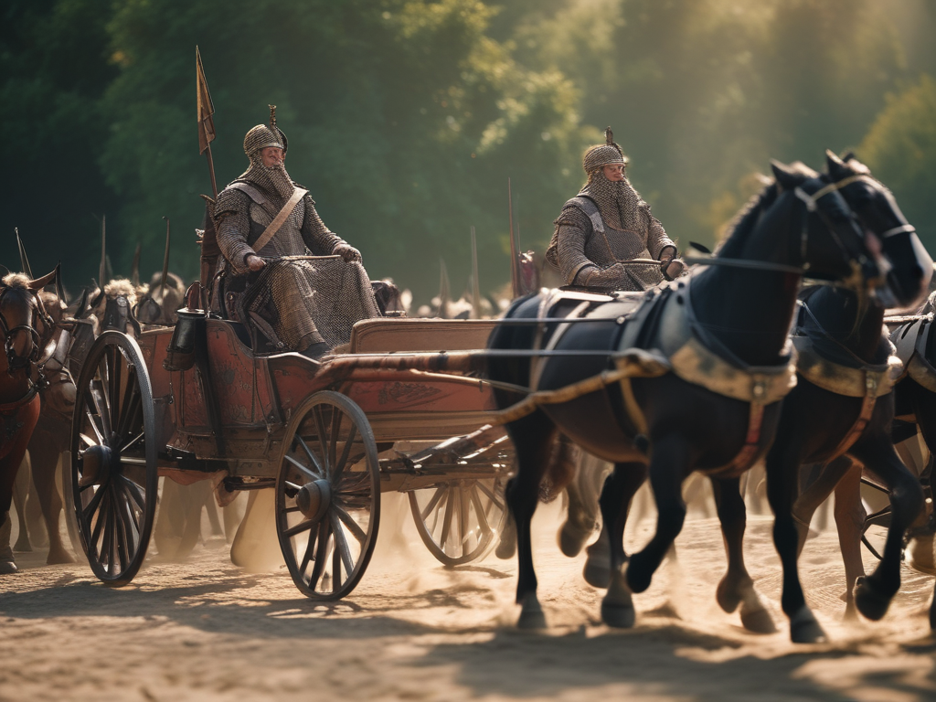
AI imagines that King Ahab looked something like this when he headed into battle.
When the kings arrived at Ramoth Gilead Ahab disguised himself and went into battle. He had convinced Jehoshaphat to put on his robes and go into battle. When the Syrian captains saw him, thinking he was Ahab, they went after him. When they saw it was not Ahab they turned back.
The Biblical record says that a “certain man drew his bow at random, and struck the King of Israel between the joins of his armor.” The soldiers of Israel propped up the king in his chariot and he died that evening. Ahab was taken back to Samaria for burial.
No amount of disguise can hide one from the LORD. This is another events that shows that the LORD rules in the kingdoms of men.
Read 1 Kings 22 for the full account of this event.
Posted in Archaeology, Bible Lands, Bible Places, Bible Study, Israel, Jordan, Old Testament, Photography, Travel
Corinth is located about two miles south of the narrow isthmus which forms the land bridge, and controlled access, between the main land mass of Greece and the Peloponnesus. Corinth seemed to have flourished from the 8th to the 5th centuries B.C., and there are signs of habitation much earlier. In 146 B.C. the Greek history of Corinth was terminated when the Roman consul Mummius destroyed it. All that remains today of the old Greek city are the seven columns of the Temple of Apollo. Julius Caesar rebuilt Corinth in about 46 /4 4 B.C. as a Roman colony and settled many Roman soldiers there. Corinth became the capital of the Roman province of Achaia and had direct communications with Rome. There were enough Jews in the city to account for a synagogue (Acts 18). Perhaps the two most noticeable sites at Corinth today are the ruins of the temple of Apollo and the Acrocorinth (the mountain or high point of Corinth). The temple of Apollo was built in the 6th century B.C., but only seven of the original 38 Doric monolith columns are standing. There were numerous other pagan temples in the city including one dedicated to Asklepios, the god of healing.

The judgment-seat (Greek, bema) was a speaker’s platform on which the judge sat or stood for the trial of one against whom an accusation had been made. In the excavations a t Corinth which have been conducted since 1896 the bema has been exposed in the agora. It is likely that Paul stood before Gallio at this place (Acts 1 8:12). The bema is dated to A.D. 44, but could be as early as the time of Augustus. The gospel was successful in this pagan city. Paul preached “Christ and Him crucified” (1 Cor. 2:2; 15:1-4). Paul was fearful but the Lord told him, “Do not be afraid any longer, but go on speaking and do not be silent; for I am with you, and no man will attack you in order to harm you, for I have many people in this ci ty” (Acts 18:9-10 ). Paul remained in Corinth for a year and six months.

Inscribed in a limestone pavement near the theater at Corinth is a phrase which reads in Latin: ERASTVS PRO AEDILITATE S P STRAVIT. The translation goes something like this: Erastus , in return for the aedileship, laid the pavement at his own expense. It is possible, but not certain, that this Erastus was the friend of Paul (Rom. 16:2-3; 2 Tim 4:20). If so, then Erastus may have been one of the few (contrast, not many) of the socially elite at Corinth who accepted the gospel (1 Cor 1:26).
Posted in Apostle Paul, Archaeology, Bible Places, Bible Study, Book of Acts, Greece, Photography, Travel
Tagged Bible, Bible Study, Christianity, Corinth, Paul
At the top of our home page, we have a link to INDEXES (INDICES). There, occasionally I have included a collection of posts on a specific subject. If you have not used this feature of the blog, I suggest you take a look.
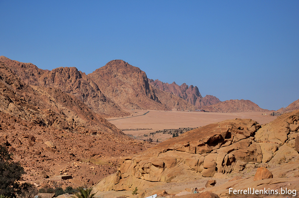
Specifically, I am calling attention to the INDEX: Route of the Exodus and the Location of Mount Sinai. Click on the link below to visit that page which includes many photos pertaining to the exodus and Mount Sinai.
Recently I observed on a social media site a discussion conducted by several young preachers. One was asking others what they thought about the location of Mount Sinai. A few days ago I received a note from an older former student about a column that some are calling Solomon’s Post or Pillar. I have learned enough about archaeology to know that an artifact must have a context. One random stone is not enough to build a legitimate conclusion. What archaeological excavation has determined the origin and provenance of the stone post? What ancient document has mentioned the post? What evidence do we have that it is in any way associated with Israelite King Solomon?
One respondent in the exchange on social media did call attention to the articles on my blog, but mostly they each were giving their opinion. The thing that really got my attention what that not one of them referenced a Bible dictionary or Bible encyclopedia. No one called attention to a Bible Atlas. When I was in college and several students gathered in a room to pool our ignorance we called it Shooting the Bull.

Most of my Bible Atlases can be seen in this photo, but I have some others in digital format, and I do have several other smaller atlases on different shelves. Over half a century of travel to the Bible lands might explain why I have collected so many atlases as well as numerous road atlases and maps. Every preacher/teacher needs a few good Bible Atlases.

Some scholars concentrate on certain areas of study and produce good material. Here I call attention to the work of Gordon Franz. He has written several essays under the category of Cracked Pot Archaeology at https://www.lifeandland.org/category/cracked-pot-archaeology/
His article on “Where is Mount Sinai in Arabia (Galatians 4:25)? Is especially helpful. Franz documents the view that the region commonly called Sinai was known as Arabia in Roman times:
Also check the article, MT. SINAI IS NOT AT JEBEL EL-LAWZ IN SAUDI ARABIA.
When you arrive at the Life and Land page search for Saudi Arabia. The site will return links for several articles.
Many of the articles written by Gordon Franz are available on the ABR (Associates for Biblical Research) web site. Go there and search for Mount Sinai. Use the link below to visit this site.
https://biblearchaeology.org/search#ges:searchword%3DMount%2BSinai%26page%3D1
Franz exposes the claims of the late Ron Wyatt and Robert Cornuke pertaining to several biblical events.
Carl Rasmussen says there are at “at least ten different proposals for the location of the Red Sea or Reed Sea including three lakes near the Mediterranean Sea, five lakes along the line of the present-day Suez Canal, as well as the Gulf of Suez and the Gulf of Elath. In addition, there are at least twelve different candidates for Mount Sinai: five in the southern part of the peninsula, four in the north, one in the center, one in Midian (Saudi Arabia), and another in Edom (southern Transjordan). (Zondervan Atlas of the Bible Revised Edition. 105).
The following map is part of a collection by David at BibleMapper now numbering 165. You may access this wonderful resource here.

Anson F. Rainey was considered one of the top scholars on matters of Old Testament geography. I am pleased to have an autographed copy of The Sacred Bridge which was written by Anson Rainey (OT) and Steven Notley (NT).

Rainey’s comment on this matter is on page 120 of The Sacred Bridge. “Mount Sinai = Horeb = Mount Paran. The wilderness itinerary (Num 33:1–49) seems to point to a location for Mount Sinai in the southern Sinai Peninsula. Mount Sinai (סִינַי) is mentioned fifteen times in the books of Exodus, Leviticus, and Numbers as the place where the people of Israel received the revelation of the Torah. Poetic passages (e.g. Judg 5:5; Ps 68:9 [Eng. 8; note also v. 18 = Eng. 17]) depict it as the dwelling place of YHWH. Two call it Mount Paran (הַר פָּארָן; Deut 33:2; Hab 3:3). The steppe land (wilderness) of Paran (מִדְבַּר פָּארָן; e.g. Num 10:12; 12:16; 13:3) seems to be the generic name for the main Sinai expanses of which there are various subdivisions. Its name may be preserved in that of the oasis of Feirân known as Φαραν in Byzantine sources (Aharoni 1979:199). In Numbers 10:33 Sinai is called “the mountain of YHWH.” Seventeen times in the Hebrew Bible, especially throughout Deuteronomy and three passages in Exodus (3:1; 17:6; 33:6) and elsewhere (1 Kgs 8:9; 19:8; 2 Chr 5:10; Ps 106:9; Mal 3:22), the name Horeb (חֹרֵב) is used, evidently for the same place.” He also reminds us that several passages mention the mountain of God.
In conclusion, I am writing this post in an effort to encourage all preachers and teachers to study more widely and deeper. I am aware that books are extremely expensive these days and many churches do not take into account this peculiar expense that ministers have. Perhaps this word to the sufficient is wise.
Posted in Archaeology, Bible Lands, Bible Places, Bible Study, Books, Egypt, Maps, Old Testament, Photography, Travel
Adramyttium is mentioned only once in the New Testament. In Acts 27:2 we are informed that the ship used to transport Paul to Rome for his appeal before Caesar was “a ship of Adramyttium” (Acts 27:1-2). Paul continued in this ship as far as Myra in Lycia (Acts 27:5-6) where he was transferred to an Alexandrian ship.
But there is still a chance that Paul stopped at Adramyttium on the return from his second preaching journey. Luke provides us with a detailed account of the stops along the way. He says, “And when he met us at Assos, we took him on board and went to Mitylene. And sailing from there we came the following day opposite Chios; the next day we touched at Samos; and the day after that we went to Miletus” (Acts 20:14-15 ESV).
Notice the reference to Chios. When we check a variety of versions we come up with some interesting results.
The Greek word used here is antikpus and usually means off or opposite. Mark Wilson suggests that “Paul probably passed near Adramyttium on his second journey to Troas, if the southern route below Mysia is reckoned (Acts 16:8). He also probably passed through the city following his departure from Ephesus while traveling up the coast to Troas (Acts 20:1-2; 2 Corinthians 2:12).” (15
So, whether or not, here is a photo from ancient Adramyttium in the modern Turkish town of Ören in the Mersin district of Turkey.
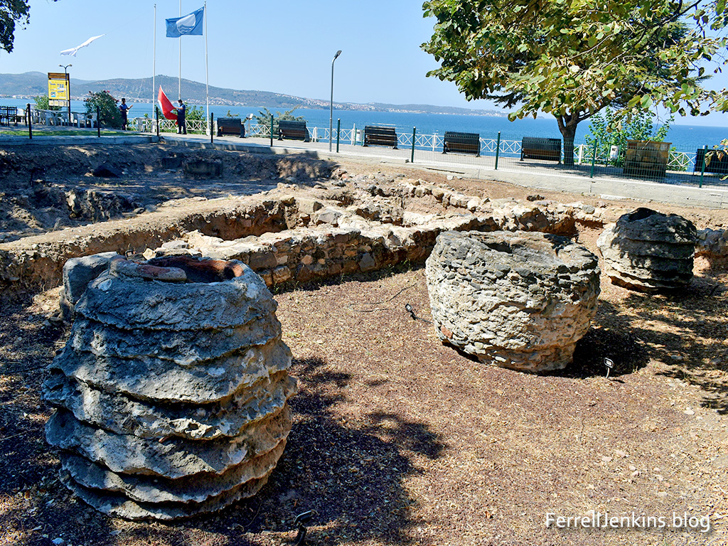 This area of excavation is under some large trees causing
the dark spots in some places.
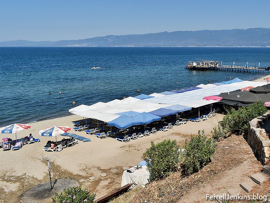
The next photo shows the beautiful beach at Ören.
Source: Williams, Mark. Biblical Turkey. 4th ed., Yayinlari, 2020, pp. 185-87.
Posted in Apostle Paul, Archaeology, Bible Lands, Bible Places, Bible Study, Book of Acts, New Testament, Photography, Travel, Turkey
About AD 560 the church at Madaba, now in Jordan, decided they needed a map in their building. They could not order one from their Bible class publisher, so they made a large Mosaic map on the floor of the building. This map was rediscovered in the 1880s.
Madaba was known as the Ammonite city of Medeba in Joshua 13:9,16 and Isaiah 15:2.
For now I wish to share a photo of a surviving portion showing the Jordan River flowing into the Dead Sea.
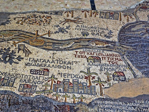
I understand the designer of the map to be saying that the fish of the Jordan River could not survive in the Salt Sea. This portion of the map also shows Jericho, the city of Palm trees (Deuteronomy 34:3; 2 Chronicles 28:15).
Posted in Archaeology, Bible Lands, Bible Places, Bible Study, Church History, Jordan, Old Testament, Travel
The areas of Turkey that have been hit by the 7.8 earthquake are along the East Anatolian Fault. It has been my pleasure to visit many of these cities: Gaziantep, Karaman, and Antakya. Also Aleppo in northern Syria. The areas around Antakya might include the other historical sites of Tel Tayinat and Tel Alalak.
Did you knowthat Antakya was part of Syria until about 1935 when it was annexed as part of Turkey? Antaka is the location of the New Testament site of Antioch of Syria. This was a city where Paul, Peter, and Barnabas worked, and where the disciples of Jesus were first call Christians.
So Barnabas went to aTarsus to look for Saul,
26 and when he had found him, he brought him to Antioch. For a whole year they met with the church and taught a great many people. And in Antioch the disciples were first called aChristians.
(Acts 11:25-26 ESV)
Our photo below shows the city of Antakya built on Mount Silpius along the Orontes River.

Posted in Archaeology, Bible Lands, Bible Places, Bible Study, Israel, Old Testament, Photography, Travel
Cupbearers were important servants in the ancient Near East. In the Bible we read about the cupbearer in Egypt in the time of Joseph (Genesis 40-41). Some English translations use the term butler.
The only person mentioned by name in the Bible as a cupbearer is Nehemiah (Nehemiah 1:11).
“O Lord, let your ear be attentive to the prayer of your servant, and to the prayer of your servants who delight to fear your name, and give success to your servant today, and grant him mercy in the sight of this man. “Now I was cupbearer to the king.” (Nehemiah 1:11 ESV)”O Lord, let your ear be attentive to the prayer of your servant, and to the prayer of your servants who delight to fear your name, and give success to your servant today, and grant him mercy in the sight of this man. “Now I was cupbearer to the king.” (Nehemiah 1:11 ESV)
A source that I enjoy and use frequently is the IVP Bible Background Commentary: Old Testament. The comment about the cupbearer is brief but full of significant facts.
“The cupbearer in the ancient Near Eastern court held a very important position. He had direct access to the king and thus had great influence. Texts and reliefs describe cupbearers in Assyrian and Persian courts. The cupbearer was in close proximity to the king’s harem and thus was often a eunuch, although there is no evidence that this was the case with Nehemiah. Later sources identify the cupbearer as the wine taster. In addition he was the bearer of the signet ring and was chief financial officer.”
Have you visited the Bible Land Museum in Jerusalem? The museum is located across the parking lot from the Israel Museum. There is a separate entry fee for this smaller museum. It contains many artifact from a private collection. It is a good place to make photos that are useful in teaching the Bible. This rhyton or cup from the Persian Empire is one good example. This is likely the type of cup used by Nehemiah in his function as cupbearer to the king.

Posted in Archaeology, Bible Lands, Bible Places, Bible Study, Culture, Israel, Old Testament, Photography, Travel

You must be logged in to post a comment.