Category Archives: Photography

The Arabah (introduction)

Recently I was doing some reading in the late Denis Baly’s Geographical Companion to the Bible (1963) and decided to share his description of the Arabah (Arava in Israel).

The southern section of the Rift Valley is normally known as the Arabah, and it is, to the surprise of many people, almost as long as the section of the valley between the south end of the Dead Sea and the Lake of Galilee. A north-east-south-west upfold running across it raises the central part of the Arabah to 1,000 feet above sea-level, and then it sinks southwards again towards the Red Sea. Everywhere it is desert, save where occasional springs provide a welcome supply of water. However, historically it has had a double importance: as a trade route to the Red Sea and as a source of cooper. This is found in the dark-red Nubian sandstone which outcrops particularly on the eastern, or Edomite, side of the rift. The most important of these copper mines was at Punon (the modern Feinan), almost certainly the place where Moses raised the serpent in the wilderness (Num. 21:4-10; 33:42-43). On the western side the copper-bearing rock outcrops only in the extreme south, and is being mined today at Timna, where also it was obtained in ancient times. This is the place known to the modern tourist as “King Solomon’s Mines” (Deut. 8:9). (p. 57).

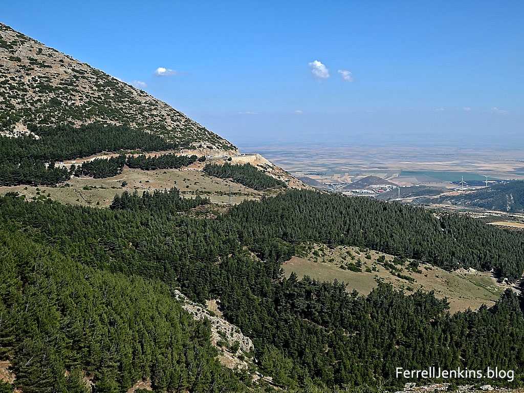
I propose in a series of posts to discuss briefly Lot’s Wife, views of the Arabah, the excavations at Tamar, Keturah, Timnah, and Eilat.

A short distance south of the southern end of the Dead Sea is a formation called Lot’s wife. While there is no historical reality to the formation being Lot’s wife it is an interesting natural formation that promotes the memory of Lot and his family. In the biblical description of the overthrow of the cities of Sodom and Gomorrah we are told,

But Lot’s wife, behind him, looked back, and she became a pillar of salt. (Genesis 19:26 ESV)

Lot's Wife, a natural formation south of the Dead Sea. Photo by Ferrell Jenkins.

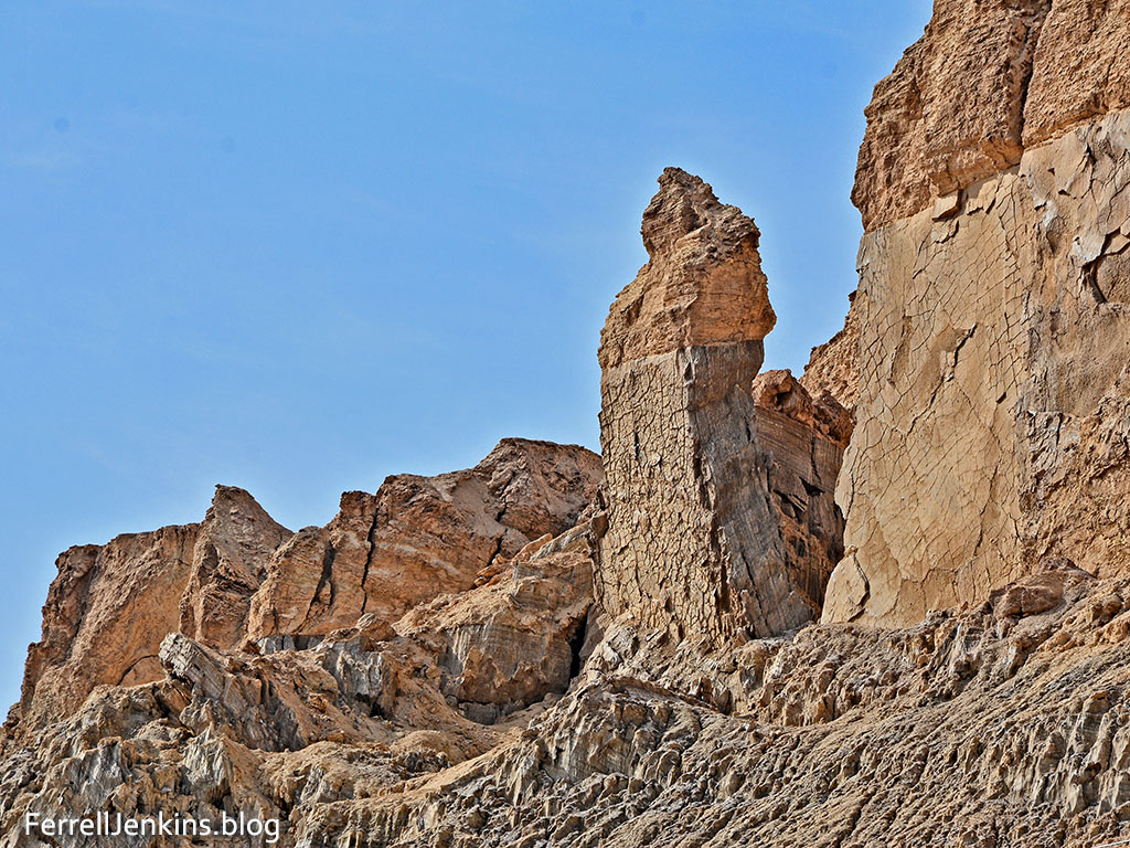
Lot’s Wife, a natural formation south of the Dead Sea. Photo by Ferrell Jenkins.

Lot’s wife stands as a perfect illustration of those who turn back from doing the will of the Lord. Even Jesus called attention to this Old Testament event.

Remember Lot’s wife. (Luke 17:32 ESV)

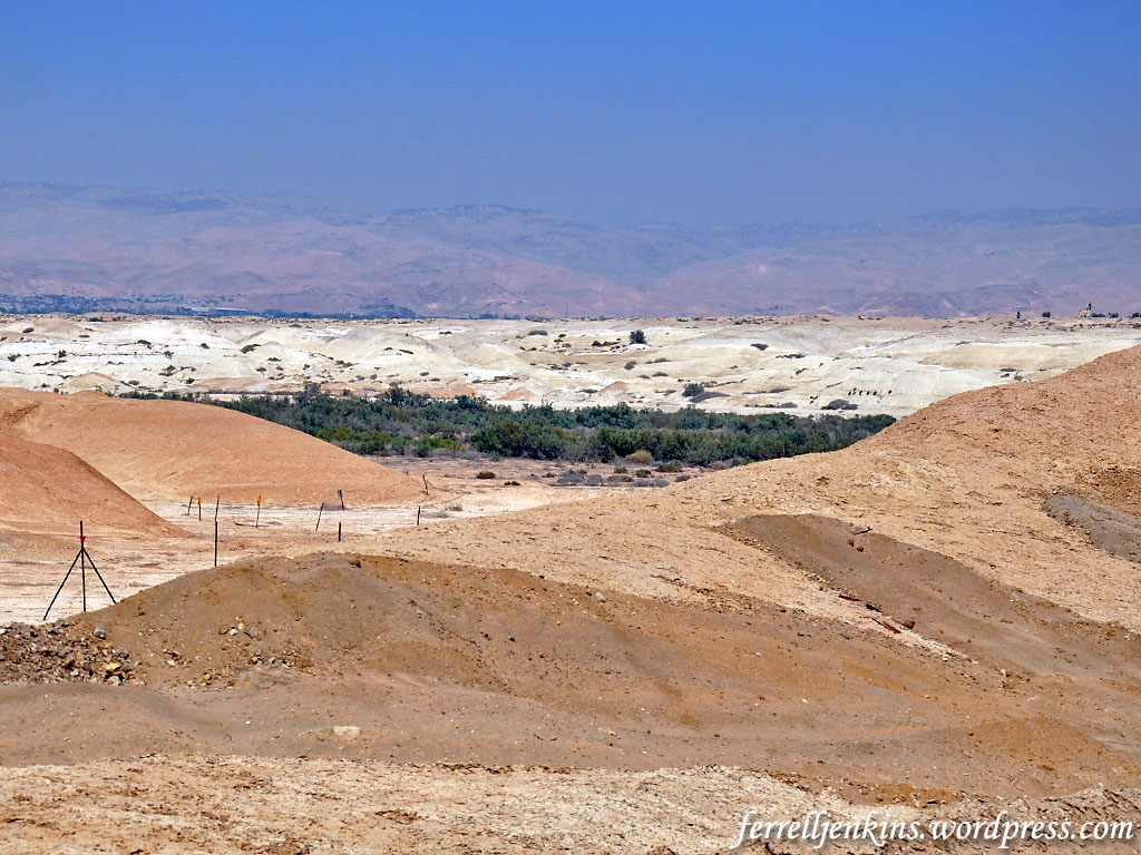
In the next post we plan to show you some of the arid terrain as we continue south in the Arabah.

Sadly, I see that neither Logos nor Accordance have Denis Baly’s The Geography of the Bible or The Geographical Companion of the Bible available.

Along the Great Rift

As I began to think about a series of articles on the Arabah (or Aravah) in Israel I realized that I should begin with a general discussion of the rift valley or, as it is sometimes called, the Great Rift.

View south from the Amanus mountains in modern Turkey. Photo by Ferrell Jenkins.

View south from the Amanus mountains in modern Turkey. In this general area Photo by Ferrell Jenkins.

If we begin in the north, the great rift begins south of the Amanus Mountains in southern Turkey, near modern Antakya (biblical Antioch of Syria, Acts 11). Antioch was built on the Orontes River, a river that flows north from Lebanon’s Bekaa Valley finally turning west and flowing into the Mediterranean. As it flows northward from its source into Syria it passes the site of Riblah (2 Kings 23:33; 25:6, et al.), and through Lebo-hamath (or the entrance of Hamath, as many English version read; 2 Kings 14:25). Hamath is located at the site of modern Hama, Syria. From there the Orontes flows north in the rift valley of Syria till it approaches the Amanus Mountains.

Going back to the Bekaa Valley between the Lebanon and Anti-Lebanon mountains, we look to the south. The rift enters Israel near Dan. Abel-beth-Maacah  (1 Kings 15) overlooks the rift from the west. Those who have traveled north of the Sea of Galilee in Israel likely have some idea about the great depression or rift in that region.

This aerial view of the Jordan valley north of the Sea of Galilee illustrates perfectly the Great Rift. Photo by Ferrell Jenkins.

This aerial view of the Jordan valley north of the Sea of Galilee illustrates perfectly the Great Rift. Photo by Ferrell Jenkins.

Running south from Israel’s northern border with Lebanon continues to the Hulah Valley, then through the Sea of Galilee where it is about 700 feet below sea level. From there it continues south in the Jordan Valley until it reaches the Dead Sea at  more than 1300 feet below sea level.

I plan to begin a series of articles dealing with the portion of the Great Rift that runs from the south end of the Dead Sea to the Gulf of Eilat (or Gulf of Aqaba in Jordan). In Israel, the rift runs from Dan to Eilat (or Elath). From Eilat the depression continues south through the Gulf of Eilat/Aqaba to the Red Sea and into eastern Africa. On our recent study trip Leon Mauldin and I traveled the entire length of the rift from Dan to Eilat.

One can easily find articles and maps explaining the great rift on the Internet, as well as explanations in many good Bible atlases. Describing the Rift Valley in Israel, Carl Rasmussen says,

This depression is part of the Rift Valley system that extends for 3,700 miles from southern Turkey into Africa. North of Israel the system continues in a northeasterly direction into the Lebanese Beqa; to the south it runs through the Red Sea and down into Africa.

In Israel proper, this depression runs from Dan in the north to the southern tip of the Dead Sea, a distance of 150 miles, and then continues south-southwest as far as Elath, a distance of 110 miles. The various sections of the Rift Valley are diverse in character; a considerable amount of rain falls in the northern section (24 in. at Dan), whereas in the south the rainfall is negligible (2 in. at the south end of the Dead Sea). The valley receives runoff water from the mountains to the west and east along its entire length. (Rasmussen, Carl G. Zondervan Atlas of the Bible. Revised Edition. Grand Rapids, MI: Zondervan, 2010. Print.)

The Gulf of Eilat/Aqaba enters the Red Sea proper at Sharm el Shekh near the tip of the Sinai. Back when the Sinai was under Israeli control I had the opportunity to visit the site. At the time Sharm el Shekh was only a place with a few cabins and a place for the adventurous to park their small trailers. It later became a popular Egyptian resort with expensive hotels. In recent years tourism has suffered due to terrorism in the vicinity.

Rusted-out gun left from the Israeli-Egyptian war in 1967. Photo made in 1973 by Ferrell Jenkins.

Rusted-out gun left from the Egyptian closure of the Straits of Tiran to Israeli shipping in 1967. Tiran island can be seen about three or four miles to the east. Photo made in 1973 by Ferrell Jenkins.

In 1967 Egypt closed the Straits of Tiran to ships delivering goods to Israel. This is generally thought to be the act that precipitated the June War of 1967.

As I began to study about the Great Rift  for the past several days I realized that I have visited all of the major area from north to south along this rift from the Amanus Mountains of Turkey through Syria, Lebanon, and Israel until it reaches the Red Sea at the tip of the Sinai peninsula.

An understanding of this rift helps the Bible student better understand many events of the Scripture.

Some recommended resources

Sale Deadline on The Book of Ruth collection

If you received the BiblePlaces Newsletter for April  a few days ago you already know about the new volume in the Photo Companion of the Bible series. This one is on The Book of Ruth. I received a complimentary advance copy and found some of this material to be helpful on the recent study trip to Jordan. I am confident that anyone studying or teaching the book of Ruth will find the material helpful. You can download the recent BiblePlaces Newsletter filled with much helpful information here.

Available through April 22 for $20.

There are 350 images in PowerPoint to illustrate the four chapters of the Book of Ruth. The collection is on sale until midnight April 22 for $20. Bolen says, “Shipping is free in the US and satisfaction is guaranteed.” Go here for ordering information. Take a look at the four volume set on the Gospels.

Appian Media Producing New Series

Our friends at Appian Media have already produced a wonderful set of high-quality videos entitled Following the Messiah. They will soon be returning to Israel to film a new series dealing what many of us call the Biblical period of the United Kingdom. The series will be called Searching for a King.

Appian Media Searching for a King

Filming for this series begins very soon.

Appian Media provides membership access to their material, and they are seeking donations to assist in the work. See details here. Some videos are available for viewing on the website.

A New Video on Lachish

Lachish: The Epic Unearthed, a 48 minute video about the history and excavations of the biblical city of Lachish has been produced by Dr. Robert Henry and Rachel Martin. Henry summarizes the film:

This documentary brings you into the exciting world of Biblical Archaeology as it reveals the history of one of the largest Old Testament cities and tells the story of the volunteers who dig it up. This epic story reveals the turbulent warfare of the first temple period of Biblical history, the discoveries that expand the Biblical narrative and the impact this experience had on the people who came to Israel to dig. Watch as these determined volunteers unearth a Biblical land mark that hasn’t been touched in over two thousand five hundred years.

The video features comments by Prof. Yosef Garfinkle and Prof. Michael Hasel, directors of the fourth excavation at Lachish, as well as interviews with some of those working on the dig including my friend Luke Chandler.

Some viewers will be unfamiliar with the pronunciation of such sites as Lachish and Azekah. Instead of Lake-ish and ah-ZECK-ah, you will hear LAH-KISH and AZ-e-kah, pronunciations more common in Israel.

I am thankful to have provided a few of my aerial photographs for the video. Henry and Martin encourage you to use this video in your teaching and for personal study free of charge.

Walking the Bible Lands with Dr. Wayne Stiles

Wayne Stiles, whose web site we have mentioned several times, is now developing a video series called Walking the Bible Lands. This is old hat for Wayne who had been traveling to the Bible lands, teaching and writing about them for many years.

Wayne’s new material is available on a membership arrangement. Detailed information is available at his Walking the Bible Lands website here. You will find some samples there.

Welcome to ferrelljenkins.blog

The change is so subtle that you probably didn’t even notice that the address bar or location line now reads https://ferrelljenkins.blog/.

Anyone who can spell Will Ferrell and Florence Foster Jenkins can handle ferrelljenkins.

Our first post was dated May 2, 2007. This is now our 1984th post. Admittedly some of the posts are insignificant  (like this one). But I think that many of the posts continue to be helpful to Bible students and teachers who are searching for information, and photos, of Bible lands and customs.

You may ask, “Why did you change the domain, and if it is important why did you not do it sooner.” Here are a few reasons. This blog has been hosted free of charge by WordPress all these years. For a long time there were no advertisements appearing with the blog, but lately that has changed. I can’t blame WordPress. The company wants to make a profit. To do so they sell services including ads for the blogs they host. Sometimes these ads showed up in the right column. Others showed up at the bottom of a post. I noticed them especially when searching for a particular subject such as Bethlehem or shepherds (just examples). Some ads were innocuous, but others promoted viewpoints that I do not hold or approve.

WordPress has been peppering me with Emails advertising new URL’s. The hundreds of photos that have appeared here and the tremendous cost to procure them have been covered exclusively by me. It is true that I do license a few photos for various publishers, but this would not pay for my flight from Tampa to New York, let along to Israel, Jordan, Turkey, Egypt, or Greece, to mention a few of the places we have traveled to study and make photos.

ferrelljenkins.blog

It takes a lot of travel and work to prepare Ferrell’s Travel Blog.

No complaint. I consider this work part of my service to the LORD and His servants who want to enhance their understanding of the Bible.

Those who have followed the blog for any length of time have undoubtedly noticed that my posts have been few and far between in the past two or three years. This is due to some health issues in my family. Often I prepare photos for presentation but never get around to writing the information to accompany them. Not promising, but I do hope to do better in the months to come.

Many thanks to our faithful readers. Will you do me a favor? Send an Email to a few friends and encourage them to follow this blog. This means they will be notified each time we post something. The blank to fill in to be added to the list is near the top of the right column.

By the way, if you have a link or bookmark to the old URL it will still work, but change it for future use.

Traveling through the Wilderness of Zin

Yesterday we traveled from Eilat to Jerusalem with stops at Mitzpe Ramon, Avedat, and Ein Avedat.

The ancient Israelites wandered in the wilderness of Zin (Numbers 33:36), an area that included Kadesh Barnea and was the southern boundary for the tribe of Judah.

The land allotted to the tribe of Judah by its clans reached to the border of Edom, to the Wilderness of Zin in the Negev far to the south. (Joshua 15:1 NET)

We enjoyed a burger at the McDonald’s at Avedat, an important town along the Nabatean spice route between Petra and Gaza. Having been at Petra a few days earlier made this stop especially interesting.

We walked to the cold water pool at Ein Avedat. As we drove to that area we stopped to make some photos of the wadi. Most wadis have less greenery, but this one receives some water from the spring. During the rainy season water would be rushing through it in abundance.

This photo shows a wadi in the wilderness of Zin at Ein Avedat. Photo by Ferrell Jenkins.

This photo shows a wadi in the wilderness of Zin at Ein Avedat. Photo by Ferrell Jenkins.

Scenes such as this must have been especially refreshing to the ancient Israelites.


Traveling in Jordan again

For the past week I have been traveling in Jordan with long-time traveling friend Leon Mauldin on a personal study trip. We enjoy these trips going to places that  we miss during regular tours. That is because some of the places are difficult to reach and would have little interest to the first-time traveler to the Bible Lands. It sometimes takes us half a day to locate a place and visit it.

The tourist folks in Jordan like to call their country “the other Holy Land.” Not only did Jesus visit this area but it was often the area of travel for the patriarchs, prophets, and kings of ancient Israel.

Today we visited the Jabbok River a few miles east of the Valley Road (Roman Perea) and Deir Allah. This is thought by some to be the place where Jacob met his brother Esau on the return from Padan Aram. See Genesis 32 for the full story). This photo will give you some idea of the terrain and the small river, now called the Zarka.

The Jabbok River east of the River Jordan. Near here Jacob a life-changing encounter with the LORD. Photo by Ferrell Jenkins.

The Jabbok River east of the River Jordan. Near here Jacob had a life-changing encounter with the LORD. Photo by Ferrell Jenkins.

Has the seal of Isaiah the prophet been found?

The discovery of a bulla (seal impression) possibly bearing the name of the prophet Isaiah is announced by Eilat Mazar in the current issue of Biblical Archaeology Review (44:2, March/April; May/June 2018). I am not sure if this article is available to non-members of the BAS Library, but you may try this link.

This discovery was made nearly 10 years ago in the Ophel area south of the Temple Mount. Mazar announced the discovery of a bulla bearing the inscription “Belonging to Hezekiah [son of] Ahaz king of Judah” in 2015, and we reported it here with a nice photograph of the seal impression.

Now, imagine the excitement when the researchers found the name Isaiah on a bulla. Mazar says that Isaiah was a common name, but with the possibility that this particular Isaiah is called the prophet, that is super exciting.

Just one problem. One, or possibly two letters, are missing from the word for prophet. A National Geographic article by Kristin Romey explains,

The seal is impressed in Old Hebrew script with the name Yesha‘yah[u] (the Hebrew name of Isaiah), followed by the word nvy.

Because the seal is damaged at the end of the word nvy, Mazar suggests that our reading may be incomplete. If nvy was originally followed by the Hebrew letter aleph, the result would be the word “prophet,” rendering the reading of the seal as “Belonging to Isaiah the prophet.”

Drawing by Reut Livyatan Ben-Arie of the Isaiah Bulla, a 2,700-year-old clay seal impression which potentially belonged to the biblical prophet Isaiah. (Illustration: Reut Livyatan Ben-Arie/© Eilat Mazar; Photo by Ouria Tadmor/© Eilat Mazar)

Drawing by Reut Livyatan Ben-Arie of the Isaiah Bulla, a 2,700-year-old clay seal impression which potentially belonged to the biblical prophet Isaiah. (Illustration: Reut Livyatan Ben-Arie/© Eilat Mazar; Photo by Ouria Tadmor/© Eilat Mazar)

Could this last word on the bulla be the name of the Novi family, or the name of a town (Nob, is suggested)?

The discovery of the bulla with the name of Isaiah just ten feet from the one bearing the name of Hezekiah is significant. Mazar is quoted as saying,

The names of King Hezekiah and the prophet Isaiah are mentioned in one breath 14 of the 29 times the name of Isaiah is recalled (2 Kings 19–20; Isaiah 37–39). No other figure was closer to King Hezekiah than the prophet Isaiah. (TOI)

The Trumpet has published a well-done YouTube 13 minute video that will be of interest to some readers. The article in The Trumpet contains photos and drawings of the bulla.

The article in today’s The Times of Israel contains several good photos here.

HT: Joseph I. Lauer, et al.

Clearing the landmines at Qasr al-Yahud baptism site

My first visit to the traditional site of the baptism of Jesus and the work of John the Baptist was in 1967 (see photo of the group here). After the Six Days War in June, 1967, it was not possible to visit the site until about 2011. My next visit to the site in Israel was in May, 2011. In the meanwhile I had already taken three groups to Jordan so we could visit the site, traditionally known there as Bethany Beyond the Jordan.

In May, 2011, we had to stop at this gate and wait for someone from the military to come and open the gate for the bus to enter. Photo by Ferrell Jenkins.

In May, 2011, we had to stop at this gate and wait for someone from the military to come and open the gate for the bus to enter. Photo by Ferrell Jenkins.

The expression “beyond the Jordan” in John 1:28 distinguishes this Bethany from the Bethany on the east slopes of the Mount of Olives, the home of Mary, Martha and Lazarus (cf. John 11:1). Jesus was with John “beyond the Jordan” (3:26), and went away to this region prior to his final work in Judea (10:40). The Greek word for beyond is peran, from which comes the geographical term Perea. Perea was on the east side of the Jordan River.

The NKJV follows late manuscripts in the reading Bethabara. There are textual variants on this point, but the earliest and best reading is Bethany in John 1:28.

One reason for the long delay in opening the site in Israel was that it was in a military area. Much of the area had been filled with landmines and anti-tank mines after the 1967 war to prevent Jordanian tanks from crossing it.

Seven churches had been constructed in the area during the British Mandate period in the 1930s. A drone video included in the The Times of Israel article (link below) shows ruins of the Franciscan Compound, the Ethiopian Church, the Syrian Church, and the Romanian Church. Greek Orthodox pilgrims were already allowed to visit the baptism site to celebrate Epiphany.

Now, the HALO Trust fund has begun raising money to rid the area of mines. The TOI article says the Israel Defense Ministry contributed funds as well.

I call the Jordan a shy river that seldom shows itself. One can drive through the Jordan Valley from Tiberias to the Dead Sea and rarely get a glimpse of this famous River. That is because of the depth of the Jordan Valley and the growth along the banks of the River.

The River no longer floods the valley as it once did, and it is no longer as wide as it once was. This is because the water is now being used by both Israel and Jordan for agriculture and to provide drinking water for the growing population.

A view to the north of the Jordan River at Qasr al-Yahud. Photo by Ferrell Jenkins.

A view of the Jordan River to the north at Qasr al-Yahud. At this point the river is about 405 meters (1330 feet) below sea level. Photo by Ferrell Jenkins.

As we leave the River we stop to look back across the Ghor (depression) to the Zor (the thicket, shown as the green line) where the River flows. This is the view slightly north of the baptism site.

This photo shows the east side of the Jordan River in the foreground, the Ghor (depression) of the Jordan River, the Zor (thicket), the land of Perea on the east side of the Jordan and the mountains of Ammon. Photo by Ferrell Jenkins.

This photo shows the west side of the Jordan River in the foreground, the Ghor (depression) of the Jordan River, the Zor (thicket), the land of Perea on the east side of the Jordan, and the mountains of Transjordan in the haze. Photo by Ferrell Jenkins.

Barb wire and signs warn the adventurous from wandering off the dirt road leading back to Highway 90.

This is one of the signs warning of the landmines. We also see these in certain area of the Golan Heights. Photo by Ferrell Jenkins.

This is one of the signs warning of the landmines. We also see these in certain areas of the Golan Heights. Photo by Ferrell Jenkins.

Here are links to two recent articles from Israeli papers that I have enjoyed.

  • “Christian Pilgrims From Across the World Come to Israel to Visit This Site. There’s Just one Problem: It’s Sitting in a Minefield” (Haaretz).
  • “Israel will soon clear 4,000 landmines at Qasr al-Yahud baptism site” (Times of Israel).

In spite of many environmental warnings about the impurity of the water in the Jordan River at this site many groups continue to baptize there.

“I will make your enemies your footstool” – # 2

In the previous post we discussed the common motif found in the Ancient Near East showing a monarch with his foot on the neck of a subdued enemy. We discussed how this helps us visualize certain Biblical texts.

Here I wish to add an illustration from the Roman world shortly after New Testament times. In the statue below we see the Emperor Hadrian (A.D. 117-138) with his foot on the neck of an enemy.

Hadrian has his foot on the neck of an enemy. Istanbul Archaeology Museum. Photo by Ferrell Jenkins.

Hadrian has his foot on the neck of an enemy. Istanbul Archaeology Museum. Photo by Ferrell Jenkins.

This statue is displayed in the Istanbul Archaeology Museum in Istanbul, Turkey. It is made of marble and is said to have come from Hierapitna, Crete.

The photo below is a closeup of the captive with the Emperor’s foot on his neck.

Closeup of Hadrian with his foot on the neck of an enemy. Photo by Ferrell Jenkins.

Closeup of Hadrian with his foot on the neck of an enemy. Photo by Ferrell Jenkins.

In the New Testament, Peter quotes Psalm 110:1 to show that Jesus is now seated on the throne of David at the right hand of God (Acts 2:35).

The apostle Paul understood this. He said of Jesus,

For he must reign until he has put all his enemies under his feet. (1 Corinthians 15:25 ESV)

The last enemy is death (1 Corinthians 15:26).

The illustrations here and in the previous post are suitable for use in PowerPoint presentations for sermons and Bible classes. We only ask that you leave our credit line intact so others will know how to reach our material.

“I will make your enemies your footstool”

A common motif found in Ancient Near East reliefs shows a monarch placing his foot on his enemy. One illustration of this is the large relief showing the Assyrian King Tiglath-Pileser III (reigned 745-727 B.C.) with his foot on the neck of an enemy. Tiglath-Pileser III is known as Pul in the Bible.

Pul the king of Assyria came against the land, and Menahem gave Pul a thousand talents of silver, that he might help him to confirm his hold on the royal power. (2 Kings 15:19 ESV)

So the God of Israel stirred up the spirit of Pul king of Assyria, the spirit of Tiglath-pileser king of Assyria, and he took them into exile, namely, the Reubenites, the Gadites, and the half-tribe of Manasseh, and brought them to Halah, Habor, Hara, and the river Gozan, to this day. (1 Chronicles 5:26 ESV)

The Assyrian relief below is displayed in the British Museum.

Tiglath-Pileser III Subjugates an Enemy. British Museum. Photo by Ferrell Jenkins

Tiglath-Pileser III Subjugates an Enemy. Note the spear held above the body of the enemy. British Museum. Photo by Ferrell Jenkins

Here is a closeup of what we are seeking to illustrate.

Tiglath-Pileser III Puts His Foot on the Neck of an Enemy. BM. Photo by Ferrell Jenkins.

Tiglath-Pileser III Puts His Foot on the Neck of an Enemy. BM. Photo by Ferrell Jenkins.

Several biblical passages come to mind in this connection.

And when they brought those kings out to Joshua, Joshua summoned all the men of Israel and said to the chiefs of the men of war who had gone with him, “Come near; put your feet on the necks of these kings.” Then they came near and put their feet on their necks. (Joshua 10:24 ESV)

The LORD says to my Lord: “Sit at my right hand, until I make your enemies your footstool.” (Psalm 110:1 ESV)

Peter quotes Psalm 110:1 to show that Jesus is now seated on the throne of David at the right hand of God (Acts 2:35).

And Paul says,

For he must reign until he has put all his enemies under his feet. (1 Corinthians 15:25 ESV)

The last enemy is death (1 Corinthians 15:26).

Note: This post is a repeat of one we published October 21, 2011, but we have exchanged the photos for more recent ones.

In the next post we plan to show an illustration from the Roman world.