Category Archives: Old Testament

Roman Roads and Milestones

A new website devoted to Roman Roads and Milestones in Judaea/Palaestina has recently come to our attention. This site is co-sponsored by the Kinneret College on the Sea of Galilee Department of Holy Land Studies and Tel Aviv University IMC-Israeli Milestone Committee. Most readers will know that Kinneret is the Hebrew name for the Sea of Galilee. The website includes articles by the late Israel Roll and others, as well as maps showing the location of the roads. Many of the articles are in Hebrew or another language other than English. The maps, however, should be useful to those who do not read Hebrew.

The English website is available here. (If it links to the Hebrew page look in the upper left hand corner and click on EN.)

Good Bible atlases include a map of the known roadways. See, for example, the following:

  • Rasmussen, Zondervan Atlas of the Bible. Rasmussen includes a map showing the Natural Routes/Roads, and a discussion of International Routes.
  • Beitzel, The New Moody Atlas of the Bible. Beitzel includes a map showing The Roads of Palestine and a discussion of the principles back of making decisions about the roads.
  • Schlegel, Satellite Bible Atlas. The second map in this atlas shows the Regions and Routes of the Land of Israel.

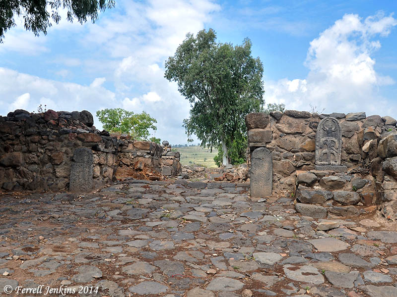
Our photo below shows remains of the Roman road that Jesus might have taken from near Nazareth to the Sea of Galilee. These roads are often in danger of destruction by careless builders and farmers.

The Roman Road near Golani Junction in Galilee. This road collected Diocaesarea (Zephoris) and Tiberias. Photo by Ferrell Jenkins.

The Roman Road near Golani Junction in Galilee. This road connected Diocaesarea (Zephoris) and Tiberias. Photo by Ferrell Jenkins.

Jesus taught His disciples about the attitude they should have toward the Roman authorities.

And if anyone forces you to go one mile, go with him two miles.(Matthew 5:41 ESV)

New Testament writers gave distances in their descriptions of travel from one city to another. Luke says that Emmaus was about seven miles from Jerusalem (Luke 24:13). John says that Bethany was about two miles from Jerusalem (John 11:18).

Milestones were common in Roman times and numerous ones have been found throughout the land of Israel. I understand that the milestone below is from the Jezreel Valley. It is one of many displayed on the grounds of the Beit-Sturman Museum near En Harod.

Roman Milestone from the Jezreel Valley. Photo by Ferrell Jenkins.

Roman Milestone from the Jezreel Valley. Photo by Ferrell Jenkins.

HT: Jack Sasson

Gaza is in the news again

After my first tour to the Bible Lands, including Rome, Greece (Athens and Corinth), Egypt, Lebanon, Syria (Damascus), Jordan, and Israel, in April/May, 1967, I decided to make a second tour the following year. For many years, I always added some new places on each tour. In 1968 I added Beersheba and Gaza. The Gaza Strip (named such because of the long, narrow size of the small entity) had been under Egyptian control for several decades until June, 1967
There was not much to see at Gaza. By the time we visited in 1968, Gaza was under Israeli control. We drove to the coast where there were only a few houses and some small fishing boats. This is one of the few slides that I have to illustrate the visit to Gaza.

Gaza on the Mediterranean Sea in May, 1968. Photo by Ferrell Jenkins.

Gaza on the Mediterranean Sea in May, 1968. Photo by Ferrell Jenkins.

Gaza is mentioned several times in the Old Testament. Here is a summary of these references.

  • Gaza was the southwestern boundary of the Canaanites in the table of Nations (Genesis 10:19).
  • The original inhabitants of Gaza were replaced by the Caphtorim, likely the ancestors of the Philistines (Deuteronomy 2:23).
  • Joshua defeated Canaanites “even as far as Gaza” (Joshua 10:41).
  • Joshua eliminated the Anakites except in Gaza, Gath, and Ashdod (Joshua 11:21-22). We recognized these cities as later belonging to the Philistines.
  • Gaza is listed as belonging to the tribe of Judah (Joshua 15:47; Judges 1:18).
  • The Midianites oppressed Israel, “as far as Gaza”, for seven years (Judges 6:4).
  • Samson had contact with the inhabitants of Gaza (Judges 16).
  • Gaza is listed as one of the five Philistine cities in the time of the Israelite Judges (1 Samuel 6:17).
  • Solomon controlled territory as far southwest as Gaza (1 Kings 4:24).
  • Hezekiah defeated the Philistines as far as Gaza and its territory (2 Kings 18:8).
  • Jeremiah makes reference to Gaza being conquered by Pharaoh (Jeremiah 47:1).
  • The prophets of Judah pronounced judgments upon Gaza (Amos 1:6-7; Zephaniah 2:4; Zechariah 9:5).

The only New Testament reference to Gaza is in Acts 8:26. Philip the evangelist was instructed to go south on the road that descends from Jerusalem to Gaza. English translators struggle with the issue of whether the city was desert, or the road leading to the city ran through a desert area. (I will leave that for some other time.)

The first display one sees as he enters the archaeology wing of the Israel Museum is that of the anthropoid coffins from Deir el-Balah, a site south of Gaza city. The coffins, excavated by Trude Dothan in 1972, bear evidence of Egyptian influence. They date to the 13th century B.C.
Anthropoid Coffins from Deir el-Balah in the Israel Museum. Photo by Ferrell Jenkins.

Anthropoid Coffins from Deir el-Balah in the Israel Museum. Photo by Ferrell Jenkins.

Reprint from January 7, 2012.

July 4th at Lachish

In the previous post I mentioned that several former students and friends are participating in the dig at Tel Lachish this year.

Six years ago on this day I wrote about Lachish on July 4th, 1980. Since we have many more readers now I think it appropriate to re-post that entry here.

— • —

On July 4, 1980, I was participating in the excavation at Tel Lachish in Israel along with three of my colleagues from Florida College (James Hodges, Phil Roberts, and Harold Tabor). There were sizable numbers of participants from Israel, United States, Australia, South Africa, and Germany. In addition to the hard work out in the sun, we had some fun. On the morning of July 4th a few of the guys got an American flag and put together a drum and bugle corp and marched across the tel. Note especially the plastic bucket being used as a drum in this photo.

"Parade" at Tel Lachish, July 4, 1980

“Parade” at Tel Lachish, July 4, 1980

Lachish is identified with Tell ed-Duweir, located in the shephelah (lowlands) of Judah about 30 miles south west of Jerusalem. It is mentioned in Scripture during the period of the conquest (Joshua 10, 12, 15). Lachish served as one of the Judean store cities during the period of the kingdom Judah. Many of the LMLK jar handles have been found here. The city fell both to the Assyrians and the Babylonians.

Excavations were carried out by the British between 1932 and 1938 under the direction of J. L. Starkey. Starkey was murdered in 1938 while en route to the opening of the Palestine Archaeological Museum (later the Rockefeller Museum) in Jerusalem. Professor Yohanan Aharoni of Tel Aviv University excavated the “Solar Shrine” in 1966 and 1968. A new excavation was begun in 1973 under the auspices of The Institute of Archaeology of Tel Aviv University and The Israel Exploration Society. Dr. David Ussishkin served as the director until 1994.

One afternoon while we were in our tented camp a short distance from the tel, a bus load of Arabs from Jordan arrived. They had once lived in the area, prior to the founding of the State of Israel. Some of the older men had worked with Starkey. This photo which I took shows four of the Arab men and three of the Israeli archaeologists, along with one American. See if you recognize Gabriel Barkay, Richard Whitaker, Adam Zertal, and David Ussishkin.

https://ferrelljenkins.blog/wp-content/uploads/2008/07/lachish_arab-visit_07-1980-t.jpg

The Arab men enjoyed seeing the old photos from the Starkey excavations and pointing out themselves as much younger men. I think you will see Ussishkin’s head to the left of the Arab, and Barkay on the right.

https://ferrelljenkins.blog/wp-content/uploads/2008/07/lachish_07-1980_arab-visit-photos-t.jpg

Update (July 6, 2008). Todd Bolen, at BiblePlaces.com has commented on this blog under the title Reminiscences of Lachish. He says he heard Gabriel Barkay tell about this event, but he includes some additional information that I did not know, including the name of the village where the Arabs previously lived.

The town of Qubeibe was leveled by the Israeli military in the 1960s and the stones of the village, probably many taken from the ruins of Lachish, were sold to building contractors.  Who knows but some ancient inscription was unknowing transferred from Lachish to Qubeibe and is now part of a wall in the area?

I recall that Richard Whitaker was the one best able to converse in Arabic.

Friends and former students at Lachish

The archaeological season is well under way at Tel Lachish. I have several friends and former students who are participating in this new expedition. Wayne Galloway has posted a few nice photos on Facebook and has given me permission to post a couple of these here.

The first photo shows an overview of section B. Wayne says,

The squares are on the right, sifted dirt and rocks removed from the squares on the left. Each special item found (ex. sling stone, arrow heads, special pottery finds, etc.) is carefully documented. Pottery is removed washed and identified, bones are kept, the location, depth, etc.

Tel Lachish, section B, 2014. Photo by Wayne Galloway.

Tel Lachish, section B, 2014. Photo by Wayne Galloway.

I understand that the group Wayne is with are working on the northern side of the tel above the well. He describes the next photo as a “Big Picture” of the square he is working in. Notice a portion of a wall that presumably will extend into the next square when it is opened.

The square where Wayne is working. Photo by Wayne Galloway.

The square where Wayne is working. Photo by Wayne Galloway.

Luke Chandler is posting additional information about the dig on his blog here.

New excavations at Tel Achziv (Achzib)

The Nelson Glueck School of Archaeology, Hebrew Union College, and the French Research Center at Jerusalem has announced the first season of an Israeli-French mission at Tel Achziv from June 29 to July 9. This announcement is from Yifat Thareani, one of the directors of the dig. (HT: Jack Sasson).

The town of Achziv (English Bibles use Achzib) is located on the Mediterranean coast of Western Galilee about 9 miles north of Acco (Akko, Acre = Ptolemais). This is in the northern portion of the Plain of Acco.

Achziv was assigned to the tribe of Asher (Joshua 19:29; Judges 1:31), but Asher was not able to drive out the Canaanite inhabitants of the land.

Asher did not drive out the inhabitants of Acco, or the inhabitants of Sidon or of Ahlab or of Achzib or of Helbah or of Aphik or of Rehob, (Judges 1:31 ESV)

Achziv remained primarily a Canaanite or Phoenician town throughout most of biblical history.

In exchange for cedar and cypress timber and gold, Solomon gave 20 cities in the land of Galilee to Hiram king of Tyre (1 Kings 9:11-13). That portion of western Galilee was called the land of Cabul. This is another indication that this region continued under the influence of the Phoenicians. King Hiram visited the cities but they did not please him.

Sennacherib, king of Assyria (704-681 B.C.), claims in the Taylor and Chicago Prisms to have conquered the cities of Sidon, the mainland city of Tyre, Achziv, and Acco.

In New Testament times Achziv was known as Ecdippa (Ekdippon) (Josephus, JW 1.257).

The map below shows the location of Acziv between Acco and the Ladder of Tyre. The Ladder of Tyre is a natural formation that has served as a border between Israel and Lebanon during many historical periods, including the present time.

Aczib on the Mediterranean coast of Western Galilee. BibleAtlas.org.

The Crusaders built a fortress at Achzib and named it Casal Imbert. The Mamluk’s captured the site in 1271, and an Arab village remained there until the War of Independence in 1948.

Achziv is built on a sandstone (kurkar) ridge overlooking the Mediterranean Sea. The remaining structures from the Arab period, now part of a National Park, are made from stones of the Crusader fortress.

Arab period structures made from stones of the Crusader fortress. The Mediterranean Sea is in view when you reach the top of the tel. Photo by Ferrell Jenkins.

Arab period structures made from stones of the Crusader fortress. The Mediterranean Sea is in view when you reach the top of the tel. Photo by Ferrell Jenkins.

This photo was made from Tel Achziv looking north to Rosh Hanikra and the Ladder of Tyre, a distance of about 4 miles.

The view north from Tel Achziv to Rosh Hanikra. Photo by Ferrell Jenkins.

Some artifacts from Achziv are exhibited in the Hecht Museum in Haifa.

The City Gate − Heart of the Ancient City

The site of et-Tell, thought by some to be the location of New Testament Bethsaida, has provided more evidence of being Old Testament Geshur, or a town of Geshur.

Maacah, one of David’s wives, was the daughter of Talmai king of Geshur (2 Samuel 3:3). Absalom, son of David and Maacah, stayed at Geshur for three years (2 Samuel 13:37-38).

Our photo shows the city gate of this Iron Age city. A sign in the courtyard says,

This is the heart of the ancient town. Here the public activities of the city took place. It was the center of commercial, judicial, and religious life.

And it includes a fitting text that illustrates the importance of the gate in a Biblical city.

Now David was sitting between the two gates, and the watchman went up to the roof of the gate by the wall… (2 Samuel 18:24 ESV)

The Iron Age city gate at a town of Geshur. Photo by Ferrell Jenkins.

The Iron Age city gate at a town of Geshur. Photo by Ferrell Jenkins.

Notice the plain standing stones on either side of the gate. And notice the stylized figure of a horned bull on the right of the gate. The image is said to represent an Aramean (Syrian) god. There is a Biblical reference to such an image in 2 Kings 23:8.

For more information see these posts:


Using an animal skin churn

The practice of churning to make butter has been around for thousands of years. It is mentioned in the Wisdom Literature of the Bible.

For the churning of milk produces butter, And pressing the nose brings forth blood; So the churning of anger produces strife. (Proverbs 30:33 NAU)

The ESV consistently uses the word pressing, from the Hebrew mits, three times in that verse.

For pressing milk produces curds, pressing the nose produces blood, and pressing anger produces strife. (Proverbs 30:33 ESV)

The NET Bible probably best conveys the meaning of the text by the use of churning, punching, and stirring up.

For as the churning of milk produces butter and as punching the nose produces blood, so stirring up anger produces strife. (Proverbs 30:33 NET)

The photo below shows a churn made of an animal skin in the reconstructed first century kitchen at Nazareth Village. I remember from childhood that we kept our churn on the hearth near the fire.

A churn in the kitchen. Nazareth Village. Photo by Ferrell Jenkins.

A churn in the kitchen. Nazareth Village. Photo by Ferrell Jenkins.

Don’t “churn” anyone in the nose today.

The shepherd and the sheepfold

One may visit an ancient biblical site without sensing the reality of people living at the place. One sees only the foundation of ancient buildings. But when one visits Nazareth Village he sees real people acting out the common activities of Bible times.

I have visited Nazareth Village several times and it is always different. It may be because of the time of the year, but sometimes it is because there are different actors filling the various roles. No two visits have been the same. This photo of the shepherd with sheep in the sheepfold was made in May, 2010. Look carefully at the sheep between the sticks of which the sheepfold is made.

Shepherd and sheep fold at Nazareth Village. Photo by Ferrell Jenkins.

Shepherd and sheep fold at Nazareth Village. Photo by Ferrell Jenkins.

There are several biblical references to the sheepfold, or the fold of the sheep (Jeremiah 50:6; Micah 2:12; John 10:1, 16). Jesus used an illustration involving the sheepfold:

Truly, truly, I say to you, he who does not enter the sheepfold by the door but climbs in by another way, that man is a thief and a robber. But he who enters by the door is the shepherd of the sheep. (John 10:1-2 ESV)

Archaeologist pushes for a park at Carchemish

The ancient site of Carchemish (modern Karkamiş in Turkey) was identified by George Smith in 1876, and later excavated by the British Museum beginning in 1911. The various directors included Hogarth, Thompson, Wooley, and Lawrence. Many remains of Assyrian and Neo-Hittite periods were uncovered.

Carchemish is mentioned only a few times in the Bible, but it was one of the most significant cities in the ancient Bible world.

  • Isaiah made a reference to Carchemish (Isaiah 10:9). The city had been sacked by Sargon II in 717 B.C.
  • Pharaoh Necho of Egypt went up to Carchemish on the Euphrates to assist the Assyrians against the Babylonians in 609 B.C. (2 Chronicles 35:20; Jeremiah 46:2). King Josiah of Judah tried to stop him, but was killed.

One of the Babylonian Chronicles says that Nebuchadnezzar “crossed the river to go against the Egyptian army which lay in Carchemish.”

The tell (mound) at Carchemish consists of a smaller high mound and a larger lower mound. Hazor, in Israel, would be a similar site. The first photo shows the higher mound which is immediately north of the Turkish border with Syria. The Turkish military is making use of the tell. On the left side of the tell, above the trees you will see a blue metal structure. That is the bridge crossing the Euphrates River. Part of the ancient city is now within Syria. On the right side of the photo above the lower trees you will see portions of ancient walls.

Carchemish is now used by the Turkish military. Photo by Ferrell Jenkins.

Carchemish is now used by the Turkish military. Photo by Ferrell Jenkins.

Professor Nicola Marchetti of Bologna University in Italy has been heading a new excavation on the lower tell. Last year Marchetti announced plans to build a new archaeological park at Karkamiş. Monday he made a new call for the opening of the park and a museum to display artifacts from the site.

He said establishing an archaeology park in the ancient city would draw many tourists to the region.

The most important areas in the excavations are a lower palace and a lower city, which they had unearthed two years ago, and there were two temples in this area, said Marchetti, adding the most important stage of the excavations would be finished this year.

See the article in Hurriyet Daily News here. (HT: Bible Places Blog).

A few weeks ago we were able to get close to the ancient site, but was not able to visit the excavation. In the photo below you will see a military tank on top of the lower tell near the recent excavations. The high tell is immediately to the left.

Lower tell of Carchemish. Photo by Ferrell Jenkins.

Lower tell of Carchemish. Photo by Ferrell Jenkins.


Mark Wilson speaks to group in Antalya

Dr. Mark Wilson shared a meal with us at the hotel one evening in Antalya, Turkey. After dinner Mark spoke to the group about his work in Turkey. He is the founder and director of the Asia Minor Research Center, and spends most of each year working and doing research in Turkey. He has updated several of the works of Sir William M. Ramsay, and written several helpful books on the book of Revelation. You will find much helpful material by Dr. Wilson on the Seven Church Network web site.

Our tour group heard a brief preview of the presentation Dr. Wilson plans for one of the upcoming annual professional biblical studies meetings in San Diego, California. He has been working on discovering the projected route of Paul’s Second Journey in Anatolia based on the biblical text, known roads, milestones, etc. from the first century. This was ideal for our group who had just completed a tour visiting all of the sites associated with Paul’s First Journey in Anatolia (modern Turkey).

Dr. Mark Wilson speaks about the route of Paul's second journey. Photo by Ferrell Jenkins.

Dr. Mark Wilson speaks about the route of Paul’s second journey in Anatolia to a tour group in Antalya, Turkey. Photo by Ferrell Jenkins.

We were pleased to see Dr. Wilson’s book, Biblical Turkey: A Guide to Jewish and Christian Sites of Asia Minor, available in many of the museum books stores including the Istanbul Archaeological Museum. Many of our tour members who did not already have a copy of the book got one from Mark after the presentation. You may purchase a copy from Amazon by clicking on the title above.

Tour members were delighted to have their book autographed by the author.

Dr. Wilson autographs a copy of Biblical Turkey for Stacy. Photo by Ferrell Jenkins.

Dr. Wilson autographs a copy of Biblical Turkey for Stacy. Photo by Ferrell Jenkins.