Category Archives: Israel

Ramoth in Gilead

Ramoth in Gilead (or Ramoth-gilead) was a town in Gilead that was included in the territory of the Israelite tribe of Gad in Transjordan (Joshua 20:8). It was one of the Levitical cities of refuge for the Israelites (Joshua 21:38). The most memorable associated with Ramoth-gilead recorded in the Bible is the battle with Aram (Syria) in which Ahab was killed (1 Kings 22). Elijah sent one of the sons of the prophets to Ramoth-gilead to anoint Jehu as king of Israel (2 Kings 9:1).

The identity of Ramoth-gilead is uncertain. Two sites are frequently mentioned by scholars: Tall ar-Rumeith and Ar-Ramtha.

Burton MacDonald, in East of the Jordan, says,

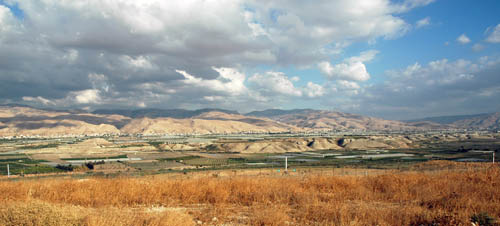
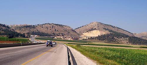
There is also archaeological support for choosing Tall ar-Rumeith, situated in the fertile plain area just to the southeast of the junction of the ‘Amman-Damascus and Irbid-Mafraq highways, as the location for Ramothgilead. (page 200)

Paul Lapp excavated at Tall ar-Rumeith in 1967. Little archaeological work has been done at Ar-Ramtha. I have not gone into the Jordanian city of Ramtha, but understand that the mound is covered by the town, thus making it difficult to conduct an excavation.

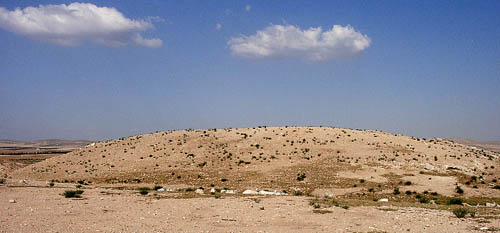
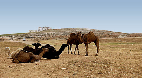
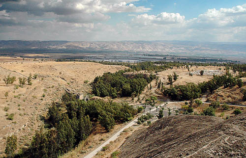
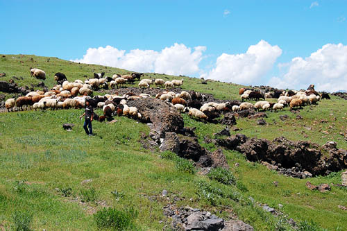
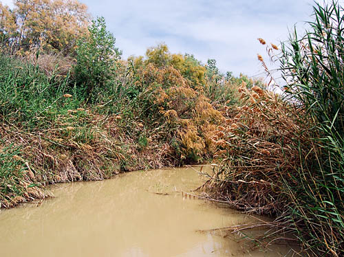
Here is a photo I made at Tall ar-Rumeith in 2002. It is not surprising to see camels here because the desert is near (to the east). From the top of the tell there is a great view looking north across a fertile plain to the border with Syria.

Earlier this year I went back to the site, but found that some modern housing has been built adjacent to the east side of the tell. It appears to be serving as housing for Indian students. I speculate that they attend a nearby university.

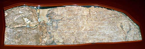
This photo shows a modern trench made to make a road to part of the construction site.

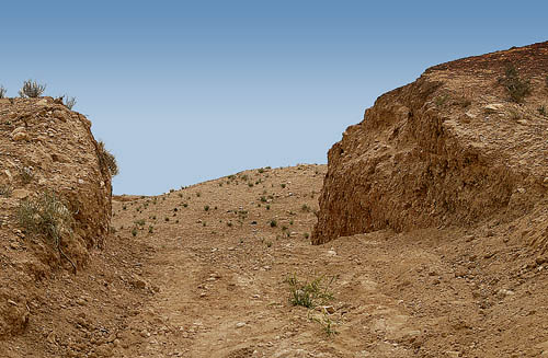
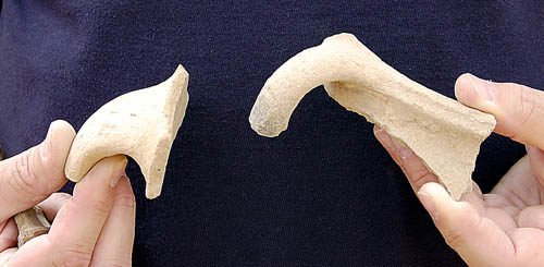
We found some pottery in the road, but can not be certain that it came from the damage to the tell. I did not see any shards along the edge of the cut.

This illustrates a real problem associated with ancient sites in isolated places. In a place like Jordan there are so many sites that it is impossible to excavate, preserve, and guard all of them.

A note on spelling. You may note different spellings of the word describing an archaeological mound. In Israel the term Tel is used. Earlier the term Tell was used throughout the Middle East. In Jordan the term Tall has come into common use.

There is also much variation in the spelling of some of the compound biblical names in scholarly sources, and even in English translation of the Bible. This is illustrated in this post and the previous one on Bethshan.

Bethshan – Bet She’an

Bethshan is mentioned only a few times in the Old Testament. The New American Standard Bible uses the following spellings for this town: Beth-shean; Beth-shan; Bethshan. Today the modern town and ancient site go by the name Bet-She’an. The site was important because of its location at a major junction of two valleys, the Jordan valley with the Jezreel valley. The tell, called Tell el-Husn or Tel Bet She’an, commands an impressive view of the area, including a great view of the land of Gilead.

Today I am preparing a class dealing with the account of the eastern tribes building an altar “in the region of the Jordan which is in the land of Canaan” (Joshua 22:10). While looking for some photos to illustrate this episode in the history of Israel I thought of the view from the tell of Bethshan. We do not know the exact location, but this view provides a wonderful view of the land of Gilead (now in Jordan) which was given to Gad and Manasseh. You will observe trees below the tell. This is the where the River Harod flows, continuing down to the Jordan. You will notice ruins of a bridge that once crossed the river.

“You cows of Bashan”

Amos of Tekoa is recognized as a straight forward, no nonsense, prophet (Amos 1:1). He called the women of the northern kingdom of Israel cows. Nothing politically correct about that.

Hear this word, you cows of Bashan who are on the mountain of Samaria, Who oppress the poor, who crush the needy, Who say to your husbands, “Bring now, that we may drink!” (Amos 4:1)

The sn (study note) in the NET Bible is worth reading.

The expression cows of Bashan is used by the prophet to address the wealthy women of Samaria, who demand that their husbands satisfy their cravings. The derogatory language perhaps suggests that they, like the livestock of Bashan, were well fed, ironically in preparation for the coming slaughter. This phrase is sometimes cited to critique the book’s view of women.

Bashan is in the area we now call the Golan Heights. It is located to the east of the Sea of Galilee and northward. Golan in Bashan was one of the cities of refuge located in the territory of eastern Manasseh (Joshua 20:8). The region was noted as good pasture land.

In the modern state of Israel we notice an attempt to grow crops known from biblical times in the same area where they were grown then. And the same is true of cattle. Here is a photo I made this year of some of the cows grazing in ancient Bashan (modern Golan Heights).

Another kind of Poppy

A few days ago I posted a photo of some poppies in Turkey and included the term anemone with it here. Reader J. P. Van de Griessen, of the Netherlands, informed us that he thinks that this is the “Papaver rhoeas or family of it.” I do not have much knowledge about plants, but I had noticed that the poppies in Turkey were a bit different from the ones I have seen in Israel and Jordan in the spring of the year. J. P. has a section of his blog dealing with flora. Even if you can not read the Dutch you might be able to make a suitable translation using the Google language tools.

In the past three trips to Israel, with good digital equipment, I have not seen many poppies growing. In past visits, earlier in the year, we have seen entire fields colored with them. Here is a photo of some poppies among the ruins at Jerash in Jordan.

I understand this to be the anemone. Dr. David Darom, in Beautiful Plants of the Bible, calls it the common poppy (Papaver sp.). One Wikipedia article indicates that there are more than 150 varieties of the poppy. Darom links this plant with the “lilies of the field” mentioned by Jesus.

And why are you worried about clothing? Observe how the lilies of the field grow; they do not toil nor do they spin, yet I say to you that not even Solomon in all his glory clothed himself like one of these. “But if God so clothes the grass of the field, which is alive today and tomorrow is thrown into the furnace, will He not much more clothe you? You of little faith! (Matthew 6:28-30)

The UBS Fauna and Flora of the Bible comments on the New Testament word krinon:

It is used by Jesus in the Sermon on the Mount, when he says: ‘Even Solomon in all his glory was not arrayed like one of these.’ Most commentators now think of the Anemone coronaria, the anemone with beautiful bright colours which is to be found on the hills of Galilee, where it would undoubtedly have been seen by the people listening to Jesus. (page 135)

Thanks, J.P. Any other help will be appreciated.

Speaking of poppies. In Turkey, another type of poppy is legally cultivated. On the outskirts of Yalvac (near Pisidian Antioch of Acts 14), I have seen cultivated fields of white poppies along the road. Under U. S. pressure, Turkey outlawed the growing of poppies in 1971. By 1974 they were allowing them to be grown under strict government control. Government factories convert the dried stems into poppy-straw concentrate (PSC) and then into morphine and codeine (See “The Poppy,” National Geographic, Feb., 1985, pp. 143-189). Here is a photo I made last year. I trust that I will not be charged with possession of a poppy photo!

From the mountains of Ararat to the island called Patmos

Or, from Genesis to Revelation. I did not make an intentional plan to do so, but within the past twelve months I have visited areas of the Bible world, from the mountains of Ararat to the island of Patmos. What a blessing to have the opportunity to spend about four weeks in Turkey, covering most of the sites mentioned in the Bible, about 10 days in Greece, more than a week in Israel, and a week in Jordan.

This means that I have been able to visit some of the most significant portions of the Bible world. Better than visiting the area alone, I have been able to share the area with other teachers (both men and women) who will be incorporating this information into their lessons for years to come.

When I first reflected on the past year and realized that I had been to Mount Ararat, in the mountains of Ararat, and on the Island of Patmos, I realized that this covers from Genesis 6 to the book of Revelation. Of course, this doesn’t mean that I have visited every place in between, but it does give a sense of comprehensive overview.

Here are a couple of photos I trust you will find helpful. The first is of a shepherd with his sheep in the mountains of Ararat. Remember that the book of Genesis records that Noah’s ark rested “upon the mountains of Ararat” (Genesis 8:4).

This photo was made at the entry to the cave of the Apocalypse on “the island called Patmos” (Revelation 1:9). John was exiled here during the reign of the Roman emperor Domitian. Whether the book of Revelation was written on Patmos, or after John’s release, we can not say with certainty. The mosaic over the entry to the cave shows John dictating the revelation given to him by the Lord.

It is my conviction that Bible land travel can enhance one’s Bible study and improve one’s understanding of the text. This, in turn, needs to be converted to action in obedience to the will of the Lord, and in service to Him.

More tourists visiting Israel

Todd Bolen of BiblePlaces is now in Israel with a student group. He calls attention to this news item:

The Ministry of Tourism reports that 290,000 tourists visited Israel in April 2008, an amount similar to that recorded in Israel’s record-breaking tourism year, 2000.

The totals for this past April were 26% over April 2006, as well as 41% more than April 2007, when tourism was still negatively affected by the Second Lebanon War eight months earlier.

Annual Rate Up 43%
During the first four months of 2008, 936,000 tourists arrived in Israel – an increase of 43% from the same period in 2007, and 34% more than the same period in 2006.

The current pace of growth is consistent with Tourism Ministry goals to attract 2.8 million tourists to Israel this year. However, Tourism Ministry Director General Sha’ul Tzemach says that this blessing places in bold relief the increasing shortage of available guest rooms in Israel.

“The current number of guest rooms does not match future demands,” Tzemach said. The Ministry hopes to attract 5 million tourists in 2012. “We hope to build another 2,500 rooms within three years, and to increase the budget for building hotels and assisting local and foreign entrepreneurs who have recently shown great interest in investing in the Israeli hotel industry.”

For the full report click here.

When we were there in April, we could see the increase over 2006. We did not see quite as many Americans, but there were more tourists. Hotel space is difficult to get, and I hear that hotel prices are going up. Sort of like oil; the more they sell, the higher they price it!

Significant biblical artfacts in the Istanbul Museum

My favorite place in Istanbul is the Archaeological Museum. There are several buildings. One contains items from the Ancient Orient, that is, from Mesopotamia, Assyria, Babylon, and a collection of Hittite items. Another has numerous items from the Greco-Roman world. On the third floor artifacts from Syria, Palestine, Lebanon, and Cyprus, are displayed.

The Ottoman Empire controlled Palestine in from the 16th to the 20th centuries. The earliest archaeology in Palestine was done at Megiddo, Tanaach, and Gezer. Since the Turks were in charge, many of the artifacts were brought to Istanbul. These items have not always been easy to see. Once or twice, in past years, I had to made a “donation” to the museum in order to get in room where these items are exhibited. Even now, it is difficult (for older visitors) because there are no elevators going to the third floor.

There is not time now to mention all of these items. However, I am pleased to share with you what I consider an unusually good photo made without a tripod and special lighting. It is the famous Siloam Inscription. We sometimes call its the Hezekiah;s tunnel inscription.

This inscription was cut from Hezekiah’s tunnel in Jerusalem shortly after it was discovered in 1880. The tunnel was built to connect Gihon Spring with the Pool of Siloam (ca. 710 B.C.; 2 Kings 20:20; 2 Chronicles 32:30; cf. John 9:7). Palestine was part of the Turkish empire at the time of the discovery and this is how the inscription came to be in Istanbul. The inscription, written in the ancient Hebrew script, describes the completion of the tunnel when the workers met near the middle on the last day of work. It reads, in part:

while there were still three cubits to be cut through, (there was heard) the voice of a man calling to his fellow, for there was an overlap in the rock on the right (and on the left). And when the tunnel was driven through, the quarrymen hewed (the rock), each man toward his fellow, axe against axe; and the water flowed from the spring toward the reservoir for 1,200 cubits, and the height of the rock above the head(s) of the quarrymen was 100 cubits. (Ancient Near Eastern Texts 321)

I have walked through Hezekiah’s tunnel several times and have seen the place from which the inscription was taken.

Pictures of Adam?

The title could be misleading. It could be like all of those drawings showing John the Baptist pouring water over the head of Jesus. The Adam we speak of is a place mentioned in the account of the Israelite crossing of the Jordan River.

the waters which were flowing down from above stood and rose up in one heap, a great distance away at Adam, the city that is beside Zarethan; and those which were flowing down toward the sea of the Arabah, the Salt Sea, were completely cut off. So the people crossed opposite Jericho. (Joshua 3:16)

Our fellow-blogger over at Aantekeningen bij de Bijbel in the Netherlands asks,

Do you have also pictures from the Jordan in the neighbourhood of Adam? The place where the Jordan was halted for some time?

To my knowledge It is not possible to approach the Jordan except an area between the Sea of Galilee and Beth-shan, and at Bethany Beyond the Jordan. Photos are not allowed at the various military check points.

The best I can do is to show you a photo I made in November of 2005. This photo is looking east toward the mountains of Gilead. I think the rift to the right of the middle of the photo is the Jabbok Valley. Adam would be located somewhere to the right in this photo. If some other reader can be more specific I would be happy to know.

The fence in the foreground of the photo is the boundary between Israel (West Bank area) and Jordan. I often describe the Jordan River as being shy. All along the Jordan Rift, one only sees the River at a place or two. The Jordan flows in the green area in the bottom of the rift. All of the white horizontal lines in the photo are hot houses use for growing agricultural produce.

The Jordan River

The distance from the principal source of the Jordan at the foot of Mt. Hermon to the northern end of the Dead Sea is about 135 miles, but the serpent-like Jordan flows over 200 miles. At the source, the elevation is about 1150 feet above sea level. By the time the river reaches the Sea of Galilee it is about 700 feet below sea level, and when it reaches the Dead Sea it is more than 1300 feet below sea level. These and other unusual physical characteristics make the Jordan a significant river. To the Bible student the importance of the river is found in the events which transpired in it.

Israel crosses the Jordan. The children of Israel crossed the Jordan when the water was out of all its banks during the time of harvest (Josh. 3:15). An American reader might think of this as the fall of the year, but actually it was in the spring, at the time of the latter rain (Joel 2:23). As spring approached in Bible times the Jordan would overflow its banks due to the heavy latter rains (about early April) and the melting snows of Mount Hermon. Conditions are different in modern times. Water that once flowed south from the Sea of Galilee and from tributaries such as the Yarmuk River is now used for irrigation. This makes the Jordan much smaller than in earlier times. The crossing of the Jordan by the Israelites provided the imagery for our hymn, “On Jordan’s Stormy Banks I Stand.”

Elijah and Elisha. Both of these oral prophets crossed the Jordan on dry ground prior to Elijah=s being taken up by a whirlwind into heaven. Elisha later used the mantle of Elijah which had fallen upon him to smite the Jordan so that he was able to return (2 Kings 2:8-14).

Naaman the leper. Naaman, captain of the army of the king of Aram, was told by the prophet Elisha to wash seven times in the Jordan to be cleansed of his leprosy. For a reason not explicitly given, Naaman complained that the Abanah and Pharpar, the rivers of Damascus, were better than all the waters of Israel. When he eventually obeyed the Lord, he was made clean (2 Kings 5:1-14). We understand that it was not in the properties of the water but by the power of the Lord that Naaman was made clean through his obedience.

John and Jesus. John immersed in the Jordan River (Mt. 3:1-6). The last important biblical event and the crowning glory of the Jordan was the baptism of Jesus (Mt. 3:13-17).

Photographs of the Jordan south of the Sea of Galilee have been difficult to make since 1967 because the river has served, more or less, as the boundary between Israel (or the occupied West Bank) and Jordan. This photograph was made at the site across from Jericho that may be identified as “Bethany beyond the Jordan” (John 1:28), where John the Baptist baptized at first (John 10:40).

The first attempt on the life of Jesus

Nazareth is located in the hills of Lower Galilee, where the elevation is about 2000 feet above sea level. These hills lie on the north side of the Valley of Jezreel (Esraelon, or Megiddo).

In this photo some of the buildings of upper Nazareth can be seen to the left. The hill on the right, with the scaring from quarrying, is popularly called the hill of precipitation. If this is correct, and we have no certain evidence, then this would be the the hill spoken of in Luke’s account of Jesus speaking in the synagogue at Nazareth.

And they rose up and drove him out of the town and brought him to the brow of the hill on which their town was built, so that they could throw him down the cliff. (Luke 4:29, ESV)

A synagogue, similar to the one that might have existed in Nazareth during the time of Jesus, has been built at the Nazareth Village. The photo shows the view from the door of the synagogue. The hill of precipitation can be seen. Jesus was brought up in a small town that was located near the heart of all important travel through the land of Israel (Canaan, Palestine).