Category Archives: Bible Study

Camel caravans carry merchandise and people

Traveling in the Sinai Peninsula is an interesting experience. I recall flying into the Sinai twice, and traveling through the Peninsula by bus or car twice. Thoughts immediately turn to the Israelites traversing this wilderness, stopping at Mount Sinai to receive “the Law of Moses, which the LORD God of Israel” gave to them (Ezra 7:6).

The caravan traveling here in the eastern Sinai is not carrying merchandise, but is on its way to the resort area of the Gulf of Eilat (or Aqaba). The camels seem to be ready with their saddles to entice the tourists to ride. The little camels are ready for the kids.

Camel caravan in the Eastern Sinai Peninsula. Photo by Ferrell Jenkins.

Camel caravan in the Eastern Sinai Peninsula. Photo by Ferrell Jenkins.

Several Biblical stories come to mind. Think of Rachel coming from Padan-Aram to southern Canaan to wed Isaac.

And Rebekah lifted up her eyes, and when she saw Isaac, she dismounted from the camel (Genesis 24:64 ESV)

Or of the sons of Jacob preparing to sell Joseph to a band of Ismaelites.

Then they sat down to eat. And looking up they saw a caravan of Ishmaelites coming from Gilead, with their camels bearing gum, balm, and myrrh, on their way to carry it down to Egypt. (Genesis 37:25 ESV)

At Avedat in the Negev Highlands of Israel there is a display of the types of goods often transported across the Spice Route by the Nabateans.

Frankincense, Myrrh, and other spices were transported by camel caravans across the famous Spice Route. Photo by Ferrell Jenkins.

Frankincense, Myrrh, Pepper, and other spices were transported by camel caravans across the famous Spice Route. Photo by Ferrell Jenkins.

The stork in the Bible and the Bible Lands

Early in my travels to the Middle East I learned about the migration of the stork. They spend the winters in south-east Africa and then follow the great rift or depression through Israel, some going east to Asia and others going west to Europe. In the fall of the year they make their way back to Africa.

If you have traveled from Tiberias to Jericho by way of the Jordan valley you know that the valley is sometimes far below the highway. Once I saw a flock of storks traveling north through the valley. The stork, and other birds, spend some time in the Hulah valley north of the Sea of Galilee before continuing their trek.

Jeremiah seems to be describing the migratory habits of the stork.

Even the stork in the heavens knows her times, and the turtledove, swallow, and crane keep the time of their coming, but my people know not the rules of the LORD. (Jeremiah 8:7 ESV)

I have seen many storks in Turkey. They make their nests on chimneys (has to be summer!), on power poles, and on old columns. The Psalmist indicates that they also nest in the fir trees (Psalm 104:17). Our photo today was made near an old Roman road at Kovanlik, Turkey. It’s almost like they know to follow the roads through Asia to Europe.

A stork standing on her nest at Kovanlik, Turkey. Photo by Ferrell Jenkins.

A stork standing on her nest at Kovanlik, Turkey. Photo by Ferrell Jenkins.

According to the Mosaic law the stork was an unclean bird (Leviticus 11:19; Deuteronomy 14:18). The prophet Zechariah uses the movement of the storks with their strong wings as an illustration (which I dare not try to interpret).

Then I lifted my eyes and saw, and behold, two women coming forward! The wind was in their wings. They had wings like the wings of a stork, and they lifted up the basket between earth and heaven. (Zechariah 5:9 ESV)

The Keren Kayemeth Leisrael JNF website provides good information about storks, and other birds, in the Hulah valley here. Here is another nice site with information about storks and some good photos.

Improved look of the Holy Sepulchre edicule

The dome of the Holy Sepulcher (Sepulchre) is easily recognizable to all visitors of the Old City of Jerusalem. It is the larger of two gray domes seen in the photo below. The smaller dome marks the traditional site of Calvary, the place where Jesus was crucified. The Church of the Holy Sepulcher was built by the Roman Emperor Constantine after his mother Helena visited Jerusalem. Murphy-O’Connor dates the dedication of the building to September 17, 335.

The aerial photo below shows Jaffa Gate at the bottom center. The Citadel is in the bottom right. The traditional Holy Sepulchre (larger gray dome) and the site of Calvary (smaller gray dome) are visible in the upper left corner of the photo. Evidence leads us to conclude that the Holy Sepulchre was outside the city wall at the time of Jesus. The Old City is now enclosed by a 16th century A.D. Ottoman (Turkish) wall.

Aerial view of Jaffa Gate. Photo by Ferrell Jenkins.

Aerial view of Jaffa Gate area. Photo by Ferrell Jenkins.

An edicule or small building within the church is said to cover the tomb in which Jesus was laid after the crucifixion, that is, the tomb of Joseph of Arimathea (Matthew 27:57-60). The photo below shows some of the metal scaffolding used to secure the structure in recent years.

For years it was known that the structure needed to be repaired. Finally, someone donated $1.3 million dollars to be sure the work could begin.

A view of the edicule with scaffolding to hold it up prior to the recent reconstruction work. Photo by Ferrell Jenkins.

A view of the edicule with scaffolding to hold it up prior to the recent reconstruction work. Photo by Ferrell Jenkins.

Below is the photo I made in late April, 2017.

A view of the edicule in late April, 2017, after the refurbishing. Photo by Ferrell Jenkins.

A view of the edicule in late April, 2017, after the refurbishing. Multitudes line up daily to have an opportunity to go inside for a moment. Photo by Ferrell Jenkins.

Only a few people saw the area of the original tomb during the renovation. Again the original tomb is covered by stone. The Franciscan Museum in the Old City of Jerusalem has a model to show what the original tomb looked like.

Photo by Ferrell Jenkins.

Cross section model of the tomb at the Holy Sepulchre in the Franciscan Museum, Jerusalem. Photo by Ferrell Jenkins.

Jerome Murphy-O’Connor, the late Catholic scholar, asks the question, “Is this the place where Christ died and was buried?” He answers, “Yes, very probably.”

But Murphy-O’Connor also describes vividly the situation one finds today.

One expects the central shrine of Christendom to stand out in majestic isolation, but anonymous buildings cling to it like barnacles. One looks for numinous light, but it is dark and cramped. One hopes for peace, but the ear is assailed by a cacophony of warring chants. One desires holiness, only to encounter a jealous possessiveness: the six groups of occupants—Latin Catholics, Greek Orthodox, Armenian Orthodox, Syrians, Copts, Ethiopians—watch one another suspiciously for any infringement of rights. The frailty of humanity is nowhere more apparent than here; it epitomizes the human condition. The empty who come to be filled will leave desolate, those who permit the church to question them may begin to understand why hundreds of thousands thought it worthwhile to risk death or slavery in order to pray here. (The Holy Land, 5th Ed., p. 49).

Our faith in the resurrected Christ does not depend on the actual tomb in which He was placed after being taken down from the cross. It depends rather on the testimony of those reliable witnesses who saw Him after the resurrection. Luke reports that eyewitness testimony (Luke 1:1-4). Here is what he says the women who went to the tomb on the first day of the week were told when they found the empty tomb.

He is not here, but has risen. Remember how he told you, while he was still in Galilee,  that the Son of Man must be delivered into the hands of sinful men and be crucified and on the third day rise.” (Luke 24:6-7 ESV)

Did Philip baptize the Ethiopian at ’Ain ed-Dirweh?

Note: This post replaces one from June 22 which was taken down when I learned that I had incorrectly equated two obscure places that should not have been. You will need to read this entire post to get the correct story.

Though the Bible does not specify a place, scholars and religious leaders like to point out possible places where significant events transpired. Such has been true of the place where Philip baptized the government official from Ethiopia (Acts 8:26-39).

One reader asked if this really matters. Those of us who believe in the accuracy of the Bible look for the land and the Book to agree. I think in this instance we have several possible places where the baptism could have taken place.

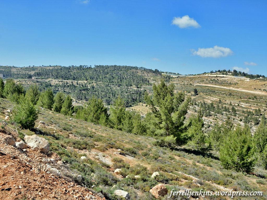
Ain el-Haniyeh (see here) in the Rephaim Valley is not the only place suggested as the location of the baptism of the Ethiopian eunuch. In fact, Baedeker’s Palestine and Syria, 4th ed., 1906, says,

The tradition that Ain el-Haniyeh was the spring in which Philip baptized the Eunuch of Ethiopia (Acts viii. 36) dates from 1483, before which the scene of that event was placed near Hebron.

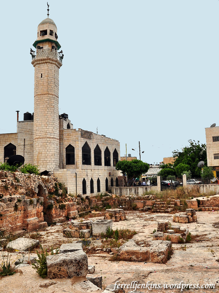
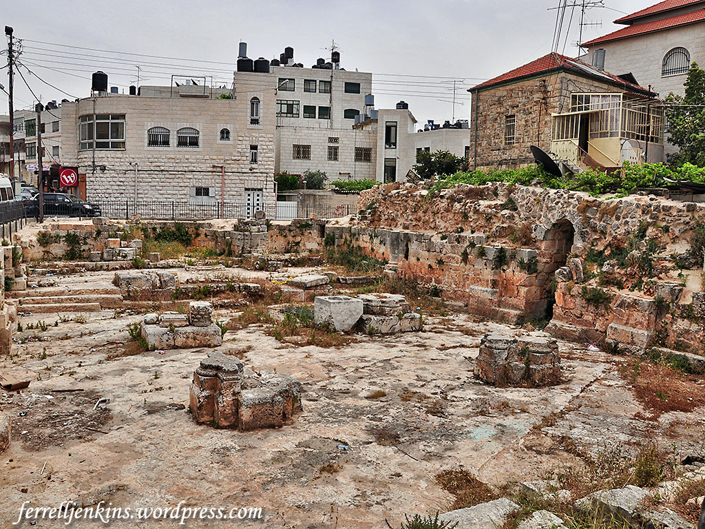
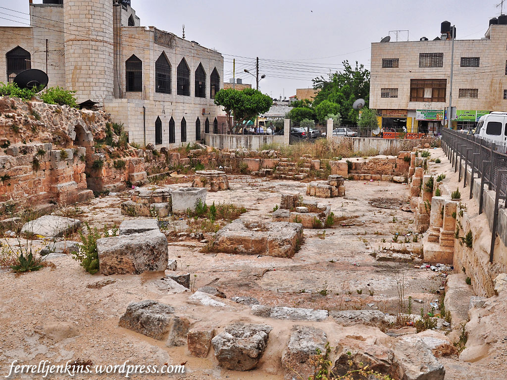
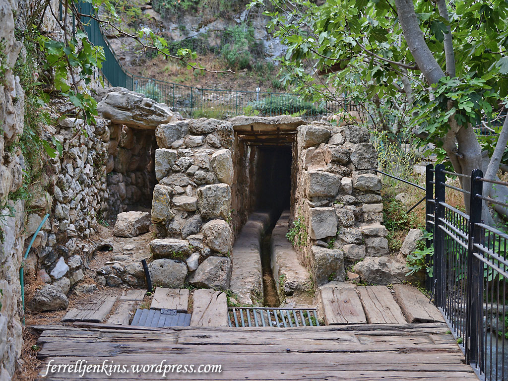
The place near Hebron is known as ’Ain ed-Dirweh. My only visit there was in 1979, but it has been associated with Philip’s work since the early Christian centuries. After visiting Bethlehem, The Bordeaux Pilgrim (A.D. 333) went to “Bethasora” (footnote: Bethzur, Beit Sur) where, he says,

There is the fountain in which Philip baptized the eunuch

Baedeker says,

… we reach the spring of ‘Ain ed-Dirweh, above which are a Mohammedan house and a praying-place. In the time of Eusebius [of Caesarea; c. 265 – c. 339] the spring in which Philip baptized the eunuch was pointed out here (comp. p. 93), and it is so marked on the mosaic map of Madeba. The traces of an ancient Christian church were formerly visible.

The Madaba Map (also spelled Madeba or Medeba), dated between about A.D. 560 and 565, provides a glimpse into the understanding of the Christians of that time about the location of certain biblical events.

Here I cite the information from the Franciscan Cyberspot’s The Madaba Mosaic Map web site. The map shows “a conventional church” and a “disk circled in black with a yellow centre. It is the basin related to the inscription.”

The inscription, above the letters OYDA (ouda, in Iouda = Judah), is translated as follows:

The (church) of Saint Philip, where they say that the eunuch Candaces was baptized.

Go to the Discussion page here and read the comments by various scholars who have examined the matter. I note that some (e.g. Avi-Yonah) suggest that the makers of the map are expressing doubt about the place of the event in the 6th century A.D. by writing “where they say.”

The portion of the Madaba Map (late 6th century A.D.) showing Bethsora [Bethzur) in Judah). Photo by Ferrell Jenkins.

The portion of the Madaba Map (late 6th century A.D.) showing Bethsora and the place where it was said that Philip baptized the eunuch of Candace. Photo by Ferrell Jenkins.

To the left of the church building you will see the Greek for the word BETHSURA. This site is often identified with the Beth-zur of Joshua 15:58. Eusebius referred to it as Bethsoro. The 
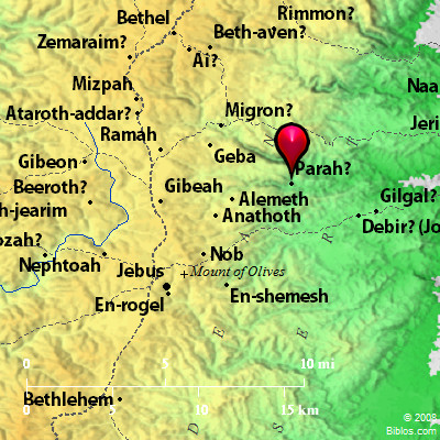
Survey of Western Palestine has Bt. Sur. These two places, Bethsura and ’Ain edh-Dhirweh, are essentially the same.

Portion of Survey of Western Palestine map. Courtesty of BiblePlaces.com.

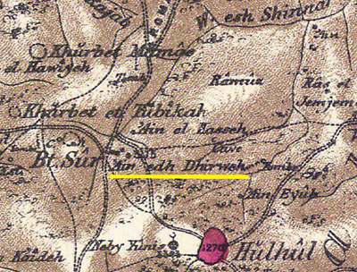
Portion of Survey of Western Palestine map showing Bt. Sur and ‘Ain edh Dhirweh. Courtesty of BiblePlaces.com.

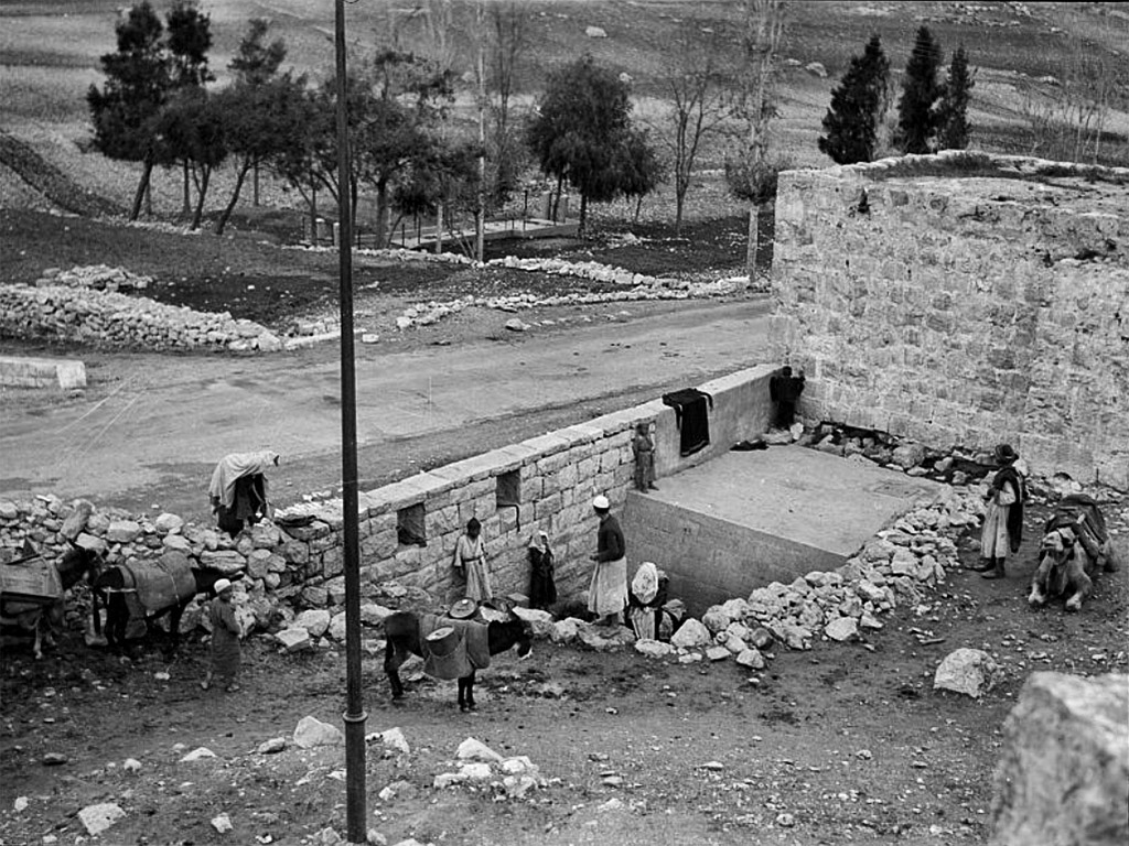
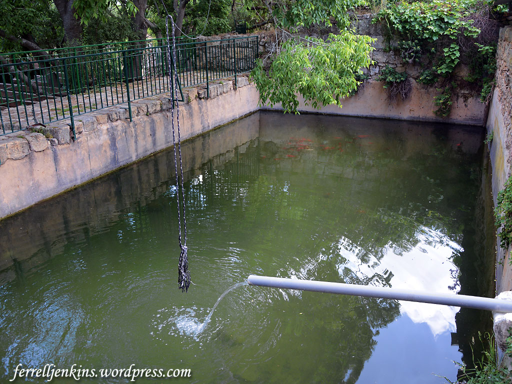
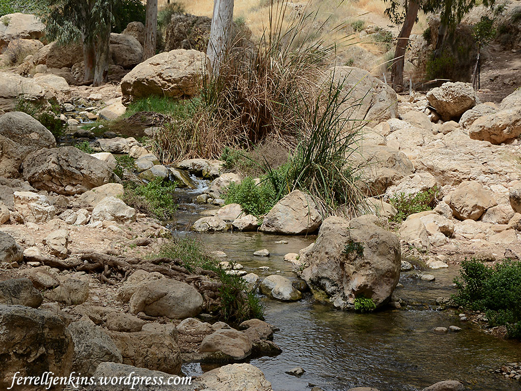
The famous Matson Photograph Collection includes at least two photos of Ein el-Dirweh. The first one was made between 1934 and 1939.

Ein el-Dirweh, Philips Fountain at it looked between 1934 and 1939. Matson Photographic Collection now in the Library of Congress.

Ein el-Dirweh, Philips Fountain as it looked between 1934 and 1939. Matson Photographic Collection now in the Library of Congress.

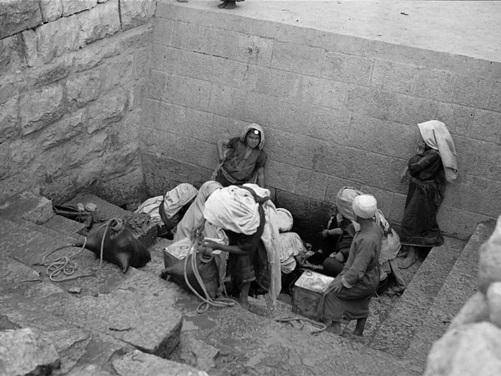
In the next photo we see those who have brought containers to get water for their homes. Notice on the top step where containers are placed there are two water skins being used to collect water. These photos can be enlarged by clicking on them, and even larger images are available on the web site. Go to https://www.loc.gov/ and search for Philips fountain.

Ein el-Direh, Philips Fountain, at it looked between 1934 and 1939. Matson Photographic Collection, now in the Library of Congress.

Ein el-Dirweh, Philips Fountain, at it looked between 1934 and 1939. Matson Photographic Collection, now in the Library of Congress.

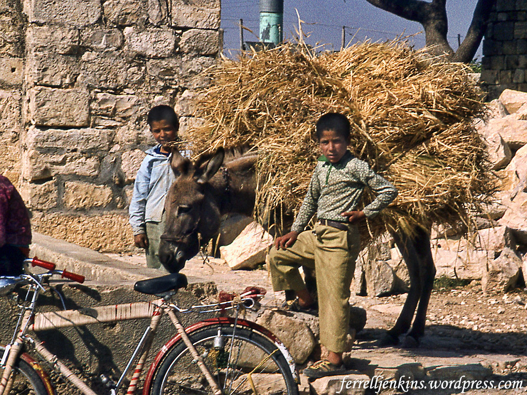
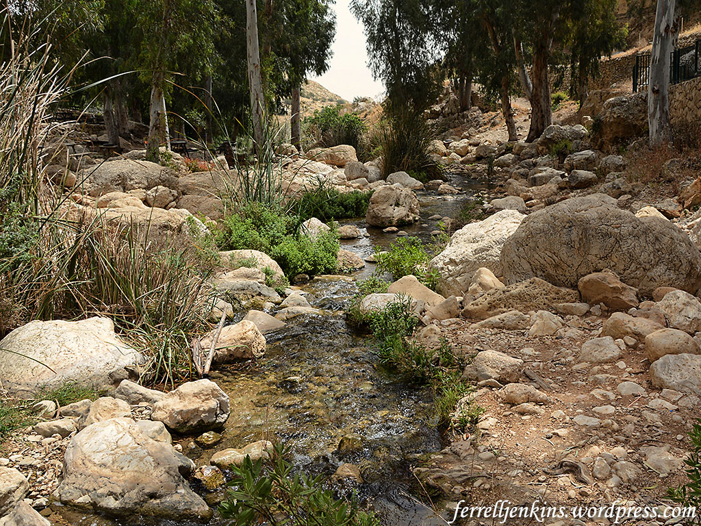
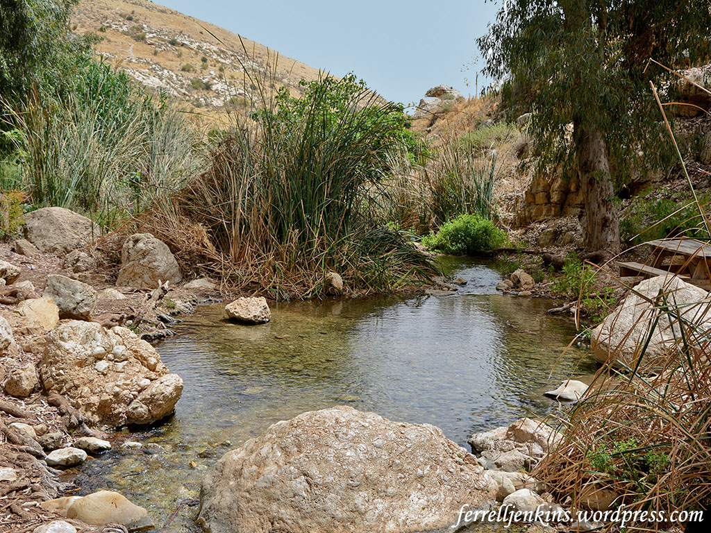
And finally, here is a photo I made in 1979. At the time there was very little water in the pool, but it seemed to be a good place for boys to stop on their way home. The site was so unimpressive to me that I never returned.

Philips Fountain between Bethlehem and Hebron in 1979. Photo by Ferrell Jenkins.

Philips Fountain between Bethlehem and Hebron in 1979. Photo by Ferrell Jenkins.

We still do not know the answer to the question, “Where did Philip baptize the Ethiopian Eunuch?,” but this is an older tradition than the site at Ain el-Haniyeh.

Rasmussen, in his Zondervan Atlas of the Bible, says,

The site of this event is difficult to locate precisely, but since the Ethiopian was riding in a chariot it seems that he must have been traveling on a developed road. It may be that he was traveling on the road that led from Bethlehem to the Valley of Elah, the route that David had taken when he carried supplies to his brothers (1 Sam 17) and the one that the Romans eventually paved and marked with milestones. This road led south from the Valley of Elah through the low rolling hills of the Shephelah to Betogabris and continued from there west to Gaza. (p. 217)

On a modern Israeli road from Bethlehem to the Valley of Elah this would be highway 375.

Notley cites Eusebius, but thinks it is unlikely that Philip continued as far south as Beth-zur. He says,

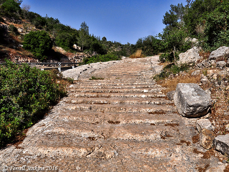
Southwest of Bethlehem the ancient route divides. The watershed route continues to Beth-zur and Hebron, while a western spur follows the Hushah ridge and descends into the Elah Valley (Wadi es-Samt). The Romans paved this descent and evidence of these efforts can still be seen in steps cut into the Judean hills. (Rainey and Notley. The Sacred Bridge: Carta’s Atlas of the Biblical World, p. 371).

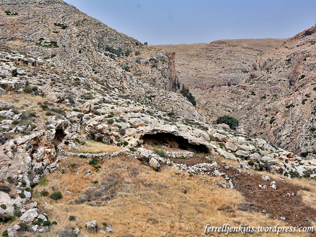
The photo here shows the steps along the road cut into the rock near the Elah Valley. Just a personal thought. I think one might prefer to get out of a chariot and walk down the steps instead of remaining in the chariot.

Roman Road 4.2 km W of Mata on Hwy 375. S of Hwy. Photo by Ferrell Jenkins.

Roman Road 4.2 km W of Mata on Hwy 375. S of Hwy. Photo by Ferrell Jenkins.

Notley thinks the baptism may have taken place at one of the numerous springs in the Elah Valley before Philip and the Ethiopian separated to take different routes, Philip to Azotus and the Ethiopian to Gaza and beyond.

And there are other suggestions, but I will leave those for your own study.

A note about spelling. One difficulty in searching for information about some of these ancient places is the various spellings we find. Even in this article I have used ’Ayn ed-Dirweh and Ein el-Dirweh. The Franciscan website uses ’Ayn al-Dhirwah and ’Ain Dhirwe. Hachetts’s The Middle East uses Ain Dirweh. Vilnay uses Ein Dirwa. The Survey of Western Palestine uses ’Ain edh Dhirweh. And on and on it goes.

Sources. There are helpful ways you can access the old, detailed maps included in the Survey of Western Palestine. (1) Buy your own digitized set from Life in the Holy Land. (2) Use the information collected on Ancient Locations here.

Thanks to Tom Powers for many helpful hints in the production of this post. Some of his work may be accessed at his View From Jerusalem website. I keep a link to it at the site listed below under Blogs.

At the BiblicalStudies.info Scholarly page, under Map of Bible Lands, I keep a list of various maps that are helpful.

Where had Mary and Joseph stopped when they missed Jesus?

After his presentation in the Temple, there is no record of Jesus returning to Jerusalem until he is 12 years of age.

Now his parents went to Jerusalem every year at the Feast of the Passover.  And when he was twelve years old, they went up according to custom.  (Luke 2:41-42 ESV)

When the Feast of the Passover ended, his parents began the return to Nazareth. We can easily imagine that a large caravan of people were traveling together on this trip that would take several days. Jesus stayed behind in Jerusalem spending time among the teachers, “listening to them and asking them questions.” Because Mary and Joseph had relatives and acquaintances in the caravan they assumed that Jesus was among them until the end of the first day.

Keener provides some background on caravan travel.

Caravans, which afforded protection from robbers, were common on pilgrimages for the feasts in Jerusalem. Traveling with a caravan, in which neighbors from their town would watch the community children together, Mary and Joseph might assume that the near-adult Jesus was with companions, especially if by now they had younger children to attend to. If we assume a pace of twenty miles per day (though perhaps slower, depending on transportation and the children), Nazareth would be a little over three days’ journey along the shortest route. (Keener, C. S., The IVP Bible background commentary: New Testament)

Where did Mary and Joseph stop at the end of that first day of travel? We can not be certain of the route taken from Jerusalem to Nazareth. Travel from Galilee to Jerusalem was often through Perea on the eastern side of the Jordan Valley. We later find Jesus traveling north along the central mountain range through Samaria (John 4).

Ruins of medieval church beneath a Mosque in El Bireh. Photo by Ferrell Jenkins.

Ruins of medieval church beneath a Mosque in El Bireh. Photo by Ferrell Jenkins.

Tradition identifies the stop at el-Bireh (El Bira). Tradition has it that the first day’s stop after leaving Jerusalem was at a place now known as El Bira (or Bireh) east of Ramallah. El Bira is an Arab town. There is a spring and ruins of a medieval church. The Hachette World Guides: The Middle East (1966) says that the tradition associating this event with El Bireh dates to the 16th century. Eugene Hoade says it is probable that this church was built in 1146 “in memory of” the event mentioned in Luke 2. (Guide to the Holy Land). The apse of the church is visible in the photo below. The Hachette World Guide says the building was destroyed in 1915 and the stones were used for building bridges along the mountain route.

Ruins of medieval church beneath a Mosque in El Bireh. Photo by Ferrell Jenkins.

Ruins of medieval church beneath a Mosque in El Bireh. Photo by Ferrell Jenkins.

This site is only about 8 miles north of Jerusalem, but with a large caravan including women and children it is possible that a short distance was covered the first day. It was necessary to stop where water and various food supplies were available (John 4:6-8; Luke 9:51-53).

View of the ruins of the church at El Bireh. The apse is visible in the foreground. Photo by Ferrell Jenkins.

View of the ruins of the church at El Bireh. The apse is visible in the foreground. Photo by Ferrell Jenkins.

Is this Beeroth? Since the time of explorer Edward Robinson (1867), some scholars have identified El Bireh with the Old Testament Gibeonite city of Beeroth. The word Beeroth indicates the presence of a well. Biblical references include Joshua 9:17, 18:25, Ezra 2:25, and Nehemiah 7:29. Beeroth was considered part of the tribe of Benjamin (2 Samuel 4:2).

The late David Dorsey, after surveying the scholarship on the matter, says,

At present, therefore, the site of biblical Beeroth remains a matter of dispute. The most likely candidate would still seem to be the one originally proposed by Robinson, i.e., el-Bireh. (The Anchor Yale Bible Dictionary)

Where did Philip baptize the Ethiopian eunuch?

Note of Correction

In the comments below by Outremer (Tom Powers) you will see that I made a mistake in equating Ein Yael and Ein El-Haniyeh. I could see a difference in my photos and the site pictured in the video or the drawings in Thomson, The Land and the Book, but I thought the passing of time might have made the difference. I also misunderstood the statement by Vamosh that the spring was “just past the entrance to the Ein Yael Living Museum.” I understood it to mean that the spring was in that park.

Well, this is embarrassing. Under some circumstances I could delete the post, but about 2500 individuals receive an Email every time I post.

Tom’s comments also involve political matters that I understand, but for the purpose of this blog prefer not to go into. I write primarily for a group of Christians who study the Bible, but who have little knowledge of the Bible lands and customs. This blog tries to bridge that gap. Of course, I am always delighted when others find the material useful.

One of the “Must see” places for my next visit to Israel is to see Ein El-Haniyeh!

— The Original Article —

One of the “Must see” places I had on my list during the last visit to Israel was a site called Philip’s Fountain or Philip’s Spring. Miriam Feinberg Vamosh describes the location.

The spring is located about one mile southwest of the entrance to the Rephaim Valley portion of Jerusalem Park, just past the entrance to the Ein Yael Living Museum. The Rephaim Valley is mentioned frequently in the Bible, as one of the borders of the tribe of Judah (Josh. 15:5) and the scene of a battle between David and the Philistines (2 Sam. 5:17–22). (www.haaretz.com, tourist tip #302; the page is no longer available online)

The entrance to Ein Yael, there the spring and pool is located. Photo by Ferrell Jenkins.

The entrance to Ein Yael, where the spring and pool are located. Photo by Ferrell Jenkins.

Just before we entered the park, as well as from the park, we had some nice views of the Rephaim Valley. The northeastern end of the valley (on our left) ends at approximately the northern end of the Valley of Hinnom.

A view of the Rephaim Valley from near the entry of Ein Yael park. Photo by Ferrell Jenkins.

A view of the Rephaim Valley from near the entry of Ein Yael park. Photo by Ferrell Jenkins.

Vamosh continues,

The New Testament site of Philip’s Spring, known in Arabic as Ein El-Haniyeh is here as well, in this southern portion of the park. It is located at the foot of the Palestinian village of Walajeh, whose people have been tilling the ancient terraces in this area for generations.

She says Christian pilgrims have been coming to Ein el-Haniyeh to recall the story recorded in Luke’s history of the early church. In Acts 8:26-39 we learn that Philip, one of the seven [deacons] who had been chosen to care for the needy disciples in Jerusalem later went to Samaria to preach (Acts 8:5). After what many preachers call a successful “work” in Samaria he was returning to Jerusalem.

Now an angel of the Lord said to Philip, “Rise and go toward the south to the road that goes down from Jerusalem to Gaza.” This is a desert place. (Act 8:26 ESV)

Whether the road itself ran through a deserted area, or the destination was at that time deserted is a matter of discussion among scholars.

The spring begins from the hillside above the Rephaim Valley. Today the water is diverted to for use in the park, but you can see a channel through which some of it flows to a nearby pool. Photo by Ferrell Jenkins.

The spring begins from the hillside above the Rephaim Valley. Today the water is diverted for use in the park, but you can see a channel through which some of it flows to a nearby pool. Photo by Ferrell Jenkins.

It is true that the Rephaim Valley was used as one of the main entries to Jerusalem from the coastal area, but was this where the court official of the Ethiopian queen said, “See, here is water! What prevents me from being baptized?” (Act 8:36 ESV).

Our next photo show an old pool where water from the spring is collected. Some goldfish can be seen in the far end of the pool. In spite of a nearby “Swimming is Prohibited” sign in three languages, the rope hanging over the pool indicates that boys still use it was for swimming on occasion.

Some identify the pool here as Philip's Fountain, the site where Philip immersed the Ethiopian. Photo by Ferrell Jenkins.

Some identify the pool here as Philip’s Fountain, the site where Philip immersed the Ethiopian. Photo by Ferrell Jenkins.

A nice YouTube video here shows the site prior to the development of the park, with a cameo appearance by Shimon Gibson. In it you may see the pool in its original state.

William M. Thomson, in his The Land and the Book, mentions this site and says that it was identified “by monkish legend St. Philip’s Fountain, where he baptized the Ethiopian eunuch.” Thomson includes a drawing of ruins resembling a church at the site (The Land and the Book, 1882, pp. 55-56). This is the volume covering Southern Palestine and Jerusalem.

In a following post we will take a look at another site called Philip’s Fountain.

New discovery at Machaerus where John was imprisoned

All four of the Gospels make some reference to the imprisonment of John the Baptist (Matthew 14:3,10; Mark 6:17; Luke 3:20; John 3:24). This must have been a significant and traumatic event for both the disciples of John and the disciples of Jesus.

Mark, the shortest gospel,  gives the most complete account of why Herod Antipas arrested and executed John. See Mark 6:17-32.

Josephus, the late first century Jewish historian, includes a long section about John in Antiquities 18:116-119. Perhaps another time we will take a closer look at all of it. For now, I am concerned with the place of execution.

Accordingly he was sent as prisoner, out of Herod’s [Antipas] suspicious temper, to Machaerus [or spell it Macherus], the citadel I before mentioned, and was there put to death. Now the Jews had an opinion that the destruction of this army was sent as a punishment upon Herod, and a mark of God’s displeasure to him. (Antiquities 18:119)

Josephus also records that Herod’s wife, the daughter of Aretas IV, king of Petra (the Nabateans), learned of his plan to divorce her and marry Herodias. Without telling Antipas that she knew, she asked for permission to be sent to Machaerus.I suspect that Herod was glad to get her out-of-town. She was no dummy. She had made arrangements for her father’s army to bring her safely [from Machaerus] to Arabia [perhaps Petra]. This event led to a war between the armies of Aretas and Herod Antipas. Herod’s army was destroyed. See Antiquities 18:109-115 for the full story.

After several years of archaeological work at Machaerus, the Hungarian Archaeological Mission to Machaerus announces discovery of a large mikveh (ritual bath and immersion pool). The best report that I have seen is by Philippe Bohstrom in Haaretz here. He says,

The bath is the biggest of its kind ever found in Jordan. It boasts 12 steps and a reserve pool containing water to fill the pool when its water ran low.

Beyond its sheer dimensions, the architecture closely resembles mikvehs discovered in Qumran, on the other side of the Dead Sea, in Israel,  that had previously been considered to be unique.

The king-size mikveh was found three meters below the royal courtyard, where it had been hidden under 2,000 years of sand and dust. It had originally been equipped with a vaulted stone ceiling.

Large mikveh in Herod's palace at Machaerus, Jordan. Photo courtesy of Hungarian Archaeological Mission to Machaerus.

Large mikveh in Herod’s palace at Machaerus, Jordan. Photo courtesy of Hungarian Archaeological Mission to Machaerus.

The director of the Hungarian Archaeological Mission to Machaerus is Dr. Győző Vörös.

The location of the fortress is stunning. Herod the Great built it overlooking the Dead Sea from the east, as he had built a palace and fortress at Masada on the west side of the sea.

This photo gives some idea of the terrain. The citadel is located about 2300 feet above sea level. This would make it about 3600 feet above the Dead Sea.

Two columns stand on the top of Machaerus, where once the great palace of Herod the Great was located. Photo courtesty of the Hungarian Archaeological Mission to Machaerus.

A few columns stand on the top of Machaerus, where once the great palace of Herod the Great was located. Photo courtesy of the Hungarian Archaeological Mission to Machaerus.

According to an article in The Jordan Times here,

The excavation team is employing theoretical architectural reconstruction as its first step towards the restoration and presentation of the monument. Through this process, archaeologists were able to reach new findings. 

Simulation of Herod's palace-fortress at Machaerus. Photo courtestsy of the Hungarian Archaeological Mission to Machaerus.

Simulation of Herod’s palace-fortress at Machaerus. Photo courtesy of the Hungarian Archaeological Mission to Machaerus.

Here is a brief summary about Machaerus.

  • Built by Alexander Jannaeus (102-75 B.C.).
  • Rebuilt by Herod the Great. This fortress is the eastern parallel to Masada.
  • Assigned to Herod Antipas at the death of Herod the Great (4 B.C.).
  • Destroyed by the Romans (A.D. 57).
  • Occupied by Jewish rebels (A.D. 66).
  • Captured by the Romans (A.D. 71).

The photos I have used here have been sized suitable for presentations. These, and others, are found in a higher resolution in the Haaretz article.

If you could use some nice photos of Machaerus to illustrate Bible lessons, I suggest you check out those by David Padfield here. Todd Bolen, at Bible Places Blog, had already posted a photo of the newly excavated Machaerus mikveh last November.

HT: Joseph I. Lauer

Where did Jeremiah go? Euphrates or En Prat?

The prophet Jeremiah is told to,

“Take the loincloth that you have bought, which is around your waist, and arise, go to the Euphrates and hide it there in a cleft of the rock.” (Jeremiah 13:4 ESV)

Various English translations use waistband, shorts, sash, girdle, and underwear to describe the piece of clothing that Jeremiah had bought. Whatever, the indication is that the garment was relatively new. Now he must take it to the Euphrates and hide it in a cleft of the rock.

Remember that Jeremiah was was from the little town of Anathoth, on the NE side of Jerusalem (Jeremiah 1:1). We still lack certainty regarding the specific location of the town, but the name lives on today in the Arab town of Anata.

Where was the Euphrates? At first we think of this as an easy question to answer. But on second thought there is another possibility. Jeremiah may have been told to go to a place identified as En Prat (or Ein Prat) in modern Israel. This place is identified with Parah in Joshua 18:23, and is called Perath in English transliteration of the Hebrew word. The Hebrew word en means spring. It is sometimes spelled ein, and in Arabic we find it as ain.

I have seen the Euphrates in several locations in Turkey, Syria, and Iraq. In Turkey the river is called the Firat Nehri.

The Firat Nehri (Euphrates River) in Birecik, Turkey. Photo by Ferrell Jenkins.

The Firat Nehri (Euphrates River) in Birecik, Turkey. Photo by Ferrell Jenkins.

The translator notes in the NET Bible provide a helpful comment:

There has been a great deal of debate about whether the place referred to here is a place (Parah [= Perath] mentioned in Josh 18:23, modern Khirbet Farah, near a spring ’ain Farah) about three and a half miles from Anathoth which was Jeremiah’s home town or the Euphrates River. Elsewhere the word “Perath” always refers to the Euphrates but it is either preceded by the word “river of” or there is contextual indication that the Euphrates is being referred to. Because a journey to the Euphrates and back would involve a journey of more than 700 miles (1,100 km) and take some months, scholars both ancient and modern have questioned whether “Perath” refers to the Euphrates here and if it does whether a real journey was involved. Most of the attempts to identify the place with the Euphrates involve misguided assumptions that this action was a symbolic message to Israel about exile or the corrupting influence of Assyria and Babylon. However, unlike the other symbolic acts in Jeremiah (and in Isaiah and Ezekiel) the symbolism is not part of a message to the people but to Jeremiah; the message is explained to him (vv. 9–11) not the people. In keeping with some of the wordplays that are somewhat common in Jeremiah it is likely that the reference here is to a place, Parah, which was near Jeremiah’s hometown, but whose name would naturally suggest to Jeremiah later in the LORD’s explanation in vv. 9–11 Assyria-Babylon as a place connected with Judah’s corruption (see the notes on vv. 9–10). For further discussion the reader should consult the commentaries, especially W. Holladay, Jeremiah (Hermeneia), 1:396 and W. McKane, Jeremiah (ICC), 1:285–92 who take opposite positions on this issue.

I have no fixed view on this subject, but the thought that Jeremiah went from Anathoth to Perath (= En Prat), a distance of 3 miles or so, is more sensible to me. Remember that Jeremiah had to make two trips to Perath, one to deposit his undergarment and another to retrieve it.

En Prat is located in the western edge of the wilderness of Judah at an elevation of 910 feet above sea level. You recall that Jerusalem is about 2400 feet above sea level. Here is a view as we approach En Prat. The elevation where I was standing is 1,060 feet above sea level.

In the wilderness on the way to En Prat. Photo by Ferrell Jenkins.

In the wilderness on the way to En Prat. In the photo you see caves, some of which were used as sheepfolds in the past. Photo by Ferrell Jenkins.

As Leon Mauldin and I reached En Prat this was the first photo of the area with a view to the west.

My first photograph of En Prat. Photo by Ferrell Jenkins.

My first photograph of En Prat. Photo by Ferrell Jenkins.

I thought about places Jeremiah might have hidden his under garment.

Many rocks around En Prat suitable for hiding a garment. Photo by Ferrell Jenkins.

Many rocks around En Prat suitable for hiding a garment. Photo by Ferrell Jenkins.

Here is a final photo with a view east. This stream, Nahal Prat, is also known as Wadi Kelt (or Qelt, or Qilt) and flows past Jericho to the Jordan Valley.

En Prat, view east toward the Jordan Valley. Photo by Ferrell Jenkins.

En Prat, view east toward the Jordan Valley. Photo by Ferrell Jenkins.

The small map below will show the relation between Jerusalem and Anathoth and En Prat (Perath, Parah).

This map identifies Perath as possibly the site mentioned in Joshua 18:23. Map courtesty of BibleHub.com.

This map identifies Parah as possibly the site mentioned in Joshua 18:23. Map courtesty of BibleHub.com.

The Pictorial Library of Bible Lands, sold by BiblePlaces.com, includes a fabulous selection of photos of En Prat and Wadi Qilt in Vol. 4 – Judah and the Dead Sea.

Hadrian at Caesarea Maritima

We have written several posts about the Roman Emperor Hadrian (A.D. 117 – 138). The most recent one was about the unique Hadrian exhibit at the Israel Museum here. Others can easily be found by putting the Emperor’s name in the Search box.

Years ago when I visited Caesarea with my groups I would see a headless statue made of porphyry thought to belong to Hadrian near the entrance to the Crusader Fortress. The statue, which was discovered accidentally in 1954, was displayed with a white marble statue on a later Byzantine street. I had asked a couple of guide friends but they did not know where the statue had been moved. A few weeks ago I spent some time trying to locate the statue in its new location but was unsuccessful.

When I realized that Larry Haverstock would be wandering around the Caesarea area for a few days ahead of joining a group tour I asked him if he would try to locate the statue.

Larry did not give up easily, and finally found the statue. Here is how he vividly describes his experience:

Turns out the elusive king’s imposing presence has been incorporated into the grounds of a large restaurant. According to Google Earth, his regal eminence is only 515 feet from the ticket seller for the Crusader Fortress / Harbor entrance at Caesarea. I just couldn’t believe it, after driving a couple of miles all around the site through banana groves and empty fields (following the museum guide’s instructions), only to discover that his headless visage had been hidden behind a fence which makes it impossible to know he’s there. In the end, I parked for free less than 200 feet from the truly impressive Emperor of Old.

A headless porphyry statue thought to be that of Emperor Hadrian displayed at Caesarea Maritima. Photo by Larry Haverstock.

A headless porphyry statue thought to be that of Emperor Hadrian displayed at Caesarea Maritima. Photo by Larry Haverstock.

And Larry thought it helpful to pose in front of the statue to give us some idea of the size.

Larry Haverstock and the headless Emperor Hadrian. Photo by L. Haverstock.

Larry Haverstock and the headless Emperor Hadrian. Photo by L. Haverstock.

Is Hadrian important to Caesarea? Certainly. When the city began to need more water than that supplied by the aqueduct built by Herod the Great, Hadrian added another aqueduct.

High level aqueduct at Caesarea Maritima. the portion on the right of the photo (east side) was built by Herod the Great. The portion beside it on the left was added by Hadrian. Photo by Ferrell Jenkins.

High level aqueduct at Caesarea Maritima. the portion on the right of the photo (east side) was built by Herod the Great. The portion beside it on the left (west side) was added by Hadrian. Photo by Ferrell Jenkins.

Thanks to our intrepid explorer, or as he described himself in an email today, “your antiquities sleuth in the field.”

Caesarea Maritima was a first century Roman capital and seaport. The gospel was first preached to the Gentiles here when Peter came from Joppa to Caesarea to tell Cornelius words by which he could be saved (Acts 10, 11).

The Apostle Paul used the harbor at Caesarea several times. He was imprisoned in the city for two years before departing for Rome (Acts 24:27; 27:1).

The Double and Triple Gates of the Temple Mount

In two previous posts I wrote about visiting the Dome of the Rock and the Al-Aksa Mosque. You must know that I learn more from this blog than anyone. That is one of the reason I enjoy preparing it.

In the last post I stated that “There is good reason to believe that both Jesus and the Apostles used this entry to the Temple (Matthew 21:12-13; Acts 3:1).” Mark Hoffman, a professor who writes the helpful Biblical Studies and Technological Tools blog, after leaving nice comment about my post, said,

One question: I was under the impression that the typical pilgrim in Jesus’ time would enter by the triple gates to the right (east) and exit by the double gates to which you draw attention. Do you know if this is correct?

I’m trying to locate the rabbinic reference, but I believe that people who entered by the double gates were mourning or grieving, and by walking up the steps through the double gates, others were made aware of their sorrow.

I began to dig into the sources at hand to see if I could find an answer. Perhaps I had rushed past this information before, but I don’t remember it.

This morning Joseph I. Lauer, who provides so much helpful information that I use on the blog, provided an answer.

Mishnah Middot 1:3 states in part that “the two Huldah Gates in the south were used for entering and exiting.” Mishnah Middot 2:2 states in part that “All those entering the Temple Mount enter towards the right and circle and exit toward the left, except for one to whom something [adverse] occurred, for he would circle toward the left.” Circling toward the left would indicate to the others that he was a mourner or had been excommunicated.

Most of the Double Gate is covered by a later building, but a small portion of the eastern door jamb can be seen in the left of our photo. Herodian stone work has been found inside the gate. The lower part of a window in the Al Aksa Mosque is visible at the top of the photo. Photo by Ferrell Jenkins.

Most of the Double Gate is covered by a later building, but a small portion of the eastern door jamb can be seen in the left of our photo. Herodian stone work has been found inside the gate. The lower part of a window in the Al Aksa Mosque is visible at the top of the photo. Photo by Ferrell Jenkins.

By this time I had already located that reference and other interpretations of the Mishnah quotation. One source that was helpful was John McRay’s Archaeology and the New Testament.

In the Mishnah it is said that temple worshippers entered on the right and exited on the left. [Middoth 2:2] This statement may relate to the purification process involved. At Qumran, for example, small partitions in the stairways of the ritual baths kept those purified from being defiled by those who were yet unclean. A Talmudic passage refers to Gamaliel (the teacher of the apostle Paul, Acts 22:3) and the elders standing on top of the stairs at the Temple Mount. [Tosepthta Sanhedrin 2:2] Thus, entrance to the Temple Mount may have been through the Double Gates and exit through the Triple Gates. [Middoth 1:3, etc.] (McRay, John. Archaeology and the New Testament. Grand Rapids: Baker, 1991: 107)

Jack Finegan, in The Archaeology of the New Testament, suggests that the Double Gate, on the west, was used both for the “entry and exit of pilgrims,” and that the Triple Gate (on the east) “was used by the priests.”

On the south side of the Temple enclosure may be seen two gates, which are about seventy meters apart and now walled up. They are known as the Double Gate and the Triple Gate. They are usually identified with the gates in the middle on the south side mentioned by Josephus, and with the two Huldah Gates mentioned in Middoth, and they are sometimes called the Western and Eastern Huldah Gates, with the supposition that pilgrims entered the Temple area by the western gate and departed by the eastern gate. An alternate theory supposes that the Double Gate itself provided for entry and exit of pilgrims and was thus itself the two Huldah Gates while the Triple Gate was used by the priests. (Finegan, Jack. The Archaeology of the New Testament. Rev. ed. Princeton: Princeton UP. 1992. 206-207.)

The Triple Gate in the southern wall of the Temple Mount. The gates you see here are much later, but an original Herodian stone is located to the left of the gates. Photo by Ferrell Jenkins.

The Triple Gate in the southern wall of the Temple Mount. The gates you see here are much later, but an original Herodian stone is located to the left of the gates. Photo by Ferrell Jenkins.

I would also like to share one additional comment by Meir Ben-Dov. He begins by discussing why the entry to the Temple would be from the south.

Throughout the ages it was a standard practice to build temples in the highest spot in any given area, so that a visit to the holy site involved “ascent.” The slope to the south of the Temple Mount was the longest and steepest of all the gradients surrounding it; only there was it possible to manifest the idea that the approach to the Temple Mount would be both impressive and steep enough to create the feeling of ascent. This also explains the call in the Bible, “Arise ye, and let us go up to Zion” (Jeremiah 31:6), not in its modern “Zionist” sense but quite literally; for it was addressed to the inhabitants of Jerusalem, most of whom were then living in the City of David, south of and below the Ophel.

After that he proceeds to discuss the southern gates that are the subject of interest here.

The two gates in the southern wall are about 70 meters apart and served the pattern established for entry and exit: “Whoever it was that entered the Temple Mount came in on the right and went around and came out on the left, save any [who have suffered some tragedy], for he went round to the left. ‘What aileth thee that thou goest to the left?’ ‘Because I am a mourner.’ ‘May He that dwelleth in this House give thee comfort’” (Midot Tractate 2:2).

The picture that emerges from this description has the majority of the public entering the compound via the eastern Hulda Gate, walking around the Temple, and exiting through the western Hulda Gate} while a person in mourning that year would walk around the Temple in the opposite direction, entering through the western gate and leaving through the eastern one. This was a fitting custom, for if a visitor to the Temple met anyone walking in the opposite direction – even a perfect stranger he immediately understood that the man had suffered a tragedy, inquired about it, and comforted the mourner in his grief. In this way, a visit to the Temple was personalized and helped to cultivate a sense of national solidarity, which was not common to the temples of other peoples. (Ben-Dov, Meir. In the Shadow of the Temple. Trans. Ina Friedman. Jerusalem: Keter, 1982. 136.)

Thanks to the two gentlemen who stimulated this study. I now leave it to others who may have interest to do additional research and draw their own conclusions.