Category Archives: Bible Places

The Wise Woman of Abel-Beth-Maacah

No sooner had King David put down the rebellion of his son Abaslom when a Benjamite by the name of Sheba led a rebellion against him. The men of Israel rebelled against David and followed Sheba, but the men of Judah remained loyal to the king.

Realizing that Sheba was a greater threat than Absalom had been, David called on Abishai to take servants (warriors) and capture Sheba. Joab’s men when out from Jerusalem to capture Sheba. This pursuit took Joab’s men all the way to the north of the Israelite territory, to a town named Abel-Beth-Maacah. Some English versions use Abel Beth Maacah, or a similar variant. In modern Israel this town is almost on the border with Lebanon between Kiryat Shmona and Metulla.

Sheba traveled through all the tribes of Israel to Abel of Beth Maacah and all the Berite region. When they had assembled, they too joined him. So Joab’s men came and laid siege against him in Abel of Beth Maacah. They prepared a siege ramp outside the city which stood against its outer rampart. As all of Joab’s soldiers were trying to break through the wall so that it would collapse, a wise woman called out from the city, “Listen up! Listen up! Tell Joab, ‘Come near so that I may speak to you.” (2 Samuel 20-14-16 NET)

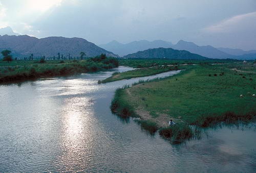
Our photo, looking east, shows the massive mound thought to be the site of Abel-Beth-Maacah. This photo was made the last day of August. The dry tell stands out distincting from the surrounding orchards. Apples are grown in this area. On a clear day one would be able to see the Beka Valley and Mount Hermon beyond the tel.

Abel-Beth-Maacah in northern Israel. Photo by Ferrell Jenkins

Abel-Beth-Maacah in northern Israel. Photo by Ferrell Jenkins

The wise woman reasons with Joab. She tells him that this town formerly was a place where people would ask for advice to end a dispute. She said,

I represent the peaceful and the faithful in Israel. You are attempting to destroy an important city in Israel. Why should you swallow up the LORD’s inheritance? (2 Samuel 20:19 NET)

Joab agreed that he would not destroy the city if she would hand over Sheba. She agreed to throw the head of Sheba over the wall. She did what she promised and the destruction was averted. Joab went back to the king in Jerusalem.

Abel-beth-Maacah is mentioned in at least two other passages.

  1. The city was conquered by Ben-hadad, king of Aram [Syria] (1 Kings 15:20).
  2. The city was captured by Tiglath-pileser, king of Assyria, in the days of Pekah of Israel.

BiblePlaces Newsletter

Todd Bolen’s BiblePlaces Newletter for December is now available. It includes a wonderful aerial photo of the Elah Valley. The main feature is a series of (Google) satellite photos of Jerusalem with the natural features (hills, valleys, springs, quarters of the city, etc.) identified. If you teach any lesson dealing with the city of Jerusalem you need these PowerPoint slides.

You should subscribe to the BiblePlaces Newsletter, but if you have not yet done so you may access the current issue here. The subscription link is at the bottom of the page.

The photo below shows one of the modern gates of Jerusalem. It is labeled Stephen’s Gate on one of the slides mentioned above. Murphy-O’Connor says that Suliman called it the Bab el-Ghor (the Jordan Valley Gate). In Hebrew it is called the Lions’ Gate, but you may notice that the animals to the left of the gate are panthers. Murphy-O’Connor says this was “the heraldic emblem of the Mamluk sultan Baybar (1260-77). This is the only gate of the Old City on the east side that is currently open.

Lions Gate or St. Stephen Gate. Photo by Ferrell Jenkins.

Lions' Gate or St. Stephen's Gate. Photo by Ferrell Jenkins.

Bethlehem – the Birthplace of Jesus

Years ago we would say that Bethlehem is located in the hill country of Judea about six miles south of Jerusalem. Today, Jerusalem stretches all the way to Bethlehem. It is no longer easy to get to Bethlehem. The massive wall built by Israel (Israelis call it the “fence”) separates Bethlehem from Israel.

During the Patriarchal period the town was called Ephrath (Genesis 48:7; 35:9-27). Later, as part of the territory allotted to the tribe of Judah, it was the home of Ruth and Boaz and became the birthplace and early home of David (1 Samuel 17:12, 15). The town was sometimes called the “city of David” (Luke 2:4, 11), but is most famous as the birthplace of Jesus (Micah 5:2; Luke 2:4-15; Matthew 2:1-16).

When one visits the Bible lands today he must realize that 2,000 years of history, involving both repeated building and the destruction of what has been built, has left nothing to remind one of the original place where Jesus was born. Justin Martyr (ca. A.D. 160) said Joseph “took up his quarters in a certain cave near the village.” Origen (mid-third century) said the cave where Jesus was born was being shown and even the enemies of the faith were talking of it. Jerome, a resident of Bethlehem (A.D. 386-420), tells how the birthplace of Jesus and other places associated with the ministry of Jesus were defiled from the time of Hadrian to the reign of Constantine. The Church of the Nativity now stands at this spot.

Today I have chosen to include a photograph of vineyards in the hill country immediately to the west of Bethlehem.

Terraces in the hill country of Judea near Bethlehem. Photo by F. Jenkins.

Terraces in the hill country of Judea near Bethlehem. Photo by F. Jenkins.

Gordon Franz has written a good article about Bethlehem which is posted on the ABR web site. Read it here.

McGarvey’s Land of the Bible

J. W. McGarvey was one of the best scholars of the 19th century Restoration Movement. He was president of the College of the Bible in Lexington, KY. One of my first books was his practical New Commentary on Acts of Apostles (1892). He had earlier (1868) written A Commentary on Acts of Apostles dealing with some of the critical issues of the book. McGarvey addressed some of the critical questions of the day in The Authorship of Deuteronomy, Jesus and Jonah, and Biblical Criticism.

McGarvey visited Palestine in 1879. His former students paid for the trip [I like that!], with the understanding that he would write a book. They would get their money back from the sale of the book. His book, Lands of the Bible, was published by J. B. Lippincott & Co., London and Philadelphia, in 1881. The title page indicates that 15,000 copies were printed. Impressive for a book on that subject.

J. W. McGarvey’s Lands of the Bible is available at the Restoration Movement pages here. For other works by McGarvey and other Restoration leaders begin with the home page here.

When I led my first group to the Bible Lands in 1967, one friend in the group had studied McGarvey’s book carefully. He took a tape measure with him. When we came to certain sites he took out the tape to take measurements. He wanted to be sure he was at the same place McGarvey visited.

Chapter IX in McGarvey’s book is titled “Argument from the Agreement of the Land and Book.” I have an outline of this material in my Introduction to Christian Evidences [OP], and use some of this material in my Daily Life in Bible Times series. One would be mistaken not to move beyond McGarvey, Thompson, Robertson, and the other early explorers. On the other hand, it would be amiss to dismiss what these scholars wrote.

What prompted all of this? Todd Bolen recently wrote a post on The Acoustics of Mounts Gerizim and Ebal in which he quotes from one of McGarvey’s letters here. I urge you read his post now. Also follow the link to the Biblical Studies and Technology Tools post showing the valley between Ebal and Gerizim using digital mapping tools.

I wanted to contribute something to this study by including here a scan of the plate from my original edition of Lands of the Bible (opposite page 288).

Shechem from the West. McGarvey, Land of the Bible.

Shechem from the West. McGarvey, Land of the Bible.

Todd Bolen has a great photo of Mount Ebal from Mount Gerizim. I would like to add the other side of the valley. Here is a photo showing Mount Gerizim from above Mount Ebal. It is an aerial shot made for me by the well known photographer Zev Radovan.

View of Mount Gerizim from above Mount Ebal.

View of Mount Gerizim from above Mount Ebal.

Maybe later we will discuss some of the important biblical events that took place in this area. For not let us note that this is where the blessings and curses of the law were read after the children of Israel entered the promised land (Deuteronomy 11:19). Here is the account of that event:

All Israel with their elders and officers and their judges were standing on both sides of the ark before the Levitical priests who carried the ark of the covenant of the LORD, the stranger as well as the native. Half of them stood in front of Mount Gerizim and half of them in front of Mount Ebal, just as Moses the servant of the LORD had given command at first to bless the people of Israel. Then afterward he read all the words of the law, the blessing and the curse, according to all that is written in the book of the law.  There was not a word of all that Moses had commanded which Joshua did not read before all the assembly of Israel with the women and the little ones and the strangers who were living among them. (Joshua 8:33-35 NASB)

The Rivers of Damascus

Naaman was the commander of the army of the king of Aram (Syria). The biblical text says he was “esteemed and respected by his master” because of the victories he had given the country. Great people often have great problems as well as great acclaim. Naaman was a leper. The term leper is used throughout the Old Testament of a serious skin disease without a cure. Read the full account in 2 Kings 5:1-18.

A young girl who had been taken captive from Israel during one of the raids made by the Arameans was serving as an attendant to Naaman’s wife. She knew of the prophet [Elisha] in Samaria and was confident he could cure Naaman of his leprosy.

When Elisha send a messenger to Naaman to tell him to “Go and wash in the Jordan seven times” the commander was furious. He said,

Are not Abana and Pharpar, the rivers of Damascus, better than all the waters of Israel? Could I not wash in them and be clean?” So he turned and went away in a rage. (2 Kings 5:12 ESV)

These rivers, Abana and Pharpar, flow from the Anti-Lebanon range eastward into the desert. Here is a photo that I made of the Nahr Barada river a short distance west of Damascus (on the outskirts of the city). The river continues to flow through the city of Damascus. The Nahr Barada is often identified with the Abana of the Bible.

The Abanah River near Damascus. Photo by Ferrell Jenkins.

The Abanah River near Damascus. Photo by Ferrell Jenkins.

Naamam was cured of his leprosy only after he dipped in the Jordan seven times. We should not elevate our judgment (opinion) to the point that we can argue with the Lord about what ought to be done. He is the Creator; we are the creature.

Summary of the blogs

Over at the Biblical Studies Info Page, under Scholarly, then Blogs, I keep a list of several blogs that I regularly check. Here is a brief summary of some current items you might find of interest.

Todd Bolen calls attention to the continuation of the Western Wall excavations here. This excavation is on the extreme western side of the Western Wall plaza.

Aren Maer gives a wrap-up of the recent excavations at Gath (Tell es-Safi) here.

Ben Witherington includes a seminar paper by one of his doctoral students in review of Barth Ehrman’s Lost Christianities here. This has to do with the formation of the canon.

Mark Copeland has posted good photographs of 299 Sermon Charts pained by Steve Hudgins here. Steve pained a few charts for me, and some of my tour banners, years back. This shows the type of visual aids that some of us used. It was before flannel boards, opaque projections, overhead projections, and PowerPoint. The biggest problem is that the audience knew when we were only half finished! I doubt any of you will want to use a chart like this now, but you can get some great ideas for sermon starters, put them in PowerPoint, and see if they will gel.

Claude Mariottini has called attention to the problem of Fake Degrees, even among ministers and professors of biblical studies, here. Every now and then I see some preacher who wouldn’t know how to write a research paper advertising himself as Dr. So-and-so. Shameful.

A river in Pamphylia

This week I am busy with a number of projects, but I wanted to share a beautiful photo that I made early one morning in the mid-80s. This is a river that flows from the Tarus Mountains into the Mediterranean at Antalya, Turkey. Antalya is know in the Bible as Attalia. Paul and Barnabas sailed from Attalia at the conclusion of the first preaching journey.

When they had spoken the word in Perga, they went down to Attalia. From there they sailed to Antioch, from which they had been commended to the grace of God for the work that they had accomplished. (Acts 14:25-26)

Attalia was in the Roman province of Pamphylia in the days of Paul.

A river in Pamphylia with the Tarus Mountains in the background.

The Dead Sea is dying!

Not exactly current news, but ABC News, Saturday, July 12, 2008, had a report about this. Read the story, and find a link to the video here. In a word, the Dead Sea is drying up because of a lack of water. Water that once flowed into the Dead Sea from the Jordan River is now being diverted primarily by Israel, and Jordan for domestic and agricultural use. The Jordan River no longer experiences the annual flooding that was known even fifty years ago. I have seen a tremendous change in the 41 years that I have been traveling in the area.

The Dead Sea is called the Salt Sea in the Bible (Genesis 14:3; Numbers 34:3, 12). Josephus knew the Dead Sea at Lake Asphaltites in Roman times (Antiquities 1.174; 15:168).

Many old sources have listed the Dead Sea as being 1,292 feet below sea level. According to a study in 2005, the sea was 1,368 feet below sea level. That number would be greater now. The lowest point in the United States is 282 feet below sea level, at Death Valley in California.

This photo shows encrustations of salt that build up on the rocks along the shore of the Dead Sea.

Here is a photo of a sign, a bit defaced, in Jordan at sea level showing a cross-section topography of the Dead Sea.

The joy of traveling together

It is unfortunate that many younger couples are not able to travel to the lands of the Bible. This is especially true of young preachers who need the knowledge they could gain in their ministry. Some young folks could travel to these places if they wanted to. One fine lady who, along with her husband, had been on a tour to Israel and Greece, told me that she had rebuked (not her word) some of the young professionals she knew. She told them that they ought to give up a few ski trips and go to the Bible lands. A matter of priorities, isn’t it.

I find that many women want to travel, but their husbands refuse to do so. It often happens that the husband dies and the wife gets to travel. Too bad they could not have made these memories together. Elizabeth and I have enjoyed being blessed to travel to many parts of the world. We realize that most of those years are behind us and we have great memories to share. And we have made many wonderful friends in our travels.

The photo below was made at Pamukkale, Turkey (ancient Hierapolis). We are standing on the colonnaded Roman road, and the monumental gateway behind us is the Arch of the Emperor Domitian (A.D. 81-96). It was constructed in A.D. 82-83.

Hierapolis was the home of Papias (c. A.D. 60 to c. A.D. 130). He was a disciples of the apostle John and a companion of Polycarp. There are some traditions associating Philip (apostle?, evangelist?) with the city.

The city of Hierapolis is one of the three cities of the Lycus River valley named in the New Testament.

For I testify for him that he has a deep concern for you and for those who are in Laodicea and Hierapolis. (Colossians 4:13).

Enjoying the local customs

One of the joys of travel is learning about the customs of the local people. Of course, I have a special interest in finding customs that remind us of customs in Bible times. In many places the local entrepreneurs realize that tourist enjoy this so they make it possible for you to see and participate in the customs. This woman at a restaurant near Memphis, Egypt, is baking bread as it has been done for centuries in Egypt. Yes, the bread was delicious.

Perhaps you can recall the episode in Genesis 40 about “the cupbearer and the baker for the king of Egypt.”