Category Archives: Bible Lands

Honoring Dr. Jack P. Lewis

Dr. Jack P. Lewis was honored March 6 at a dinner hosted by Faulkner University, Montgomery, Alabama, during their annual Bible lectureship. I was pleased that I could attend the lectures one day and be present for the dinner honoring Dr. Lewis.

Lewis is Professor Emeritus at the Harding Graduate School of Religion in Memphis. Among several good teachers that I had, Lewis was unique. He holds two earned doctorates, a Ph.D. in New Testament from Harvard, and a Ph.D. in Old Testament from Hebrew Union. He was the most demanding teacher I had, and one of a few from whom I learned the most.

After the high school years at Athens Bible School, and four years of Bible at Florida Christian College (now Florida College), with teachers such as Homer Hailey, I had a good general knowledge of the Bible. I think I had about 60 hours of Bible at FCC. The graduate work was not too difficult, it was just on a higher level.

It was part of the graduate program generally, but Lewis taught the importance of using primary sources where possible and the importance of thorough preparation. He entered the class room, called the roll, and began lecturing. As a student I made notes the best I could, then spent hours after each class verifying the names, dates, and facts presented. Different from the students I had in college, we would never imagine asking “How do you spell that?” He taught us the importance of using up-to-date sources in our research.

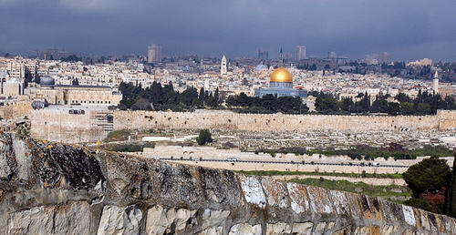
Jack Lewis was my first teacher who had spent a considerable amount of time studying the land of the Bible. He had worked in the archaeological excavation at Arad, and had spent a year as a fellow at the American Schools of Oriental Research in Jerusalem (now the Albright Institute).

In one of the classes with Dr. Lewis I did a paper on “Authentic First Century Remains in Palestine.” Soon afterward I began to prepare for my own visit to the Bible lands. I might have gone anyway, but I must credit Dr. Lewis, and his unique insight into the land of the Bible, for spurring my interest in traveling to this part of the world. The other day, as we visited, he said something like this: “There is nothing as valuable as seeing the places you study about.” So, now you know one of the major motivations in my travels to Bible lands over all these years since the first trip in 1967. I still learn on every trip, and in the preparation for the trip.

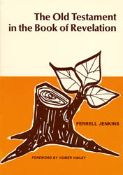
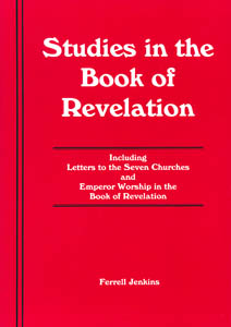
Dr. Lewis is a prolific writer. His many books included The History of the English Bible from the KJV to the NIV, The Interpretation of Noah and the Flood in Jewish and Christian Literature, Historical Backgrounds to Bible People, a two volume commentary on the Gospel of Matthew. There are also books on the prophets and other areas of biblical studies.

Several Faulkner faculty members spoke of what Lewis had meant to them. These included Dr. Cecil May, Jr., Dr. Carl Cheatham, and Dr. Ed Hicks. Dr. Jim Howard, from Memphis, was also on the program. Carl and Jim were at HGSR when I was there. Cecil and I spoke on the same topic at both the Nashville and Dallas meetings of institutional and non-institutional brethren a few years back. It was a pleasure to see them.

In the afternoon, Dr. Lewis had presented a lecture on “The Battle for the Integrity of the Bible.” In his typical rapid-fire manner, he surveyed the battles that have been won in demonstrating the integrity of the Bible. It was just a survey, but he seemed as sharp as in those classes on The History of the English Bible and on Archaeology and the Bible from which I profited so much.

Today Dr. Jack Pearl Lewis is 89 years old. Happy birthday, Dr. Lewis.

Dr. Jack P. Lewis and Ferrell Jenkins. Photo by Leon Mauldin.

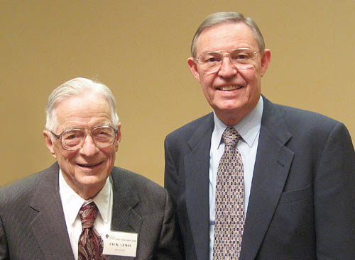
This photo was made March 6 after the lecture on “The Battle for the Integrity of the Bible.”

Israel Issues a New 2-Shekel Coin

A new 2-shekel coin entered circulation recently in Israel. This might be of interest to people who plan to travel to Israel. The Israeli New Shekel is worth about 27 cents in US money, so the 2-shekel (NIS 2) will be roughly equivalent to our half-dollar. Most American tourists who are in travel groups have prepaid their arrangements and have little need to exchange funds. Dollars are widely accepted in Israel.

The new coin has an interesting historical association on the reverse side. It is a design of a cornucopia, a horn of plenty, and a pomegranate. This design is from an historical coin minted in the days of John Hyrcanus. Hyrcanus was one of the Maccabeans who successed Judas. He became high priest, and then ruler of the Hasmonean Dynasty from 135-104 B.C. During his reign we have the first reference to the Jewish parties, Pharisees and Sadducees, that are prominent in New Testament times.

John Hyrcanus extended the territory of the Maccabeans by seizing Idumaea (enter Herod!) and compelling the Idumaeans to be circumcised. He seized Samaritan territory and destroyed the temple of the Samaritans on Mount Gerizim. This is the temple alluded to by the woman of Samaria when she said to Jesus, “Our fathers worshiped in this mountain [Gerizim], and you people say that in Jerusalem is the place where men ought to worship” (John 4:20).

History is interesting, isn’t it? Here is a photo of the new 2-shekel and the bronze Prutah minted in the time of Hyrcanus. The photo is from Wikimedia Commons. Glancing through Hendin and Meshorer, I see that this design was fairly common during the period of the Maccabees.

Israel 2-shekel and coin from time of John Hyrcanus.

The pomegranate can be eaten fresh, used for fresh juice, or processed into an alcoholic drink for future use. Writers say the pomegranate,

“is a beautiful, symmetrical fruit, scarlet in color. Filled with small seeds surrounded by juicy pulp, the fruit became an obvious symbol of fertility” (King and Stager, Life in Biblical Israel, 104).

Another source says,

“The pulp is divided into 9 or 10 partitions which hold the numerous seeds. The pulp is delicious and very refreshing to eat because of its copious juice. the seeds yield a syrup called grenadine. The flowers are used in the treatment of dysentery” (Fauna and Flora of the Bible, 169).

Saul stayed on the outskirts of Gibeah “under the pomegranate tree” (1 Samuel 14:2). The girl of the Song of Solomon is told twice that her “temples are like a slice of a pomegranate behind your veil” (Song 4:3; 6:7). She also says, “I would give you spiced wine to drink from the juice of my pomegranates” (Song 8:2). The fruit was used as the design for decoration on the hem of the garment of the high priest (Exodus 28:33).

This beautiful pomegranate was growing at the site of ancient Aphrodisias in Turkey. The photo is better than some I have from Israel. Enjoy.

Pomegranate growing at Aphrodisias in Turkey.

Sunset at the Dead Sea

Here is a photo that I made at sunset on the shores of the Dead Sea in Jordan. The view looks west over the sea and the mountains of Judea between Bethlehem and Jerusalem. The Dead Sea is called the Salt Sea in the Bible (Genesis 14:3; Numbers 34:3, 12). The width of the sea at this point is about 11 miles. The level of the Dead Sea is now almost 1400 feet below [Mediterranean] sea level. This northern end of the Dead Sea is about 1300 feet deep.

Sunset at the Dead Sea, looking toward the mountains of Judea. Photo by Ferrell Jenkins.

Biblical Sites in Eastern Turkey

For the past two weeks I have been working on a presentation for a class at the Florida College Annual Lectures (February 5, 2008 at 9 a.m. in Puckett Auditorium). I plan to make a similar presentation at the Citrus Park Church of Christ, 5105 W. Ehrlich Road, Tampa, FL, Sunday evening January 27 at 5 p.m. If you live in the Tampa Bay area I would be pleased to have you present for this lesson.

I have visited biblical sites all over Turkey for many years. Two personal study trips have been made to the eastern part of the country, one in 1995, and another in June, 2007. Check the June archives for those blogs.

Our presentation will cover the land of Urartu (biblical Ararat), Mount Ararat, Mesopotamia, the Tigris and Euphrates Rivers, Harran, Carchemish, and a few other places. We will be looking at the biblical, historical, and geographical information that makes these places important in Bible history.

Here is a photo of Mount Ararat from June, 2007. The mountain is located near the Turkish border with Iran and Armenia, and many think it was the landing place of Noah’s ark (Genesis 6-9).

Mount Ararat in Eastern Turkey. Photo by Ferrell Jenkins

“An amazing experience”

An Associated Press report by Anne Gearan is headlined “Bush Visits Biblical Holy Sites.” You may read the entire article here. The article says,

Bush retraced the steps of Jesus and his disciples in the ancient town of Capernaum and gazed out on the nearby Sea of Galilee, where the Bible says Jesus walked on water and calmed a sudden storm by commanding the wind and waves to cease. The waters were crystal blue and calm when Bush visited, leaning in to listen as a brown-robed friar narrated his tour with New Testament passages.

“An amazing experience,” Bush happily said later.

It is an amazing experience for anyone with an interest in the Bible and Jesus. Bush is reported to have said, “I came as a pilgrim.” Many people make pilgrimages to worship at a particular holy site. There is, perhaps, a higher purpose for visiting these sites. On our tours we seek to demonstrate the accuracy of the Bible in describing the Bible land. This involves learning about the geography and topography of the land that help one to better understand the important events that transpired there.

Sunset at Dalmanutha (Mark 8:10) at the northwest corner of the Sea of Galilee. Photo by Ferrell Jenkins.

Sunset at Dalmanutha

The photo above was made at sunset from the site known as Dalmanutha, near the Mount of Beatitudes. Dalmanutha is mentioned only once in the New Testament. After the feeding of the 4000, Mark records that Jesus immediately “entered the boat with His disciples and came to the district of Dalmanutha” (Mark 8:10). In the distance, on the left, you can see the silhouette of Mount Arbel. Then, just to the right of that is the Via Maris (the way to the Mediterranean Sea) from Galilee. The saddle-shaped hill is an extinct volcano known as the Horns of Hattin.

It is “an amazing experience” to visit this land and contemplate these great events.

Resources on the Book of Revelation

Yesterday I received an Email from Dr. Georg S. Adamsen in Denmark, asking that I change the link to his Revelation Resources page on my Biblical Studies Info Page. First, let me say I appreciate his notifying me of the change. Many individuals ask to include a link but never notify us when they close down the page.

Revelation Resources is now presented in blog format. Adamsen describes the blog this way:

Revelation Resources – about 250 hand-picked references on valuable resources for the study of the Book of Revelation. Many topics have separate introductions…

My Old Testament in the Book of Revelation has been included at Revelation Resources for several years. I was pleasantly surprised this evening when I was checking the URL to see that the book is featured on this page (January 7).

Because the current publisher of the book does not have a marketing strategy many people think the book is out of print. You may secure a copy from the Florida College Bookstore. I wasn’t able to locate the book on the website, but you can send an Email to bookstore@floridacollege.edu for information. I think the book now sells for $4.95. I saw a used copy on Amazon recently for $59.96!

Jenkins, The Old Testament in the Book of Revelation

Florida College also recently reprinted my Studies in the Book of Revelation. It sells for $5.99. In my judgment this is an excellent source for a class study of the Revelation.

Jenkins, Studies in the Book of Revelation

Studies in the Book of Revelation (90 page paperback) is composed of these sections.

Introducing the Book at the End of the Bible
Worthy Is the Lamb
Saints Victorious
Does Revelation Teach Premillennialism?
Letters to the Seven Churches
Emperor Worship in the Book of Revelation

If you prefer to call Florida College Bookstore and speak to one of the friendly staff, use their toll free number (1-800-423-1648).

What does this have to do with travel, you wonder. The Revelation was written to the seven churches of Asia, the Roman province of Asia Minor, in the late first century A.D. The seven cities were Ephesus, Smyrna, Pergamum, Thyatira, Sardis, Philadelphia, and Laodicea. Several of them have significant ruins that can be visited. We have included them on several study tours we call Steps of Paul and John, including Turkey, Greece, and the Aegean Islands. During the course of this tour we spend some time lecturing on the setting of the Book of Revelation. We plan to do that in May when we again visit these and other cities associated with Paul and John.

Temple of Roman Emperor Trajan at Pergamum. Photo by Ferrell Jenkins.

This photo shows the reconstruction of the Temple of (Roman Emperor) Trajan ( A.D. 98-117). This was the second temple in Pergamum dedicated to the Emperor. The first temple in all of Asia was erected to Augustus in 29 B.C. Altogether Pergamum had three imperial temples.

Selecting a Bible Atlas

A few weeks ago I had a request to recommend a good Bible Atlas. In recent years I have found it difficult to recommend any “good” book unless I have extensive knowledge about the ability of the person making the request, and understand why they need the book. I have more than 15 Bible atlases in my study, and have used others, but no one of them completely satisfies when I get to looking for something special.

Some reader might be thinking, “I have maps in my Bible.” You should either stop reading or continue reading. Maps included in various Bibles can be helpful in seeing a general area, but are of little value in studying details. And, I note that many people have old Bibles that can not have the benefit of the latest research.

So, I have turned to the judgment of someone I trust in this area.

Todd Bolen is Associate Professor of Biblical Studies at the Israel Bible Extension of The Master’s College in Israel. He has been teaching in Israel in the area of biblical archaeology, geography and history for the past ten years, but is currently on leave to continue his studies in the USA. Take a look at his Annotated Bibliography of Selected Books for Israel Studies. Click here.

Among the atlases briefly mentioned are the following:

The Carta Bible Atlas, by Aharoni.
The Moody Atlas of Bible Lands, by Beitzel.
The Holy Land Satellite Atlas, by Cleave.
Student Map Manual: Historical Geography of the Bible Lands, by Monson.
Zondervan NIV Atlas of the Bible, by Rasmussen

Bolen says,

“This [Zondervan NIV Atlas of the Bible] is the atlas to buy to *read* – and therefore is the first choice for a beginning student who can read only one work on the geography of the land. Though the maps are not as extensive or detailed as Macmillan, the text is well-organized, well-written, and trustworthy. The first seventy pages are a geographical overview of the land, region by region. The remaining 130 pages is a historical overview of the lands of the Bible through the biblical periods.”

Bolen also has helpful lists of books on Geography, Old Testament Archaeology, Archaeology Periodicals, Jerusalem Archaeology, New Testament Background, History of Ancient Israel, Modern Israel, et al. The list was last updated October 26, 2007.

On the Bible Places Blog, Bolen comments on “Two New Bible Atlases.” The IVP Atlas of Bible History, by Paul Lawrence, and the Oxford Bible Atlas (4th ed.), by Adrian Curtis.

Here is a review of Carta’s New Century Handbook and Atlas of the Bible. This is an abridgement of The Sacred Bridge. Bolen says,

“Just to be clear, there are many things in this book that I disagree with. If you’re looking for something more conservative, try the NIV Atlas of the Bible, by Carl Rasmussen or the Moody Atlas of Bible Lands, by Barry Beitzel.”

Bolen also has some information on Electronic Maps for Bible Teaching here. Written in 2004, the following works are reviewed or mentioned prominently:

Carta’s Comprehensive Bible Atlas
Bible Maps from Manna
Logos Deluxe Map Set
Nelson’s 3-D Bible Mapbook
Logos Bible Atlas

Below I will list some additional information I have gathered on some other digital sources.

OpenBible.info Bible Atlas (uses satellite photos as the basis of the maps). This includes links to some photos, but many are of no value. Scripture references open to the English Standard Version.

BibleMap. In this program you start with the Bible text to locate places marked on Google satellite maps (photos) or modern road maps. Information from the outdated (1913) International Standard Bible Encyclopedia is also included in the program.

Bible Geocoding claims to contain the location of every identifiable place mentioned in the Bible.

Prof. Mark V. Hoffman writes a blog called Biblical Studies and Technological Tools (From scroll to screen… codex to computer…). Scroll down on the right and click on the label for bible mapping to find information on various digital programs.

American Bible Society has some very nice Interactive Maps in flash format. These would be fine for online study, and it would be great if ABS would make them available in a larger format. The maps require Flash which I was unable to use in Firefox, but I did see the maps in Internet Explorer.

In preaching, and in much teaching, I find that a map showing the general area is adequate for the purpose. I use these various maps in my PowerPoint presentations, but none of these really get at the issue of topography and geography. I use some of the Manna Bible Maps by my friend Matt Hennecke. Scott Richardson, a friend and former student, has prepared some good general purpose Bible Study Maps that I sometimes use in PowerPoint.

For more detailed work I often use the NASA satellite photos and work up maps that will allow me to show not only the place name, but also the terrain and travel routes. Here is an example of what I am talking about.

Satellite View of Area of Paul’s First Journey

Even though I note that several preachers seem excited about some of the programs using satellite imagery, I wonder if a person who has not visited the lands of the Bible can really use these to good advantage.

Visit BiblicalStudies.Info, click on Scholarly, then Maps of Bible Lands, for some additional sources of maps. These vary in quality but may be useful for some purposes.

Bethlehem and the birth of Jesus

The media is giving its usual Christmas Eve attention to Bethlehem today. The New Testament teaches that Jesus was born in Bethlehem of Judea in the days of Herod the king (Matthew 2:1). The month, day, and year of the birth of Jesus is not stated in the New Testament. We do have some historical information that helps with the date, but not precise information is available (Luke 2).
Do we know the place of the birth of Jesus in Bethlehem? About A.D. 160 Justin Martyr said, “when the child was born in Bethlehem, since Joseph could not find a lodging in that village, he took up his quarters in a certain cave near the village” (Dialogue With Trypho, 78). Near the middle of the third century Origen said that the cave where Jesus was born was being shown and that even the enemies of the faith were talking of it. Jerome was a resident of Bethlehem from A.D. 386 until his death in A.D. 420. He tells how the birthplace of Jesus, the place of the crucifixion and the tomb where Jesus had lain were defiled from the time of Hadrian to the reign of Constantine. The Church of the Nativity now stands at this spot. Of this location, Dalman says:

No one could discern in this former rocky chamber the place of the Nativity. The altar at the east end was perhaps not erected originally to designate the exact spot, although the background of the grotto would make it probable. Here also is the only remarkable feature in it, namely a small adjoining room which contains in the right wall a low niche resembling a manger (Sacred Sites and Ways, 38).

Typical of so many, this site has enjoyed its share of fanciful speculations. Tradition locates the spot where the adoration of the Magi took place and a projection in the background is taken to be the table at which the Virgin ate with the Magi. Like so much speculation, these overlook the fact that the gospel account represents the Magi as arriving at some time after the birth of Jesus and that they found the child with Mary in a “house.” The Wise Men may have had a fast means of transportation, but one should not forget that they traveled by plain, not plane; they came not from the east side of town, but from the East.
This photo shows the exterior of the Church of Nativity in Bethlehem.

Bethlehem - The Church of Nativity

The Church of the Nativity has a long history. It is now a Greek Orthodox church. Underneath the altar is the Grotto of the Nativity where it is said that Jesus was born. Maybe, maybe not. A silver star was set in the marble pavement in 1717. The Latin inscription, “HIC DE VIRGINE MARIA JESUS CHRISTUS NATUS EST.” The translation: “Here Jesus Christ was born of the Virgin Mary.”

Bethlehem - The Church of Nativity - Star in the Grotto of the Nativity

Among the confusion of the date of the birth of Jesus, and the lack of New Testament authority for a church celebration on a certain day, let us not forget that the eternal Word became flesh, and dwelt among men in order to bring salvation to those who obey Him through his death upon the cross (John 1:1, 14; Luke 19:10).

“Although he was a son, he learned obedience through what he suffered. And being made perfect, he became the source of eternal salvation to all who obey him.” – Hebrews 5:8-9, ESV

Where did Noah’s Ark land?

Bible and Spade has made the Fall 2006 issue available in PDF. The entire issue deals with questions of current interest to scholars about the landing of Noah’s Ark. Some recent claims that the ark might have landed in Iran are discussed. The evidence for the two main sites (or regions) in Eastern Turkey are discussed in detail.

One of the main sites is on, or near, Mount Ararat. The mountain is located just a few miles from the Iranian border in eastern Turkey. Here is a photo I made at Mount Ararat earlier in the summer.

Mount Ararat in Eastern Turkey. Photo by Ferrell Jenkins

The other location is Mount Cudi in southeastern Turkey near the border with Iraq. We were unable to visit this site due to the issues between Turkey and the PKK (very much in the news lately).

The Bible says the ark came to rest on the “mountains of Ararat” (Genesis 8:4). Either of these sites fall within that description.

You may download the Fall 2006 issue of Bible and Spade here in PDF (2.0 MB).

Bible and Spade - Fall 2006

I recommend Bible and Spade. I subscribe and have the back issues in Logos Libronix format for easy searching. Go here for more information about subscribing or securing the back issues. Dr. Bryant G. Wood is the editor of Bible and Spade.

I Hope You Won’t Get Jerusalem Syndrome

Journalist Ari Rabinovich has written about the Jerusalem Syndrome here. He briefly describes JerSyn in these words:

Only about a dozen Jerusalem tourists per year suddenly get agitated, imagine themselves to be characters from the Bible, fashion makeshift togas out of hotel sheets and go out to holy sites to recite the Psalms, sing hymns or harangue passers-by to repent.

It is a fascinating article, and also has a link to another article he has written, “Come to Jerusalem, see the Messiah?”

Jerusalem From the Mount of Olives

I think you will admit that the view of Jerusalem from the descent of the Mount of Olives is breathtaking. It is even more so when you see it in person.