Category Archives: Archaeology

A Bible Land tour for less than $20.00

Journey Through the Holy Lands is a DVD featuring Michael Hasel of Southern Adventist University. Dr. Hasel is Director of the Institute of Archaeology and teaches archaeology at SAU in Collegedale, Tennessee.

In 2007 Hasel was filmed at important biblical sites providing a commentary about the significance of the site. The following sites are visited:
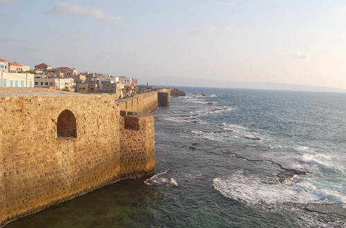
Jerusalem
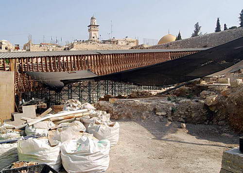
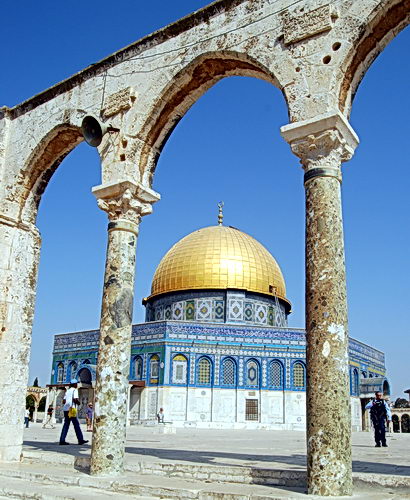
Garden Tomb; Church of the Holy Sepulcher; the Cardo; Western Wall; Temple Mount; Sheep Gate (often called St. Stephen’s or Lion’s Gate); Pool of Bethesda; Damascus Gate; the First Century House in the Jewish Quarter.
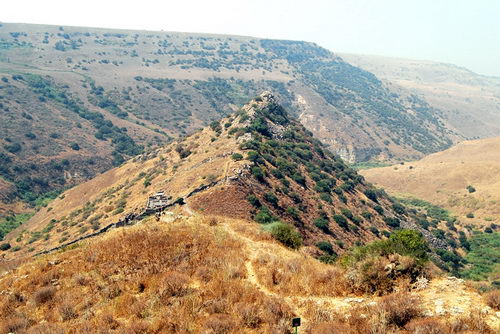
The Dead Sea Area
Qumran, Dead Sea, Masada, Wadi Qelt; Jericho

Egypt and the Sinai
The Giza Pyramids; Saqqara; St. Catherine’s Monastery; Mount Sinai

This DVD is not one of those slick TV presentations. It is the film of a competent scholar who is well acquainted with the history and archaeology of the area telling his tour group about it. I was impressed that Hasel spelled out the facts about such competing sites as the Holy Sepulcher and the Garden Tomb. At some places the commentary was very brief. At Jericho he mentioned the relevant research but did not show any of the evidence on the tell. There is no visit of sites in the Galilee.

At St. Catherine’s, Hasel tells about the discovery of the Sinaiticus Manuscript. Attractive maps and artwork has been added to the film. The background noise at the Giza Pyramids is noticeable and a distraction. The narration could have been added in a studio back home, but it would have changed the character of the film.

It was a pleasure to view the video. I would recommend it to those who have visited these areas and would like an on site review. It would be good for those who will never visit the sites, or those who are preparing for a trip.

Journey Through the Holy Lands is available for $15.00. Shipping and Handling for 1 or 2 copies is $2.50 each. For 3 or more copies it is $5.00.  Payment must be made by money order or check payable to Southern Adventist University. Send order to: Institute of Archaeology, Southern Adventist University, P.O. Box 370, Collegedale, TN 37315.

The Institute of Archaeology operates the Lynn H. Wood Museum which is the repository of the William G. Dever Near Eastern Collection. Check the web page here. I plan to visit the museum if I have an opportunity to travel in the area.

Review: Views That Have Vanished

Todd Bolen, BiblePlaces.com, has released an extremely valuable CD that will be helpful to all students of the Bible lands. Views That Have Vanished is a collection of more than 700 high resolution photographs made by David Bivin beginning in 1963.

Views That Have Vanished - Photos of the 1960s.

Views That Have Vanished - Photos of the 1960s.

These photographs were made with one of the best cameras available at the time with the intent to be able to share them with family and friends who were unable to visit Israel, Jordan, Egypt and Greece. Bivin has now lived in Israel more than 30 years. Many of the places he visited in the 1960s have changed since then because of natural erosion. Some of the changes occurred because of archaeological activity, and the normal deterioration that takes place once a site is uncovered. Primarily the sites have changed because of the building activities of man.

My first visit to the Middle East was in 1967. Since then I have returned nearly 40 times and I have observed the tremendous changes made. Some sites, in preparation for visitors, are necessarily changed. Other sites are neglected and become dangerous for all but the most intrepid explorers to visit. Bivin had the wonderful opportunity live in Israel and record his experience in full color. I observe that many of the landscape photographs he made have a beautiful clear sky. Perhaps the sky was clearer 40 years ago. But, this is the advantage of living in the country and being able to go out when the weather is just right.

Everyone who has old photographs and slides knows that they begin to deteriorate after a few years. This happened to some of Bivin’s photographs. Todd Bolen has scanned these old negatives with high quality equipment. In many instances the color has been restored.

The photographs are available in high-resolution (1600 x 1200 or higher) in jpg format and also in PowerPoint with explanatory notes. I was especially impressed with the large number of photographs of some of the well known archaeologists of the past (Glueck, Yadin, et al.) and some historic views such as people in Jerusalem mourning the death of Anwar Sadat, president of Egypt.

Views That Have Vanished is a great addition to the already long list of photographic materials published by BiblePlaces. The CD belongs in the library of every church and every person who teaches Bible classes with an emphasis on the land in which these historical events took place. Frequently I say to my groups, “I wish you could have seen this before….” Now, you can see it through these photographs.

The CD is available for only $20 during October. Take a look here. If you would like to see some examples of Views then and now, take a look here.

Archaeology: The Bible as blueprint

The Jerusalem Post has been running a series of “People of the Year” articles. The most recent one was on Dr. Eilat Mazar. Mazar has been involved in a dig in the City of David over the last several years. The article says,

Mazar, who is both revered and reviled by some of her colleagues for being a “biblical archeologist,” says that the Bible is unquestionably the most important historical source for her work, since it contains a “genuine historical account of the past.”

“I work with the Bible in one hand and the tools of excavation in the other,” she says. “The Bible is the most important historical source.”

The area where Mazar believes she has found a palace that might have belonged to David, has been covered by a structure to protect it. Here is a photo I made in early April.

A portion of the City of David excavation. Photo by Ferrell Jenkins.

A portion of the City of David excavation. Photo by Ferrell Jenkins.

The full article may be read here.

HT: Joseph I. Lauer.

The Roman city of Volubilis

Students of the New Testament probably realize that the Roman Empire was vast. Did you know that there are ruins of a large Roman city in Morocco in north eastern Africa? Twice I have taken tours to Volubilis, about 20 miles from Meknes. Most of the ruins in the city date from the second and third centuries A.D. I have a slide from a 1980 tour with the name of the first century emperor Claudius (A,D, 51-54) on it. This was the time of Paul’s journeys (Acts 18:2).

This photo shows the Triumphal Arch dedicated to the Emperor Caracalla and his mother in A.D. 217. The Roman Basilica is visible on the right.

Roman ruins of Volubilis in Morocco. Photo by Ferrell Jenkins.

Roman ruins of Volubilis in Morocco. Photo by Ferrell Jenkins.

Volubilis has been added to the list of World Heritage Sites because “this site is an exceptionally well preserved example of a large Roman colonial town on the fringes of the Empire.”

Professor Avraham Biran

Dr. David Ilan, Director of the Nelson Glueck School of Biblical Archaeology, announced the passing of Professor Avraham Biran. Jack Sasson reports to the academic community the passing of Prof. Avraham Biran.

It is my sad duty to inform you that Prof. Avraham Biran passed away last night.  He was one month shy of his 99th birthday.

Avraham Biran, a third generation Israeli, received his Ph.D. at Johns  Hopkins University under William Foxwell Albright and was Thayer Fellow in the American Schools of Oriental Research, Jerusalem, 1935-37. Formerly Director of the Israel Department of Antiquities and Museums, he served as Director of Hebrew Union College-Jewish Institute of Religion’s Nelson Glueck School of Biblical Archaeology in Jerusalem from 1974-2003. He participated in the excavations of the  Uiversity of Pennsylvania in Iraq, at Tepe Gawra near Mosul, and at Hafaje near Baghdad. He accompanied Nelson Glueck in his epoch-making discoveries at the head of the Gulf of Eilat. Professor Biran directed the excavations of Anathoth, Tel Zippor, Ira, Aroer, the synagogue of Yesud Hama’alah, and the longest ongoing excavations in Israel at Tel Dan (under his direction from 1966 to 1999).

It was my pleasure on several occasions to hear Prof. Biran at professional meetings. I remember hearing him tell of the discovery of the House of David inscription. He always spoke with such enthusiasm; it was contagious. The last year I saw him at one of these annual meetings I was walking across the street from my hotel to the conference center. There was Prof. Biran. I spoke to him and more or less helped him across the street. 

The tremendous work done at Tel Dan seemed to me to be a testimony to his continuing work there. It takes a long time to do a lot of good things, especially archaeology.

The significant discoveries at Dan are too numerous to mention just now. In 1979 a complete Middle Bronze city gate (19th/18th century B.C.) was found at Dan (ancient Laish). This gate illustrates that the city was strongly fortified at the time Abraham rescued Lot (Genesis 14:14). I made this photo of the preserved gate on August 31.

The Middle Bronze age city gate at Dan. Photo by Ferrell Jenkins.

The Middle Bronze age city gate at Dan. Photo by Ferrell Jenkins.

HT: Joseph I. Lauer

Azekah was an important fortified city of Judah

The biblical site of Azekah is identified with Tell ez-Zekariyeh which overlooks the Valley of Elah. Azekah is a town of the Shephelah and is mentioned seven times in the Bible. Here is a summary of the information:

  • Azekah is mentioned in the account of Joshua’s long day (Joshua 10:10-11).
  • It was assigned to the tribe of Judah (Joshua 15:35).
  • The Philistines camped at Ephes-Dammim, between Socoh and Azekah, at the time of the conflict between David and Goliath (1 Samuel 17:1).
  • It was one of the fortified cities of Rehoboam, king of Judah (2 Chronicles 11:9).
  • Upon return from Babylonian captivity some of the Jews settled in Azekah and its villages (Nehemiah 11:30).

Jeremiah states that only Lachish and Azekah remained of the fortified cities of Judah at the time of the Babylonian captivity of Judah in 586 B.C. (Jeremiah 34:7). This indicates that Jeremiah wrote shortly before Lachish Letter # 4 was written. The last portion of the letter reads this way:

And let (my lord) know that we are watching for the signals of Lachish, according to all the indications which my lord hath given, for we cannot see Azekah. (The Ancient Near East an Anthology of Texts and Pictures, 322)
Here is a photograph of Azekah from the Valley of Elah.
Tel Azekah overlooks the Valley of Elah. Photo by Ferrell Jenkins.

Tel Azekah overlooks the Valley of Elah. Photo by Ferrell Jenkins.

A photograph of the Valley of Elah made from atop Tel Azekah may be seen here. An excavation conducted by Bliss and Macalister in 1898-99 showed that Azekah was occupied from Canaanite times. (The New International Dictionary of Biblical Archaeoogy, 83).

Second Temple wall of Jerusalem uncovered

The Israel Antiquities Authority announced last week the discovery of a wall below modern “Mount Zion” that dates from the time of the Hasmonean kings to the destruction about A.D. 70. Here are a few comments in the official press release.

An exciting discovery in Jerusalem constituting extraordinary remains of the wall of the city from the time of the Second Temple (second century BCE-70 CE) that was built by the Hasmonean kings and was destroyed during the Great Revolt, and also the remains of a city wall from the Byzantine period (324-640 CE) which was built on top of it, were uncovered in an extensive excavation that is currently underway on Mount Zion. The lines of these fortifications delineated Jerusalem from the south in periods when the ancient city had reached its largest size.

The new finds were presented today (Wednesday) at a press conference that was held on Mount Zion. The excavation has been in progress for the past year and a half, under the direction of archaeologist Yehiel Zelinger of the Israel Antiquities Authority, in cooperation with the Nature and Parks Authority and with financial support provided by the Ir David Foundation.

You may read the entire news release at the IAA web page.

Here is an aerial photograph of the excavation, Mount Zion Valley. Photograph: Skyview, courtesy of the Israel Antiquities Authority.

Aerial photo of Mount Zion valley. Skyview. Courtesy of Israel Antiquities Authority.

Aerial photo of Mount Zion valley. Skyview. Courtesy of Israel Antiquities Authority.

This pictures shows the excavation area.

Tsilla Sagiv. Courtesy of the IAA.

The excavated area. Photo: Tsilla Sagiv. Courtesy of the IAA.

Todd Bolen provides a concise summary of the information on this discovery at his BiblePlaces Blog.

A day in the old city of Jerusalem

Elizabeth and I have been visiting sites in Israel for the past two weeks. We are delighted to be going home to see Drew, but I wish we had another week or two. I would say that I have been successful in seeing 80 to 90 percent of the places I had hoped to visit. Well, there is always a reason for another visit.

We entered the Old City through the Dung Gate this morning and went immediately to the Temple Mount. Everyone who had visited Jerusalem and the Western Wall should remember that the entrance into the Temple Mount is through the Mugrabi Gate. For years this had been a mount of earth. At first if overlooked the Western Wall to the north. Later, after excavations leading to the pre-70 A.D. street, only a narrow mound of earth led up to the Temple Mount. In recent years Israel has erected a new entrance, and at the same time they have conducted excavations in the previous earth mound. There is considerable conflict between Israeli and Muslim authorities over this matter.

Here is a view of the Mugrabi Gate today and just a glimpse of the excavations.

Mugrabi Gate leading to the Temple Mount. Photo by Ferrell Jenkins.

Mugrabi Gate leading to the Temple Mount. Photo by Ferrell Jenkins.

In recent years it has not always been possible to visit the Temple Mount because it is under the control of Muslim authorities. The present Dome of the Rock sits on (or very near) the site of the biblical temple. I was delighted to get some good morning shots of the Dome of the Rock and the Al Aqsa mosque. Here is one of those photos.

The Dome of the Rock. Photo by Ferrell Jenkins.

The Dome of the Rock. Photo by Ferrell Jenkins.

We made a stop at the Pool of Bethesda because the sun was in the east. This provided perfect lighting for the site. Then we went along the Way of the Cross. At the first stop I was able to make arrangements to visit the museum of the Studium Biblicum Franciscanum. I had been there many years ago and it was good to have a reminder of the collection. SBF has conducted archaeological excavations at Cana, Capernaum, Nazareth, Mount Nebo, and other places.

Our next stop was at the Sisters of Zion. This was once the site of the Fortress of Antonio. Many have visited it thinking that it was where Jesus appeared before Pilate. It may have been, but the beautiful Roman street and pavement apparently date to a time after the destruction of the temple in A.D. 70. Nice visit. Very few tourist were at these sites, so we had freedom to enjoy and make photos.

Numerous stops were made along the way to the Church of the Holy Sepulchre. We arrived in time for one of the religious ceremonies involving the tomb of Jesus. From there we visited the nearby Russian church to see walls believed to be from the first century. This indicates that the Church of the Holy Sepulchre was built outside the wall of the city at the time of Jesus.

I revisited the roof of the Petra Hotel where one has a view of the so-called pool of Hezekiah, and of several important area landscapes. We stopped by the Church of St. James in the Armenian Quarter, and then made some photos of Jaffa (Joppa) Gate.

By this time we were ready to head to the hotel. We used a taxi today due to the fact that the entire day was spent in the Old City. We passed along the Kidron Valley and the afternoon sun was on the Mount of Olives. I asked the driver if he would be able to stop at this point so I could make a photo. He agreed. Here is one of the photos. It shows the Church of All Nations. The Garden of Gethsemane is to the left. The “onion top” building to the right is the Russian Orthodox Church of Mary Magdalene.

Garden of Gethsemane on the Mount of Olives. Photo by Ferrell Jenkins.

Garden of Gethsemane on the Mount of Olives. Photo by Ferrell Jenkins.

Cove of the Sower, Akko, Upper Galilee

Today I put forth some extra effort to make a good photo at the spot on the north end of the Sea of Galilee called the Cove of the Sower. Some have suggested that this would have been the place where Jesus could speak to large numbers who assembled to hear Him.

Read the full account given by Mark in 4:1-20. Here is the way it begins:

He began to teach again by the sea. And such a very large crowd gathered to Him that He got into a boat in the sea and sat down; and the whole crowd was by the sea on the land.  And He was teaching them many things in parables, and was saying to them in His teaching,  “Listen to this! Behold, the sower went out to sow. (Mark 4:1-3)

Read the parallel accounts in Matthew 14:1-15 and Luke 8:4-10.

B. Cobbey Crisler conducted some experiments at places where the Bible records that large crowds gathered. The attempt was to see if the large number were able to hear a speaker without the aid of modern sound equipment. The places were Kadesh-barnea, Shiloh,  and The Cove of the Sower in Galilee. I suggest you read the entire article (“The Accoustics and Crowd Capacity of Natural Theaters in Palestine.” Biblical Archaeologist, 1976. Vol. 39. Num. 4.

The study indicated that the Cove of the Sower would allow between 5000 and 7000 people to hear.

The water level of the Sea of Galilee is extremely low at this time due to lack of rain and snow in the past few years. In the photo posted below you will see many rocks in the foreground. Most years these rock would be covered with water. Due to the crops, and a highway, it is difficult to make out the amphitheater-like terrain. It would require several photos from different locations to show this, but it is there.

The "Cover of the Sower" in Galilee. Photo by Ferrell Jenkins.

The Cove of the Sower in Galilee. Photo by Ferrell Jenkins.

We made a wrong turn and realized we were near Dan. We had been there in April, but I decided to make new photos of the gates. This was a good move, because the light was perfect for the purpose.

We drove to Metulla, on the Lebanese border, to make a photo of Abel beth-maacah. Read 1 Kings 15:20; 2 Kings 15:29 and 2 Samuel 20:16. In this case the tel was dry, and brown, but the surrounding area was green with fruit trees. It made the tel stand out.

Our next stop was at Kedesh, one of the cities of refuge in Old Testament times (Joshua 21:32). We were at the same place yesterday, but did not have time to get good photos. I am now sure that I was successful today either.

Our last stop before returning to Tiberias was to visit Acre (Acco, Akko). We passed the ancient tel on the way to see the Crusader ruins. The city is mentioned only once in the Old Testament (Judges 1:31), as a city that the tribe Asher was unable to retain as their possession.  Akko is known as early as 1800 B.C. from Egyptian execration texts. In the period between the testaments the city came under the control of the Ptolemies of Egypt. As a result, the city’s name was changed to Ptolemais. Paul visited brethren in the city for a day on the return from his third journey (Acts 21:7).

The Crusader fortress at Akko (Acre). Photo by Ferrell Jenkins.

The Crusader fortress at Akko (Acre). Photo by Ferrell Jenkins.

Elizabeth and I realized today that we have traveled not only from Dan to Beersheba, but from Eilat on the Rea Sea to the border of Lebanon.  We have traveled from the Jordan Valley to the Great Sea, the Mediterranean. We are very thankful for this opportunity.

In the Galilee

We spent the day visiting sites in the Galilee region of Israel. This morning we stopped by Magdala, but was not successful in getting photos. New excavations were conducted a few months ago, but the site is fenced and locked. In the afternoon I found a location on the road above that provided a fairly good overview of the site.

Magdala is not mentioned in the Bible, but is thought to be the home of Mary Magdalene. According to the gospel of John, Mary Magdalene was the first disciple to see the “open tomb” of Jesus.

Now on the first day of the week Mary Magdalene came early to the tomb, while it was still dark, and saw the stone already taken away from the tomb. (John 20:1).

As we continued North I noticed a good view of Mount Arbel and the Via Maris (the way to the Sea).

We tried to locate the cove of the sower, a sort of natural amphitheater that may be the site of Jesus sitting in a boat and speaking to a larger crowd of disciples on the shore (

And He got into one of the boats, which was Simon’s, and asked him to put out a little way from the land. And He sat down and began teaching the people from the boat. (Luke 5:3).

Our next stop was the Greek Orthodox church at Capernaum. From there we went to Gamla, an impressive fortress east of the Sea of Galilee. Jewish zealots were defeated by the Roman army about A.D. 66. Josephus describes the site in vivid terms:

for it was located upon a rough ridge of a high mountain, with a kind of neck in the middle: where it begins to ascend, it lengthens itself, and declines as much downward before as behind, insomuch that it is like a camel in figure, from where it is so named, although the people of the country do not pronounce it accurately. Both on the side and the face there are abrupt parts divided from the rest, and ending in vast deep valleys; yet are the parts behind, where they are joined to the mountain, something easier of ascent than the other; but then the people belonging to the place have cut an oblique ditch there, and made that hard to be ascended also. On its slope, which is straight, houses are built, and those very thick and close to one another. The city also hangs so strangely, that it looks as if it would fall down upon itself, so sharp is it at the top. (Wars of the Jews 4:5-7)

See for yourself in this photo I made today.

Gamla. Photo by Ferrell Jenkins.

Gamla. Photo by Ferrell Jenkins.

About Noon we stopped at Kursi, the site of a 6th century Byzantine monastery near the possible site of the miracle of the swine (Mark 5:11-13). See an article by Charles Page, excavator at Kursi, here.

We drove north in the Golan Heights and crossed from east of the Jordan River to the west side at a site called the bridge of Jacob’s daughters. We had some beautiful views of the Jordan River in this area north of the Sea of Galilee. It appears that some folks were having a lot of fun on the Jordan.

Jordan River at the Bridge of Jacob's Daughters. Photo by F. Jenkins.

Jordan River at the Bridge of Jacob

We made a stop at Hazor and I quickly made photos at each major area on the tel. We were here earlier this year, but I wanted to get a few additional photos.

Our last major stop was at Tel Kedesh in Upper Galilee, near the Lebanon border. This Kedesh was located in the territory of the Israelite tribe of Naphtali (Joshua 19:37). It is probably best known as one of the six cities of refuge assigned to the tribe of Levi (Joshua 20:7; 21:32).

By the time we pulled in to our hotel on the shore of Lake Kinneret, we were ready for a shower and a good dinner.