
The origin of the synagogue is difficult to determine, but it is generally held that it arose during the time of the Babylonian exile. Synagogues did not become common until the intertestamental period. The term intertestamental is used by many writers to describe the period between the close of the Old Testament (about 425 B.C.) and the coming of John the Baptist in the early first century A.D. Others use the term interbiblical, or the longer phrase, between the testaments.
With the destruction of the Temple (586 B.C.), sacrifices ceased. Prayer and the study of the sacred Scriptures, however knew no geographical limitations. The Book of Ezekiel describes the elders of Israel gathering in the prophet’s house (8:1; 20:1-3) (Charles Pfeiffer, Between the Testaments, 59).
In the sixth year, in the sixth month, on the fifth day of the month, as I sat in my house, with the elders of Judah sitting before me, the hand of the Lord GOD fell upon me there. (Ezekiel 8:1 ESV)
In the seventh year, in the fifth month, on the tenth day of the month, certain of the elders of Israel came to inquire of the LORD, and sat before me. And the word of the LORD came to me: “Son of man, speak to the elders of Israel, and say to them, Thus says the Lord GOD, Is it to inquire of me that you come? As I live, declares the Lord GOD, I will not be inquired of by you. (Ezekiel 20:1-3 ESV)
The word synagogue is of Greek origin. It simply refers to a gathering of the people, or a congregation. “The Hebrew word for such a gathering is keneseth, the name used for the parliament in the modern state of Israel” (Pfeiffer, 59).
After the rebuilding of the Temple (520–516 B.C.), the synagogue continued to fill the spiritual needs of the Jews of the Diaspora. There were synagogues in many of the cities visited by Paul: Damascus (Acts 9:2); Salamis (13:5); Antioch of Pisidia (13:14); Thessalonica (17:1); Corinth (18:4); Ephesus (19:8), and others. Only ten families were needed to compose a synagogue.
In 1898 a partial inscription mentioning a “synagogue of the Hebrews” was found at Corinth. It was published by Benjamin Powell in 1903 and identified as having come from the synagogue where Paul preached. McRay says that further study showed that it should be dated considerably later than the time of Paul. (Archaeology and the New Testament, p. 319).
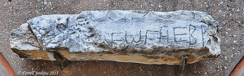
Synagogue Inscription displayed in Corinth Museum. Photo by Ferrell Jenkins.
A small plaque mounted underneath the inscription at the Corinth Museum reads, “Inscription from a late Roman synagogue.”
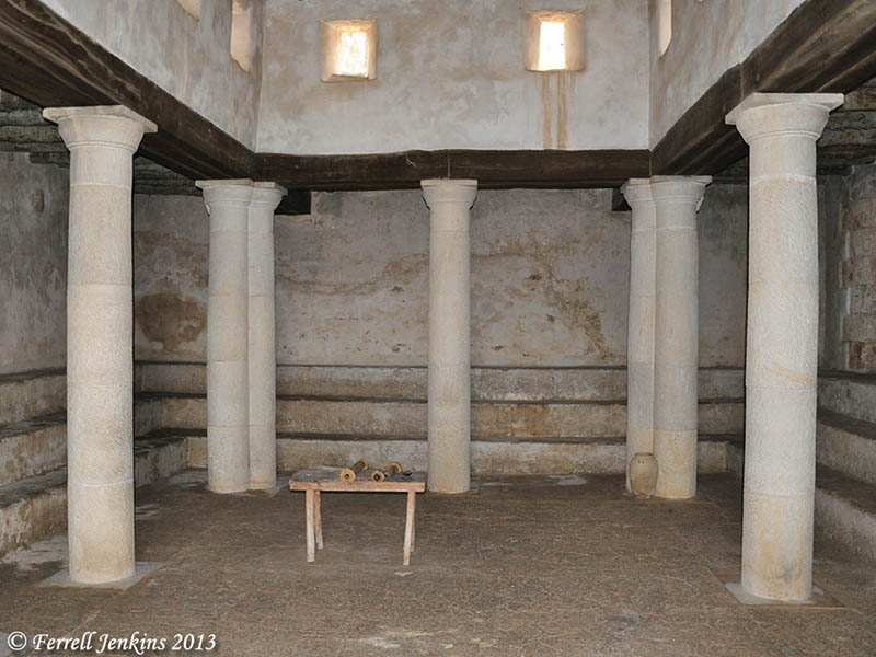
One rabbinic tradition has it that there were 480 synagogues in Jerusalem alone. Even the small villages of Galilee had synagogues at the time of Jesus (Mt. 4:23; 9:35).


You must be logged in to post a comment.