Category Archives: Bible Lands

The land of Gennesaret and the travel route west

The Sea of Galilee is called the “lake Gennesaret” by Luke (Luke 5:1). The area on the northwest corner of the Sea of Galilee is called the “land at Gennesaret.” In the view below we see the land of Gennesaret and the Via Maris. The travel route here leads to the Beit Netofa Valley and the sites of Khirbet Cana, Sepphoris, Nazareth, Yodfat (Jotapata), and Ptolemais (Akko). Yodfat was fortified by Josephus during the Jewish revolt against Rome. Josephus, commander of the Jewish rebels, surrendered to the Roman Emperor Vespasian at Yodfat.

Mount Arbel and the Plain of Genessaret. Photo by Ferrell Jenkins.

Mount Arbel and the Plain of Gennesaret. Photo by Ferrell Jenkins.

Many of the miracles of Jesus were performed in this area.

When they had crossed over, they came to land at Gennesaret. And when the men of that place recognized Him, they sent word into all that surrounding district and brought to Him all who were sick; and they implored Him that they might just touch the fringe of His cloak; and as many as touched it were cured. (Matthew 14:34-36 NAU)

A new tool for tour leaders

Near the end of January when I received my copy of The Satellite Bible Atlas, I decided that I would secure a copy for each member of my April tour group. Arrangements were made to have the books delivered to my tour operator in Jerusalem so that they would be available for use by the group at the beginning of the tour.

Ideally, it would be good for tour groups to meet together for classes prior to the tour. I have never been able to do this because my groups have come from many states, and sometimes a foreign country.

The first morning of touring I had the driver stop on the kurkar ridge along the Mediterranean Sea a few miles north of Netanya while we handed out the “surprise” books and explained them to the tour members. I asked them to turn to the maps that showed the area where we would be traveling that day. This procedure continued throughout the tour.

By the end of the tour the group members were talking about how the SBA would help them in their studies when they returned home.

On the last day of the tour we stopped by Yad HaShmona where Bill Schlegel works with the IBEX (Israel Bible Extension) program. Bill met our group and gave us a brief geographical orientation of the location and the importance of geography in the biblical story. From Yad HaShmona one can see the site of Kiriath-jearim (see here) to the east, and the coastal plain to the west. Todd Bolen includes a brief description of Yad HaShmona at BiblePlaces.com (here).

Bill Schlegel autographs a copy of The Satellite Bible Atlas for Ferrell Jenkins.

Bill Schlegel autographs a copy of The Satellite Bible Atlas for Ferrell Jenkins.

I can highly recommend the use of the SBA in connection with tours anywhere in Israel. Details about the publication, and how to order your own copy, may be found here.

The Satellite Bible Atlas is not to replace a standard Bible atlas such as the Zondervan Atlas of the Bible by Carl Rasmussen, or The New Moody Atlas of the Bible by Barry Beitzel. In fact, get all three. You will find each of them useful.

The “wild goats” of the Old Testament

Wild goats (Hebrew ya’el) are mentioned in a few Old Testament passages (1 Samuel 24:2; Job 39:1; Psalm 104:18; Prov. 5:19). This animal is often identified with the Ibex.

The ibex, a type of wild goat, is still found in Southern Palestine, Sinai, Egypt and Arabia; it was known also in ancient times, as is evident from rock carvings. (Fauna and Flora of the Bible, 46).

The wild goats are associated with En Gedi on the shore of the Dead Sea.

Now when Saul returned from pursuing the Philistines, he was told, saying, “Behold, David is in the wilderness of Engedi.” Then Saul took three thousand chosen men from all Israel and went to seek David and his men in front of the Rocks of the Wild Goats. (1 Samuel 24:1-2 NAU)

The Ibex may also be seen at En (Ein) Avdat (Avedat) and Mitzpe Ramon in Israel. The photo below shows one of the young Ibex on the run at En Avdat

Young Ibex on the run at En Avdat. Photo by Ferrell Jenkins.

Young Ibex on the run at En Avdat. Photo by Ferrell Jenkins.

The next photo illustrates how well the Ibex blend in with the terrain in which they live.

Ibex at Avdat in the Wilderness of Zin. Photo by Ferrell Jenkins.

Ibex at En Avdat in the Wilderness of Zin. Photo by Ferrell Jenkins.

The last photo shows the sure-footed Ibex seeking out the high places.

Ibex in the wilderness of Zin near En Avdat. Photo by Ferrell Jenkins.

Ibex in the wilderness of Zin near En Avdat. Photo by Ferrell Jenkins.

The reference to the hind or deer (Hebrew ayyalah) in Psalm 18:33 (Hebrew 18:34) indicates a different species, but the analogy is the same. Both Hebrew terms are used in Job 39;1.

He makes my feet like hinds’ feet, And sets me upon my high places. (Psalm 18:33 NAU)

He gives me the agility of a deer; he enables me to negotiate the rugged terrain. (Psalm 18:33 NET)

If you would like to see another photo of the Ibex at En Gedi, click here.

Personal Note: A few friends who have missed the blog have contacted me to see if I had returned home and was doing o.k. The answer is yes, and yes. After being away for three weeks I needed some time to recoup, tend to personal matters, and get my photos organized. The subscription price remains the same. Thanks for your concern.

Rivers in the Desert – Wadi Zin

Rivers in the Desert is the title of Nelson Glueck’s 1959 history of the Negev. These rivers also may be seen in the Judean wilderness and in the Sinai. Thomas Levy followed up on some of Glueck’s research in a Biblical Archaeology Review article in 1990.

If one travels in the desert during the summer months he will see a dry, desolate bad land with only an isolated tamarisk tree or shrub where the last water of the winter rain flowed. In the winter it can be different. Israel has two dominant seasons: winter and summer. The summer is dry and the winter is wet. The early rains begin about mid-October and continue till the late rains of early April. See Deuteronomy 11:14 and Joel 2:23.

Levy reminds us that “Nahal, incidentally, is Hebrew for a dry river bed or valley that flows at most a few times a year. In Arabic, the word is wadi. The two words are used interchangeably in Israel today.” The wadi is similar to the arroyo of the American southwest.

While traveling south of Beersheba, yesterday and today, we crossed the Wadi Zin (Joshua 13:21ff.) at least three times in each direction we traveled.

Here is what the Wadi looks like when it is dry.

Wadi Zin near Avedat in the Negev of Israel. Photo by Ferrell Jenkins.

Wadi Zin near Avedat in the Negev of Israel. Photo by Ferrell Jenkins.

And this marker on the highway shows travelers the depth of the water when the wadi is flooded. The person in the photo is six feet tall. The marker goes to 1.5 meters (about 5 feet), and the pole is higher.

Marker to let travelers know the depth of the water in the Wadi Zin.

Marker to let travelers know the depth of the water in the Wadi Zin. Photo by Dan Kingsley.

For more pictures, including rivers in the desert during the rain season, see here.

North of the Sea of Galilee

Most of our visits today were north of the Sea of Galilee. Here are some of the stop we made.

The fishing port of Tiberias, where we saw fishermen bringing in some large fish. One of the owners of the Ron Beach Hotel told us these large fish were used for fish oil.

Hazor.

Senir (Hasbani) River. One of the sources of the Jordan.

Dan. To photograph the Middle Bronze city gate (19th-18th century B.C.).

Beit Ussishkin Museum at Dan. The museum is mostly about the flora and fauna of the region, but there are a few pieces from the Dan excavations.

Hermon Stream Nature Reserve (or Banias River). To see the waterfall.

Omrit. Site of possible Herodian temple to Augustus. The road is horrible, and there is still a long walk to visit the site. It is really not prepared or intended for the casual visitor. Someday it should be.

Abel-beth-maacah (or Abel of Beth-maacah). A city called “a mother in Israel” (2 Samuel 20:19). We had a view of Mount Hermon with a small amount of snow still on the top.

Abel-beth-maacah and Mount Hermon. View toward east. Photo by Ferrell Jenkins.

Abel-beth-maacah and Mount Hermon. View toward east. Photo by Ferrell Jenkins.

Metula. This Israeli town is on the border with Lebanon. We looked over into Lebanon.

Hula Lake/Agamon Lake. This is the restoration of a portion of Hula Lake that had been drained in the mid-20th century. Birds from Asia and Europe travel through the Great Rift and their way to Africa and back. This lake is a favorite stopping place for many of them.

It was a hot day, but an enjoyable one.

A miscellany of sites on Monday

There are numerous small museum scattered across Israel. I had read about the Beit Sturman Museum at En Harod and had wanted to visit it. The Israel Museum Guide describes the museum in these terms:

Beit Sturman Museum is one of the biggest archaeological museums of the country. Rich collection of flora and fauna of the region. History of Jewish settlements in Israel valley. The museum is named in honour of one of the founders of kibbutz – Haim Sturman.

What really caught my attention was when I read that the Museum had a large collection of Roman milestones that were found in the Jezreel Valley.

Only seven milestones are visible in the photo below but there are dozens of others in the courtyard of the Museum. Many of them are broken, and very few of them have any visible inscription. I thought I recognized TR on one of them. I think this would indicate a milestone erected during the reign of the Emperor Trajan in the early 2nd century A.D.

Roman Milestones at Beit Sturman Museum, En Harod, Israel. Photo by Ferrell Jenkins.

A few of the Roman Milestones displayed at the Beit Sturman Museum, En Harod, Israel. Photo by Ferrell Jenkins.

The museum has a display of flora and fauna of the Jezreel Valley, several cases of pottery from sites in the area, and a display of agricultural practices including the first bale of cotton grown in Israel. That brought back a lot of childhood memories of when I picked cotton and went to the gin with my father or grandfather in North Alabama.

Earlier we tried to visit the Spring of Harod, the place where Gideon gathered the 300 men to fight the Midianites (Judges 7:1-8). This site was closed when my group were scheduled to visit a few days ago. We thought, at the time, that there might be some flooding in the area. However, it was still closed today. Dan and I tried to enter through a hotel or guest house, but they refused us entry. When we asked why the park was closed they just said “bureaucracy.” I suggested it might be a form of “sequestration.”

We also visited Tell Shalim, thought to be the site of Salim in the duo Aenon near to Salim, where John the Baptist baptized after Bethany Beyond the Jordan (John 3:23; 1:28). This is a place that would be impossible for a tour bus to go. It is about 8 miles south of Beth-shan, near the Jordan River.

There were a few other stops. We were disappointed when we were unable to get to the Roman Road at Golani Junction. A new road has been built east from the McDonald’s with a metal rail and a ditch that I didn’t think I would want to try to cross. Some individual travelers will be disappointed in this change.

A morning with Shmuel Browns

Shmuel Browns is an Israel Tour Guide. While he can handle any tours in Israel, he seems to specialize in taking care of individuals or small groups. Shmuel and I had not met till today, but we have come to know each other through our blogs and occasional correspondence. We decided to meet in person.

This morning Shmuel picked up Dan and me at the hotel. Last evening we had discussed where we might go to make some good photos. Several places were discussed, but we decided on the Herodion. Shmuel has developed a one day (or less) program to take a person/group to the Herodion, and then to see the Herod the Great exhibit at the Israel Museum.

I had been to the Herodion several times but had never spent much time in the lower Herodion. I was impressed with the things Shmuel showed us there. In the photo below he is explaining about a large Mikve (ritual bath) that was part of the complex built by Herod the Great.

Shmuel Browns, Israel Guide, at Lower Herodion. Photo by Ferrell Jenkins.

Shmuel Browns, Israel Tour Guide, at the Lower Herodion, Photo: Ferrell Jenkins.

On the way to the Herodion we stopped on the north side of the Mar Elias Monastery. The Greet Orthodox Monastery overlooks Bethlehem and the Herodion. Tradition has it that it is here where Elijah rested when he was fleeing from Jezebel (1 Kings 19:2ff.). It is also associated with more recent historical characters with the name Elias.

Across the road (north) is the ruin of the Kathisma (seat), an octagonal Byzantine church building discovered in 1992. A large stone in the center of the church is said to be where Mary rested on her way to Bethlehem (Luke 2:4-5). (Perhaps more about that later.) In the same area there is an old Olive grove. I enjoyed the beauty of this scene and thought you might also.

Olive trees near the Kathisma church. Photo by Ferrell Jenkins.

Olive trees near the Kathisma church. Photo by Ferrell Jenkins.

Shmuel has a nice web site with some great photographs. He also sells prints of his photos. Read all about it at Israel Tours | Israel Tour Guide.

From time to time I have someone who tells me they will have a free day or two while traveling in Israel on business. They want to know what they can see, or who could guide them. You need a guide in Jerusalem if you have never been there before. Shmuel would be a good man to call. All contact info is on his web page. I did not inquire about the costs, but you can check that when you contact him.

We had a great morning. Thanks, Shmuel.

Last day of the tour

Today was the final day of the 2013 Bible Land tour of Israel. We had some great visits today, but it has been a long day and I am about ready to turn in for the day.

Our group should be boarding their flight to the USA. My friend, Dan, arrived on time, but without his luggage. It went to LAX instead of TLV! Not an easy mistake to make.

We will be spending about a week or more traveling about the country.

Late this afternoon our group had dinner at a seaside restaurant in Joppa. I decided to share the beautiful sunset we saw about the time we finished eating.

Sunset on the Mediterranean from Joppa. Photo by Ferrell Jenkins.

Sunset on the Mediterranean from Joppa. Photo by Ferrell Jenkins.

A nice conclusion to a wonderful, sunny day.

Temple Mount, Pools, Jericho, Jordan River

Today was a great day for travel in and around Jerusalem. We started the day by visiting the Temple Mount. This is a place filled with Bible history relating to Abraham, David, Solomon, Jesus, and Peter (as well as all of the apostle). It is a place destroyed by the Babylonians (586 B.C.) and the Romans (A.D. 70).

The site has been under Islamic control since the 7th century.

We visited the Pools of Bethesda (John 5) and the Pool of Siloam (John 9).

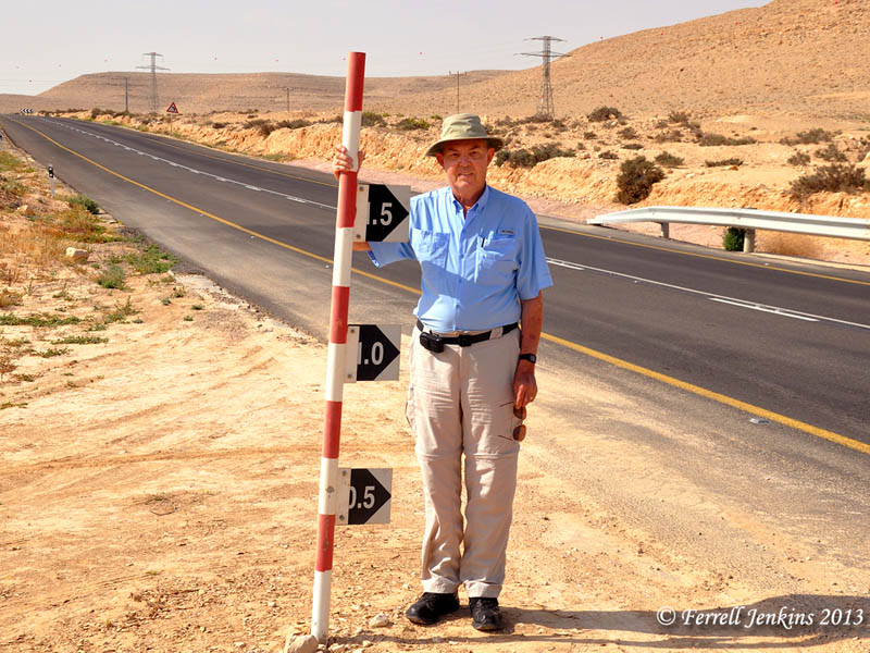
Yesterday, by the time we visited Masada, Qumran, and Jericho, it was too late to visit the baptismal site on the Jordan River, a site known as Qasr el-Yahud. This site on the Israel side is across from the Jordanian site identified as Bethany beyond the Jordan (John 1:28).

We stopped in Jericho for lunch at the Temptations Restaurant. The restaurant is located on the south end of Tell es-Sultan, identified with Biblical Jericho (Joshua 3-6).

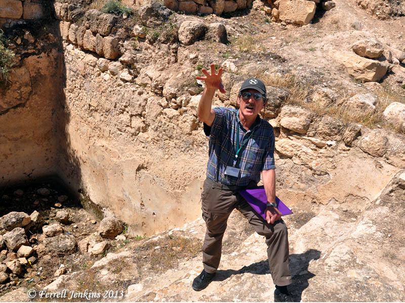
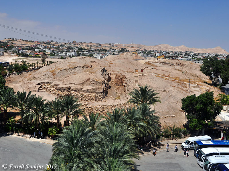
The restaurant has lots of parking space for tour buses and good food. That’s a good combination in the tourist industry. As I was leaving I noticed a sign with the wording “View of Jericho”, and thought I should check it out. It took a climb of 11 flights of stairs to reach the roof. It was worth it for the view which was exceptionally good in all directions.

The view to the north is of Tel es-Sultan. See below. You may notice some wires (cables) across the photo. These are for the cable car that goes up to the traditional Mount of Temptation (Matthew 4).

Jericho (Tell es-Sultan) from the south. Photo by Ferrell Jenkins.

Jericho (Tell es-Sultan) from the south. Photo by Ferrell Jenkins.

Afterwards we visited the Jordan River. On the way back to Jerusalem we stopped by the St. George Monastery in the wilderness of Judea. The monastery building appear to hang on the side of a cliff overlooking the Wadi Qilt. Quite a sight.

We stopped at the Inn of the Good Samaritan (Luke 10:25-37) which now houses many mosaic floors from Jewish synagogues, Samaritan Synagogues, and Byzantine Churches, as well as a few other interesting artifacts.

It was a great day.

The 2013 group in Jerusalem

It is traditional for groups to have a photo made on the Mount of Olives with a view of Jerusalem in the background. I like the tradition, so I try to do that each time I bring a group to Israel.

Here is the photo we made this morning. You may click on the photo for a larger image.

Jenkins Bible Land Group - Jerusalem - April 22, 2013.

Jenkins Bible Land Group – Jerusalem – April 22, 2013.

In addition to the Mount of Olives, we visited the Garden of Gethsemane on the western slope of the Mount of Olives. After that we made our way to the Christian Quarter of the Old City to visit the Church of the Holy Sepulcher. A local lunch was enjoyed in the Old City.

In the early afternoon we went to the Israel Museum. There were three major things to see there:

  1. The Second Temple Model of Jerusalem.
  2. The Shrine of the Book.
  3. The Israel Museum. We visited the Herod the Great: the kings final journey exhibit as well as the archaeology section of the Museum.

There was time enough to go to Bethlehem to visit the Church of the Nativity, and to do some shopping at the Kando shop.

Everyone in our group seems to be staying well. For this, we are thankful.