Category Archives: Israel

Friday’s findings

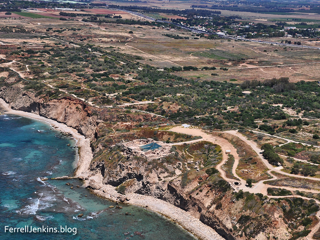
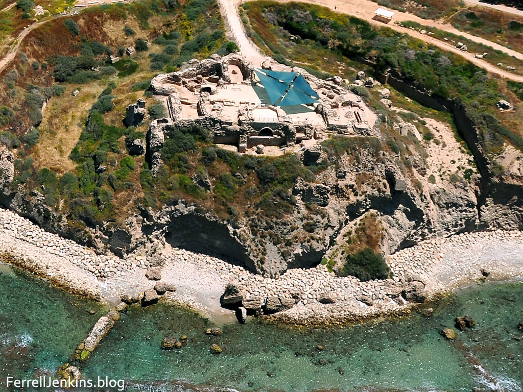
Looking for Joshua’s Ai. Gary Byers, administrative director of the Khirbet el-Maqatir excavation, has already posted info on six days of the dig. Because I assume this series will continue, I suggest you begin with Day One here. The expedition has posted photos on Facebook here. This will give prospective diggers some idea what goes on during a dig. Information about the purpose of the dig, a project of the Associates for Biblical Research, is posted here. Dr. Bryant Wood, and others associated with this dig, are looking for an alternative site for Ai.

Hidden Pyramids. Dr. Zahi Hawass has called in question the BBC program about the work of Dr. Sarah Parcak using satellite imagery to discover 17 new pyramids and other structures.

Although satellite imaging is useful for discovering new sites and monuments, interpretation of the images is not straightforward. No one can say with certainty that the features displayed under the sand are actually pyramids. Such anomalies could be houses, tombs, temples, pyramids, buried cities or even geological features. The only way we can definitely identify what is there is by excavating it – by investigating it physically. This was not made clear in the article.

Read the complete article here. See our earlier report here.

Corinth Matters. David Pettegrew, assistant Professor of History at Messiah College near Harrisburg, PA., has started a blog called Corinth Matters. Pettegrew completed a dissertation on Corinth on the Isthmus. The new blog deals with the ancient city of Corinth, the Isthmus, the Diolkos, and other things Corinthian. You will find readings lists, links to conferences, info on excavations, maps and images relating to Corinth and the Corinthian correspondence.

Dr. Pettegrew currently is traveling in Albania, the location of ancient Illyricum, visiting Corinthian colonies from the pre-Christian period. Paul made reference to preaching as far as Illyricum.

by the power of miraculous signs and wonders, and by the power of God’s Spirit. As a result, I have fully proclaimed the good news about the Messiah from Jerusalem all the way around to Illyricum. (Romans 15:19 CSB)

Corinth Canal - Photo by Ferrell Jenkins.

A ship is towed through the Corinth Canal. View west toward the Gulf of Corinth. Photo by Ferrell Jenkins.

Having taught the Corinthian correspondence for several year, I find this blog especially interesting.

The rocks of the wild goats (Ibex)

Wild goats (Hebrew ya’el) are mentioned in a few Old Testament passages (1 Samuel 24:2; Job 39:1; Psalm 104:18; Prov. 5:19). This animal is often identified with the Ibex.

The ibex, a type of wild goat, is still found in Southern Palestine, Sinai, Egypt and Arabia; it was known also in ancient times, as is evident from rock carvings. (Fauna and Flora of the Bible, 46).

The wild goats are associated with En Gedi on the shore of the Dead Sea.

Now when Saul returned from pursuing the Philistines, he was told, saying, “Behold, David is in the wilderness of Engedi.” Then Saul took three thousand chosen men from all Israel and went to seek David and his men in front of the Rocks of the Wild Goats. (1 Samuel 24:1-2 NAU)

Our photo below was made at En Gedi.

Ibex at En Gedi. Photo by Ferrell Jenkins.

Ibex at En Gedi. Photo by Ferrell Jenkins.

The Psalmist says the high mountains are for the wild goats.

The high mountains are for the wild goats; The cliffs are a refuge for the shephanim. (Psalm 104:18 NAU)

SourceFlix has put together a nice video showing the Wild Goats (Ibex) at En Gedi.

The Crags of the Wild Goats from SourceFlix on Vimeo.

HT: Dr. Claude Mariottini

Update: Yesterday worked on this post, with the intention of completing it this morning. Early today I had to go to the airport to take a loved one. When I returned I continued working on the post and published it. Just now I decided to check some other blogs. To my surprise, I see that Todd Bolen has posted some fascinating videos of the Ibex fighting. Check it here.

What is that expression about great minds?

Apollonoia (Tel Arsuf) and the Plain of Sharon

Apollonia is not mentioned in the Bible, but the site is significant in understanding the land of the Bible. The coastal plain from Tel Aviv north to Haifa is known as the Plain of Sharon. The pasture lands of Sharon were allotted to the tribe of Gad (1 Chronicles 5:16). The plain seems to be mentioned in the account of the healing of Aeneas by Peter at Lydda (the area of modern Lod). Word spread quickly to the residents of Lydda and Sharon.

There he found a man named Aeneas, bedridden for eight years, who was paralyzed.  And Peter said to him, “Aeneas, Jesus Christ heals you; rise and make your bed.” And immediately he rose.  And all the residents of Lydda and Sharon saw him, and they turned to the Lord. (Acts 9:33-35 ESV)

The city at Tel Arsuf was established by the Phoenicians and dedicated to Reshef, the Canaanite god of fire. The Greeks equated Reshef with Apollo and called the city Apollonia (Alon, Israel National Parks & Nature Reserves, 286).

Apollonia was important to the Crusaders near the close of the 12th century and the decades to follow when the Crusaders “established part of their kingdom in the coastal area of the Holy Land, without Jerusalem” (Alon, 287). The fortress and walls from 1241 A.D. are now part of the National Park.

Our first photo shows the coastal plain of Sharon. Notice especially the kurkar ridge along the coast. Israel highway 2 may be seen a short distance inland. You will see Apollonia on the ridge overlooking the sea.

Aerial View of Apollonia and the Plain of Sharon. Photo by Ferrell Jenkins.

Aerial View of Apollonia and the Plain of Sharon. Photo by Ferrell Jenkins.

The second photo shows an aerial close up of the site of Tel Arsuf or Apollonia. This site is being damaged by the sea.

Aerial view of the Crusader fortress of Apollonia. Photo by Ferrell Jenkins.

Aerial view of the Crusader fortress of Apollonia. Photo by Ferrell Jenkins.

Ha’aretz English Language Edition Magazine reports on an exhibition at the Eretz Israel Museum, Tel Aviv, of the “Last Supper at Apollonia.”

Apollonia Final Supper of the Crusaders. Photo: Ha'aretz.

Apollonia Final Supper of the Crusaders exhibition. Photo: Ha’aretz, Leonid Pedrol.

The exhibition offers a first-time look at a collection of Crusader kitchen utensils. The Mameluke siege of the Crusader fortress began in late March 1265. Inhabitants of the area fled to the fortress.

During the few and far-between peaceful times in the Kingdom of Jerusalem, the fortress, built a generation earlier and leased to the Order of the Hospitallers just four years before its fall, was home to about 50 knights and their servants. At the start of the siege, which would go on for many bloody weeks, nearly 2,000 people were crammed into the fortress

Ronit Vered, author of the article, describes the siege.

During the five-week siege, more than 2,700 heavy boulders brought in from the Samaria hills were catapulted at the fortress walls. Some 1,200 iron-tipped arrows were fired at the defenders, and arrows wrapped in cloth and dipped in a flammable material were launched at the drawbridge and the heavy door, which was made of wood and bronze plates. The archers of the Order of the Hospitallers returned fire and even launched clay grenades filled with fiery materials at their enemies, but they had no defense against the tunnels dug by the Mamluks to undermine the wall’s foundations. On Thursday, April 29, the Mamluk fighters seized control of parts of the Arsur wall and raised their flag over it.

The Crusaders lost almost 1,000 men in the battle. Prof. Israel Roll led an excavation of the site in 1999. A cache of Crusader kitchen utensils were found. These are now exhibited for the first time at the Eretz Israel Museum.

The complete fascinating article may be read here. Larger images are available for those who may find them useful. Just click on the image above.

HT: Joseph I. Lauer

The Mediterranean coast along the Plain of Sharon

Today I am sharing a photo of the Mediterranean Sea made from the kurkar ridge of the Plain of Sharon at Netanya, Israel.

The Mediterranean Sea from the kurkar ridge at Netanya, Israel. Photo by Ferrell Jenkins.

The Mediterranean Sea from the kurkar ridge at Netanya, Israel. Photo by Ferrell Jenkins.

Biblical Israel was given the Great Sea as the western border of the promised land.

For the western border, you shall have the Great Sea and its coast. This shall be your western border. (Numbers 34:6 ESV)

In other texts the Mediterranean is simply called the western sea (Deuteronomy 11:24).

The sheep of His pasture

The photo we are sharing today is typical of the beautiful scenes in the Shephelah (lowland) of Israel in the spring (Obadiah 1:19). After the grain has been harvested the sheep are led by their shepherd into the fields to graze. The photo today shows the fields and hills between the Valley of Elah and Beit Guvrin to the east of Highway 38. This is near the entry to the Adullam Grove Nature Reserve and Horbat Midras.

Sheep grazing in the Shephelah. Photo by Ferrell Jenkins.

Sheep grazing in the Shephelah. Photo by Ferrell Jenkins.

Numerous biblical references come to mind. Note what the Psalmist said about the role of man in relation to the animals.

You have given him dominion over the works of your hands; you have put all things under his feet, all sheep and oxen, and also the beasts of the field, the birds of the heavens, and the fish of the sea, whatever passes along the paths of the seas. O LORD, our Lord, how majestic is your name in all the earth!  (Psalm 8:6-9 ESV)

Or, the reference to God’s people as the sheep of His pasture.

But we your people, the sheep of your pasture, will give thanks to you forever; from generation to generation we will recount your praise. (Psalm 79:13-1; cf. 100:3 ESV)

Or, perhaps the most familiar of all:

The LORD is my shepherd; I shall not want. (Psalm 23:1 ESV)

A hi-res photo suitable for use in teaching is available by clicking on the image. You can make your own caption across the sky or the grain field.

Fields white for harvest

Many biblical accounts contain information not easily understood without some knowledge of the history and culture of the time. Such is true in the account of Jesus traveling through Samaria in John 4. You probably recall that He met the woman of Samaria when she came to the well to draw water.

While His disciples were in the city buying food Jesus taught the Samaritan woman. She then went into the city and began to tell the men that she had met this man who knew her intimate life.

When the disciples returned to Jesus He said,

Do you not say, ‘There are yet four months, then comes the harvest’? Look, I tell you, lift up your eyes, and see that the fields are white for harvest. (John 4:35 ESV)

This is one of those statements with a literal meaning as well as a spiritual one. What did he mean by four months? Four months separate the sowing and the harvesting. Barley harvest could begin around April 15. Wheat harvesting begins six weeks later in late May or early June. In May the fields would be white unto harvest. This helps to date the episode in John 4 to December or January, depending on whether the crop was barley or wheat.

When Jesus said the fields were white for harvest He was speaking of a spiritual harvest. The disciples did not know that He and the woman had already sowed the seed. They would reap the harvest. It is not inappropriate to see the harvesting in the two days Jesus stayed there teaching (John 4:39-43), or in the later events of Acts 8:39-43.

The photo below was made from En-Dor, looking north to Mount Tabor. The wheat fields are almost ready for harvesting.

Wheat ready for harvest at En-Dor near Mount Tabor. Photo by Ferrell Jenkins.

Wheat ready for harvest at En-Dor near Mount Tabor. Photo by Ferrell Jenkins.

Under some light the fields even have a white appearance, as you see in the photo below.

Wheat ready for harvest near En-Dor and Mount Tabor. May 13. Photo by Ferrell Jenkins.

Wheat white for harvest. May 13. Photo by Ferrell Jenkins.

These little tips, scattered here and there in Scripture, reveal much about the daily life and culture of Bible times.

The khamsin (hamsin) before and after

Yesterday we wrote about the effect of the east wind on Larry’s hike along the Jesus Trail. Here is a brief followup that should be helpful.

Dr. Carl G. Rasmussen, author of Zondervan Atlas of the Bible, also maintains the Holy Land Photos website. He has a series of photos showing the effect of the khamsin (which he spells without the silent k, as hamsin), and the same view with normal visibility. To see these fascinating photos, with additional descriptive info, click here.

Carl now has 3230 photos of 322 biblical sites available on his website. The photos are available for free download in various sizes. Perhaps the most helpful feature to teachers and preachers is that they are available PowerPoint ready. He also discusses “The Transitional Seasons”, with the same beautiful photos, in the Zondervan Atlas of the Bible (rev. ed.) pages 30-31.

Click Zondervan Atlas of the Bible to order this book for $25.20 (free shipping). This is a savings of 37%.

New difficulties on the “Jesus Trail”

We have reported about Larry’s hiking on the “Jesus Trail” from Nazareth to Bethsaida. Larry’s last post was at the end of Day 3. On his trek from Moshav Arbel eastward he encountered a new problem — the strong East winds.

Almost everyone who has visited Israel has learned of the West winds that make their way through the depressions around the Sea of Galilee and create storms on the Sea. Unless you travel in the “transitional season” or in the (dry) summer season you may not have learned about the East wind. This wind is called the sirocco. In Egypt it is known as the khamsin, and in Israel as the sharav.

Denis Baly, The Geography of the Bible (1974 ed., pp. 51-53), explains these winds. He says they occur in the transitional seasons from early April to mid-June (that is now), and from mid-September to the end of October. Baly says,

It is this intense dryness and the fine dust in the air which are so exhausting, for other hot days, though troublesome, do not have the same effect. People with a heart condition, nervous complaints, or sinus trouble are particularly affected, but even the mildest-tempered person is apt to become irritable and to snap at other people for no apparent reason. Tourists find the sirocco especially frustrating, for not only does travel become fatiguing, but the fine yellowish dust which fills the air drains it of all color, blots out all but the immediate vicinity, and makes photography a mockery.

Here is how Larry described his day in an Email to me overnight.

No blog last night because of the storm. I woke to high winds from the east which dusted up the air so badly that photos were mostly useless. Worst part was that it was directly against me and really HOT. Pushing against 20+ mph winds really took the steam out of me. By the end of the day I was utterly exhausted.  Drank my full 3 litres and had good dinners and breakfasts, but energy levels are still very low.

The photo below is one of the aerial shots we made a week ago. It was made while flying over the west shore of the Sea of Galilee, with the view to the west. You can see Mount Arbel and the Wadi Hamam below. The Via Maris runs in this valley which is also called the Valley of the Doves. You will notice two lines of mountains further west.

I am rather sure that this is the route Larry was walking yesterday. Larry has lived in Washington state for many years. I think he is not bothered by the sudden rains, but the intense heat and strong wind from the east may be another matter. I want you to think about the fact that all of the biblical characters from the Patriarchs to Jesus and His disciples encountered conditions similar to these (and worse).

Aerial view of Arbel and the Via Maris. Photo by Ferrell Jenkins.

Aerial view of Arbel, Wadi Hamam, and the Via Maris. Photo by Ferrell Jenkins.

Baly cites several biblical references to the east and south winds that bring in the hot air and the dust storms. He says, “Where the mountains come close to the sea a strong sirocco pours down the slopes like a flood, at 60 miles an hour or more, stirring the sea into a fury.”

By the east wind you shattered the ships of Tarshish. (Psalm 48:7 ESV)

In the prophecy against Tyre, Ezekiel says,

“Your rowers have brought you out into the high seas. The east wind has wrecked you in the heart of the seas. (Ezekiel 27:26 ESV)

Notice Elihu’s comments to Job about the south wind.

Do you know the balancings of the clouds, the wondrous works of him who is perfect in knowledge,  you whose garments are hot when the earth is still because of the south wind?  (Job 37:16-17 ESV)

Jesus also observed the effect of the south wind:

And when you see the south wind blowing, you say, ‘There will be scorching heat,’ and it happens. (Luke 12:55 ESV)

Do you remember Jonah’s problems after enjoying the shade of his plant?

When the sun rose, God appointed a scorching east wind, and the sun beat down on the head of Jonah so that he was faint. And he asked that he might die and said, “It is better for me to die than to live.” (Jonah 4:8 ESV)

Baly calls attention to the effect of the spring siroccos on the crops.

The spring siroccos destroy the winter grass and may damage the crops if they come too soon, and hence they appear constantly in the Bible as a symbol of the impermanence of riches or of human life.

Note these additional references in your own study: Psalm 103:16; Isaiah 40:6-8; Hosea 13:15; Ezekiel 17:10; James 1:11.

When Larry goes back on line I am sure his vivid descriptions of his experience will be well worth reading. Here is the link.

Update: Larry is back in Jerusalem Wednesday evening.

Saul visited a medium at En-Dor (Endor)

En-Dor (or Endor) is a fairly insignificant site. It is now located in the middle of wheat fields and groves. I had seen it from the road, but this time I was able in a car to drive to it and get some better photos. This one shows the low tel, and a wheat field ready for harvest. The view is to the north. Mount Tabor dominates the scene to the right, but it is not visible in this photo. One has to go with the light in making photos.

En-Dor on the shoulder of the Hill of Moreh. Photo by Ferrell Jenkins.

En-Dor on the shoulder of the Hill of Moreh. Photo by Ferrell Jenkins.

Shards of pottery are visible all around, especially in the low areas of the farm road as well as in the plowed field. This is a certain indication of an ancient inhabited site.

Pottery shards at En-Dor. Photo by Ferrell Jenkins.

Pottery shards at En-Dor. Photo by Ferrell Jenkins.

En-Dor was located in the territory of Issachar, but was allotted to the half tribe of Manasseh that settled on the west bank of the Jordan (Joshua 17:11).

The most significant biblical event recorded in connection with En-Dor is the visit of  King Saul to the medium of En-Dor.

The Israelites were gathered with Saul on Mount Gilboa. When Saul saw the Philistines gathered against him in the valley below he was afraid and sought out a medium or necromancer, even though earlier he had them removed from the land. This medium lived over the Hill of Moreh on the northern slopes at En-Dor. This tel is located about 2½ miles south of Mount Tabor on the south and east side of Highway 65. It is easily discernible by the palm trees growing there.

Then Saul said to his servants, “Seek out for me a woman who is a medium, that I may go to her and inquire of her.” And his servants said to him, “Behold, there is a medium at En-dor.” (1 Samuel 28:7 ESV)

Map showing location of En-Dor. Courtesy of BibleAtlas.org.

Map showing location of En-Dor. Courtesy of BibleAtlas.org.

Following Larry on the “Jesus Trail”

Last week Larry and I spent the week traveling here and there in Israel to many places not easily accessible to a tour group. Friday afternoon I dropped Larry in Nazareth where he would spent the night and begin the next morning walking the five-day jaunt on the Jesus Trail from Nazareth to Capernaum and Bethsaida.

He tells about the beginning in Nazareth here. He reports on finding the Roman Road earlier on Friday, May 13 here.

The events of Saturday, May 14, from Nazareth through Sepphoris (Zippori) to Cana of Galilee, is recorded here.

Day 2 (May 15) of the journey from Cana (Kefr Kanna) of Galilee to Ilaniya is recounted here. He includes photos of flowers and butterflies that he saw along the way, and records his encounter with three vicious-appearing sheep dogs.

By the time you look at these blogs you will be ready to continue following the rest of the journey without any notification from me.

I am taking the liberty to include two of Larry’s many photos to entice you to take a look at his blog. The first shows one of the beautiful butterflies on a thistle bloom. There are several varieties of thistles (or briers) mentioned in the Bible. (If I am wrong about this, I know one of our readers who will send the correct information.)

Butterfly on a thistle bloom. Photo © Larry Haverstock.

Butterfly on a thistle bloom. Photo © Larry Haverstock.

This is where Larry spent the second night of his “Third Journey.”

Accommodation on the Jesus Trail - Night 2. Photo © Larry Haverstock.

Accommodation on the Jesus Trail - Night 2. Photo © Larry Haverstock.

No matter how “primitive” our accommodations may be, we are reminded of Jesus’ statement about his own situation on earth:

Jesus said to him, “The foxes have holes and the birds of the air have nests, but the Son of Man has nowhere to lay His head.” (Matthew 8:20 NAU)

Here is a self-photo of Ferrell (l) and Larry (r) on the Roman Road near Golani Junction.

Ferrell Jenkins & Larry Haverstock on Roman Road at Golani Jct.

Ferrell Jenkins & Larry Haverstock on Roman Road at Golani Jct.

For better photos of the Road see Larry’s blog (linked above) or this blog, here.