Category Archives: Israel

Israel trip comments

Elizabeth and I returned last Thursday from a two week trip to Israel. We hosted our first tour in 1967. Since that time I have been to Israel nearly forty times. We have been privileged to show hundreds of Bible students the land of the Bible. Of course, there are also tours to Greece, Turkey, and Egypt, that also visited Bible sites.

We made the recent trip to visit some places we had not been, and also to make digital photographs at some places, both Old Testament and New Testament, we had not been able to visit with a good digital camera. We were able to get to a great percentage of the sites we intended to visit. A few eluded us, mostly due to a lack of time. There were also some surprises along the way that allowed us to visit a few sites that were not on our list.

August is not the ideal time to visit Israel due to the heat. If you followed our blog you know that we encountered temperatures of 113 degrees Fahrenheit some days. Of course, we had an air conditioned car and nice air conditioned hotels. We used Delta Reward Miles for our flights. Considering my schedule and the available Reward dates, it was the best we could do. Having visited Israel in March, April, May, June, July and November, it was good to add August to the list. In many cases I think the 2600+ high resolution photos we made were good. We made our overseas flight from Detroit on Air France via Paris. The return was on Delta’s non-stop flight from Tel Aviv to Atlanta (12 hours and 45 minutes). We had enough points to fly business. Getting back to coach will be difficult!

One advantage of traveling in the summer is that the days are longer for making photos. In the winter the daylight hours are much shorter, and you face the likelihood of rain and larger crowds.

Driving in Israel is little different from driving in the USA, but the cities are not laid out in the neat western way of avenues and streets. Parking is difficult in most of the cities. The day we visited the Old City of Jerusalem we took a taxi to the Dung Gate, and then another taxi at the end of the day from Jaffa Gate. We rented from Eldan, and also rented a GPS unit from the company that supplies the units for all car rental agencies. We received a defective unit that was a real pain for four days until we were back near the airport to replace it. We rented a cell phone from Travel Cell before leaving the USA that allowed free incoming calls.

Gasoline costs about $8 per gallon, and prices for food are about double what we would expect to pay in the USA. The water in Israel is good, but we bought bottled water for our daily travel. The hotels had small refrigerators for our use. Internet connections cost as high as $20 per day. Most were $12 a day. One hotel, the Ron Beach in Tiberias, charged only $2 per day. The $12 and $20 rates are really tough when we think of getting free Internet connections in most American hotels. By the way, the Ron Beach is an ideal hotel for individuals traveling. It is away from the the hustle and bustle of Tiberias and is situated on the shore of the Sea of Galilee.

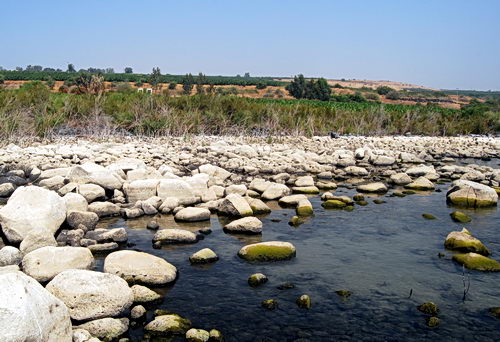
Plastic water bottles and cigarette butts abound everywhere Israelis hike. The area around the Sea of Galilee is especially bad. If I could give the officials some advice it would be to declare a clean up day.

We do not advise the first or second time traveler to try it on your own. You need to be with a group and a competent guide.

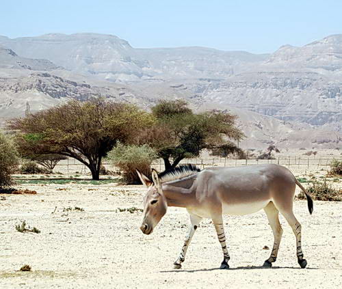
Perhaps the biggest danger we faced was at the Hai-Bar Nature Reserve. I let down the car window to make a photo of one of the ostriches and almost lost a lens. See for yourself.

Ostrich at the Hai-Bar Nature Reserve. Photo by Ferrell Jenkins.

Ostrich at the Hai-Bar Nature Reserve. Photo by Ferrell Jenkins.

The ostrich is listed among the unclean birds for the Israelites in Leviticus 11:16 and Deuteronomy 14:15.

We drove almost 1900 miles, traveled from Dan to Beersheba, even from the border of Egypt on the Gulf of Eilat (Aqaba) on the Red Sea to the border with Lebanon at Metulla. We drove along the Lebanon border in the mountains of Upper Galilee from Kedesh to Akko. We were close to the Gaza strip when we visited Ashkelon. We drove from the Mediterranean Sea on the West to the border with Jordan in the Arabah, and along the Jordan River valley. Some of the sites along the central mountain range (read West Bank) are not easily accessible.

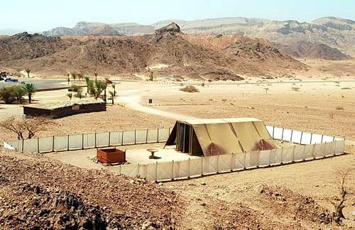
Israel has a good National Parks system. When we travel with a group the guide buys an entry card for the sites we will visit. This was what we intended to do, but our first stop was at Bet Guvrin/Maresha. We bought a pass, good for a year, to visit all of the parks. This was a good purchase, and we still have time to get back and visit some other sites. 🙂 There were a few other places we visited that were not part of the national parks network (e.g., Timna Park, and the Tabernacle Model).

Both of us stayed healthy the entire tour and arrived home safely. Every flight was on time. We are thankful to the Lord for this wonderful opportunity and look forward to using what we learned and photographed in teaching others.

Home! Sweet Home!

We arrived safely at our Florida home this morning after two weeks visiting Bible sites in Israel. I will try to write a few more posts about the trip after a little catching up. Thanks for your interest in Ferrell’s Travel Blog. We had a marvelous trip, but I am reminded of the words of John Howard Payne (1823):

Mid pleasures and palaces though we may roam,
Be it ever so humble there’s no place like home!
A charm from the skies seems to hallow us there,
Which, seek through the world, is ne’er met with elsewhere:
Home! Home! sweet, sweet Home
There’s no place like Home!

Up to Jerusalem again

The Bible speaks of going up to Jerusalem and down from Jerusalem. Certainly the main reason for this is the elevation of Jerusalem. It is located in the central mountain region of Judea at an elevation of about 2400 to 2500 feet above sea level.

We left Tiberias and the Sea of Galilee (Kinneret) this morning, spent some time in the Jezreel Valley, stopped by Caesarea Maritima, and then drove up to Jerusalem.

Here is a photo I made this morning at sunrise from my window on the shore of Galilee. I had in mind a photo that would be suitable for a presentation background. It reminded me of the fact that some of the disciples were fishermen, and were called by the Jesus to leave that work and accept His offer to become fishers for men.

Going on from there He saw two other brothers, James the son of Zebedee, and John his brother, in the boat with Zebedee their father, mending their nets; and He called them.  Immediately they left the boat and their father, and followed Him.  (Matthew 4:21-22)

A fisherman on the Sea of Galilee at sunrise. Photo by Ferrell Jenkins.

A fisherman on the Sea of Galilee at sunrise. Photo by Ferrell Jenkins.

Cove of the Sower, Akko, Upper Galilee

Today I put forth some extra effort to make a good photo at the spot on the north end of the Sea of Galilee called the Cove of the Sower. Some have suggested that this would have been the place where Jesus could speak to large numbers who assembled to hear Him.

Read the full account given by Mark in 4:1-20. Here is the way it begins:

He began to teach again by the sea. And such a very large crowd gathered to Him that He got into a boat in the sea and sat down; and the whole crowd was by the sea on the land.  And He was teaching them many things in parables, and was saying to them in His teaching,  “Listen to this! Behold, the sower went out to sow. (Mark 4:1-3)

Read the parallel accounts in Matthew 14:1-15 and Luke 8:4-10.

B. Cobbey Crisler conducted some experiments at places where the Bible records that large crowds gathered. The attempt was to see if the large number were able to hear a speaker without the aid of modern sound equipment. The places were Kadesh-barnea, Shiloh,  and The Cove of the Sower in Galilee. I suggest you read the entire article (“The Accoustics and Crowd Capacity of Natural Theaters in Palestine.” Biblical Archaeologist, 1976. Vol. 39. Num. 4.

The study indicated that the Cove of the Sower would allow between 5000 and 7000 people to hear.

The water level of the Sea of Galilee is extremely low at this time due to lack of rain and snow in the past few years. In the photo posted below you will see many rocks in the foreground. Most years these rock would be covered with water. Due to the crops, and a highway, it is difficult to make out the amphitheater-like terrain. It would require several photos from different locations to show this, but it is there.

The "Cover of the Sower" in Galilee. Photo by Ferrell Jenkins.

The Cove of the Sower in Galilee. Photo by Ferrell Jenkins.

We made a wrong turn and realized we were near Dan. We had been there in April, but I decided to make new photos of the gates. This was a good move, because the light was perfect for the purpose.

We drove to Metulla, on the Lebanese border, to make a photo of Abel beth-maacah. Read 1 Kings 15:20; 2 Kings 15:29 and 2 Samuel 20:16. In this case the tel was dry, and brown, but the surrounding area was green with fruit trees. It made the tel stand out.

Our next stop was at Kedesh, one of the cities of refuge in Old Testament times (Joshua 21:32). We were at the same place yesterday, but did not have time to get good photos. I am now sure that I was successful today either.

Our last stop before returning to Tiberias was to visit Acre (Acco, Akko). We passed the ancient tel on the way to see the Crusader ruins. The city is mentioned only once in the Old Testament (Judges 1:31), as a city that the tribe Asher was unable to retain as their possession.  Akko is known as early as 1800 B.C. from Egyptian execration texts. In the period between the testaments the city came under the control of the Ptolemies of Egypt. As a result, the city’s name was changed to Ptolemais. Paul visited brethren in the city for a day on the return from his third journey (Acts 21:7).

The Crusader fortress at Akko (Acre). Photo by Ferrell Jenkins.

The Crusader fortress at Akko (Acre). Photo by Ferrell Jenkins.

Elizabeth and I realized today that we have traveled not only from Dan to Beersheba, but from Eilat on the Rea Sea to the border of Lebanon.  We have traveled from the Jordan Valley to the Great Sea, the Mediterranean. We are very thankful for this opportunity.

In the Galilee

We spent the day visiting sites in the Galilee region of Israel. This morning we stopped by Magdala, but was not successful in getting photos. New excavations were conducted a few months ago, but the site is fenced and locked. In the afternoon I found a location on the road above that provided a fairly good overview of the site.

Magdala is not mentioned in the Bible, but is thought to be the home of Mary Magdalene. According to the gospel of John, Mary Magdalene was the first disciple to see the “open tomb” of Jesus.

Now on the first day of the week Mary Magdalene came early to the tomb, while it was still dark, and saw the stone already taken away from the tomb. (John 20:1).

As we continued North I noticed a good view of Mount Arbel and the Via Maris (the way to the Sea).

We tried to locate the cove of the sower, a sort of natural amphitheater that may be the site of Jesus sitting in a boat and speaking to a larger crowd of disciples on the shore (

And He got into one of the boats, which was Simon’s, and asked him to put out a little way from the land. And He sat down and began teaching the people from the boat. (Luke 5:3).

Our next stop was the Greek Orthodox church at Capernaum. From there we went to Gamla, an impressive fortress east of the Sea of Galilee. Jewish zealots were defeated by the Roman army about A.D. 66. Josephus describes the site in vivid terms:

for it was located upon a rough ridge of a high mountain, with a kind of neck in the middle: where it begins to ascend, it lengthens itself, and declines as much downward before as behind, insomuch that it is like a camel in figure, from where it is so named, although the people of the country do not pronounce it accurately. Both on the side and the face there are abrupt parts divided from the rest, and ending in vast deep valleys; yet are the parts behind, where they are joined to the mountain, something easier of ascent than the other; but then the people belonging to the place have cut an oblique ditch there, and made that hard to be ascended also. On its slope, which is straight, houses are built, and those very thick and close to one another. The city also hangs so strangely, that it looks as if it would fall down upon itself, so sharp is it at the top. (Wars of the Jews 4:5-7)

See for yourself in this photo I made today.

Gamla. Photo by Ferrell Jenkins.

Gamla. Photo by Ferrell Jenkins.

About Noon we stopped at Kursi, the site of a 6th century Byzantine monastery near the possible site of the miracle of the swine (Mark 5:11-13). See an article by Charles Page, excavator at Kursi, here.

We drove north in the Golan Heights and crossed from east of the Jordan River to the west side at a site called the bridge of Jacob’s daughters. We had some beautiful views of the Jordan River in this area north of the Sea of Galilee. It appears that some folks were having a lot of fun on the Jordan.

Jordan River at the Bridge of Jacob's Daughters. Photo by F. Jenkins.

Jordan River at the Bridge of Jacob

We made a stop at Hazor and I quickly made photos at each major area on the tel. We were here earlier this year, but I wanted to get a few additional photos.

Our last major stop was at Tel Kedesh in Upper Galilee, near the Lebanon border. This Kedesh was located in the territory of the Israelite tribe of Naphtali (Joshua 19:37). It is probably best known as one of the six cities of refuge assigned to the tribe of Levi (Joshua 20:7; 21:32).

By the time we pulled in to our hotel on the shore of Lake Kinneret, we were ready for a shower and a good dinner.

En Gedi and the Jordan Valley

The Dead Sea is the lowest place on earth. We left our hotel on the south end of the Dead Sea this morning and headed north to En Gedi. We arrived a few minutes before the park opened, so this provided an opportunity to go down to the En Gedi beach on the Dead Sea to make some photographs of encrustations of salt on the rocks at the edge of the water.

En Gedi is a wonderful nature preserve. The name means “spring of the young goat” or “kid”. We saw lots of Ibex and a few Rock Badgers. The real reason for wanting to go to En Gedi is that it is associated with David. The spelling in many English versions is Engedi or En-gedi

David went up from there and stayed in the strongholds of Engedi.  (1 Samuel 23:29)

Now when Saul returned from pursuing the Philistines, he was told, saying, “Behold, David is in the wilderness of Engedi.” (1 Samuel 24:1)

In 1 Samuel 24 we have the record of both David and Saul being in one of the caves of the area. I suggest you read the entire chapter.

There are a series of four perennial waterfalls in an otherwise barren area.  I hiked all the way to the third and highest one. Elizabeth went as far as the first one. She mentioned that she had gone to the third waterfall with some of our friends forty years ago. Here is the photo I made today.

David's Waterfall at En Gedi. Photo by Ferrell Jenkins.

David's waterfall at En Gedi. Photo by Ferrell Jenkins.

Rock badgers (coneys) are mentioned in Proverbs 30:26:

the rock badgers are a people not mighty, yet they make their homes in the cliffs; (ESV)

We passed by Qumran since we had just visited there in April. Driving a car allowed me to stop in several places that would have been impossible for a tour bus. We had great views of the Jordan Valley and the Transjordan area of Roman Perea.

I wanted to visit Tel Rehov because of the discovery of the bee hives that have been discovered. Nor surprisingly, the bee hives were covered up. This excavation is under the direction of Professor Amihai Mazar. You will find information and some good photo at the Tel Rehov website.

This morning we left the shores of the Dead Sea. Tonight we are literally on the shore of the Sea of Galilee, I estimate that our room is no more than 30 to 40 feet from the west shore of the Sea.

It was hot everywhere today, but especially in the Jordan Valley. The car showed 42 degrees celsius.

The Arabah road and Arad in the Negev

This morning we left Eilat and headed north along the Arabah road (Deuteronomy 2:8) to the Dead Sea where we planned to spend the night. On our right hand, to the east, was the territory of ancient Edom. Before checking in at the hotel, we went east up to Tel Arad. Arad is located in the Negev about 20 miles east of Beersheba.

The biblical account informs us that the king of Arad fought against Israel and took some as captives.

When the Canaanite, the king of Arad, who lived in the Negeb, heard that Israel was coming by the way of Atharim, he fought against Israel, and took some of them captive. (numbers 21:1).

Israel promised the LORD that they would destroy all of the cities if He would give them victory in a second battle.

It seems that the Kenites settled in the region of Arad (Judges 1:16). Note the reference to the “wilderness of Judah” in this text.

Tel Arad consists of two mounds. The Canaanite city belongs to the Early Bronze Age II (2900-2700 B.C.). The other is from the Iron Age, ranging from the time of Solomon to the end of the Kingdom of Judah. Various suggestions are made in an effort to solve the problem of the gap in occupation from 2700 B.C. to about 1200 B.C., when the city was built as a fortress.

Several sites in Bible times had places of worship in competition with the temple at Jerusalem (Dan, Bethel, Beer Sheba, et al.) (Amos 5:5; 8:4). One fascinating thing about Arad is the temple built to dimensions similar to the temple in Jerusalem. In the courtyard there is an altar of the same dimensions as the altar of burnt offering at the tabernacle. In the holy of holies there are two small incense altars and two standing stones. The originals are in the Israel Museum.

Aharoni, the excavator of Arad (1962-1967), thinks this was a Kenite high place.

Iron Age temple at Arad. Photo by Ferrell Jenkins.

Iron Age temple at Arad. Photo by Ferrell Jenkins.

On the way back to our hotel on the Dead Sea I made several photos of the wilderness of Judea. This view shows the Dead Sea. Notice the wadi.

The wilderness of Judea at the south end of the Dead Sea. Photo by F. Jenkins.

The wilderness of Judea at the south end of the Dead Sea. Photo by F. Jenkins.

We are where the Dead Sea used to be. There are several hotels in the area of the Dead Sea Works. The water here is being pumped from the north end of the Dead Sea because it is needed in the mining works.

The tabernacle in the wilderness

A full size model of the Israelite tabernacle has been constructed in Timna Park, 17 miles north of Eilat. This was one of the big reasons I wanted to visit Eilat on this trip. The tabernacle was built while the Israelites were at Mount Sinai (Exodus 25-40). The tabernacle was a movable tent of worship which was taken each place Israel wandered during the forty years in the wilderness. Stephen spoke of the tabernacle this way:

“Our fathers had the tabernacle of testimony in the wilderness, just as He who spoke to Moses directed him to make it according to the pattern which he had seen. (Acts 7:44)

I walked up hill above the tabernacle model and took this view of the tabernacle with the laver and the altar of burnt offering in the courtyard.

The tabernacle in the wilderness. Photo by Ferrell Jenkins.

The tabernacle in the wilderness. Photo by Ferrell Jenkins.

If you are ever near Eilat, drop by and see this wonderful model.

Where are the copper mines?

Eilat, on the north shore of the Gulf of Eilat (or Aqaba), has been our base for a couple of days. This area is significant in biblical history.

  • Israel camped at Ezion-geber. They journeyed from Ezion-geber and camped in the wilderness of  Zin at Kadesh (Numbers 33:35-36).
  • Ezion-geber and Elath (or Eloth) are linked together in some references (Deuteronomy 2:8; 1 Kings 9:26).
  • King Solomon built a fleet of ships in Ezion-geber. The Bible says it is near Eloth on the shore of the Red Sea, in the land of Edom. (1 Kings9:26)

Last evening I made this photo looking east from my hotel balcony. We face the marina; the gulf is to the right (south) of this photo. The lights, behind the large hotels, are in Jordan.

East view from Eilat to Aqaba. Photo by Ferrell Jenkins.

East view from Eilat to Aqaba. Photo by Ferrell Jenkins.

The “promised land” was described to the Israelites as “a land whose stones are iron, and out of whose hills you can dig copper” (Deuteronomy 8:9). Copper was mined in the Negev (called the south in older English translations) as far back as the time of Solomon. Copper is still mined at Timna about 17 miles north of Eilat. Some years ago Belgian engineers made a survey proving the presence of 100,000 tons of metallic copper. Iron ore has been found in the Negev and in eastern Upper Galilee (Vilnay, The Israel Guide, 17).

The Bible does not say that Solomon had copper mines at Ezion-geber, but the presence of mining facilities dating to the time before Solomon indicates that this may have been one of the reasons why the King built a port and had a navy stationed there (1 Kings 9:26-28). Ezion-geber was more than 220 miles from Jerusalem. The copper provided a good medium of exchange for gold, spices, and other items that Israel needed.

In 1938, Nelson Glueck, reported that he had found a copper-refining plant at Tell el-Kheleifeh, which he identified as Ezion-geber, on the north shore of the Gulf of Aqaba (the Israelis call it the Gulf of Eilat).  The hotel in which we are staying in Eilat, Israel, is very near the border. Glueck identified Tell el-Kheleifeh as King Solomon’s copper mines, and explained that the apertures in the buildings served as flueholes. Through them, he thought, “the strong winds from the north-northwest entered into the furnace rooms of this structure,” which he called a “smelter, to furnish a natural draft to fan the flames.”

There is no question that copper smelting was done in the Negev in the time of Solomon, but Glueck later changed his mind about the building he had formerly identified as the refining plant. He later stated that the apertures in the building “resulted from the decay and or burning of wooden beams laid across the width of the walls for bonding or anchoring purposes.”

This does not affect any statement of the word of God, but it does mean that the old argument about the copper refining plant found in the Arabah is no longer valid. Glueck’s identification of Tell el-Kheleifeh with Ezion-geber is no longer accepted.

The tendency now is to identify Tell el-Kheleifeh with Elath (Eloth). Pharaoh’s Island (Jezirat Faraun) or Coral Island is suggested as the location of Ezion-geber. This island is located about 8 miles south of Eilat. It is now in Egyptian control so I was unable to see it on this trip, but I saw it a few
years ago.

It may be that our comfortable hotel is located on a spot where Israelites once camped.

This morning we visited Timna Park which is located 17 miles north of Eilat. The Egyptians mined and smelted copper here in the 13th-12th centuries B.C. We saw the excavations conducted by Beno Rothenberg that provided evidence of the copper smelting. I don’t have enough time tonight to give a full explanation, and I have already written a lot for one day.

Timna Park is filled with beautiful, colorful, desert landscapes. One of the formations is known as Solomon’s Pillars. Of course, it has nothing to do with Solomon, but the name is nice.

The so-called Solomon's Pillars at Timna. Photo by Ferrell Jenkins.

The so-called Solomon's Pillars at Timna. Photo by Ferrell Jenkins.

The wilderness – Zin and Paran

Yesterday we drove from Beersheba to Eilat. The whole region is inhospitable and uninviting. Here is a photo of a section of the Wadi Zin. The wadi is dry now, but when there is rain it will become a river in the desert.

Wadi Zin. Photo by Ferrell Jenkins.

Wadi Zin. Photo by Ferrell Jenkins.

In Wadi Zin there are some small springs and a cool water pool. We did not take time to hike to the pool, but stopped by a small spring to watch the Ibex. Here is a young Ibex drinking water that reminds me of Psalm 42:1.

As a deer pants for flowing streams, so pants my soul for you, O God. (Psalm 42:1)

A young Ibex in Wadi Zin. Photo by Ferrell Jenkins.

A young Ibex in Wadi Zin. Photo by Ferrell Jenkins.

When the time came for Moses to die, the Lord told him that he would not be allowed to enter the promised land,

because you broke faith with me in the midst of the people of Israel at the waters of Meribah-kadesh, in the wilderness of Zin, and because you did not treat me as holy in the midst of the people of Israel. (Deuteronomy 32:51)

Today we visited the Yotvata Hai-Bar Nature Reserve, located about 20 miles north of Eilat in the Arabah. I made photos of many of the animals in the reserve.

A Somalia Wild Donkey at the Yotvata Hai-Bar Reserve. Photo by Ferrell Jenkins.

A Somalia Wild Donkey at the Yotvata Hai-Bar Reserve. Photo by Ferrell Jenkins.

Ishmael is described in these terms:

He shall be a wild donkey of a man, his hand against everyone and everyone’s hand against him, and he shall dwell over against all his kinsmen.” (Genesis 16:12)

Sometimes the LORD used simple facts to illustrate His wisdom. He asked Job,

“Who has let the wild donkey go free? Who has loosed the bonds of the swift donkey, (Job 39:5)

We are located less than a mile from the border with Jordan. In the afternoon we drove down to the Taba border crossing with Egypt. We also saw some of the beautiful coral and colorful fishes in the Red Sea.

The temperature today was 45 degrees celcius. Go figure! (For those of you who are metrically challenged, that is 113 degrees farenheit. It was really hot. We were expecting it to be 105!)