Category Archives: Bible Study

“Every man under his vine and fig tree”

The expression used as our title may seen strange to modern man, but it was clearly understood in biblical times. Notice two biblical verses:

But they shall sit every man under his vine and under his fig tree, and no one shall make them afraid, for the mouth of the LORD of hosts has spoken. (Micah 4:4 ESV)

In that day, declares the LORD of hosts, every one of you will invite his neighbor to come under his vine and under his fig tree. (Zechariah 3:10 ESV)

Commenting on Zechariah 3:10, Hailey says,

Under one’s vine and fig tree was a symbol of peace enjoyed in the midst of safety and security (1 Kings 4;24-25; Isaiah 36:16), promised by Jehovah through Micah in the kingdom of the Messiah (4:4).” (Hailey, Homer. A Commentary on the Minor Prophets. Baker, 1972, p. 337).

The biblical record explains that Sennacherib, king of Assyria, was the dominant power in the region.For he had dominion over all the region west of the Euphrates from Tiphsah to Gaza, over all the kings west of the Euphrates. And he had peace on all sides around him. And Judah and Israel lived in safety, from Dan even to Beersheba, every man under his vine and under his fig tree, all the days of Solomon.  (1 Kings 4:24-25 ESV)

Sennacherib, king of Assyria, urged the people of Judea,

Do not listen to Hezekiah. For thus says the king of Assyria: Make your peace with me and come out to me. Then each one of you will eat of his own vine, and each one of his own fig tree, and each one of you will drink the water of his own cistern, until I come and take you away to a land like your own land, a land of grain and wine, a land of bread and vineyards. (Isaiah 36:16-17 ESV)

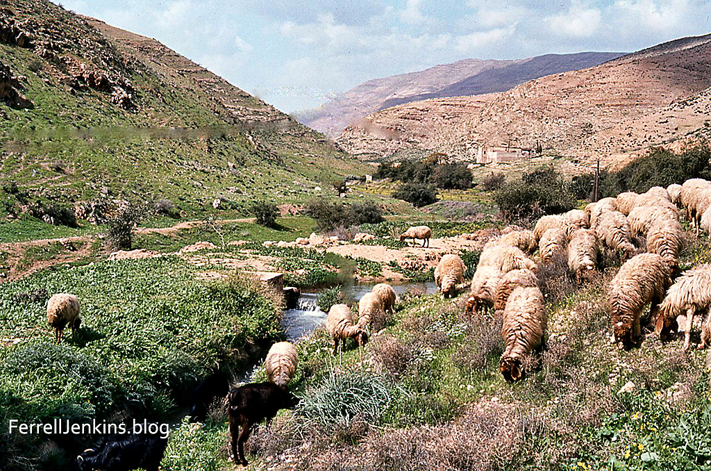
We still see examples of people living under their own vine and fig trees in the Bible Lands today.

A small cottage at Seleucia (Acts 13:4) with a vine growing over it. The vine provides summer shade and fresh fruit for the owner. From here Barnabas, Paul, and John Mark sailed to Cyprus.
Near the cottage and vine there is a fig tree. You will see the promise of ripe figs in due time.

We might compare this to the modern expression, “We have a good job and have been able to buy a house and have enough to pay for the groceries.”

A Request: This blog is sent to you at no charge. We have never requested funds from our readers. If you enjoy our blog please encourage two or three of your friends to subscribe (follow) it. When they do this they will receive an Email with the content.

Like Almond Blossoms

There is emphasis in the Hebrew Bible and in the New Testament that the biblical tabernacle and its furniture were made according to the pattern given by God (Exodus 25:9;

“And on the lampstand itself were four cups made like almond blossoms, with their calyxes [bulbs, knops, cups] and flowers,” (Exodus 37:20; Hebrews 8:5 ESV).

Earlier this year I made some pictures of almond trees in bloom at a site overlooking the Lebonah valley, on the north side of Shiloh. It is, in my judgment, a thing of beauty.

An almond blossom at a site overlooking the Lebonah Valley. Photo by Ferrell Jenkins.
An almond blossom at a site overlooking the Lebonah Valley north of Shiloh.

The Importance of the Cornerstone

Many of us think of the cornerstone of a building as a marble or bronze plaque somewhere near the outside corner of a building. It will contain the name of the organization using the building and perhaps a note about the donor, engineer, etc. The Dictionary of Biblical Imagery describes the cornerstone this way:
The cornerstone is the principal stone around which construction in antiquity was achieved. In the lexicon of biblical images of architecture, no image is more evocative than the cornerstone, the focal point of a building, the thing on which it most depends for structural integrity. Thus early in the catalog of God’s acts of creation in Job 38:6, the divine voice from the whirlwind asks regarding the world, “Who laid its cornerstone?” (Ryken, Leland et al. The Dictionary of Biblical Imagery. 2000: 166. Print).
There are repeated references to Jesus as the cornerstone rejected by the builders. Paul explains that Christ Jesus is the chief cornerstone of the church which is built upon the foundation of the apostles and prophets (Ephesians 2:20). This concept is the fulfillment of Old Testament prophecies (1 Peter 2:6; Psalm 118.22; Matthew 21:42; Acts 4:11, et al. The Louw-Nida Lexicon says the Greek word used in these texts refers to “The cornerstone or capstone of a building, essential to its construction – ‘cornerstone, important stone.” I notice that several sources use the term capstone. I have seen these capstones at the top center of an arch used in the construction of an entry arch to a large building. Without the capstone the arch would soon fall.

One of the largest cornerstones of the Temple Mount enclosure wall. This is the area of Robinson’s Arch.

Wiemers describes the large cornerstone pictured above:
A very large corner stone with margin and boss, located on the southwest corner of the Temple Mount. This southwest corner has some of the largest ashlar stones of the entire Temple Mount complex, measuring 39 feet 4 inches long by 7 feet 10 inches wide and 43 inches high. The large stone shown here is called the master course stone and weighs about 80 tons. All these stones form a strong corner as they alternate back and forth as headers and stretchers all the way up. The larger stones helped stabilize the smaller stones stacked below. (Wiemers, Galyn. Jerusalem History, Archaeology and Apologetic Proof of Scripture. Waukee, Iowa, Last Hope Books and Publications, 2010, p. 105.)
We noted earlier that several sources suggest the Greek word for cornerstone could also describe a capstone. I have seen several of these capstones used in arches. The next photo shows an example from Patara (Acts 21:1; now in Turkey). It is a triple-arched gate. For more information see Wilson, Biblical Turkey. The capstone may be seen above each of the arches, but is especially noticeable above the center arch. These capstones are not just for beauty; they are essential to hold the arch together.

The gate was built “around AD 100 during the reign of Trajan” (Wilson, Biblical Turkey).

The Appian Way

During his preaching journeys, the apostle Paul used several of the famous Roman roads. On the way to Rome as a prisoner he traveled the Appian Way (Latin Via Appia).

The Appian Way on the south side of Rome.

There we found brothers and were invited to stay with them for seven days. And so we came to Rome. And the brothers there, when they heard about us, came as far as the Forum of Appius and Three Taverns to meet us. On seeing them, Paul thanked God and took courage. And when we came into Rome, Paul was allowed to stay by himself, with the soldier who guarded him. (Acts 28:14-16 ESV)

Aswan and the First Cataract of the Nile

he new high dam at Aswan was constructed at a time when the Soviet Union was providing technical, economic and military support to Egypt. I remember staying in a hotel in Egypt in 1973 filled with Soviet tourists. In the following years we saw none of them. Lake Nasser stretches south for more than 300 miles. Many of the Nubians who lived in this area had to be resettled by the Egyptian government.

Aswan is the location of the first cataract of the Nile River. This made it an ideal location for the Aswan Dam which was built between 1898 and 1902. This created a small lake south of the dam, but it was nothing to compare with Lake Nasser which has been formed as a result of the building of the new high dam at Aswan between 1960 and 1971.

Some scholars identify the Arabic name Aswan with the Syene of Ezekiel 29:10 and 30:6. It may be identified with the Sinim of Isaiah 49:12.

Corinth and Neighboring Cities

After Jerusalem, Corinth is one of the best-known cities mentioned in the New Testament. The apostle Paul visited Corinth on his second preaching tour (Acts 18). At the “judgment seat” (Greek, bema) in the agora Paul stood before the proconsul Gallio. Based on the inscription now exhibited in the museum at Delphi we think that Paul entered Corinth in the fall of A.D. 51, and left in the spring of A.D. 53.

The map is cropped from a larger map of the area around Corinth on the Bible Mapper Blog here.

Since my last visit to Corinth some reconstruction has been made on the Bema and our photo below is published courtesy of Charles Savelle of BibleX.

The Bema at Corinth with the Acrocorinth in the background.
The Bema where Paul stood before proconsul Gallio. The Acrocorinth looms over the city. Photo courtesy of Charles Savelle.

Corinth is located about two miles south of the narrow isthmus which forms the land bridge, and controlled access, between the main land mass of Greece and the Peloponnese. The isthmus is less than five miles wide. Small ships were dragged across the isthmus on the paved road now called the diolkos; larger ships unloaded their cargo which was carried across and reloaded. This avoided the long 200-mile journey around the Peloponnese. Nero abandoned his attempts to dig a canal across the isthmus (A. D. 67). Some scholars think the road only allowed the “occasional movement of military ships, conveyance of building materials from the southern to northern Corinthia, small-scale portaging of luxury goods, and [served as] the principal road from the Corinthian Gulf to the pan-Hellenic sanctuary of Poseidon at Isthmia” (Pettegrew, CorinthianMatters.com blog). The canal one sees today was constructed in 1881–1893.

Corinth “was situated on a plateau overlooking the Isthmus of Corinth about two miles from the Gulf. It lay at the foot of Acrocorinth, an acropolis which rises precipitously to 1,886 ft.…” and was easily defended in ancient times (Rupprecht 960).

Corinth had two good ports. Lechaion, to the west, on the Gulf of Corinth (an arm of the Ionian Sea), and Cenchrea, to the east, on the Saronic Gulf (an arm of the Aegean Sea).

The harbor of Cenchrea, home of Phoebe. From here Paul set sail for Judea.
The harbor of Cenchrea where Paul had his hair cut before departing for Jerusalem. Cenchrea was the home of Phoebe (Romans 16:1).

Another important community near Corinth was Isthmia. The biennial Isthmian games, second in importance to the Olympic games, were held there in honor of Poseidon at the isthmus of Corinth. Some scholars think Paul may have been present for one of these events while he was at Corinth. He frequently used athletic illustrations in his letters. See 1 Corinthians 9:24-25 as an example.

The location of the ancient Isthmian games of Greece.
Ruins of the ancient site of Isthmia. The Corinth canal is to the right of this image. View is to the North West.

Over the years since the beginning of this blog I have posted several articles about Corinth. I suggest you put the name Corinth in the Search Box for a list of these posts. I think of this blog as a mini-dictionary of Bible lands and customs. I hope you will find it useful in your study of the Bible. Share it with you friends and suggest that they join our mailing list.

The Valley of Lebonah –  Preserving a Tribe

Our photo today shows an important site in the history of the tribe of Benjamin. The Valley of Lebonah is where the remnant of the tribe of Benjamin caught the daughters of Shiloh (Judges 21:16-25).

A view of the valley of Lebonah (left) and the natural hill on which Tel Shiloh can be seen on the top right.

The biblical text provides detailed information about the location of this event.

So they said, “Behold, there is the yearly feast of the LORD at Shiloh, which is north of Bethel, on the east of the highway that goes up from Bethel to Shechem, and south of Lebonah.” (Judges 21:19 ESV).

Our photo today was made from the hill on the west side of the valley of Lebonah. In the distance you will see Tel Shiloh on top of the natural hill.

The apostle Paul was of the tribe of Benjamin (Philippians 3:5).

The tabernacle stood at Shiloh for 300 years. Archaeological excavations are now being conducted by the Associates for Biblical Research under the direction of Dr. Scott Stripling. For more details on the next season of excavation see here.

The Desert in Egypt

The Sahara, an Arabic word for desert stretches all the way across northern Africa. I have been able to visit deep into Morocco and in most parts of Egypt. The desert is impressive, but it is not a place one would wish to get lost.

Camels are suited to desert travel because they can drink large amounts of water and travel long distances between watering holes of one sort or another.

Along the Nile River one may see a few areas of greenery but much of the area is desert. Portions of it are covered by sand.

The story of Gideon and his 300 men includes information about the Midianites and Amalekites who had entered the promised land from the East.

And the Midianites and the Amalekites and all the people of the East lay along the valley like locusts in abundance, and their camels were without number, as the sand that is on the seashore in abundance (Judges 7:12 ESV).

My first photo for today was made along the Nile River at the point of the first cataract near Aswan.

This photo was made along the Nile River at the first cataract of the Nile near Aswan.
Part of a camel caravan in the eastern Sinai peninsula.
A shy young camel takes a peak at the bigger world under the protection of Mom. In this area the desert is more rocky than sandy.

I rode a camel on very few occasions during my fifty-plus years of traveling in the Middle East. Having been brought up in the rural south in the 40s and 50s of the last century I heard and read the expression “I would walk a mile for a camel” I developed my own saying: “I would walk a mile to avoid a camel.”

Tirzah, Israel’s second capital

Tirzah is used in the Bible as the name of one of the daughters of Zelopehad. She and her sisters were married into the clans of the people of Manasseh the son of Joseph (Numbers 36:11; Joshua 12:24). The man in Song of Songs (or Solomon) tells his lady “You are beautiful as Tirzah, my love, lovely as Jerusalem, awesome as an army with banners” (6:4 ESV). The context, including Jerusalem, indicates he is comparing her to a beautiful city.

Tel el Farah north in March, 2022. A few stones from the excavations are visible among the weeds. Photo by Ferrell Jenkins.
This photo shows a few of the excavated ruins of Tel el Farah, thought to be the site of Tirzah.

In today’s post we consider the name Tirzah as the name of a place.

  • Joshua captured the king of Tirzah during the conquest of the promised land (Joshua 12:24; 17:3).
  • Earlier when Abraham was at Shechem, the LORD promised him and his descendants the land of Canaan (modern Nablus) (Genesis 12:1-9).
  • About 931 BC after the death of Solomon Jeroboam rebelled and became king over Israel (the northern kingdom) at Shechem (1 Kings 11). Later the capital was moved to Tirzah (1 Kings 14:17).
  • R. K. Harrison describes the importance of Tirzah in the kingdom of Israel: “perhaps as the result of increasing political and economic relationships with Syria. Tirzah was the capital of Israel during the time of Baasha (1 Kings 15:21,33) and Elah (1 Kings 16:8-9). The seven-day reign of Zimri ended when he burned the palace over himself at Tirzah was being besieged by Omri (1 Kings 16:17-18). After ruling from Tirzah for six years, Omri moved the capital of Israel to Samaria (1 Kings 16:23-24) , probably because of his economic and political alignment with Phoenicia. Menahem, a resident of Tirzah, was able to overthrow Shallum (752 B.C.) toward the close of the northern kingdom’s existence and to usurp the throne, ruling for almost eleven years.
Caretaker at Tel el Farah (Tirzah) in 1982. Photo by Ferrell Jenkins.
In 1982 I first visited Tel el Farah with the late Jimmy Cravens, a photographer friend from Tampa, Florida. The site still showed evidence of excavation. The gentlemen in the photo lived in a little house on the tel and served as the caretaker. I recall that he is showing us some of the walls that indicated a divider between the poor and those better off. He said he had worked with De Vaux during all of the excavations. The image is scanned from a slide that is still in good condition after 40 years.

The location of Tirzah is not certain. W. F. Albright identified it with Tel el Farah, a mound located about seven miles NE of Shechem (at modern Nablus). Roland De Vaux was associated with the Ecole Biblique in Jerusalem and conducted nine seasons of archaeological excavations at Tel el Farah between 1946 and 1960. Most of the tel is currently covered by an orchard.

Shrine model from Tel el Farah north from the excavations. Now in the Louvre.
Several archaeological artifacts from Tel el Farah are displayed in the Louvre. This is a shrine or temple model from the site.

Tel el Farah north (likely Tirzah) should not be confused with Tel el-Farah south (likely Besor). See our article about a visit there a few years ago here. Google Earth Pro includes one photo from the south site with the information about the north site. It is easy to make this mistake.

If you wish to look up the site on Google Earth Pro or the maps you will need to search for Tel Fara North. Remember also that the site is in Palestine.

Leading sheep beside quiet waters

David is known as a shepherd in the Bible. We are informed that he made regular trips back and forth from the Elah Valley where his older brothers were engaged in a battle with the Philistines to Bethlehem to feed his father’s sheep (1 Samuel 17). Later, the LORD called David to shepherd His people. It is a fact that shepherds were and are honored people in the villages of the Bible world.

Then all the tribes of Israel came to David at Hebron and said, “Behold, we are your bone and flesh.
2 In times past, when Saul was king over us, it was you who led out and brought in Israel. And the LORD said to you, ‘You shall be shepherd of my people Israel, and you shall be prince over Israel.'”
3 So all the elders of Israel came to the king at Hebron, and King David made a covenant with them at Hebron before the LORD, and they anointed David king over Israel.
4 David was thirty years old when he began to reign, and he reigned forty years.
5 At Hebron he reigned over Judah seven years and six months, and at Jerusalem he reigned over all Israel and Judah thirty-three years.
6 And the king and his men went to Jerusalem against the Jebusites, the inhabitants of the land, who said to David, “You will not come in here, but the blind and the lame will ward you off”– thinking, “David cannot come in here.”
7 Nevertheless, David took the stronghold of Zion, that is, the city of David. (2 Samuel 5:1-7 ESV)

Traveling in Israel, Jordan, Egypt, Turkey and other countries of the Bible world we see numerous examples that illustrate the Bible teaching and examples.

The photo below has been scanned from a slide made in 1982 in the Wadi Farah (or Faria) near the Biblical site of Tirza (now known as Tel Farah North).

A shepherd guides his sheep in green pastures beside still  waters. This image is scanned from a slide I made in May 1982.
Sheep grazing beside still or quiet water.