
The New Testament site of Antipatris was known as Aphek in Old Testament times. It is the place where the Philistines were encamped when they took the ark of the covenant from the Israelites who had camped at nearby Ebenezer (1 Samuel 4:1).
Antipatris was built by Herod the Great and named in honor of his father Antipater.
Because Aphek/Antipatris sat on a major south-north and west-east routes, it was dominated by many nations. The dominant feature of the site today is the Turkish fort. Inside are the excavated ruins of buildings from Canaanite to Herodian/Roman times.
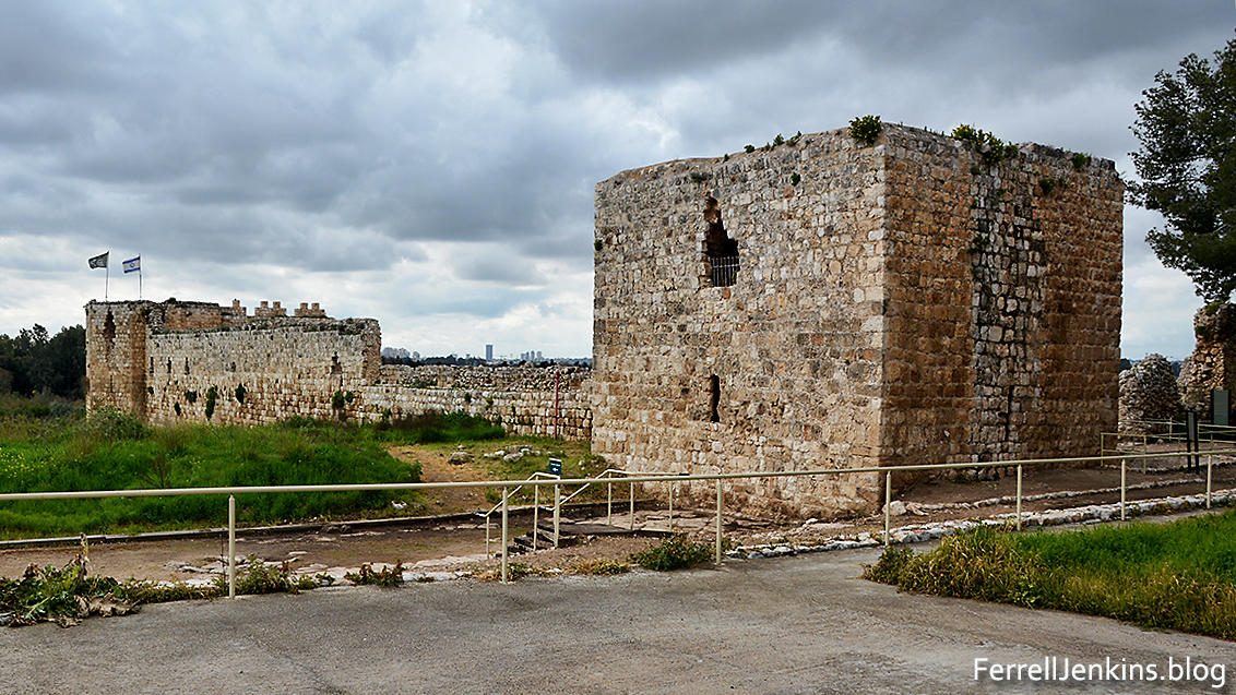
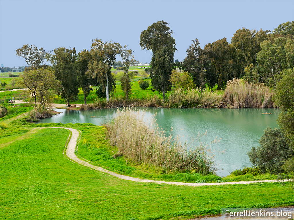
Aphek/Antipatris is known by the modern name Ras el-Ain because it is located at the source of the Yarkon River which flows a few miles into the Mediterranean.
When a plot was raised against Paul while he was in the Fortress of Antonia in Jerusalem, he was sent by night to Antipatris. The next day he was escorted to Caesarea Maritima. Luke records the event,
So the soldiers, according to their instructions, took Paul and brought him by night to Antipatris. And on the next day they returned to the barracks, letting the horsemen go on with him. When they had come to Caesarea and delivered the letter to the governor, they presented Paul also before him. (Acts 23:31-33 ESV)
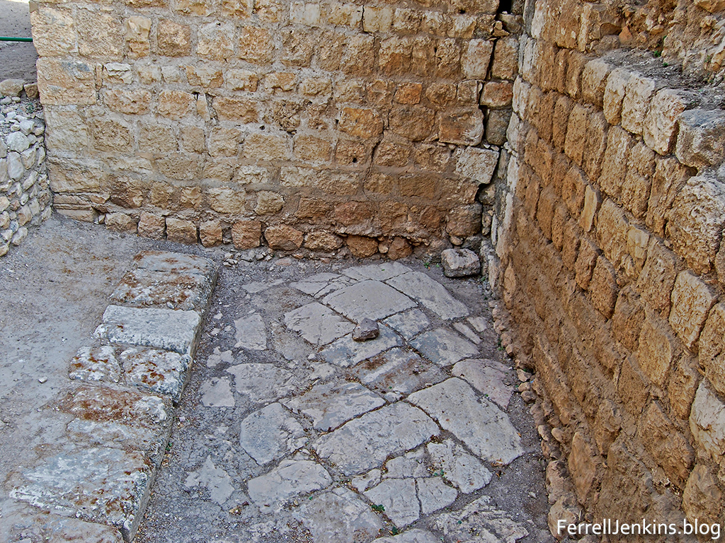
A small portion of the Roman cardo, the main East-West road has been uncovered.
From Jerusalem to Antipatris is about 30 miles. From there to Caesarea Maritima is an additional 27 miles.
Paul would remain in custody at Caesarea Maritima for two years. We probably realize that the wheels of power often turn slowly.
The map below is used courtesy of BibleMapper blog.

Courtesy of BibleMapper blog.

Imagens marcantes, artigo muito bem elaborado. Deus o abençoe muito, irmão em Cristo Ferrel Jenkins, por nos fornecer estas preciosidades. Daqui da Cidade de São Paulo, Brazil
In the 1930s, when a burgeoning Jerusalem began to outstrip its existing local water sources (the Arroub-Solomon’s Pools system and Ein Farah), the British engineers of the Mandate Period looked to the cluster of springs at Ras-el Ain. Despite lying nearly 30 miles distant to the northwest, and some 2,000 feet lower in elevation, Ras el-Ain began supplying Jerusalem with water at that time via some rather elaborate British-built infrastructure– a pipeline with a series of intermediate pumping stations. The Brits must have chosen well, since this site continues as the main source of Jerusalem’s water to this day, now via Israel’s Mekorot national water utility. Today’s nearby Israeli town , Rosh Haayin, echos the traditional Arabic place-name, Ras al-‘Ayn (a former Palestinian village depopulated in 1948) — “headwaters” or “spring-head” in the two languages. The American Colony/Matson photo archive contains many photos of Jerusalem’s water infrastructure of that period, including Ras al-Ain, HERE: https://www.loc.gov/pictures/search/?q=jerusalem+Water+works&sp=1&co=matpc.
TOM POWERS / Waynesville, NC