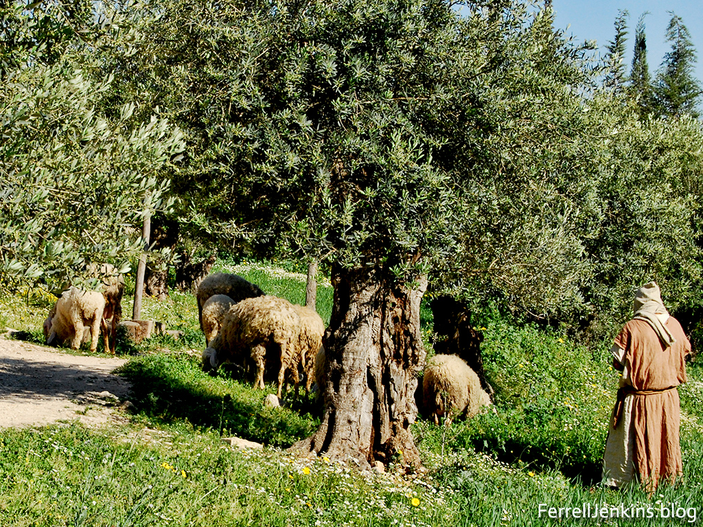
Jesus claimed to be the Good shepherd. Not only in the Bible but from Egyptian and Mesopotamian records we learn that the rulers are referred to as the shepherd of the people.

Jesus claimed to be the Good shepherd. Not only in the Bible but from Egyptian and Mesopotamian records we learn that the rulers are referred to as the shepherd of the people.
Posted in Bible Study
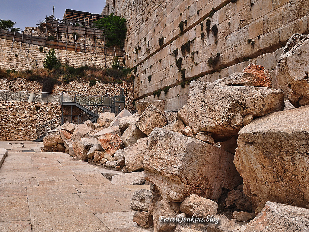
The photo below shows stones that fell, or were pushed from, the temple platform when the Romans destroyed the temple and the city of Jerusalem in A.D. 70.
Posted in Bible Study
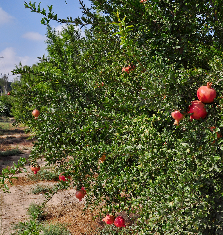
The Pomegranate was a popular fruit in Bible times. The ancient Israelites were promised “a land of wheat and barley, of vines and fig trees and pomegranates, a land of olive trees and honey” (Deuteronomy 8:8 ESV).
Our photo below shows the Pomegranate growing at Lachish in modern times.
Posted in Bible Places, Bible Study, flora, Israel, Old Testament, Photography, Travel
With former students and other acquaintances attending the Florida College Homecoming and Bible lectureship this week, I thought it would be wise to make a list of my available books that you will be able to purchase from the Florida College Bookstore. while you are on campus.
Ask one of the workers where the books are located when you visit the store.
Many of these books make excellent class studies.
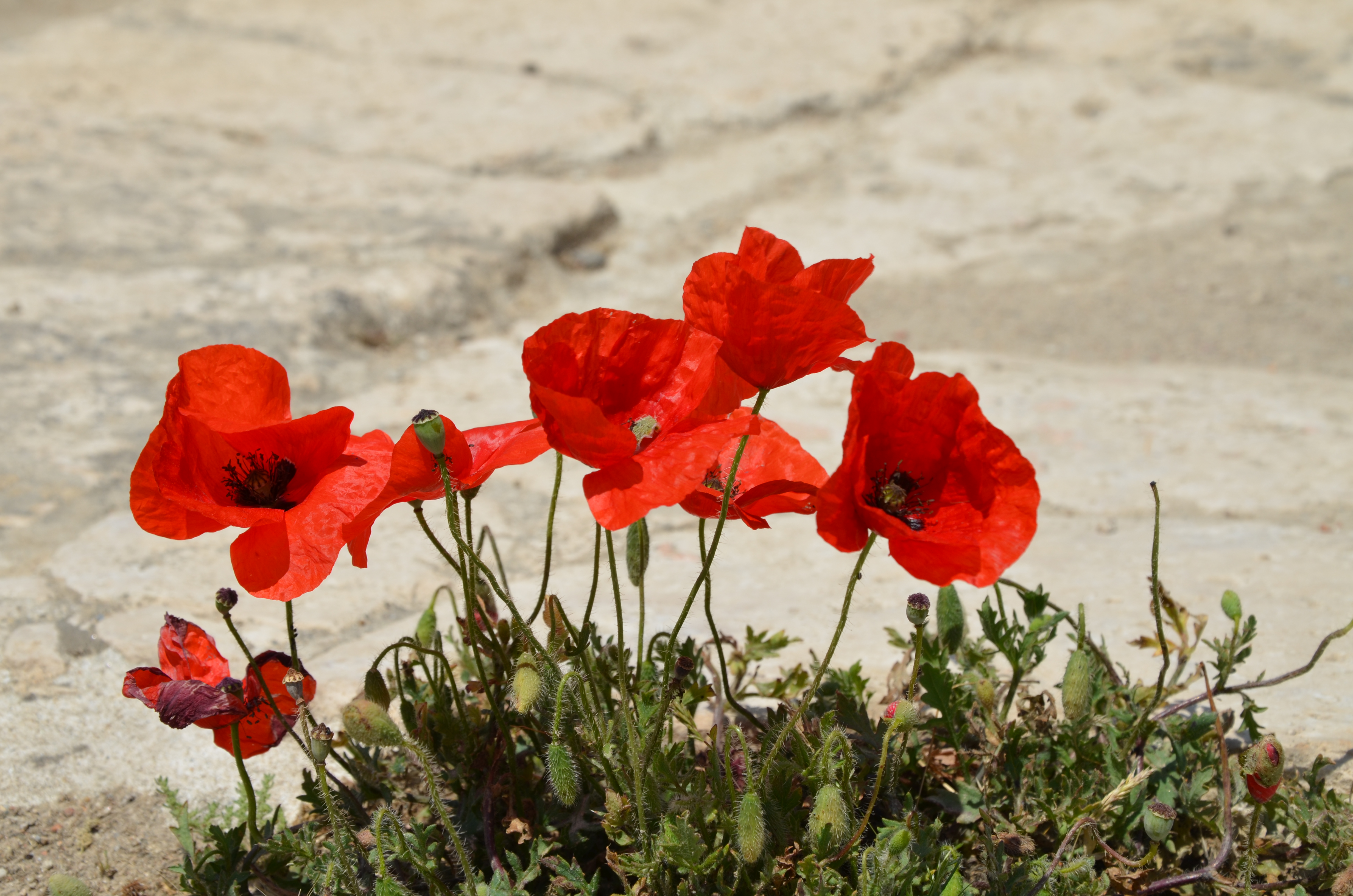
Jesus used an illustration of little flowers like those shown in our photo below to teach Hs disciples that God cares for them. See Luke 11:27. Older English translations used the term lilies. Some scholars identify the Anemone as the flower Jesus had in mind. When one sees fields full of these in the spring it is hard to disagree.
Our readership is growing because some of you are asking your friends to take a look at the blog. Thank you.
Using the SEARCH box you can search for more posts that mentions the lilies or the Anemone
Posted in Bible Lands, Bible Study, Flora and Fauna, Israel, New Testament, Photography

Subscribe to get access to the rest of this post and other subscriber-only content.
Comments Off on The Site of Colossae
Posted in Bible Study
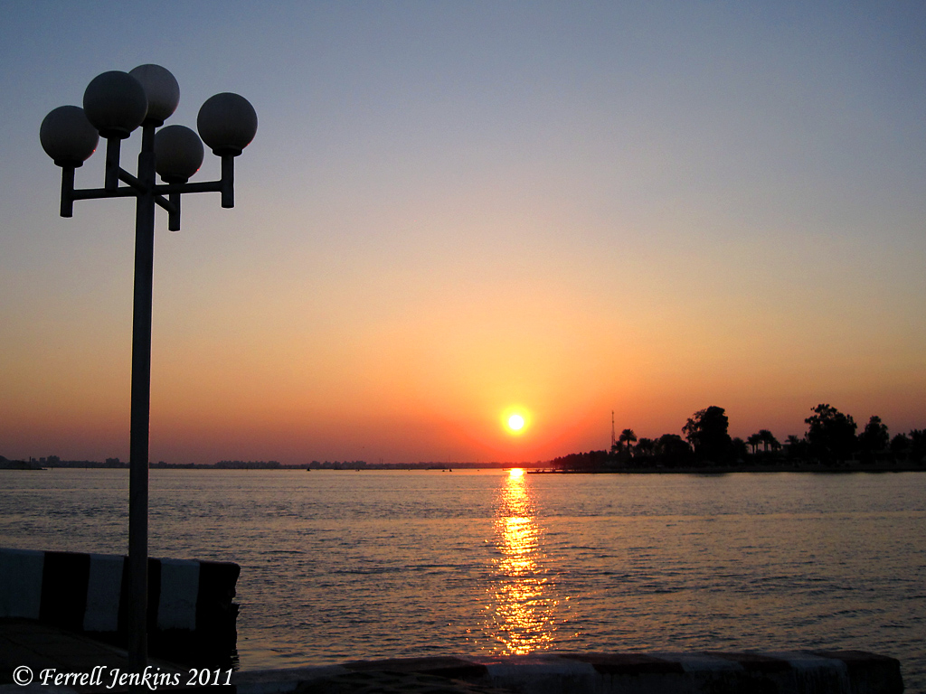
The photo below shows a beautiful sunset across the Suez Canal in
the vicinity of Lake Timsah.
Posted in Bible Study
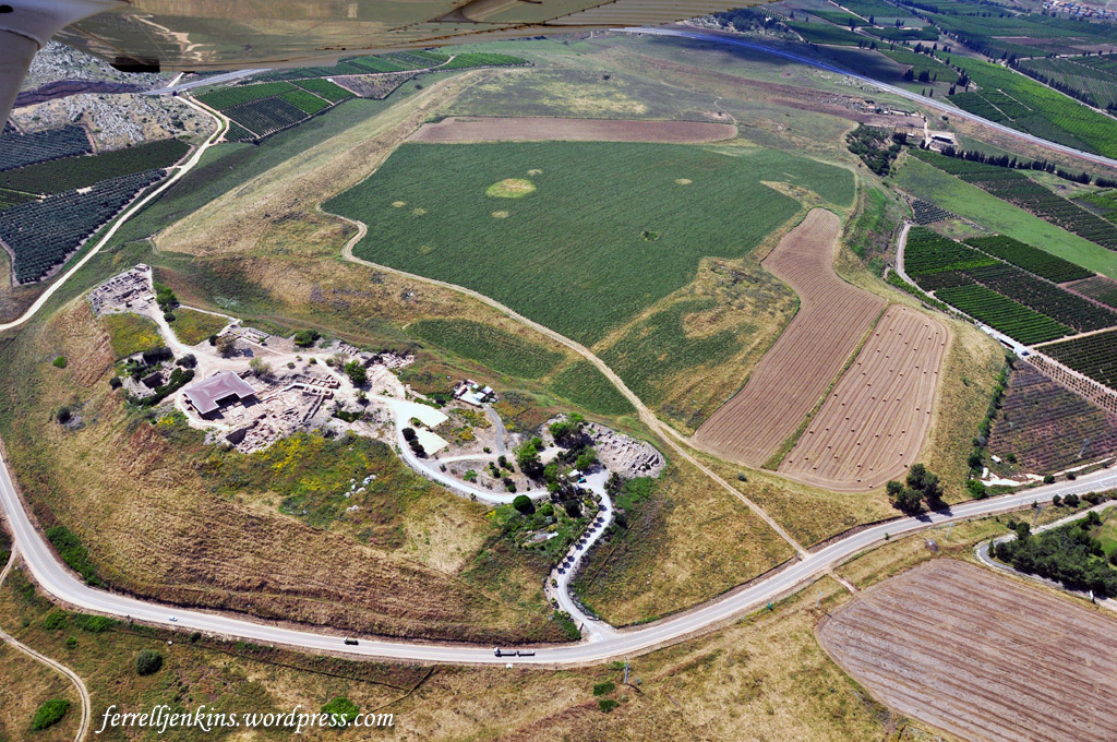
Over the years of leading tours and making personal study trips I have flown over many of the significant Biblical sites. The aerial view sometimes provides a perspective not available from the ground view.
Below is a view of the mound or tell (tel in Israel) of ancient Hazor.
Posted in Bible Study
Apologies to those who received an Email of the post without the image. FJ
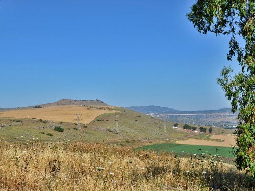
The photo below provides a view of the Horns of Hattin with a view NW from Highway 77 near Tiberias, Israel, and the Sea of Galilee .
Posted in Bible Lands, Bible Places, Bible Study, Israel, Photography, Travel
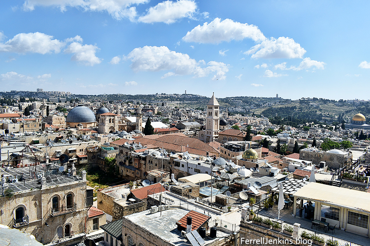
The photo below was made from the roof of the Tower of David at Jaffa (Joppa) Gate. It gives one a nice view of some of the highlights of the Old City of Jerusalem and, left to right, Mount Scopus, and the northern portion of the Mount of Olivet.

You must be logged in to post a comment.