
The first photo today shows that Caperanum is located on the [north] shore of the Sea of Galilee. The enclosed area belongs to the Franciscan Fathers who bought the property already thought to be Capernaum in 1894. The site was fenced to prevent removal of the materials.
In our photo you see the property as it has been edited by various archaeological digs. Two structures stand out among the ruins – the synagogue and the new memorial church we wrote about in the previous post. Click on the photo for a larger image suitable for use in teaching.

Viewing Capernaum from the air. Photo by Ferrell Jenkins.
With our view to the north, the property on the right of the Franciscan property belongs to the Greek Orthodox Church. You will see their little red-domed church near the middle of our image. The property between that church and the Franciscan property was excavated after 1978 under the direction of Vassilios Tzaferis but is not open to the public.
Further east a dock extending into the water provides a place for boats to dock and allow passengers to meet their bus to continue touring.
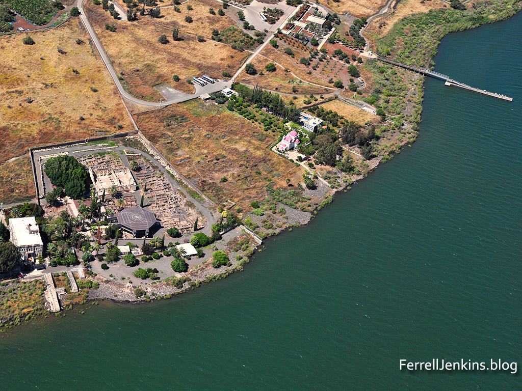
Capernaum from the air. Fransciscian property on left (west) and the Orthodox property on the right (east). Photo by Ferrell Jenkins.
Much of the earthly ministry of Jesus was conducted in this little plot of land. Imagine such a small beginning here and in the surrounding towns. By the early 60s of the first century the preaching that Jesus is the Christ had reached the capital of the Roman empire (Acts 28).

Do you know… is the ancient village all within the fenced boundaries, or does more of it exist buried beyond the fence?
Beautiful picture!
A beautiful picture. I would love to use it in our brochure for an April 2021 tour. Do you have a subscription or allow use of your photography. Thank you
Tommie: 770.853.8613 zionsbridge.org tommieathome@gmail.com
>