
Read our first post about the Citadel of Jerusalem here.
Our main reason for visiting the Citadel on the most recent trip was to visit the newly opened Kishle (Prison). As a part of the tour we took at the Citadel we went to the top of the Tower of David (sometimes called the Tower of Herod) for a view of the Old City of Jerusalem.
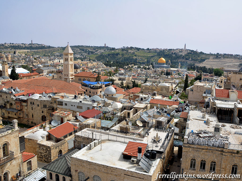
The first view looks east. The pyramidal tower in the left foreground belongs to the Christ the Redeemed Lutheran Church. A climb to the top of that tower also provides a wonderful view across the city. In the distance to the right of center is the easily recognizable Mosque of Omar, commonly known as the Dome of the Rock. This is where the Temples of Solomon and Herod stood in Bible times (see Ritmeyer, Jerusalem The Temple Mount, 16-17).
Notice the mountain range to the east. You already know that the Citadel, the highest part of the Old City is more than 2500 feet above sea level, but the mountain range to the east is more than 100 feet higher than the area of the Citadel. There are three towers on the mountain range. On the left (north) is Mount Scopus. To the south you will see the tower of the Augusta Victoria Hospital. Finally, further south is the Tower of the Church of Ascension on the Mount of Olives.
Beyond the Mount of Olives lies the Wilderness of Judea which stretches down to the Jordan Valley and Dead Sea.
This is a view east from the Tower of David. Photo by Ferrell Jenkins.
There are many wonderful views from the Citadel Tower. This view is slightly north and provides a look at the two domes of the Church of the Holy Sepulchre. The large dome covers the traditional tomb of Jesus and the smaller dome is nearer to the traditional site of Calvary.
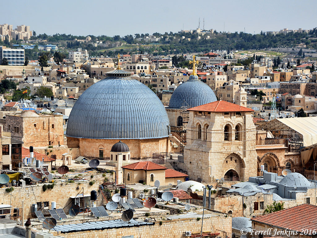
The domes of the Holy Sepulcher from the Tower of David. Photo by Ferrell Jenkins.
In most of these views you may notice the mountains surrounding Jerusalem. This reminds us of the statement of the Psalmist.
As the mountains surround Jerusalem, so the LORD surrounds his people, from this time forth and forevermore. (Psalm 125:2 ESV)
The prominent building in the photo below is the Kishle. This building was used by the Ottomans and the British as a prison. It now serves as the Police Station of the Old City. (Click on the photo for a larger image.)
Notice the small street to the left of the Police Station. That street runs through the heart of the Armenian Quarter of the Old City. In the distance, to the left of the street and photo there is a square building with a dome. That is the roof of the Armenian church, St. James Cathedral. Armenian tradition has it that James the brother of Jesus is buried there.
Notice the pole with several antennas on it. The building in the distance to the right of the pole is the Church of the Dormitian. It is outside the southern wall of the Old City.
Look now to the right side of the photo where you see a grassy knoll and a portion of the southern wall.
Remember that this photo is made from the Tower of David (or Herod) in the Citadel. The area stretching south from the citadel to the southern wall is now known as the Armenian Garden. It is thought by some archaeologist to be the area of Herod’s Palace and the military barracks. This, of course, would make it the area of the Praetorium and the place of Jesus trial. I suggest Shimon Gibson’s “The Trial of Jesus at the Jerusalem Praetorium: New Archaeological Evidence” in Craig A. Evans, Ed., The World of Jesus and the Early Church (Peabody: Hendrickson 2012). The volume on Jerusalem Revealed that we mentioned in the earlier post also has information on this subject.
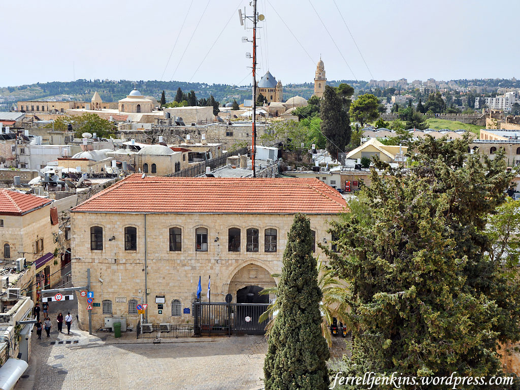
View looking south from the Tower of David. The building in the foreground is the police station. Photo by Ferrell Jenkins.
Some mounted police work out of this police station. If you have ever walked the narrow stepped streets of the Old City you know what this might be the best mode of transportation for the police officers.
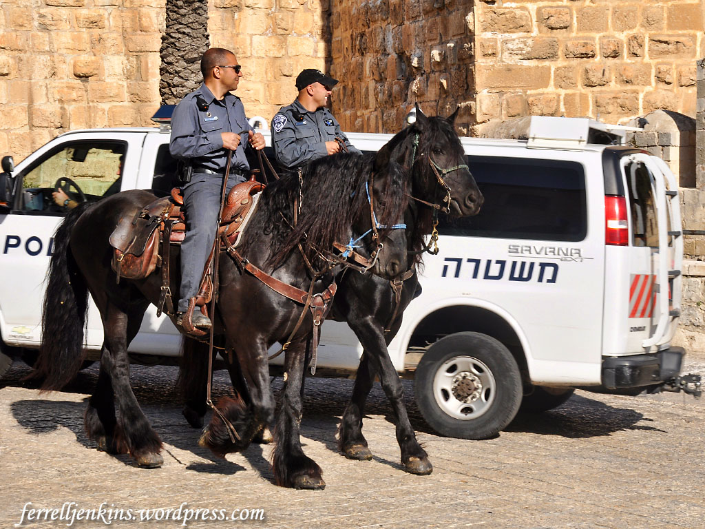
Mounted police in front of the prison. Photo by Ferrell Jenkins.
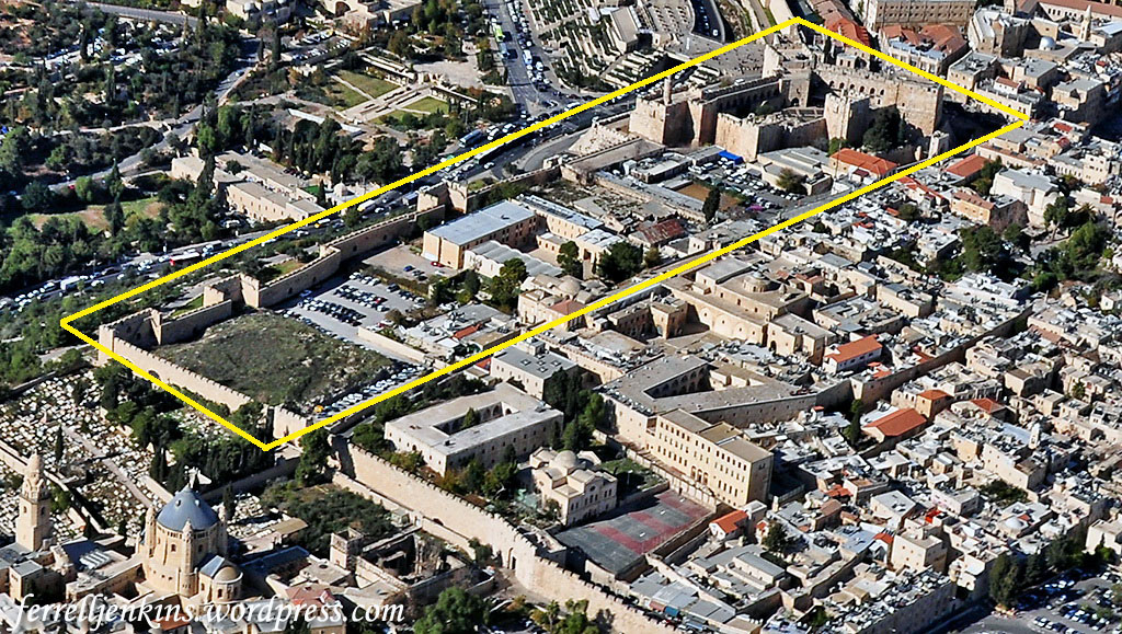
We will close with an aerial view of the Armenian Quarter of the Old City of Jerusalem. The Citadel can be seen in the upper right quarter of the photo.
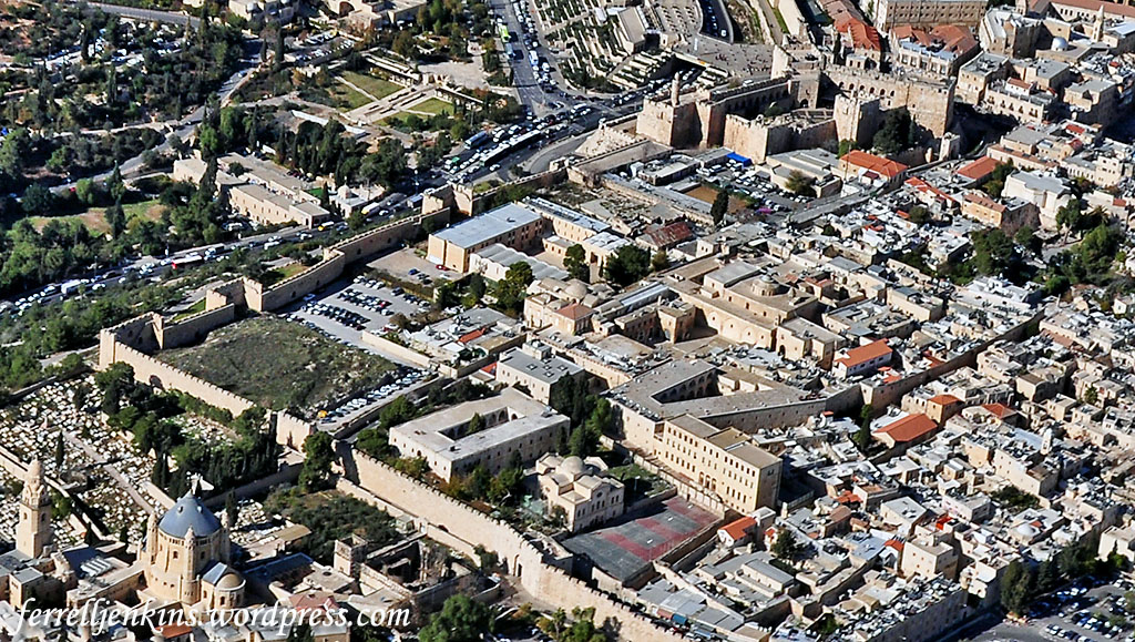
Aerial view of the Armenian Quarter. The area marked in yellow is the area of Herod’s Palace. Photo by Ferrell Jenkins.
In the next photo I have marked the Citadel and the area south to the southern wall of the Old City. This view is from the southeast to the northwest.
Aerial view of the Armenian Quarter. The area marked in yellow is the area of Herod’s Palace. Photo by Ferrell
The area of Herod’s Palace is thought to have extended east of (right) the boundary I have drawn, but the buildings there make it impossible to carry out further excavations.
In the next post on the Citadel we plan to take you to see the Kishle excavations.

Pingback: Under the jail – a visit to the Kishle | Ferrell's Travel Blog
Thanks for the caption correction. My oversight.
Well done. I’m looking forward to the Kishle post- that site was not open yet when I lived in Jerusalem.
NOTE: The caption for your photo #3 should read “view from the north” or “view looking south”.
All the best…
TOM POWERS / Waynesville, NC
Fantastic!
Great post and wonderful shots!